
Recomendados
Mais conteúdo relacionado
Último
Último (20)
Destaque
Destaque (20)
Sstf 2012 street_map
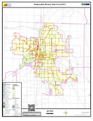
- 1. Legend Pavement Markings Linetype ¹º V Rated Roads Current Road PCI Reference Streets Zoning Sustainable Streets Task Force 2012 All FAU
- 2. Legend Pavement Markings Linetype ¹º V Rated Roads Current Road PCI Reference Streets Zoning Sustainable Streets Task Force 2012 All Major Streets
- 3. Legend Pavement Markings Linetype ¹º V Rated Roads Current Road PCI Reference Streets Zoning Sustainable Streets Task Force 2012 Major Streets Non FAU
- 4. Legend Pavement Markings Linetype ¹º V Rated Roads Current Road PCI Reference Streets Zoning Sustainable Streets Task Force 2012 Principal Arterials
- 5. Legend Pavement Markings Linetype ¹º V Rated Roads Current Road PCI Reference Streets Zoning Sustainable Streets Task Force 2012 Minor Arterials
- 6. Legend Pavement Markings Linetype ¹º V Rated Roads Current Road PCI Reference Streets Zoning Sustainable Streets Task Force 2012 State-County-Roads in COGR
- 7. Legend Pavement Markings Linetype ¹º V Rated Roads Current Road PCI Reference Streets Zoning Sustainable Streets Task Force 2012 Collectors
- 8. Legend Pavement Markings Linetype ¹º V Rated Roads Current Road PCI Reference Streets Zoning Sustainable Streets Task Force 2012 Local Streets
- 9. Legend Pavement Markings Linetype ¹º V Rated Roads Current Road PCI Reference Streets Zoning Sustainable Streets Task Force 2012 Borderline Streets
- 10. Legend Pavement Markings Linetype ¹º V Rated Roads Current Road PCI Reference Streets Zoning Sustainable Streets Task Force 2012 All Streets