USGS Study on Affects of Shale Fracking on Water Wells in Fayetteville Shale
•
3 gostaram•1,191 visualizações

A new detailed scientific study released by the U.S. Geological Survey titled "Shallow Groundwater Quality and Geochemistry in the Fayetteville Shale Gas-Production Area, North-Central Arkansas, 2011". The study looks at 127 water wells in the heavily drilled Fayetteville Shale area of Arkansas, comparing pre- and post-drilling samples for those wells. The results found tha fracking does not affect groundwater sources.

Recomendados
Recomendados
Mais conteúdo relacionado
Destaque
Destaque (18)
Semelhante a USGS Study on Affects of Shale Fracking on Water Wells in Fayetteville Shale
Semelhante a USGS Study on Affects of Shale Fracking on Water Wells in Fayetteville Shale (20)
Mais de Marcellus Drilling News
Mais de Marcellus Drilling News (20)
Último
Último (8)
USGS Study on Affects of Shale Fracking on Water Wells in Fayetteville Shale
- 1. Prepared in cooperation with (in alphabetical order) the Arkansas Natural Resources Commission, Arkansas Oil and Gas Commission, Duke University, Faulkner County, Shirley Community Development Corporation, and the University of Arkansas at Fayetteville, and the U.S. Geological Survey Groundwater Resources Program Shallow Groundwater Quality and Geochemistry in the Fayetteville Shale Gas-Production Area, North-Central Arkansas, 2011 Scientific Investigations Report 2012–5273 U.S. Department of the Interior U.S. Geological Survey
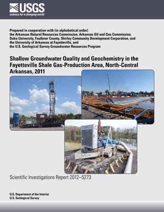
- 2. Cover: Left, Drilling rig and equipment used in the Fayetteville Shale gas-production area, north-central Arkansas. Right, Pond with synthetic liner used to store water at shale gas-production facility in the Fayetteville Shale area, north-central Arkansas. Bottom, Freshwater pond and distribution lines for source water used in drilling and hydrofracturing in the Fayetteville Shale gas-production area, north-central Arkansas. All photographs by Timothy M. Kresse, U.S. Geological Survey.
- 3. Shallow Groundwater Quality and Geochemistry in the Fayetteville Shale Gas-Production Area, North-Central Arkansas, 2011 By Timothy M. Kresse, Nathaniel R. Warner, Phillip D. Hays, Adrian Down, Avner Vengosh, Robert B. Jackson Prepared in cooperation with (in alphabetical order) the Arkansas Natural Resources Commission, Arkansas Oil and Gas Commission, Duke University, Faulkner County, Shirley Community Development Corporation, and the University of Arkansas at Fayetteville, and the U.S. Geological Survey Groundwater Resources Program Scientific Investigations Report 2012–5273 U.S. Department of the Interior U.S. Geological Survey
- 4. U.S. Department of the Interior KEN SALAZAR, Secretary U.S. Geological Survey Marcia K. McNutt, Director U.S. Geological Survey, Reston, Virginia: 2012 This and other USGS information products are available at http://store.usgs.gov/ U.S. Geological Survey Box 25286, Denver Federal Center Denver, CO 80225 To learn about the USGS and its information products visit http://www.usgs.gov/ 1-888-ASK-USGS Any use of trade, product, or firm names is for descriptive purposes only and does not imply endorsement by the U.S. Government. Although this report is in the public domain, permission must be secured from the individual copyright owners to reproduce any copyrighted materials contained within this report. Suggested citation: Kresse, T.M., Warner, N.R., Hays, P.D., Down, A., Vengosh, A., and Jackson, R.B., 2012, Shallow groundwater quality and geochemistry in the Fayetteville Shale gas-production area, north-central Arkansas, 2011: U.S. Geological Survey Scientific Investigations Report 2012–5273, 31 p.
- 5. iii Acknowledgments The authors would like to thank numerous persons for their assistance during all phases of the study. Several people were instrumental and deserve special recognition in the early reconnaissance phase involving the petitioning of homeowners interested in participating in the study and collecting all pertinent information including home addresses and well information. Tom Kimmons of the Shirley Community Development Corporation gathered information related to homeowners with domestic wells in Van Buren County, and also assisted in locating the homes and interacting with the homeowners during sample collection in Van Buren County. Faulkner County Judge Preston Scroggin, Randy Higgins, and Randy Ingram were instrumental in spearheading efforts related to similar activities in Faulkner County. All homeowners are acknowledged for their participation in the study, their kindness extended to the sampling teams, and their sharing of information related to land-use and gas-production activities in each of the counties. The authors additionally would like to thank Jay Hansen, Senior Petroleum Geologist with the Arkansas Oil and Gas Commission, for information related to the chemistry of flowback and produced waters associated with gas production in the Fayetteville Shale. Larry Bengal, Director of the Arkansas Oil and Gas Commission, deserves a special thanks for sharing his knowledge and insight into every aspect of gas-production in Arkansas. Jon Karr, Duke University Environmental Isotope Laboratory assisted in the isotopic measurements of water and gases. Finally, Roger Miller, Arkansas Department of Environmental Quality, for providing data on organic analysis of samples from domestic wells in the Fayetteville Shale production area. The U.S. Geological Survey’s Groundwater Resources Program provided supplementary funding for completion of this report.
- 7. v Contents Abstract ...........................................................................................................................................................1 Introduction ....................................................................................................................................................2 Purpose and Scope ..............................................................................................................................2 Description of Study Area ...................................................................................................................2 Overview of Hydrogeologic Setting ...................................................................................................4 Water Sample Collection and Analysis Methods .....................................................................................6 Shallow Groundwater Quality and Geochemistry.....................................................................................7 Historical Groundwater Quality and Geochemistry ........................................................................8 Current Study Groundwater Quality and Geochemistry .................................................................9 Groundwater Quality and Spatial and Temporal Comparative Analysis ............................9 Groundwater Geochemistry and Geochemical Evolution ...................................................11 Rock-Water Interaction ...................................................................................................13 Reduction-Oxidation Processes .....................................................................................19 Methane and Carbon Isotopes .......................................................................................20 Trace Metals ......................................................................................................................24 Limitations Associated with Data Interpretation ....................................................................................26 Implications of Study Results ....................................................................................................................27 Summary .......................................................................................................................................................27 References Cited .........................................................................................................................................29 Appendixes (available online only) 1. Results of spring and fall 2012 Standard Reference Sample (SRS) inter-laboratory comparison study 2. Historical groundwater-quality analyses extracted from the U.S. Geological Survey National Water Information System database for Cleburne, Conway, Faulkner, Independence, Van Buren, and White Counties, Arkansas 3. Water-quality, isotope, and methane data collected from domestic wells in Van Buren and Faulkner Counties, Arkansas, July 2011 through November 2011 Figures 1. Map showing location of the Fayetteville Shale study area sampling sites and gas-production wells ...................................................................................................................3 2. Map showing geology of the Fayetteville Shale study area with generalized geologic cross section .................................................................................................................5 3. Graph showing relation between dissolved solids concentrations and specific conductance values for historical data (1951–83) in the Fayetteville Shale gas- production area, north-central Arkansas .................................................................................9 4. Graph showing relation between total cation and anion milliequivalent concentrations for historical data (1951–83) in the Fayetteville Shale gas- production area, north-central Arkansas ...............................................................................10 5. Boxplots for selected constituents for A, historical data and B, data from 127 wells in the Fayetteville Shale gas-production area, north-central Arkansas .................12 6. Conceptual model of geochemical evolution of groundwater with increased rock-water interaction represented by increasing dissolved solids concentrations ............................................................................................................................13
- 8. vi 7. Graph showing relation between dissolved solids concentrations and pH values from data collected in the Fayetteville Shale gas-production area, north- central Arkansas .........................................................................................................................14 8. Graph showing relation between dissolved solids concentrations and A, bicarbonate, B, sulfate, C, chloride, D, calcium, E, magnesium, and F, sodium concentrations from data collected in the Fayetteville Shale gas-production area, north-central Arkansas ...................................................................................................15 9. Graph showing relation between sodium/chloride ratios and A, calcium plus magnesium/bicarbonate ratios constructed using milliequivalent concentrations and B, dissolved solids concentrations from data collected in the Fayetteville Shale gas-production area, north-central Arkansas ............................................................16 10. Trilinear diagram showing the percentage distribution of major ions from data collected in the Fayetteville Shale gas-production area, north-central Arkansas .........17 11. Graph showing relation between dissolved solids concentrations and pH values with a depiction of the evolution of chemical water types from data collected in the Fayetteville Shale gas-production area, north-central Arkansas ...............................18 12. Graph showing relation between dissolved solids concentration and chloride as percent of total anions in milliequivalents per liter from data collected in the Fayetteville Shale gas-production area, north-central Arkansas ......................................18 13. Graph showing relation between nitrate and A, iron and B, manganese concentrations from data collected in the Fayetteville Shale gas-production area, north-central Arkansas ...................................................................................................21 14. Graph showing relation between nitrate concentrations and pH values from data collected in the Fayetteville Shale gas-production area, north-central Arkansas .........22 15. Graph showing relation between dissolved solids concentrations and A, iron and B, arsenic concentrations from data collected in the Fayetteville Shale gas-production area, north-central Arkansas .......................................................................23 16. Graph showing relation between dissolved solids and methane concentrations from data collected in the Fayetteville Shale gas-production area, north- central Arkansas .........................................................................................................................24 17. Graph showing relation between dissolved solids and boron concentrations from data collected in the Fayetteville Shale gas-production area, north-central Arkansas ......................................................................................................................................25 18. Graph showing relation between dissolved solids and strontium concentrations from data collected in the Fayetteville Shale production area, north-central Arkansas ......................................................................................................................................25 Tables 1. Descriptive statistics for selected water-quality constituents from historical data collected from 1951 through 1983 from 43 wells in the Fayetteville Shale gas-production area, north-central Arkansas .........................................................................8 2. Descriptive statistics for selected water-quality constituents from data collected in 2011 from 127 wells in Van Buren and Faulkner Counties, Arkansas ..........11
- 9. vii Conversion Factors Inch/Pound to SI Multiply By To obtain Length foot (ft) 0.3048 meter (m) mile (mi) 1.609 kilometer (km) Area square mile (mi2) 259.0 hectare (ha) square mile (mi ) 2 2.590 square kilometer (km2) Temperature in degrees Celsius (°C) may be converted to degrees Fahrenheit (°F) as follows: °F=(1.8×°C)+32 Temperature in degrees Fahrenheit (°F) may be converted to degrees Celsius (°C) as follows: °C=(°F-32)/1.8 Vertical coordinate information is referenced to the National Geodetic Vertical Datum of 1929 (NGVD 29) Altitude, as used in this report, refers to distance above the vertical datum. Specific conductance is given in microsiemens per centimeter at 25 degrees Celsius (µS/cm at 25°C). Concentrations of chemical constituents in water are given either in milligrams per liter (mg/L) or micrograms per liter (µg/L).
- 11. Shallow Groundwater Quality and Geochemistry in the Fayetteville Shale Gas-Production Area, North-Central Arkansas, 2011 By Timothy M. Kresse1, Nathaniel R. Warner2, Phillip D. Hays1, Adrian Down2, Avner Vengosh2, and Robert B. Jackson2 for this study. Chloride serves as an important indicator Abstract parameter based on its conservative transport characteristics and relatively elevated concentrations in production waters The Mississippian Fayetteville Shale serves as an associated with gas extraction activities. Major ions and trace unconventional gas reservoir across north-central Arkansas, metals additionally had lower concentrations in data gathered ranging in thickness from approximately 50 to 550 feet and for this study than in the historical analyses. Additionally, no varying in depth from approximately 1,500 to 6,500 feet statistical difference existed between chloride concentrations below the ground surface. Primary permeability in the from water-quality data collected for this study from 94 wells Fayetteville Shale is severely limited, and successful located less than 2 miles from a gas-production well and extraction of the gas reservoir is the result of advances 33 wells located 2 miles or more from a gas-production well; a in horizontal drilling techniques and hydraulic fracturing Wilcoxon rank-sum test showed a p-value of 0.71. to enhance and develop secondary fracture porosity and Major ion chemistry was investigated to understand permeability. Drilling and production of gas wells began in the effects of geochemical and reduction-oxidation (redox) 2004, with a steady increase in production thereafter. As of processes on the shallow groundwater in the study area along April 2012, approximately 4,000 producing wells had been a continuum of increased rock-water interaction represented completed in the Fayetteville Shale. by increases in dissolved solids concentration. Groundwater In Van Buren and Faulkner Counties, 127 domestic in sandstone formations is represented by a low dissolved water wells were sampled and analyzed for major ions and solids concentration (less than 30 mg/L) and slightly acidic trace metals, with a subset of the samples analyzed for water type. Shallow shale aquifers were represented by methane and carbon isotopes to describe general water dissolved solids concentrations ranging upward to 686 mg/L, quality and geochemistry and to investigate the potential and water types evolving from a dominantly mixed- effects of gas-production activities on shallow groundwater bicarbonate and calcium-bicarbonate to a strongly sodium- in the study area. Water-quality analyses from this study bicarbonate water type. were compared to historical (pregas development) shallow Methane concentration and carbon isotopic composition groundwater quality collected in the gas-production area. were analyzed in 51 of the 127 samples collected for An additional comparison was made using analyses from this study. Methane occurred above a detection limit of this study of groundwater quality in similar geologic and 0.0002 mg/L in 32 of the 51 samples, with concentrations topographic areas for well sites less than and greater than ranging upward to 28.5 mg/L. Seven samples had methane 2 miles from active gas-production wells. concentrations greater than or equal to 0.5 mg/L. The carbon Chloride concentrations for the 127 groundwater isotopic composition of these higher concentration samples, samples collected for this study ranged from approximately including the highest concentration of 28.5 mg/L, shows the 1.0 milligram per liter (mg/L) to 70 mg/L, with a median methane was likely biogenic in origin with carbon isotope concentration of 3.7 mg/L, as compared to maximum and ratio values ranging from -57.6 to -74.7 per mil. Methane median concentrations for the historical data of 378 mg/L concentrations increased with increases in dissolved solids and 20 mg/L, respectively. Statistical analysis of the data sets concentrations, indicating more strongly reducing conditions revealed statistically larger chloride concentrations (p-value with increasing rock-water interaction in the aquifer. As such, <0.001) in the historical data compared to data collected groundwater-quality data collected for this study indicate 1 U.S. Geological Survey, Little Rock, Ark. that groundwater chemistry in the shallow aquifer system in the study area is a result of natural processes, beginning with Division of Earth and Ocean Sciences, Nicholas School of the 2 Environment, Duke University, Durham, N.C. recharge of dilute atmospheric precipitation and evolution
- 12. 2 Shallow Groundwater Quality and Geochemistry in the Fayetteville Shale Gas-Production Area, North-Central Arkansas of observed groundwater chemistry through rock-water 2012, approximately 4,000 producing gas wells had been interaction and redox processes. completed in the Fayetteville Shale (Arkansas Oil and Gas Commission, 2012). Gas-well drilling and completion activities in the Fayetteville Shale have the potential to affect water quality in Introduction shallow aquifers through the loss of fluids used in every step of gas production, including drilling, hydraulic fracturing, and Gas production in the Fayetteville Shale area of north- storage and handling of flowback water. Transport pathways central Arkansas has provided important economic benefits for for surface-derived contaminants include potential leakage the State and the individual counties (University of Arkansas, from earthen pits used to store drilling, hydraulic fracturing, 2008); however, local citizens and citizen groups have voiced and flowback fluids, leakage from pipes, and losses from pond numerous concerns regarding potential public health and overflows and spills during transport (King, 2012). Water environmental effects associated with gas production. Issues contamination can possibly be associated with hydraulic important to citizens include potential effects to surface-water fracturing through changes in the permeability of the shale and groundwater quality, noise, traffic, road damage, and air gas formation and overlying geological units because of the pollution. These concerns parallel those voiced in other newly hydraulic fracturing process, migration of hydraulic fracturing developed shale-gas production areas throughout the country, fluids through existing vertical fractures that connect to the where oil and gas development is moving into communities shallow aquifer (Warner and others, 2012), and, more likely, where residents have no prior history and experience upward migration of gas and pressurized fluids through poorly with these activities and the potential effects to their local cased and grouted sections of the shale-gas well bore (Atlantic resources, infrastructure, health, and culture (New York Times, Council, 2011; King, 2012). Hydraulic fracturing in a properly variously dated). cased and cemented wellbore has been cited as the lowest risk One of the most common concerns is related to perceived for shallow groundwater contamination in the entire well- degradation of groundwater quality in domestic wells. development process (King, 2012). The potential for migration Appropriate groundwater-quality data to address groundwater of fracturing fluids can increase where the target formation is concerns are lacking, and up through the summer of 2010, shallower, thus reducing the separation distance between the no water-quality sampling had been performed to confirm gas-production zone and the shallow groundwater, or where or deny anecdotal evidence of groundwater contamination increased hydraulic connectivity exists through deep faulting in Arkansas from gas-production activities. The purpose of zones (Warner and others, 2012). this study by the U.S. Geological Survey, in cooperation with the Arkansas Natural Resources Commission, Arkansas Oil and Gas Commission, Duke University, Faulkner County, Purpose and Scope Shirley Community Development Corporation, the University of Arkansas at Fayetteville, and the U.S. Geological Survey The purpose of this report is to describe general water Groundwater Resources Program, was to sample groundwater quality and geochemistry of shallow groundwater in the from domestic wells, document groundwater quality and Fayetteville Shale gas-production area in north-central geochemistry, and investigate potential effects to groundwater Arkansas and evaluate the potential effects, if any, from quality from gas-production activities in Faulkner and Van activities related to shale-gas drilling and production. Buren Counties, Arkansas. Groundwater wells were sampled during 2011 in two counties The Mississippian Fayetteville Shale serves as an of north-central Arkansas: Van Buren County and Faulkner unconventional gas reservoir across north-central Arkansas. County. This report presents and assesses field and inorganic The thickness of the Fayetteville Shale ranges from water-quality data, including major ions, trace metals, methane approximately 50 to 550 feet and varies in depth from gas, and selected isotopes. Any constituents, notably organic approximately 1,500 feet to 6,500 feet below the ground compounds, that might have been added to fracturing fluids surface (Southwestern Energy, 2012). Primary permeability for gas drilling were not analyzed for this study. in the Fayetteville Shale is very low, as is typical of dense shales, and economic extraction of gas has been made possible Description of Study Area by advances in horizontal drilling and hydraulic fracturing of the formation, which are techniques that enhance secondary The study area is located in north-central Arkansas in fracture porosity and permeability and maximize connectivity Van Buren and Faulkner Counties; four of the sampling and gas yield to the production well (King, 2012). These locations were slightly outside of these two counties but technological advancements have made possible hydrocarbon near to the county lines (fig. 1). The Fayetteville Shale production from formations that previously were not gas-production area is approximately 2,500 square miles, economically viable drilling targets and have expanded oil and and wells sampled for this study were distributed across an gas industry operations into areas where such operations did approximate area of 850 square miles or about one-third of the not exist. Shale gas development in Arkansas began in 2004, total gas-production area. and production has increased steadily thereafter. As of April