SlideShare uma empresa Scribd logo
1 de 39
Introduction to the Global
                    Positioning
                    System


                                  by
                        Dr. Stephen C. Brown
                   K-State Research and Extension
                            Brown County
                                And
                             Mandy Kern
                  Hiawatha High Agriculture Educator
WHAT IS GPS?
• Satellite based radio positioning system

• Developed and maintained by the
    U.S. Department of Defense

• Made up of three segments:
        Space
        Control
        User or Ground receivers

• Used for obtaining accurate locations
       anywhere on earth
Space Segment
GPS Is An Excellent
    Mapping Tool
Instantly   gives:
 Altitude


 Speed


 Longitude   and Latitude
How It Works….


Trilateration
Math Connection
    Step 1


       •Suppose we measure our
       distance from a satellite and
       find it to be 11,000 miles.
       •Knowing that we're 11,000
       miles from a particular
       satellite narrows down all the
       possible locations we could
       be in the whole universe to
       the surface of a sphere that is
       centered on this satellite and
       has a radius of 11,000 miles.
Math Connection
    Step 2
          •Next, say we measure
          our distance to a second
          satellite and find out that
          it's 12,000 miles away.
          • That tells us that we're
          not only on the first sphere
          but we're also on a sphere
          that's 12,000 miles from
          the second satellite. Or in
          other words, we're
          somewhere on the circle
          where these two spheres
          intersect.
Math Connection
                        Step 3
•If we then make a
measurement from a third
satellite and find that we're
13,000 miles from that one,
that narrows our position down
even further to the two points
where the 13,000 mile sphere
cuts through the intersection of
the first two spheres.             •To decide which one is our true
                                   location we could make a fourth
•So by ranging from three          measurement. But usually one of
satellites we can narrow our       the two points is a ridiculous
position to just two points in     answer (either too far from Earth or
space.                             moving at an impossible velocity)
                                   and can be rejected without a
                                   measurement.
LAND          •USER SEGMENT
SEA
AIR

NEED
THREE SV’s.
Control Segment
• Maintained by the Department of Defense
Sources of Error
   Selective Availability (SA Error)

   Atmospheric

   SV Ephemeris

   Multipathing

   Poor SV Geometry
EPE
              (Estimated Position Error)


The higher the EPE,
the greater the
Positioning error!


Good EPE’s range from 10-20 feet.


Proper pre-mission planning prevents poor positioning!
Shape of the Earth
    (datum)
PRACTICAL APPLICATIONS
•Navigation
   •Sailing, hiking and aviation
   •Collecting and locating way-points

•Locating Features
   • Stocking locations or stream surveys
   • Endangered or sensitive species locations
   • Locating trails or physical structures

•GIS
   •Collecting GPS data along with attribute data
   • Mapping and database update

•Surveying
   •Locating Control Points quickly
LOW END UNITS
•Capabilities
      •20 ft accuracy
      •1-12 channel receiver
      •Collect only way point data
•Cost
      •$80 - $600
•Limitations
      •Poor reception under tree canopy
      •No file collection
•Applications
      •Navigation for hiking or sailing
MID-RANGE UNITS
•Capabilities
      • Sub-meter accuracy with DGPS
      • 6-12 channel receiver
      • Collects static, mobile and attribute data
•Cost
      • $2,500 - $15,000
•Limitations
      •Not accurate for surveying
•Applications
      • Navigation
      • Mapping
      •GIS Update
HIGH END UNITS
•Capabilities
      • cm accuracy with DGPS
      • 12 channel receiver
      • Collects static points
•Cost
      • $15,000 - $100,000
•Applications
      • Surveying
Garmin GPS Receivers
   Inexpensive and downloadable

   Available locally for less
                than $150

   Most GPS receivers similar
          in operation
Okay, lets see how it
           works!

Zoom out/in         Page Button
Button

                       Power
                       Button
   Find
  Button

Thumbstick
Pages In the GPS Unit
SV Visibility
clear view     obstructed view


clear view     obstructed view
Satellite Status
    Page
   Satellite status
    appears while the
    unit “finds” the
    satellites

   Acquisition can
    take several
    minutes
Satellite Status
 Page

Satellite elevation/position

       Signal strength


       Receiver position
Main Page
   The main page
    allows user to edit
    waypoints, tracks
    and routes or
    configure system to
    personal preference
Map Page
   Allows you to view
    map of current
    location,
    waypoints and
    tracks
Waypoints
4
                    track
           2
    3


           waypoint 1
Creating Waypoints
   Marking waypoints
    allows you to
    remember and return
    to a specific location

   Waypoints are
    created by pressing
    and holding
    thumbstick
Finding Waypoints
   Pressing “Find”
    button will bring up
    a list of waypoints

   Entering a waypoint
    will result in “as the
    crow flies”
    directions to that
Finding Waypoints

  Name of Waypoint
Distance to Waypoint

Bearing to Waypoint

          Heading

             Speed
What is
        Geocaching?


Geocaching is a worldwide “scavenger hunt”
using GPS to find “caches” of treasure. The
only rules are to leave something if you take
   something and do not disturb the cache
Links to using GPS into the
                Classroom
   http://worldofagriculture.org/WOA-precag.htm
Let’s Practice!!
   Waypoint #1 – N 39°51.102
                    W 095°31.536
   Waypoint #2 – N 39°51.081
                   W 095°31.590
   Waypoint #3 – N 39°51.113
                   W 095°31.417
   Waypoint #4 – N 39°51.090
                   W 095°31.400

Mais conteúdo relacionado

Mais procurados

Global positioning system
Global positioning systemGlobal positioning system
Global positioning systemDhiren Paryani
 
Global Positioning System (GPS) in Helthcare
Global Positioning System (GPS) in HelthcareGlobal Positioning System (GPS) in Helthcare
Global Positioning System (GPS) in HelthcareZulfiquer Ahmed Amin
 
The global positioning system an overview
The global positioning system an overviewThe global positioning system an overview
The global positioning system an overviewGurubasavaraj M
 
Introduction to gps [compatibility mode]
Introduction to gps [compatibility mode]Introduction to gps [compatibility mode]
Introduction to gps [compatibility mode]Sumanta Das
 
Introduction to the Global Positioning System
Introduction to the Global Positioning SystemIntroduction to the Global Positioning System
Introduction to the Global Positioning SystemNingeni sionmosesaam
 
GPS (GLOBAL POSITIONING SYSTEM)
GPS (GLOBAL POSITIONING SYSTEM)GPS (GLOBAL POSITIONING SYSTEM)
GPS (GLOBAL POSITIONING SYSTEM)Abdul mannan Karim
 
Celestial navigation
Celestial navigationCelestial navigation
Celestial navigationYoiYol
 
Global positioning system (GPS)
Global positioning system (GPS)Global positioning system (GPS)
Global positioning system (GPS)Henil Shah
 
Global positioning system (gps)
Global positioning  system (gps)Global positioning  system (gps)
Global positioning system (gps)Vandana Verma
 
Gps Slides Slideshare
Gps Slides SlideshareGps Slides Slideshare
Gps Slides SlideshareMark Lewellen
 
Gps and remote sensing
Gps and remote sensingGps and remote sensing
Gps and remote sensingSanila Khalid
 
Global positioning system (GPS)
Global positioning system (GPS)Global positioning system (GPS)
Global positioning system (GPS)Chandana R
 

Mais procurados (20)

Gps
GpsGps
Gps
 
GPS introduction
GPS introductionGPS introduction
GPS introduction
 
Global positioning system
Global positioning systemGlobal positioning system
Global positioning system
 
Global Positioning System (GPS) in Helthcare
Global Positioning System (GPS) in HelthcareGlobal Positioning System (GPS) in Helthcare
Global Positioning System (GPS) in Helthcare
 
GPS sattelite orbit
GPS sattelite orbitGPS sattelite orbit
GPS sattelite orbit
 
The global positioning system an overview
The global positioning system an overviewThe global positioning system an overview
The global positioning system an overview
 
Introduction to gps [compatibility mode]
Introduction to gps [compatibility mode]Introduction to gps [compatibility mode]
Introduction to gps [compatibility mode]
 
Gps Niladri
Gps NiladriGps Niladri
Gps Niladri
 
Introduction to the Global Positioning System
Introduction to the Global Positioning SystemIntroduction to the Global Positioning System
Introduction to the Global Positioning System
 
introduction-of-GNSS-1
introduction-of-GNSS-1introduction-of-GNSS-1
introduction-of-GNSS-1
 
Gps Introduction
Gps IntroductionGps Introduction
Gps Introduction
 
GPS (GLOBAL POSITIONING SYSTEM)
GPS (GLOBAL POSITIONING SYSTEM)GPS (GLOBAL POSITIONING SYSTEM)
GPS (GLOBAL POSITIONING SYSTEM)
 
Celestial navigation
Celestial navigationCelestial navigation
Celestial navigation
 
Global positioning system (GPS)
Global positioning system (GPS)Global positioning system (GPS)
Global positioning system (GPS)
 
Global positioning system (gps)
Global positioning  system (gps)Global positioning  system (gps)
Global positioning system (gps)
 
Gps technology
Gps technologyGps technology
Gps technology
 
Gps
GpsGps
Gps
 
Gps Slides Slideshare
Gps Slides SlideshareGps Slides Slideshare
Gps Slides Slideshare
 
Gps and remote sensing
Gps and remote sensingGps and remote sensing
Gps and remote sensing
 
Global positioning system (GPS)
Global positioning system (GPS)Global positioning system (GPS)
Global positioning system (GPS)
 

Semelhante a IntroGPS (20)

AFUSbjbiCiPL7EJ5488.pptx
AFUSbjbiCiPL7EJ5488.pptxAFUSbjbiCiPL7EJ5488.pptx
AFUSbjbiCiPL7EJ5488.pptx
 
Global positioning system
Global positioning systemGlobal positioning system
Global positioning system
 
Gps
GpsGps
Gps
 
Gps
GpsGps
Gps
 
GPS ppt.
GPS ppt. GPS ppt.
GPS ppt.
 
Gps and planimeter
Gps and planimeterGps and planimeter
Gps and planimeter
 
GPS.pptx
GPS.pptxGPS.pptx
GPS.pptx
 
Global positioning system
Global positioning systemGlobal positioning system
Global positioning system
 
Gps seminar
Gps seminarGps seminar
Gps seminar
 
Gps
GpsGps
Gps
 
GPS in remote sensing,P K MANI
GPS in remote sensing,P K MANIGPS in remote sensing,P K MANI
GPS in remote sensing,P K MANI
 
Gps eser
Gps eserGps eser
Gps eser
 
How gps works
How gps worksHow gps works
How gps works
 
Global Positioning System
Global Positioning System Global Positioning System
Global Positioning System
 
Global positioning System
Global positioning SystemGlobal positioning System
Global positioning System
 
GPS
GPSGPS
GPS
 
How_GPS_Works.ppt
How_GPS_Works.pptHow_GPS_Works.ppt
How_GPS_Works.ppt
 
Introduction to navstar gps
Introduction to navstar gpsIntroduction to navstar gps
Introduction to navstar gps
 
survey method "Tendua Geo-Special & Construction (OPC) Private Limited"
survey method "Tendua Geo-Special & Construction (OPC) Private Limited"survey method "Tendua Geo-Special & Construction (OPC) Private Limited"
survey method "Tendua Geo-Special & Construction (OPC) Private Limited"
 
Global Positioning System (GPS)
Global Positioning System (GPS)Global Positioning System (GPS)
Global Positioning System (GPS)
 

Último

APM Welcome, APM North West Network Conference, Synergies Across Sectors
APM Welcome, APM North West Network Conference, Synergies Across SectorsAPM Welcome, APM North West Network Conference, Synergies Across Sectors
APM Welcome, APM North West Network Conference, Synergies Across SectorsAssociation for Project Management
 
Sports & Fitness Value Added Course FY..
Sports & Fitness Value Added Course FY..Sports & Fitness Value Added Course FY..
Sports & Fitness Value Added Course FY..Disha Kariya
 
Key note speaker Neum_Admir Softic_ENG.pdf
Key note speaker Neum_Admir Softic_ENG.pdfKey note speaker Neum_Admir Softic_ENG.pdf
Key note speaker Neum_Admir Softic_ENG.pdfAdmir Softic
 
Web & Social Media Analytics Previous Year Question Paper.pdf
Web & Social Media Analytics Previous Year Question Paper.pdfWeb & Social Media Analytics Previous Year Question Paper.pdf
Web & Social Media Analytics Previous Year Question Paper.pdfJayanti Pande
 
Presentation by Andreas Schleicher Tackling the School Absenteeism Crisis 30 ...
Presentation by Andreas Schleicher Tackling the School Absenteeism Crisis 30 ...Presentation by Andreas Schleicher Tackling the School Absenteeism Crisis 30 ...
Presentation by Andreas Schleicher Tackling the School Absenteeism Crisis 30 ...EduSkills OECD
 
Class 11th Physics NEET formula sheet pdf
Class 11th Physics NEET formula sheet pdfClass 11th Physics NEET formula sheet pdf
Class 11th Physics NEET formula sheet pdfAyushMahapatra5
 
General AI for Medical Educators April 2024
General AI for Medical Educators April 2024General AI for Medical Educators April 2024
General AI for Medical Educators April 2024Janet Corral
 
fourth grading exam for kindergarten in writing
fourth grading exam for kindergarten in writingfourth grading exam for kindergarten in writing
fourth grading exam for kindergarten in writingTeacherCyreneCayanan
 
Measures of Dispersion and Variability: Range, QD, AD and SD
Measures of Dispersion and Variability: Range, QD, AD and SDMeasures of Dispersion and Variability: Range, QD, AD and SD
Measures of Dispersion and Variability: Range, QD, AD and SDThiyagu K
 
A Critique of the Proposed National Education Policy Reform
A Critique of the Proposed National Education Policy ReformA Critique of the Proposed National Education Policy Reform
A Critique of the Proposed National Education Policy ReformChameera Dedduwage
 
Ecosystem Interactions Class Discussion Presentation in Blue Green Lined Styl...
Ecosystem Interactions Class Discussion Presentation in Blue Green Lined Styl...Ecosystem Interactions Class Discussion Presentation in Blue Green Lined Styl...
Ecosystem Interactions Class Discussion Presentation in Blue Green Lined Styl...fonyou31
 
Arihant handbook biology for class 11 .pdf
Arihant handbook biology for class 11 .pdfArihant handbook biology for class 11 .pdf
Arihant handbook biology for class 11 .pdfchloefrazer622
 
Interactive Powerpoint_How to Master effective communication
Interactive Powerpoint_How to Master effective communicationInteractive Powerpoint_How to Master effective communication
Interactive Powerpoint_How to Master effective communicationnomboosow
 
Q4-W6-Restating Informational Text Grade 3
Q4-W6-Restating Informational Text Grade 3Q4-W6-Restating Informational Text Grade 3
Q4-W6-Restating Informational Text Grade 3JemimahLaneBuaron
 
Call Girls in Dwarka Mor Delhi Contact Us 9654467111
Call Girls in Dwarka Mor Delhi Contact Us 9654467111Call Girls in Dwarka Mor Delhi Contact Us 9654467111
Call Girls in Dwarka Mor Delhi Contact Us 9654467111Sapana Sha
 
Holdier Curriculum Vitae (April 2024).pdf
Holdier Curriculum Vitae (April 2024).pdfHoldier Curriculum Vitae (April 2024).pdf
Holdier Curriculum Vitae (April 2024).pdfagholdier
 
Sanyam Choudhary Chemistry practical.pdf
Sanyam Choudhary Chemistry practical.pdfSanyam Choudhary Chemistry practical.pdf
Sanyam Choudhary Chemistry practical.pdfsanyamsingh5019
 
Russian Escort Service in Delhi 11k Hotel Foreigner Russian Call Girls in Delhi
Russian Escort Service in Delhi 11k Hotel Foreigner Russian Call Girls in DelhiRussian Escort Service in Delhi 11k Hotel Foreigner Russian Call Girls in Delhi
Russian Escort Service in Delhi 11k Hotel Foreigner Russian Call Girls in Delhikauryashika82
 

Último (20)

APM Welcome, APM North West Network Conference, Synergies Across Sectors
APM Welcome, APM North West Network Conference, Synergies Across SectorsAPM Welcome, APM North West Network Conference, Synergies Across Sectors
APM Welcome, APM North West Network Conference, Synergies Across Sectors
 
Sports & Fitness Value Added Course FY..
Sports & Fitness Value Added Course FY..Sports & Fitness Value Added Course FY..
Sports & Fitness Value Added Course FY..
 
Key note speaker Neum_Admir Softic_ENG.pdf
Key note speaker Neum_Admir Softic_ENG.pdfKey note speaker Neum_Admir Softic_ENG.pdf
Key note speaker Neum_Admir Softic_ENG.pdf
 
Web & Social Media Analytics Previous Year Question Paper.pdf
Web & Social Media Analytics Previous Year Question Paper.pdfWeb & Social Media Analytics Previous Year Question Paper.pdf
Web & Social Media Analytics Previous Year Question Paper.pdf
 
Presentation by Andreas Schleicher Tackling the School Absenteeism Crisis 30 ...
Presentation by Andreas Schleicher Tackling the School Absenteeism Crisis 30 ...Presentation by Andreas Schleicher Tackling the School Absenteeism Crisis 30 ...
Presentation by Andreas Schleicher Tackling the School Absenteeism Crisis 30 ...
 
Advance Mobile Application Development class 07
Advance Mobile Application Development class 07Advance Mobile Application Development class 07
Advance Mobile Application Development class 07
 
Class 11th Physics NEET formula sheet pdf
Class 11th Physics NEET formula sheet pdfClass 11th Physics NEET formula sheet pdf
Class 11th Physics NEET formula sheet pdf
 
General AI for Medical Educators April 2024
General AI for Medical Educators April 2024General AI for Medical Educators April 2024
General AI for Medical Educators April 2024
 
fourth grading exam for kindergarten in writing
fourth grading exam for kindergarten in writingfourth grading exam for kindergarten in writing
fourth grading exam for kindergarten in writing
 
INDIA QUIZ 2024 RLAC DELHI UNIVERSITY.pptx
INDIA QUIZ 2024 RLAC DELHI UNIVERSITY.pptxINDIA QUIZ 2024 RLAC DELHI UNIVERSITY.pptx
INDIA QUIZ 2024 RLAC DELHI UNIVERSITY.pptx
 
Measures of Dispersion and Variability: Range, QD, AD and SD
Measures of Dispersion and Variability: Range, QD, AD and SDMeasures of Dispersion and Variability: Range, QD, AD and SD
Measures of Dispersion and Variability: Range, QD, AD and SD
 
A Critique of the Proposed National Education Policy Reform
A Critique of the Proposed National Education Policy ReformA Critique of the Proposed National Education Policy Reform
A Critique of the Proposed National Education Policy Reform
 
Ecosystem Interactions Class Discussion Presentation in Blue Green Lined Styl...
Ecosystem Interactions Class Discussion Presentation in Blue Green Lined Styl...Ecosystem Interactions Class Discussion Presentation in Blue Green Lined Styl...
Ecosystem Interactions Class Discussion Presentation in Blue Green Lined Styl...
 
Arihant handbook biology for class 11 .pdf
Arihant handbook biology for class 11 .pdfArihant handbook biology for class 11 .pdf
Arihant handbook biology for class 11 .pdf
 
Interactive Powerpoint_How to Master effective communication
Interactive Powerpoint_How to Master effective communicationInteractive Powerpoint_How to Master effective communication
Interactive Powerpoint_How to Master effective communication
 
Q4-W6-Restating Informational Text Grade 3
Q4-W6-Restating Informational Text Grade 3Q4-W6-Restating Informational Text Grade 3
Q4-W6-Restating Informational Text Grade 3
 
Call Girls in Dwarka Mor Delhi Contact Us 9654467111
Call Girls in Dwarka Mor Delhi Contact Us 9654467111Call Girls in Dwarka Mor Delhi Contact Us 9654467111
Call Girls in Dwarka Mor Delhi Contact Us 9654467111
 
Holdier Curriculum Vitae (April 2024).pdf
Holdier Curriculum Vitae (April 2024).pdfHoldier Curriculum Vitae (April 2024).pdf
Holdier Curriculum Vitae (April 2024).pdf
 
Sanyam Choudhary Chemistry practical.pdf
Sanyam Choudhary Chemistry practical.pdfSanyam Choudhary Chemistry practical.pdf
Sanyam Choudhary Chemistry practical.pdf
 
Russian Escort Service in Delhi 11k Hotel Foreigner Russian Call Girls in Delhi
Russian Escort Service in Delhi 11k Hotel Foreigner Russian Call Girls in DelhiRussian Escort Service in Delhi 11k Hotel Foreigner Russian Call Girls in Delhi
Russian Escort Service in Delhi 11k Hotel Foreigner Russian Call Girls in Delhi
 

IntroGPS

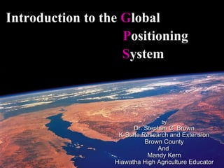
  • 1. Introduction to the Global Positioning System by Dr. Stephen C. Brown K-State Research and Extension Brown County And Mandy Kern Hiawatha High Agriculture Educator
  • 2. WHAT IS GPS? • Satellite based radio positioning system • Developed and maintained by the U.S. Department of Defense • Made up of three segments: Space Control User or Ground receivers • Used for obtaining accurate locations anywhere on earth
  • 4. GPS Is An Excellent Mapping Tool Instantly gives: Altitude Speed Longitude and Latitude
  • 6. Math Connection Step 1 •Suppose we measure our distance from a satellite and find it to be 11,000 miles. •Knowing that we're 11,000 miles from a particular satellite narrows down all the possible locations we could be in the whole universe to the surface of a sphere that is centered on this satellite and has a radius of 11,000 miles.
  • 7. Math Connection Step 2 •Next, say we measure our distance to a second satellite and find out that it's 12,000 miles away. • That tells us that we're not only on the first sphere but we're also on a sphere that's 12,000 miles from the second satellite. Or in other words, we're somewhere on the circle where these two spheres intersect.
  • 8. Math Connection Step 3 •If we then make a measurement from a third satellite and find that we're 13,000 miles from that one, that narrows our position down even further to the two points where the 13,000 mile sphere cuts through the intersection of the first two spheres. •To decide which one is our true location we could make a fourth •So by ranging from three measurement. But usually one of satellites we can narrow our the two points is a ridiculous position to just two points in answer (either too far from Earth or space. moving at an impossible velocity) and can be rejected without a measurement.
  • 9. LAND •USER SEGMENT SEA AIR NEED THREE SV’s.
  • 10. Control Segment • Maintained by the Department of Defense
  • 11. Sources of Error  Selective Availability (SA Error)  Atmospheric  SV Ephemeris  Multipathing  Poor SV Geometry
  • 12. EPE (Estimated Position Error) The higher the EPE, the greater the Positioning error! Good EPE’s range from 10-20 feet. Proper pre-mission planning prevents poor positioning!
  • 13. Shape of the Earth (datum)
  • 14. PRACTICAL APPLICATIONS •Navigation •Sailing, hiking and aviation •Collecting and locating way-points •Locating Features • Stocking locations or stream surveys • Endangered or sensitive species locations • Locating trails or physical structures •GIS •Collecting GPS data along with attribute data • Mapping and database update •Surveying •Locating Control Points quickly
  • 15.
  • 16.
  • 17.
  • 18.
  • 19. LOW END UNITS •Capabilities •20 ft accuracy •1-12 channel receiver •Collect only way point data •Cost •$80 - $600 •Limitations •Poor reception under tree canopy •No file collection •Applications •Navigation for hiking or sailing
  • 20. MID-RANGE UNITS •Capabilities • Sub-meter accuracy with DGPS • 6-12 channel receiver • Collects static, mobile and attribute data •Cost • $2,500 - $15,000 •Limitations •Not accurate for surveying •Applications • Navigation • Mapping •GIS Update
  • 21. HIGH END UNITS •Capabilities • cm accuracy with DGPS • 12 channel receiver • Collects static points •Cost • $15,000 - $100,000 •Applications • Surveying
  • 22. Garmin GPS Receivers  Inexpensive and downloadable  Available locally for less than $150  Most GPS receivers similar in operation
  • 23. Okay, lets see how it works! Zoom out/in Page Button Button Power Button Find Button Thumbstick
  • 24. Pages In the GPS Unit
  • 25. SV Visibility clear view obstructed view clear view obstructed view
  • 26. Satellite Status Page  Satellite status appears while the unit “finds” the satellites  Acquisition can take several minutes
  • 27. Satellite Status Page Satellite elevation/position Signal strength Receiver position
  • 28. Main Page  The main page allows user to edit waypoints, tracks and routes or configure system to personal preference
  • 29. Map Page  Allows you to view map of current location, waypoints and tracks
  • 30. Waypoints 4 track 2 3 waypoint 1
  • 31. Creating Waypoints  Marking waypoints allows you to remember and return to a specific location  Waypoints are created by pressing and holding thumbstick
  • 32. Finding Waypoints  Pressing “Find” button will bring up a list of waypoints  Entering a waypoint will result in “as the crow flies” directions to that
  • 33. Finding Waypoints Name of Waypoint Distance to Waypoint Bearing to Waypoint Heading Speed
  • 34. What is Geocaching? Geocaching is a worldwide “scavenger hunt” using GPS to find “caches” of treasure. The only rules are to leave something if you take something and do not disturb the cache
  • 35.
  • 36.
  • 37.
  • 38. Links to using GPS into the Classroom  http://worldofagriculture.org/WOA-precag.htm
  • 39. Let’s Practice!!  Waypoint #1 – N 39°51.102 W 095°31.536  Waypoint #2 – N 39°51.081 W 095°31.590  Waypoint #3 – N 39°51.113 W 095°31.417  Waypoint #4 – N 39°51.090 W 095°31.400