SlideShare uma empresa Scribd logo
1 de 62
Baixar para ler offline
The Use of Interdisciplinary Research within the
Wider Landscape for Conservation Purposes: A
Trial Study in Warwickshire.
2
Acknowledgements
This dissertation was carried out at the University of Durham as part of an undergraduate
(Geography Bsc (Hons) degree.
I would like to thank Dr. Jim Innes for his tutoring, guidance and support throughout the
project. In particular I thank him for encouraging my interest in conservation.
I would also like to thank Professor David Bridgland for his help with the Coulter Analyser
and counsel regarding the levels of confidence that can be associated with environmental
proxies.
I am particularly grateful to Mrs Alison Clark and the Durham University Geography
Department Laboratory Technicians for their assistance, guidance and time regarding the
preparation of the environmental proxies.
Cover Illustration: Artistic impression of the Wootton Wawen Investigation Site, 3rd
April
2013. Produced by the author.
3
Contents
1. Introduction........................................................................................1
2. Literature Extracts.............................................................................1
3. Aims....................................................................................................2
4. Literature Review...............................................................................3
4.1Conservation..................................................................................3
4.2Global Cultural Systems.................................................................4
4.3Landscape Cultural Systems.........................................................5
4.4Ecological Systems.......................................................................6
4.5Environmental Reconstruction......................................................8
5. The Warwickshire Trial Study..........................................................9
5.1Location.........................................................................................9
5.2Quaternary History........................................................................10
5.3Cultural History..............................................................................11
6. Methodology.....................................................................................11
4
6.1Field Methodology.........................................................................11
6.2Laboratory Methodology................................................................14
6.3Limitations......................................................................................15
6.4Display............................................................................................16
7. Results................................................................................................17
7.1Environmental Proxy Diagrams......................................................17
7.2Descriptions....................................................................................20
8. Discussion..........................................................................................24
8.1 Discussion Structure.......................................................................25
8.2 Environmental Proxies....................................................................25
8.3 Place-name review..........................................................................28
8.4Field Survey......................................................................................29
9. The Application of Findings................................................................32
8.2General Conclusions for Modern Conservation................................32
8.3The Warwickshire Landscape...........................................................34
10. Bibliography.............................................................................................36
11.Appendix........................................................ ......................................44
11.1 Appendix 1 (Maps).......................................................................44
12.2 Appendix 2 (Field Survey Photographs)......................................50
6
List of Figures
Figure 1 Anthropogenic transformation of the Global landscape................................... 4
Figure 2 Conception of an ecological basin of attraction.................................................7
Figure 3 Stages of ecosystem change............................................................................7
Figure 4 Constraining the site of the environmental reconstruction..............................13
Figure 5 Pollen diagram................................................................................................17
Figure 6 Fungal Spore and charcoal diagram...............................................................18
Figure 7 Deteriorated pollen diagram............................................................................18
Figure 8 Culmative particle-size distributions................................................................19
Figure 9 Catagorised particle-size distributions ...........................................................19
Appendix 1 (Maps)
Figure 1 Map of the Arden landscape...........................................................................44
Figure 2 Map of the Heart of England Forest Estates...................................................45
Figure 3 Topographic sketch map of Willow-Brook catchment.....................................46
Figure 4 Ecologically related place-names of Willow-Brook catchment........................47
Figure 5 Areas of UK Coppiced woodland in 1905.......................................................48
Figure 6 Strategic Conservation overview of the Arden landscape..............................49
Appendix 2 (Field Survey Photographs)
Figure 1 Pollen Site......................................................................................................50
Figure 2 Oak Tree Farm House Meadows SSSI..........................................................51
Figure 3 Bannam’s Wood............................................................................................52
Figure 4 Barnmoor Camp Wood..................................................................................53
Figure 5 Oversley Wood..............................................................................................54
Figure 6 Hayland Way Wood.......................................................................................55
7
1. Abstract
The impact of human activity across the wider landscape is so significant that many
scholars declare we have transitioned into a new global epoch - the Anthropocene. Within
this epoch integration between human and ecological systems has created a cultural
landscape within which social and economic demands comprise fundamental drivers for
change. The growing deterioration in ecological systems is therefore blamed on the
demands of rapid social and economic growth.
However the role of social and economic systems within the landscape is mediated to a
certain extent through the beliefs, values and meanings we cultivate through cultural
norms which change over time. The need to address these demands therefore invites a
look back at how past societies related with the landscape. This requires cooperation
across the disciplines with archaeology, anthropology and ecology providing fundamental
insights into cultural interaction with landscape for modern conservation purposes.
Interdisciplinary research is carried out within the regional setting of Warwickshire, within
which an extensive history of cultural and ecological interaction stretches across two
millennia. An environmental reconstruction aims to understand the role of ecological
systems within the landscape and relies on proxy-indicators including as pollen, fungal
spores and charcoal. Further insight is given through a review of regional place-names,
the use of historic documents and the undertaking of present-day field-surveys.
It appears the historic landscape of Warwickshire witnessed a much closer degree of
cooperation between its cultural and ecological systems. Sustainable management of the
landscape was carried out to produce wood, bio-fuel and agricultural produce whilst
retaining a high degree of diversity and consequently an inherent resilience across
ecological systems. Furthermore this landscape appeared to retain these ecological
qualities while supporting early modern industry.
The findings of this study are applied to the modern conservation agenda in order to
assess if previous forms of management can be once again undertaken throughout the
landscape. It is suggested that within the regional setting an opportunity exists to restore a
great degree of resilience and diversity across the landscape through the connection of
ecological landscape ‘attractors’ with isolated refugia containing species of historic
importance. The success of such a proposal would depend on restoring the meaning
these ecological systems once contained to the local inhabitants. The potential of cultural
landscape conservation is believed to be greatly increased through the aid of the many
existing conservation schemes across the county.
1
2. Introduction
``It is possible for categories to become so fixed a part of the intellect that the mind finally
becomes engaged in playing false to support them” (Bohm and Peat., 1987).
The beliefs we cultivate for the natural world comprise a key driver of environmental
change shaping the activities of societies through cultural norms (UNEP, 2012). In
recognising this driver, it is thought the reliance of environmental research on large
assemblages of quantitive data limits the sciences potential towards practical conservation
(Boyd., 1990). A greater focus on culturally integrated, 'holistic' ecology is needed to
increase the impact of conservation in cultural landscapes.
This paper attempts to integrate ecological theory with recent cultural shifts in the twentieth
and twenty-first centuries. It draws upon themes within archaeology, ecology and
anthropology so that it may develop landscape conservation. The ideas are tested through
reconstructing a pre-industrialised landscape which is thought to contain greater synthesis
between its cultural and ecological elements through interdisciplinary research. The
achievement of these aims has required the examination of particular themes within
conservation, sociology, history and ecology and the expression of these themes though a
common discourse. This has been reflected in the structure of the initial part of this paper
which is divided into four key elements: conservation, the cultural and ecological contexts
of landscape and environmental reconstruction.
3. Literature Extracts
Throughout this paper extracts of literature aim to instil an appreciation of landscape into
the fabric of the work, thereby actively demonstrating the significance of culture towards
our perception of landscape. The role of beliefs in the natural world mean the emphasis on
science in conservation often fails to engage people on a meaningful level because of an
ignorance of the intrinsic narratives, metaphors and stories with which people experience
the wider landscape (ARC, 2006). Language and literature are portrayed as the true
expression of the natural world by anthropologist Jay Griffiths with ‘land seeming to cross-
fertilise language and language the land in an intricate chiasmus of mind and wildness,
each a simile for the other’ (Griffiths, 2006). Therefore using selected extracts of literature
2
will relate the reader to the landscape in a highly personal fashion, a necessary step for a
real engagement in conservation.
The recent degradation of the cultural landscape discussed in this paper has inevitably
eroded the metaphors, allusion and poetry with which people once related to the natural
world. The British poet John Clare who used local dialect in describing cultural landscapes
in the early modern period was regarded as a subversive and eventually locked away
(Griffiths, 2006). As such in recalling how the landscape has been immortalised in
Shakespeare and idealised through the works of Grant an appreciation of the character of
its past is achieved and that is arguably the ultimate aim of conservation.
4. Aims
This interdisciplinary study will reconstruct past vegetation patterns and cultural meanings
for the modern conservation agenda. It will present its findings in a framework inviting
open discussion between land-owners, conservationists and economists in the hope of
moving towards accumulative gains for both society and the environment.
1.) Reconstruct vegetation composition and past environments across the Late
Holocene Warwickshire landscape. Evaluate the confidence attached to these
proxies.
- Pollen analysis
- Pollen deterioration analysis
- Fungal spore analysis
- Charcoal analysis
2.) Reconstruct vegetation patterns and their chronology and cultural meanings across
the Late Holocene Warwickshire landscape.
- Place-name review
- Field survey of modern landscape
3.) Examine the significance of past vegetation patterns and meanings for the modern
conservation agenda.
- Modern species survey
- Literature review
3
5. Literature Review
5.1 Conservation
“How to Conserve amid the creative play of a dynamic Universe?” (Naveh, 2000)
Modern conservation schemes often gravitate towards the concept of biodiversity in
seeking to define their aims. According to the Convention of Biological Diversity, whose
advice is sought by current UK governance, biodiversity is defined as ‘the variability
among living organisms from all sources and the ecological complexes of which they are
part’ (DEFRA., 2011). This definition ignores the integration of anthropogenic systems into
the wider landscape and ecology through what is reported as a non-linear interplay
between elements such as climate, geology, ecology and society (Naveh., 1994; UNEP,
2012). These interactions collectively lead to additional structural and functional qualities
within a particular system (Naveh., 2000).
In reviewing this notion it soon becomes apparent that the feedbacks and synergies
effecting ecology are not wholly appreciated by a study of ecology itself, especially when
embedded within a contemporary 'cultural landscape' such as that of modern Britain.
This shift in perspective focuses attention towards the structural and functional integration
of the bio-, eco- and socio-spheres into a more coherent land-system (Palang et al., 2000).
This shifts management attitudes away from ‘protecting’ a disembedded, fragile ecology
towards restoring its proper integration with the surrounding landscape. Furthermore, it
advocates the concept of ecosystem services, the provision of valuable monetary services
to mankind by ecosystems, widening its appeal to land-owners, economists and policy
makers (Rafelli, 2013). Ecologists have often shied away from ‘holism’ and regard it as a
‘soft’ philosophical term for which there is no room in a respectable ‘hard’ science.
However as we progress into the twenty-first century and new demands are placed onto
the environment – as new social, conservational and agricultural agendas emerge – so do
the categories with which we capture them and it becomes increasingly important to take
note of the complex interactions between cultural and natural systems in conservation,
4
5.2 Global Cultural Systems
“I had grown used to tracking a wood or hedge through seven centuries, and on going to
the spot being just in time for the dying embers of the bonfires in which it had been
destroyed” (Rackham, 1990).
There is significant quantitative evidence that human activity now impacts natural systems
to such a degree as to warrant the creation of a new global epoch – the Anthropocene.
The global population has doubled to 6 billion over the last fifty years, atmospheric C02
concentration will reach the unprecedented figure of 400ppm in 2013 (Vince, 2011),
biodiversity is undergoing a sixth great extinction event (Steffen et al, 2007) and around
three-quarters of terrestrial ecosystems have experienced transformation into
anthropogenic systems (e.g. agriculture, settlement) (Figure 1) (Ellis, 2011).
Within this context an increasing volume of research warns of the impact of ecological
feedbacks whose consequences have been recently described as ‘geopolitical dynamite’
for the future management of the landscape (Rockstrom, 2013). For example, the recent
inception of ‘planetary boundaries’ as ‘safe operating spaces for humanity’ indicates
ecosystem functions embody two boundaries that have already been exceeded (rate of
biodiversity loss and nitrogen cycle perturbation) and a third (land-system change) that is
prone to regional breakdowns (Rockstrom et al, 2009). While the case for conserving
ecological systems is made compelling through a consideration of genetic, medicinal,
aesthetic and psychotherapeutic factors (UNEP, 2012) the corrosion of planetary
Figure 1: A time-scale of anthropogenic transformation of the global landscape (Ellis, 2011).
5
thresholds calls into question our ability to meet basic development goals (e.g. Millennium
Development Goals) and therefore represents a central challenge for the Anthropocene.
The mismatch of human decision-making and environmental scales limits responses to
address these challenges and therefore a need exists to focus conservation onto scales
relevant to decision-making (Rockstrom, 2013).
5.3 Landscape Cultural Systems
The historic UK landscape has demonstrated that cultural relations with ecological
systems have not always been so one sided. In 1086 a ‘cultural landscape’ had
established itself across the UK with documents expressing ecological systems in
economic and social terms. For example, the utilisation of eleven acres of under-wood ‘to
the value of 55 shillings without causing waste or destruction’ was the norm under the
coppice-management of Heylewode, Cambridgeshire in 1356 (Rackham, 1990).
This notion of sustainability was reinforced with the arrival of the early-modern Naval and
Tanning industries of 1780-1850 which provided an economic rationale for the
maintenance of native Oak woods across much of the landscape. Much woodland is
preserved in past industrial heart-lands of the Weald, Lake District and Forest of Dean
while in rural Nofolkshire, Montgomeryshire and the Dales these ecological systems were
lost through a lack of relevance (Rackham, 2003). Indeed it can be said that the
integration of society with the natural world has been a conservation success in such
circumstances.
The need to address current management practice therefore invites a look back at how our
ancestors related with ecological systems. Indeed, this paper identifies two cultural shifts
which happened relatively recently as an opportunity to restore biodiversity and ecological
services through an environmental reconstruction.
The first great shift was part of the ‘great acceleration’ of the Anthropocene. As the advent
and wide scale adoption of industrialised agriculture in the twentieth century assimilated
biodiversity within previously heterozygous landscapes the functioning of agrarian
ecosystems collapsed (Benton et al., 2003). Additionally, the adoption of commercial
forestry practice removed as much ancient woodland from 1945-1975 in the UK as in the
previous four hundred years (Rackham, 1990). These ecosystems, having adapted to
thrive in an anthropogenic landscape offer the most viable choice for modern conservation
in a country where the population continues to increase and ‘true’ wilderness no longer
6
exists. The second shift, the recently growing desire, summarised in the government’s
Environmental White Paper to 'safeguard and restore degraded ecosystems through
integrated approaches’ (DEFRA., 2011) is based upon a greater awareness of the value of
environmental services and their fragility.
It is hypothesised that an environmental reconstruction of a pre twenty-first century
'culturally coherent and ecologically capable landscape' (Brown., 2010), one more
reflective of modern aspirations as voiced in the recent government environmental ‘White
Paper’ (DEFRA, 2011), may serve as a benchmark for assessing whether contemporary
conservation is incorporating the opportunities created by new cultural shifts. To do this it
is necessary to seek recognition of the principles discussed within the ecological literature
in order to achieve a scientific basis for our proposals.
5.4 Ecological Context
“I felt its urgent demand in the blood. The forest was a fiddler, wickedly good, eyes intense
and shining with a fast dance..every leaf in every breeze dangerously mesmerising me”
(Griffiths, 2006).
The various forms of interplay outlined previously were initially conceptualised within
ecology through the fuzzy term of ‘stability’, developed through ‘functional diversity’ and
eventually ecosystem 'resilience', the latter being the most insightful (Lister., 1997).
Ecosystem resilience is best understood through the concept of a ‘basin of attraction’
which describes an equilibrium state in which the system will be inclined to return after
rapid changes and exploitation. This central state is defined as the ‘attractor’ while the
basin comprises the wider environment and ecological assemblages that will respond to
this attractor or the overall ‘stability landscape’ (Figure 2) (Walker et al., 2006).
7
It is therefore brought to attention that biodiversity per se does not sustain an ecosystem in
a certain state, but rather it is the intrinsic interactions occurring between species and
there environment which sustain its equilibrium. These interactions are achieved by
species groupings, or 'functional groups', a term which encompasses the wider role they
play within collective stability e.g. pollinators, nutrient transporters, predators (Folke.,
2006). The function of a particular group may change over time with species fulfilling
lesser roles in the system becoming critical in regeneration after disturbance (Folke.,
2006). Therefore it is the functional groups of a particular ecosystem which constitute an
overall ‘memory’ or the ability for the system to recover from exploitation, illustrated in
Figure 3 (Folke et al., 2002).
Figure 3: An ecosystem’s various stages of change demonstrating the availability of
functional groups acts to dictate the trajectory of response. Adapted (Holling et al., 1995).
Figure 2: A basin of attraction containing its change capacity or ‘Latitude’ along the horizontal
plane, ‘Resistance’ along the vertical plane and ‘Precariousness’ comprising its current state.
The shift from a degraded system to its more established state may confer a number of
advantages regarding its ‘Resistance’, ‘Latitude’ and ‘Precariousness’ (Walker et al., 2004).
8
The structure of this paper draws attention to the impact of cultural factors on functional
groups and therefore on ecosystem resilience. It asks as to whether the industrialisation of
land practices in the twentieth century has removed certain functional groupings and the
qualities they instil to the wider ecosystem, unnoticed to the casual observer.
5.5 Environmental Reconstruction
And in this life, exempt from public haunt, find tongues in trees, books in the running
brooks, sermons in stones, and good in everything. I would not change it" (Shakespeare,
1623).
Despite the case for a greater adoption of interdisciplinary research by conservationists
recent studies have drawn attention to a ‘fundamental disconnect’ existing between
palaeoecology, archaeology and conservation (Brown., 2010, Willis and Birks., 2006).
While the most viable ecological analogues for a sustainable cultural landscape are likely
to be found in the recent past, even the more progressive studies have explored little of
this applicability (Brown., 2010; Willis and Birks., 2006). An informed restoration may offer
additional qualities that uncoordinated, piece-meal restoration attempts seeking to expand
arbitrary biodiversity may not, such as resilience.
The present situation may be partly due to the statement that ‘few are prepared to use the
palaeoecological record to plan for an uncertain green house dominated future’ (Buckland,
1993). However I need look no further than the seminal classic of E.W Jones (1945) in
which he proposed the natural periodicity of climate cycles has long been causing ‘an ever
varying proportion of species to arise and replace each other as the result of some slight
disturbance of balance’ within a natural climax community. He goes on to state such a
community would consist of ‘a mosaic of communities, at least in time’ suggesting an
inherent ability to adapt in the functioning climax (Jones, 1945). While some authors
suggest continued degradation acts to promote the proportion of resilient taxa in the
system (Darling., 2010) I stress a resilience to one type of exploitation does not confer
resilience to another and the degraded system, lacking certain functional groupings, would
in fact be less capable of responding to climate change than one restored of its ‘memory’.
When reconstructing past environments the concept of palynology is of great use and will
form the central part of this study. However poor representation of herbs within the record
9
and imprecise species identification, respectively due to low pollen values and generalised
morphological characteristics limits its capability (Rackham., 1994). Therefore multiple
evidence sources will extend the studies breadth and allow further conclusions to be
drawn through comparison. Place-names, historical records and field evidence offer
cultural as well as ecological information about past environments (Wager, 1998;
Rackham, 1990).
Through using a wide evidence basis the investigation will go beyond restoring a simplistic
environmental ‘back clothe to human activity’ (Bell., 1990) and focus on the interaction
between social and ecological systems. However it must be recognised that
environmental and historical evidence are affected by biases, filters and discontinuities
operating on different temporal and spatial scales (Davies and Watson., 2007). The
tendency palaeoecologist’s have to ‘suck in and smear’ (Ballie., 1991) whereby they seek
confirmation for known historical events in their diagrams rather than treating
environmental proxies and historical documents as independent sources must be avoided.
6 The Warwickshire Trial Study
“It was because he [Shakespeare] had seen the beauties of sunrise and sunset, the
waxing and waning of the moon in beautiful Warwickshire that he was able to write not
only as the poet of court, camp and grave but also as the poet of nature” (Grant, 1914).
6.1 Location
It is pleasing to note Warwickshire is 'often regarded as a microcosm of national contrasts
and variations' (Wager, 1998). Within these contrasts a site must be chosen which fulfils
the aims of this investigation.
Natural England's National Character Area’s (NCA’S) are determined by factors such as
geodiversity, biodiversity and culture thereby presenting an appropriate framework for
assessing the environmental history of the area. Natural England’s National Character
Area’s (NCA’S) 97, known as the ‘Arden’ incorporates an ancient landscape in which
environment and society have long been interwoven (Rackham, 1990) (Appendix 1, Figure
1). Extensive wood pastures which survived into the early Medieval period were
subsequently incorporated into the range of ‘groves’, communal based coppices, pastures
and parklands from the 11th century (Wager, 1998).
10
The Midlands have been described as palynologically empty' by Edwards (1999) due to
the lack of preservation potential in the underlying Triassic mudstone. However
'environmental data in the form of macro-fossils and pollen [may] survive within dateable
paleochannels' (Alexander, 2006). Furthermore, a recent county archaeological survey
states the 'Alne is less affected by flood alleviation schemes' than other major rivers and is
therefore likely to have continued to preserve environmental history into the present day. A
meandering tributary of the Alne known locally as the 'Willow-Brook' found within the
parish of Wootton Wawen was subsequently selected to accommodate this investigation.
In further examinations we note the dominant land use of the present-day Arden area is
grass and un-cropped land at 52% with 366 lowland grazing livestock holdings (31% of
total farms) containing 119,500 sheep and 38,000 cattle which suggests intensive cereal
agriculture is not as well developed in this county as others (DEFRA., 2010) (Natural
England., 2012). This, along with the proximity of the large-scale broadleaved woodland
restoration scheme known as the Heart of England Forest Project (Appendix 1, Figure 2)
suggests potential for landscape conservation initiatives.
6.2 Quaternary History
In order to determine the spatial and temporal resolution of the alluvial record a
geomorphic survey of the surrounding landscape is carried out (Macklin, 1999).
Geomorphic processes of the past are known to condition subsequent river sensitivity and
therefore bias the alluvial sediment (Brown, 1989). This brief review outlines the relevance
of geomorphic processes on the modern landscape.
A trans-Pennine northwest ice sheet advance over the county around 450,000 years ago
(MIS 12) is indicated by the clast lithology of ‘Thrussington Till’ at Wood Farm Quarry.
Repeated ice retreats and re-advances impeded drainage of the ancient River Bytham,
depositing glacio-fluvial and glacio-lacustrine sediments. The most recent Devensian ice
sheet (MIS-2) did not travel further than the Pennies and Lincolnshire Wolds allowing
Warwickshire a considerable period free from ice (Wymer 1999).
During this time the post-glacial ‘competence limited’ channel began to gradually acquire
the characteristics of a 'supply limited' system through the sustained action of biological,
chemical and physical processes (Brown, 1989). The stark glacial geomorphology was
replaced with gentler, rounded topographic features as the landscape underwent
smoothing, illustrated in the topographical map of Appendix 1, Figure 3. The river has
11
therefore become increasingly sensitive to local environmental processes during the
decoupling of slope-channel processes, suggesting its suitability for this study (Macklin,
1999).
6.3 Cultural History
Two sources of historical evidence are used to support the selection the Willow-Brook site
while further illuminating the local history. Firstly, a land grant states the land was given to
a nobleman called Ethellric in 716AD by King Ethelbald of Mercia in the place called
Uuidutuun (Wootton) near the river Alne. It describes a landscape of ‘fields’ ‘meadows’ and
the word saltibus meaning 'upland wood', suggesting a mosaic of ecosystems existed
within this cultural landscape from an early period, potentially providing significant value to
modern conservation schemes (Wager, 1998).
Second, the place-name Wootton combines wudu with tun (Uuidutuun in old English as
per the grant), and when used as a suffix means the settlement “had a special function in
relation to wood and its products” (Wager, 1998) suggesting the local inhabitants would
have valued the sustainability of this ecosystem service (Rafelli, 2013). Further indications
of the ecological significance the landscape had for its inhabitants is found in a review of
local place-names illustrated in Appendix 1, Figure 4, which will be examined in later
sections.
7 Methodology
“Hath not old custom made this life more sweet than that of painted pomp? Are not these
woods more free from peril than the envious court?" (Shakespeare, 1623).
7.1 Field Methodology:
Environmental Proxies: The site which proved most successful in meeting the selection
criteria is known as the Osiers and comprised of a half-mile stretch of Willow Carr and
agricultural pasture along the undeveloped WillowBrook, a tributary of the Alne. Arial
photographs in conjunction with an embankment walk identified a prominent meander
feature suspected to have preserved a sequence of alluvial archaeology.
A gauge corer extracted three cores at increasing distances from the channel in order to
determine the deepest sequence of alluvial sediment. The boreholes continued into
12
minerogenic sediment until further penetration was impossible. The deepest sequence
was found at the edge of alluvial sediment, 2.8m from the channel, illustrated in Figure 4.
A Troels-Smith description was not required due to the later use of a Coulter Analyser. The
core extended 2.59m in depth and was placed within plastic piping for transport with depth
and location labelled.
Place-name Review: An O:S Map of the WillowBrook catchment was reviewed prior to
the field-work with names of significance to the ecological management of landscape
chosen for inclusion in Appendix 1, Figure 4.
Field Survey: The field surveys were carried out from 8th
April- 9th
April 2013. Six locations
representative of the historic landscape and modern management were visited. Two
ancient semi-natural woodlands, one commercial forest, one recently planted broad-leaved
forest, a sequence of water-meadows and the local pollen site collectively provide much
insight for this investigation. Upon arrival the sites were evaluated using the principles of
historic ecological field-work laid out in Rackham (1990). Selections of photographs were
taken in order to display any distinguishing features relevant for the investigation.
13
4.)
14
7.2 Laboratory Methodology:
An initial twelve samples were extracted at regular intervals down the core, excluding the
first 60cm because of the disturbance of bioturbation. The core was sampled at 16 cm
intervals to a depth of 257cm with a narrow spatula being used to scoop up 0.5cm3
of
sediment while minimising any contamination. The remaining twelve samples were used to
increase the resolution to 8cm, with the taphonomic considerations of alluvial sediment, to
be discussed later rendering further resolution at best unnecessary within the context of
this studies objectives of and at worst misleading (Turner, 1985). Standard chemical
procedures were followed to isolate the proxies of interest - palynomorphs, non pollen
palynomorphs (NPP’s) and charcoal (Birks and Birks, 1980; Seppa, 2007). Additionally the
application of hydrofluoric acid was required due to the high silica content of the sediment.
As part of the procedure the samples were filtered under an 180um mesh with the excess
being retained within 2cl water for macro-charcoal analysis. A 5-point scale (0-4) was used
to determine macro-charcoal frequency as per Simmons and Innes (1996).
The prepared samples were then stained with red dye safranin and placed on slides with
the addition of silicane fluid to facilitate the dispersal and identification of proxies (Faegri
and Iverson, 1989). A MOTIC BA3000 microscope was used at magnifications of x400 to
count the macrofossils and microcharcoal quantities of each slide with a magnification of
x600 to x1000 occasionally used for higher definition identifications (Moore et al, 1991).
The slides were scanned at regular transects to reduce the effects of size specific grain
migration and palynomorph accumulation (Brooks and Thomas, 1968). The taxonomic
resolution extended to the genus/family level with further resolution rendered infeasible
due to the similarities of pollen and the quality of the grains themselves.
The poor preservation rates of microfossils meant 200 pollen grains were identified per
slide, which is deemed to be sufficient for observing the trajectories of taxa over time. Four
types of fungal spore were counted in addition to the pollen based on their environmental
indicator value (van Geel, 2003). These proxies were counted within the same sample
area of slide as the pollen grains for consistency. Fungal spore counts ranged from absent
to 52 with micro-charcoal counts again ranging from absent to 62. The degree of variation
is to be somewhat expected when analysing alluvial sediments exposed to rapid
fluctuations in channel-deposition (Turner, 1985).
15
7.3Limitations:
1.) Evaluate the confidence of attached to these proxies.
As per Turner (1985) it is noted geoarchaeological sites are especially prone to vertical
and lateral differentiation in the quantity and quality of surviving microfossils. Furthermore
a unknown number of hiatus’ may exist along the sequence which are hard to identify
through a qualitative analysis and can render the interpretations meaningless. As such an
attempt has been made to quantify the impact of these undesirable effects on the data and
so avoid potentially misleading conclusions through two techniques. First, the degradation
rate of selective pollen ‘indicators’ has been documented using the procedures outlined in
Crushing (1967). These rates are then recorded as a relative frequency diagram of total
pollen counts to provide an indication of the degree of microfossil deterioration across the
sequence and any changes that occur therein (Figure 7). Higher deterioration rates imply
lower confidence in the remaining sample accurately representing the wider environment.
Second, as recommended in Turner (1985) the geochemical conditions in which the
proxies were located have been quantitatively assessed through the use of a LS 13 320
Laser Diffraction Particle Size Analyser (Beckman Coulter Analyser). The Coulter Analyser
measures the ‘Franunhofer’ diffraction pattern of the light emitted at a suspended sample
of particles for each sample and collates these values to determine the nomenclature of
each grain which is illustrated in Figures 8 and 9. The sequence stratification can then be
used to make inferences about the palaeo-fluvial conditions under which deposition
occurred, and possible re-working (Turner, 1985).
The characteristics of the palynomorphs themselves may bias sampling with
entomophilous species such as Tilia producing relatively few pollen grains (Rackham,
2006), perhaps accounting for its absence in this study. Meanwhile anemophilous species
such as Pinus and Alnus are overrepresented within diagrams due to their efficient
dispersal of large quantities of pollen (Innes, 2009).
Additionally, within the grains themselves the amount of sporopellenin determines to a
certain extent the preservation potential of the grain, meaning the data may be biased
even after correcting for other factors (Turner, 1985). As such it is important to support
conclusions from pollen analysis with other sources of evidence.
16
7.4 Display:
The macrofossil and charcoal data is displayed using the stratigraphic diagrams available
through the C2 software programme (Figures 5, 6 and 7) (Juggins, 2004). The Fungal
Spores are plotted in a separate stratigraphic diagram (Figure 6) as are the deteriorated
pollen counts (Figure 7).The taphonomic considerations associated with alluvial sediment
suggest each sample represents a snapshot in time rather than continuity and therefore
bars have been chosen over a continuous line as an appropriate means of representation
(Hevly, 1981). The diagrams are an effective means of plotting complex, multi-taxa data in
a way which highlights significant trends and therefore ecological trajectories over time.
17
57
67
77
87
97
107
117
127
137
147
157
167
177
187
197
207
217
227
237
Depth(cm)
Zone A
Zone B
Zone C
Zone D
Zone E
0 20
Quercus
0
Ulmus
0 20 40
Alnus
0
Fraxinus
0 20
Betula
0
Pinus
0 20
Corylus
0
Ilex
0
Sorbus
0 20
Salix
0 20 40 60
Gramineae
0
Cereal
0
Pterdium
0
Plantago
0
Rumex0
Chenopodiaceae
0
Umbeliferae
0
Filipendula
0
Urica
0
Lythrum
0
Taraxacum
0
Rannuncules
0
Cyperacea
0
Succisa
0
Cirsium
0
Centaurea
0
Galium
0
Melampyrum
0 20 40 60 80 100
TAP:TNAP
Arboreals Shrubs Herbs
Figure 5: Stratigraphic diagram for pollen counts from the Willow-Brook alluvial site (65cm - 197cm). The use of zones which respond to
overall ecological characteristics aids the interpretation of the diagram.
8. Results
8.1 Environmental Proxy Diagrams
18
57
67
77
87
97
107
117
127
137
147
157
167
177
187
197
207
217
227
237
Depth(cm)
Zone A
Zone B
Zone C
Zone D
Zone E
0 20
D
eteriorated
Q
uercus
0 20 40
D
eteriorated
A
lnus
0 20
D
eteriorated
B
etula
0 20
D
eteriorated
C
orylus
0 20 40 60
D
eteriorated
G
ram
ineae
0
D
eteriorated
U
m
beliferae
Arboreals Shrubs Herbs
57
67
77
87
97
107
117
127
137
147
157
167
177
187
197
207
217
227
237
Zone A
Zone B
Zone C
Zone D
Zone E
0.0 1.0 2.0 3.0 4.0
M
acrocharcoal(>180um
)
0 20 40 60
M
icrocharcoal(<180um
)
0 20
G
elasinospora
(Type
1
and
2)
0 20
N
eurospora
(Type
55C)
0 20
Podospora
(Type
368)
0 20 40
Sporom
iella
(Type
113)
0 20 40 60
TotalSpore
C
ounts
Fire Indicators Grazing Indicators Figure 6: Stratigraphic diagram for the macro- and micro-
charcoal and Fungal spore counts from the Willow-Brook
alluvial core (65cm - 197cm).The fungal spores are
grouped according to indicator values. These
environmental indicators demonstrate greater
inconsistency than the pollen counts.
Figure 7: Stratigraphic diagram of deteriorated pollen counts for
selected species from the Willow-Brook alluvial core (65cm -
197cm). These species are chosen to represent wider pollen
counts throughout the core and demonstrate pulses of
increased degradation, thought to be correlated with fluvial
energy levels.
19
Figure 8: Culmative Particle-size Distribution of samples from WillowBrook alluvial core (65cm
- 197cm) displayed as per Bridgland et al (2011). The samples are categorised into four groups
based on particle-size distribution characteristics to aid in interpretation. The particle-size
group structure broadly corresponds with pollen zonatation suggesting a connection between
channel energy, soil structure and pollen preservation, as was proposed in Turner (1985).
 Figure 9: Catagorised Particle-size Distribution of samples. This figure is derived directly
from culmative particle-size distribution data for more pronounced trends and is intended
as a supplementary to aid in its interpretation.
20
8.2 Descriptions:
"The land! Listen, listen to me! The blood of Kings lies in your hand, What came before
and what shall be. Think on it. Seek to understand. Look at the earth" (Dennis, 2010a).
1.) Reconstruct vegetation composition and past environments across the Late
Holocene Warwickshire landscape. Evaluate the confidence attached to these
proxies.
Due to the holistic structure of this paper the proxies are presented and reviewed for each
group rather than each proxy, aiding in the holistic understanding of landscape.
Zone E (244cm -200 cm):
Pollen: The Arboreals exhibit consistency in both coverage (~40% TLP) and structure,
that being of a mixed-deciduous woodland noted as characteristic for Warwickshire over
the late Holocene (Wager, 1998). Quercus-Ulmus and Alnus all contribute significantly to
the canopy, with Quercus and Alnus fluctuating ~10-20% of total land pollen (TLP) and
Ulmus appearing steadily at ~5%TLP suggesting stability within arboreal species. The
shrub layer is relatively vigorous ranging from 19-22% TLP and almost completely
comprising of Corylus (17-21%TLP) which suggests active management of woodland to
favour this species. Although the herbaceous layer appears relatively subdued (38-
42%TLP) it displays significant diversity with Melampyrum, Centaurea, Succisa, Galium
and Rannuncules all making notable, albeit small appearances at (1-3%TLP) alongside
the more usual herbs. Gramineae establishes an immediate abundance which continues
to grow throughout the diagram, exhibiting an average value of 25% in Zone A. Overall
each pollen group displays consistency and stability across a widespread diversity of
species.
Fungal Spores: The indicator of fire (Neurospora Type 55C) and dry conditions
(Gelasinospora Type 1 and 2) increase to early respective peaks of 17 and 25 before
becoming absent from the record at 212cm (van Geel et al, 2003). The indicator of light
grazing (Podospora Type 36A) (Davies, 2006) and intensive grazing (Sporomiella (Type
113)) (van Geel et al, 2003) display continuity throughout the zone, peaking at the end
with values of 16 and 19 respectively (Figure 6).
21
Charcoal: Microcharcoal counts rise to a peak of 37 in the initial section of this zone,
before steadily declining to a count of 20. Macrocharcoal follows this trend, peaking at 4
(>50% coverage) early on before declining to 2 (2-10% coverage) (Figure 6).
Particle-Sizes and Pollen Degradation: The particle-size distributions demonstrate fairly
low proportions of silt (between 16-18%) with sand quantities comprising a further 29-33%
of sediment. The majority of sediment is therefore >200µm making up ~50% of total. This
suggests a relatively high energy fluvial system laid down these sediments however the
impact on pollen degradation is fairly subdued with Betula grains demonstrating no
deterioration (likely due to the low counts) and other species demonstrating ~a quarter of
grains in deteriorated state (Figures 7 and 8).
Zone D (200cm-160cm):
Pollen: A significant disruption event between180-188cm is noted whereby the sudden
absences of Quercus and Betula are accompanied by significant drops in Corylus (~20% -
~5%TLP) and a wide variety of herbs. In contrast to these declines peaks in Salix
(16%TLP) and Alnus (33% TLP) occur, both favouring bank-side habitats. Despite the
profound changes the overall assemblage exhibits an immediate recovery at 172cm to
pre-disturbance abundances, implying taphonomic factors, likely a flood event entraining
local pollen sources are the cause and further separation of zones is unjustified. External
to this event a peak of Betula (16%TLP) is accompanied by appearances of both Illex (1-
2%TLP) and Sorbus (1%TLP) all indicators of disturbance (Godwin, 1984) suggesting a
certain degree of change is occurring within the arboreals. These structural changes are
not reflected in overall TAP extent which remains fairly consistent at 33-41%TLP.
Gramineae increases to an average of 34%TLP, (30%TLP excluding the disturbance
event) in the herbaceous layer amid an overall retention of diversity excluding losses of
Galium and Melampyrum from the record.
Fungal Spores: This zone is characterised by fluctuations and irregular appearance in all
spores, except Sporomiella which is absent from the record. The disturbance event is
recognised as impacting the Fungal spores with absences in all species at 172cm (Figure
6).
Charcoal: Microcharcoal counts are sporadic, excluding the 172cm disturbance event
absence and display an overall peak of 52 counts at the end of the zone. Macrocharcoal is
characterised by two pulses of 4 at each end of the zone, corresponding with peaks in
microcharcoal (Figure 6).
22
Particle-Sizes and Pollen Degradation: The disturbance event observed during the
pollen and spore counts is firmly recognised in the sediment. Both silt and sand
components drop to very low values (an aggregate of between 17% and 18% of total
sediment). The vast majority of particles are between 212-100µm suggesting these high-
energy conditions, possibly in single storm event, and justifying the separate particle-size
distribution classification (Group C). Pollen degradation reaches its maximum values here
with over half of grains demonstrating deterioration, supporting the notion that high
channel energy is not conducive to pollen preservation (Figures 7 and 8). The loss of
fungal spores at this point further demonstrates the impacts of high energy fluvial
conditions.
Zone C (160-128cm):
Pollen: Further change throughout the arboreals characterise this zone. Previously key
species such as Quercus and Ulmus continue to decline with the former not exceeding
10%TLP and the latter appearing sporadically at ~6%TLP. Corylus steadily declines from
17% to only 9%TLP at the top of the zone (140cm) causing the shrub layer to reach a low
of 12%TLP from a high of 23%TLP in the previous zone. Earlier structural changes in the
arboreals are finally impacting upon their extent with TAP reaching a low of 29%TLP at
128cm. Despite a general consistency in Gramineae further changes are observed in the
herbaceous layer with taxa such as Rannuncules and Centaurea becoming extremely
rare. The first appearance of Taraxacum is noted at 1%TLP.
Fungal Spores: This zone is characterised by greater quantities of fungi with total counts
reaching 180 spores. An absence of all spores except Sporomiella at 148cm suggests
irregular taphonomic factors. Both indicators of fire demonstrate irregularity with counts
between 10 and 20. Podospora continues to decline reaching 6 counts at 140cm (Figure
6).
Charcoal: Microcharcoal exhibits a general decline from 37 to 8 counts across the zone,
punctuated with an anomalous high of 46 counts at 108cm depth. Macrocharcoal values
average 3 (10-50% coverage) throughout much of the zone (Figure 6).
Particle-Sizes and Pollen Degradation: A relatively substantial silt component between
20-30% and the addition of sand accounting for an aggregate of ~45-50% total sediment
accounts for classification under Zone B. Gravel clasts comprise the relatively small
remainder with 70% measuring under 300µm. A reduction in fluvial energy is implied,
correlating with lower pollen degradation counts (Figures 7 and 8).
23
Zone B (128-96cm):
Pollen: This zone suggests stability has been reached in the arboreal community or
perhaps a slow-down in exploitation with Ulmus continuing with sporadic appearances
~6%TLP alongside a flattening in the decline of Quercus at ~8%TLP. However the steady
decline of Corylus causes the shrub layer to average 13%TLP. Significant change occurs
in the herbaceous group with taxa such as Cirsium, Succisa, Rannunculus and Centaurea
becoming absent from the record, replaced with species such as Urica, Lythrum and
Taraxacum, indicating increased fertility (Godwin, 1984).
Fungal Spores: The grazing indicators are absent in this zone apart from 108cm where
Sporomiella reaches a peak of 34 counts alongside a count of 4 for Podospora with fire
indicators echoing this irregularity (Figure 6).
Charcoal: Microcharcoal exhibits great fluctuation amid no identifiable trend with counts
ranging from 3 to 35. Macrocharcoal broadly corresponds with the seemingly random
arrangement, with values ranging from 0-3 (Figure 6).
Particle-Sizes and Pollen Degradation: Particle-size distributions are marked by a rapid
increase in silt constitution, rising from ~30% at 110cm depth to ~55% at 95cm depth,
signifying the start of particle-size Zone A. While the degree of sand within these
sediments remains fairly constant the gravel component (>200µm) falls to between 20%
and 40% of total. This impies further reduction in high energy fluvial events, corresponding
well with pollen degradation trends (Turner, 1985) (Figures 7 and 8).
Zone A (96-65cm):
Pollen: The stability within TAP is proved to be short-lived in this zone reaching a new low
of 31%TLP, as opposed to the herbaceous community which experiences a high of
62%TLP. Pinus at ~4%TLP combines with relatively large amounts of Betula, Ilex and
Fraxinus pollen, peaking at 7%TLP, 2%TLP and 4%TLP respectively to imply significant
structural change with woodlands likely opening up and/or regeneration. The shrub layer
suffers the greatest decline with average values falling to 7%TLP caused by continued
reduction in the previously abundant Corylus. Within the herbaceous layer greater
abundance of species such as Gramineae (37%TLP) Pterdium (7%TLP) and Plantago
(7%TLP) occur amid an reduction of diversity. Evidence of increased fertility is noted from
relative abundances in Lythrum, Taraxacum and Urica (Godwin, 1984).
24
Fungal Spores: Indicators of fire display consistently high values while as does
Sporomiella with an average of 13 counts. However Podospora continues to fall with a
final appearance of 2 counts at 77cm. Overall the zone is quite populous with total spores
reaching 192 (Figure 6).
Charcoal: Microcharcoal exhibits a steady increase in values from 3 to 42 counts, yet
drops off to 32 counts at 65cm. Macrocharcoal is more sporadic declining from 4 to 3
between 76-65cm, after an initial low of 2 (2-10% coverage) at 92cm (Figure 6).
Particle-Size: These particle-size distributions comprise the siltiest section of the
sequence (35-52%), correlating with low pollen deterioration and high fungal-spore
readings (Figures 7 and 8).
Synthesis:
In general these proxies demonstrate a high degree of consistency in the quality of
environmental information, and correlate as would be expected (Turner, 1985, van Geel,
2003). However the fungal spore and charcoal counts are more prone to inconsistencies
and are therefore thought to be less useful in an alluvial context. When this is taken into
account they can nonetheless supplement the pollen information and extend the breadth
of this environmental reconstruction. Multiple proxies are also used to establish the cause
of inconsistencies with a comparison of deteriorated pollen counts, fungal spores and
particle-size distributions suggesting taphonomic considerations were to blame for a
notable decline in the quality of information in Zone D and occasions of high fluvial energy
reduced the preservation of environmental proxies.
9. Discussion:
"There has always been in England an older England still, where Chaucer rode to
Canterbury and Falstaff drank his fill" (Dennis, 2010a).
2.) Reconstruct vegetation patterns and their cultural meaning and chronology across
the Late Holocene in the Warwickshire landscape.
25
9.1 Discussion Structure
The pollen diagram comprises the principle basis for reconstructing vegatational changes
throughout the core with further constraints given through fungal spore and microcharcoal
counts where appropriate. The environmental proxies (Figure 5-9) offer a direct indication
as to the structure and composition of palaeo-vegetation, as well as providing indirect
suggestions about the vegetation patterning of the landscape and overall cultural
meanings behind these patterns. This understanding of vegetation patterns and cultural
meaning is then reinforced with a place-name review of the wider area (Appendix 1 Figure
4) and field-survey (Appendix 2). All research is evaluated within a framework of wider
literature to increase the confidence and breadth of its conclusions.
9.2 Environmental Proxies:
The earliest indications from the data-set suggest an ecological-system under stable
management. The ground-flora displays significant diversity with species favouring both
shade (Melampyrum) and open-spaces (Succisa) thereby implying a mosaic of habitats.
The distribution of taxa within each vegatational group remains broadly consistent
suggesting the vegetation is in equilibrium with the factors that control it.
The Quercus-Alnus-Ulmus composition seems unlikely to be caused solely by
environmental factors or natural variations as regional pollen records show the natural
climax-community was that of Tilia (Rackham, 1990).
Instead this suggests a system of coppiced management, common from the late medieval
period. Within woodland environments trees are felled on a regular cycle and since many
of them take several years to reach flowering size their expression in pollen diagrams is
consequently limited (e.g. Fraxinus 2% TLP, Ulmus ~5% TLP, Acer - , Tilia - ) (Rackham,
2003). Meanwhile the value of Quercus was in its timber and as such it was often retained
until full size as a ‘standard tree’ within the wood, allowing for a relatively vigorous
expression in the pollen diagram. This practice would also promote the abundance of
Corylus which produces little or no pollen under the shade of a closed canopy, yet can
flower as soon as the second year after felling when exposed to light (Rackham, 1990).
The successive sequence of habitats limits excessive competition within the herbaceous
layer and would favour a rich and complex assemblage of taxa such as that displayed in
Zone A.
26
However agricultural weeds such as Rannuncules, Succisa, Centaurea and Filipendula
are far more evident of unimproved grasslands (Godwin,1984; Rackham, 1994) meaning
culmative arboreal, shrub and herbaceous pollen counts indicate a patterned system of
coppiced woodlands and pastoral-based agriculture.
The remaining environmental proxies reaffirm this notion with vigorous amounts of burning
typical of intensively managed woodland and abundant Podospora implying low intensity
pastoral agriculture (Davies, 2006; van Geel et al, 2003) (Figure 6).
Regional studies further constrain this research with a Roman archaeological site finding
evidence of environmental management at this time in nearby Alcester (Grieg, 1994). A
nearby Iron Age sequence implies a steady decline took place in the arboreals at the
expense of pasture suggesting it pre-dates this sequence which displays an abundance of
pastoralism and relatively subdued and stable arboreal community at the base of the core
(38%TLP) (Smith et al, 2005). The extensive sequence of Kings Pool, Staffordshire ends
with a relatively high number of diverse pastoral indicators (e.g. Rumex acetosa, Plantago
lancelota) in 1050-1150AD, correlating with the base of this core and therefore implying a
possible age marker (Bartley and Morgan, 1990). However a lack of regional palynological
studies in the early and alter medieval periods limits the further application of regional
comparisons.
The existing coppicing hypothesis for the base of the core further suggests a post-1086
date before which coppiced systems were relatively rare, comprising just 8% of total
woodland in the nearby county of Derbyshire and therefore agrees with this age-marker
(Rackham, 2003).
A longstanding notion that C. cyanus was rare or altogether absent in Europe until the late
Middle Ages (Pals and van Geel, 1976) has been collaborated by recent studies which
suggest changes in the agricultural regime led to significant appearances in the pollen
record only after the 13th
century (Bakels, 2012). This tentatively implies the occurrence of
Centaurea at the base of the core forms an additional age-marker. However the course
taphonomic resolution of this study does not does discount a likely alternative being C.
nigra (representing no such chronological significance). Furthermore, the identification of
small amounts (>2%) of C. cyanus in the Midlands at the Kings Pool, Stafford is dated to
earlier Anglo-Saxon times (Bartley and Morgon, 1990). However Stafford was an early
centre for the import of grain with the name coming from Stoeth (wharf) (Duignan, 2009).
Isolated urban populations are thought to have preceded appearances in rural areas until
27
after agricultural changes favoured its expansion meaning this age-marker is open to
debate (Bakels, 2012).
Overlooking the anomalous disturbance event in Group D pioneers such as Betula,
Sorbus and Illex are seen to gain greater abundance in this zone, all indicators of acidic
conditions (Faulk, 2011) (Figure 5). Together with a noticeable albeit slight decline of
Corylus this is also symptomatic of the start of a gradual lengthening of the coppice
rotation, as was the fashion throughout the later medieval and early modern period.
Changes in the preference of wood the building of chimneys, the colder winters of the
1500’s associated with the Little Ice and a rising population saw a real increase in price of
logs over faggots. For example in Hayley Wood the fourteenth century ~7 year rotation
lengthened to 10-11 years by 1584 and 15 years by 1765 (Rackham, 1990). This is further
supported by increased occurrences of Illex whose presence was otherwise selected
against in the coppice system (Faulk, 2011).
Zone’s C and B continue the trend in less overall woodland management as well a
compensating increase in agricultural intensity. This is principally observed through greater
fluctuations across the arboreal community, more variations in the shrub layer and an
overall restriction of herbaceous diversity (Figure 5). Fungal spores suggest a growing
intensity in grazing, supporting the conclusions drawn from pollen evidence (van Geel,
2003) (Figure 6). Once common agricultural species become absent in Group B include
Rannuncules, Succisa and Centaurea and imply a reduction in unimproved grasslands
and open rides. Furthermore, the addition of Lythrum and Urica which are known to favour
phosphate and nitrate conditions implies improvements in agricultural productivity
(Godwin, 1984).
A core community of herbs seem to continue unaffected by the proposed agricultural
changes including Filipendula, Umbelliferae, Plantago and Rumex. One possibility for this
lies in the immediate vicinity of the brook retaining a hedged framework of unimproved
pasture which is evident to this day (Appendix 2, Figures 1 and 2).
The next significant event in the diagram is the late onset of Pinus. This likely represents
the large-scale soft-wood forestry programme undertaken by the Forestry Commission
after WWI and throughout the twentieth century. Coppicing had fallen out of favour with
the loss of ancient markets, import of foreign wood and cheap price of coal leaving only
1.65% of land under coppicing in 1905 (Appendix 1, Figure 5) (The Woodland Trust,
28
2005). However the need for a domestic timber source and greater employment saw the
newly created commission purchase over 360,000 ha of land for planting by 1934 which
further increased throughout the twentieth century (Atkinson and Townsend, 2011). This
land was often the relatively unproductive sites of ancient woodland whose longstanding
trees were grubbed up and removed. The relatively high amount of burning indicated by
charcoal and fungal levels at this period could reflect such large scale vegatational
changes at this time (Figure 6).
New planting consisted of non-native conifer monocultures at a density of up to 2000 trees
per hectare in some regions (Avery and Leslie, 1990). The loss of native-woodland is also
implied in the continued decline of Quercus which reaches its lowest point in the diagram
at~5%TLP whilst Pinus climbs to 7%TLP. A final indication of age is the near complete
disappearance of Ulmus, the tree which once inspired the phrase ‘Leafy Warwickshire’
succumbed to the ravages of Dutch elm disease in the 1970’s (Faulk, 2011).
9.3 Place-Name Review
The pollen evidence has so far provided a possible narrative about the structure and
composition of vegetation within this cultural landscape. This is now tested through a
review of place-names (Appendix 1, Figure 4) within the wider landscape which aims to
decipher overall vegetation patterns, provide some indications about chronology and
importantly deduce overall meanings attached to vegetation.
Appendix 1, Figure 4 illustrates the place-names in the vicinity which are related to the
landscape or its management. A total of twenty-two ‘woods’ and further twelve ‘coppice’
place-names which remain in current use confirm the historical wooded character of the
region, supporting the notion that intensive woodland management was widespread. While
establishing the chronology of countryside development does not by itself reveal the
particular relations of mankind and the environment, it is a pre-requisite to interpreting it.
Through an analysis of the roots of these names an inherent uncertainty in the
chronologies of these place-names is somewhat overcome. Names which are of particular
interest to the study are therefore identified and presented in order of their chronological
meaning.
‘Chessets Wood’ contains the Anglo-Saxon ending – ett implying a singular type of wood,
at odds with the overall character of Warwickshire’s woodlands (Wager, 1998). The Horse
29
Chestnut, introduced by the Romans to be cultivated in selective groves such as the
surviving Stour Wood, Harwich seems a likely candidate (Rackham, 1994). It does not
spread widely outside cultivation and therefore it’s Anglo-Saxon and possible Roman
origin presents much chronological significance.
Nearby 'Nuthurst' comes from the Anglo-Saxon hyrst or “Wooded Hill’ and indicates an
ancient area of woodland which first appeared in a regional charter dating to 699-709AD
(Wager, 1998). Another intriguing indication of continuity lies in 'Barnmoor Wood' which
sits on the site of an Iron Age hill-fort. The woodlands steep slopes must have existed from
400BC-43AD onwards and being unsuitable for agriculture suggest the wood could be
~2000 years old. Further intrigue is found in the nearby ‘Bonehill Wood, so close to an Iron
Age hill-fort could this mark the site of an ancient burial or long forgotten battlefield, the
records being unclear at this point?
The Norman-French language is well represented by Coppice demonstrating the post-
conquest medieval period saw a great integration of ecological and cultural communities
as is suggested in the pollen record. Further refinement of age is found in ‘Nunnery
Coppice’ ‘Nunley Wood’ and ‘Priests Park Wood’ which must all date before the dissolution
of the Monasteries in 1536, an event which occurred across the British Isles (Rackham,
1990).
The arrival of early-modern industry and its positive role in ecological management is not
forgotten in the naming of the regions woodland with ‘Brick Kiln Coppice’ and ‘Colley Irons
Wood’ reflecting the brick and Iron Smelting industries prominent throughout the 1800’s.
9.4 Field Survey
Field surveys are presented in Appendix 2 and used to identify modern analogues for the
historic landscape, provide additional insight into vegatational compositions and
management and therefore once again address the cultural meaning of the landscape.
The initial survey of the pollen site (Appendix 2, Figure 1) revealed frequent stands of
Alnus along the channel banks (1c). This was repeated in ‘Oak Tree Farm Meadows’
(Appendix 2, Figure 2) further upstream with frequent signs of coppicing on the Alnus’ (2b)
suggesting these trees are long-standing features adjacent to the channel and likely
account for the high counts in the pollen-diagram.
30
‘Oak Tree Farm Meadows’ is a designated SSSI comprising a sequence of water
meadows which would likely resemble large parts of the agricultural catchment prior to
industrialised agriculture (2b;2d). Species recorded at present and found in the pollen
diagram at genus level include Centaurea nigra, Rannunculus repens, Filipendula ulmaria
and Rumex acetosa (Natural England, 2013a) suggesting this site acts as a refugia for
once common agricultural species.
Bannam’s Wood has received SSSI status in recognition of its ancient woodland heritage
(Appendix 2, Figure 3) and is a legacy of previous coppice-systems (3b;3e). Primula
vulgaris provides an indication of its longevity (3d). The role of past industry in sustainably
management here receives further confirmation with a degraded out of place sophisticated
road leading to the remains of a brick kiln in the heart of the wood (3c).
Signs do exist that the land-owner is engaging in some form of coppicing (3a) however the
suspected labour requirements are too great to warrant the scale needed for significant
ecological impact without a proper economic rationale. Disrepair is therefore evident with
many areas overgrown and numerous trees displaying the last signs of coppicing over a
century ago (3b). A local naturalist states that many of the twenty-six butterfly species
recorded during the recognition of its SSSI status have disappeared with the neglect of
rides, footpaths, and coppicing (Bunchanam, 2011). Therefore while the original
framework of the wood is retained this site demonstrates a lack of recognition as to the
role of culture in ecological systems can cause a deterioration in functional groupings due
to changes in the basin of attraction (Walker et al, 2006), regardless of designation of
protection.
The surveying of the ecologically and historically significant Barnmoor Wood revealed
clear signs of a large hill-fort entrance to this day (Appendix 2, Figure 4). The longevity of
the wood is supported by noticeable occurrences of Primula vulgaris (4d) however the
majority of ‘standard trees’ appeared to be all Quercus of only ~150 year old age (4c). A
previous land-owner may have felled past trees for immediate capital requirements and
replanted with the commercially attractive Qeurcus. Overall the survey was inconclusive
about the age of the wood, however a rotational land-slip visible along the outer edge
exposes a poor, sandy soil (4h) meaning it is reasonable to assume the area has not been
ploughed for the last 2000 years.
31
The commercial Oversley Wood is perhaps most indicative of the future of the regions
woodlands (Appendix 2, Figure 5). Recently purchased by the Forestry Commission it has
come under their regeneration of’ PAWS’ (planted ancient woodland site) scheme
(Woodland Trust, 2005) (5e). While ancient coppice stands of the now-rare Ulmus may
contain links to the wildwood (5d) much of the 220 ha is planted with Corsican Pine and
Western Red Cedar, typical of many of the surviving woodlands referred to in place-names
(5e). The FC is beginning to selectively remove these in a controlled fashion with the aim
of reverting back to 80% mixed-broadleaf cover for public recreational, conservational and
heritage purposes (5e). However the deadline for this restoration has not been given and
recent statements by the Woodland Trust call for greater accountability in this applaudable
but ambiguous endeavour (Holden, 2013)
Haydon Way Wood is a prime example of the broadleaf afforestation drive unique across
Warwickshire (Appendix 2, Figure 6; 6a). It is perhaps not so remarkable that a planting
scheme impacting the landscape to such a degree is not related to the government reports
stressing the need for such activity today (DEFRA, 2011). One is reminded of the
environmental implications of the statement by Sir Barnett Cocks, ex-clerk to the House of
Commons “the committee is a cul-de-sac down which ideas are lured and promptly
strangled” (Dennis, 2010b). This tendency must be guarded against in modern
conservation as too often seemingly pleasing dialogue is not followed up by action and
environmental agencies occupying a fairly peripheral role in decision-making (Hulme,
2013).
The future structure of this plantation will closely reflect the semi-natural climax
environment described in E.W. Jones (1945). Opportunists such as Betula are planted
alongside climax species such as Qeurcus in order to create a wide array of functional
groupings, increase overall resilience and prove robust against modern day pressures
such as disease and climate change (Walker et al, 2006) (6b).
32
10. The Application of Findings
“In Warwickshire nature is never far distant. She lifts her veil shyly and blushingly to those
who would look upon here chaste face.” (Grant, 1914).
3.) Examine the significance of past vegetation patterns and meanings in the
Warwickshire landscape for the modern conservation agenda.
10.1 General Conclusions for Modern Conservation
The environmental proxies, place-name review and field survey all support the notion that
extensive ecological management took place across the landscape with Industrial
coppicing, long term investment in timber and unimproved grasslands all common
features. Furthermore, these sources indicate various changes took place in this
management over time that reduced ecological diversity, degraded cultural meanings and
decoupled human and environmental systems. Places named for provision of ecosystem-
services now display neglect or a form of commercialised monoculture removed from the
wider landscape (Woodland Trust, 2005). Pollen records demonstrate a correlation
between the intensification of agriculture and progressive reduction of herbaceous floral
diversity. The Interdisciplinary research suggests the meaning of the landscape has been
restricted and degraded and this has impacted negatively on ecological systems.
Economic necessity has driven land-owners to increase output over time at the expense of
existing vegatational patterns, diversity, and sustainability. Common Agricultural Policy
(CAP) frameworks and super-market oligopolies have reinforced this process through
subsidising high-yield crops and forcing lower prices for low-intensity production methods
such as dairy farming (Hart and Baldock, 2011).However economic rationale is gradually
changing with recent reforms ‘greening’ CAP ‘Pillar 1’policies through increasing set-aside
farmland and emphasising rural development in ‘Pillar 2’ through linking 30% of payments
with sustainable environmental management (Harrabin, 2013). The UK government has
demonstrated leadership in this area with the Environmental Stewardship scheme offering
incremental funding for environmental management which recognises local circumstances
(Natural England, 2013b).
33
For example, in 2011 James Atkins purchased 32ha of semi-improved grassland in Stoke-
on-Trent in order to establish a large mixed broadleaved woodland. Initial costs of
£100,000 were covered with a Woodland Grant Scheme of £106,400 and a further £8,400
contribution from the Farm Woodland Premium Scheme which is part of the England Rural
Development Programme (ERDP) leaving a windfall of £14,800. Future management
costs (estimated at £18,000) are to be met with a combination of grants and projected bio-
fuel income amounting to £18,800, leaving the project with a net profit of £15,600.00 over
twenty years (Homes, 2011). This may seem relatively small for such a duration however
only recently are such schemes becoming commercially viable for land-owners, providing
tremendous potential for the future of the countryside. While some land-owners are wary
about the future security of such grants, governmental discourse suggests these will very
much remain in favour (DEFRA, 2011).
The challenge lies in identifying markets for rural products and establishing enough
security for land-owners to feel confident enough to invest forms of production which
generate ecological feedbacks. Proposals land owners look at ways to diversify their
estates should go hand in hand with services aimed at locating markets for potential
products and connecting buyers and sellers. The National Forest Company in nearby
Derbyshire has been promoting wood products and rural niche markets, establishing links
between market outlets and the hardwood timber industry and developing a rural skill-base
since 1995 in order to integrate its pilot scheme with the local economy (Clarke, 2004).
Similar schemes in nearby counties stand to benefit from its focus on supply-chains and
rural skill-bases.
These recent economic developments are beginning to create a host of private custodians
such as James Atkins throughout the British countryside, each of whom have a vested
interest in the management of such woods, echoing cultural considerations of the past.
This is where archaeology, ecology and anthropology can make a real impact to land
management. Cooperation across the disciplines is required to inform local managers and
land-owners of the state of the local landscape. To connect buyers with sellers in rural
markets, to join modern forests with ancient ecological ‘attractors’ (facilitating greater
ecosystem resilience) (Walker et al, 2006) and ensure modern conservation efforts
become embedded within the cultural landscape requires an appreciation of all landscape
elements.
34
In conclusion the social realm of conservation has been extensively emphasised in recent
years with the global, spiritual and moral values of ecosystems under much discussion
(UNEP, 2012). However interdisciplinary perspectives support the notion that economic
and social meanings have proven most important in the protection and resilience of
ecological systems within cultural landscapes over time. Therefore conservation should
approach its challenges by enquiring how to create economic value within ecological
systems. How can it offer value to the farmer, the urbanite, the politician and the private
land-owner through the landscape? Over twelve million pheasants are killed in the UK
each year and yet it is one of the most ecologically successful species in the country. It is
estimated 33% of land-owners have planted or retained tree belts for pheasants (Bealey
and Robertson, 1992) while 30%of game estates carrying out some form of coppicing,
thereby increasing the ecological value of these areas (Ludolf et al, 1989). This is because
of the value and income it generates for the rural economy. It literally ‘pays its own way’ in
and that is what conservationists needs to focus on to ensure the continuation of
ecological systems across the cultural landscape of Britain. The conclusions of this report
are now applied in a regional landscape setting as per the political considerations of
Rockstrom (2013) and attempt to offer a potential road-map for cultural landscape
conservation within Warwickshire.
10.2 The Warwickshire Landscape
An analysis of ten SSSI's encompassing the Heart of England Forest Estates reveals
surviving populations of historic species which are no longer apparent in the wider
landscape (Appendix 2, Figure 6). Earlier reviews of literature suggest the new plantations
will fulfil future roles as ecological ‘attractors’ in the landscape (Walker et al, 2006) with the
establishing climax-communities providing biodiversity strongholds, biosphere feedbacks
and ecosystem services to the wider landscape. Therefore the framework of ‘outposts’
surrounding this ‘ecological attractor’ which presently functions as refugia for ‘functional
groupings’ (Folke, 2006) are selected as potential focal points for expanding the impact of
these plantations.
It is noted the addition of large quantities of nitrate and phosphate through agricultural
fertilisers has resulted in a semi-permanent increase in fertility across large parts of
Warwickshire, reflecting transgression of the global ‘nitrogen cycle’ boundary (Rockstrom
et al, 2009). Therefore species which once thrived in unimproved pastures (e.g. Succisa
35
pratensis) will remain limited in scope due to greater competition pressures from
opportunists. However populations of many species are suffering only from the intensity of
current control-methods (e.g. Rannuncules arvensis, Rannuncules parviflorus) and these
present ideal candidates for recolonisation (Godwin, 1984; Greig, 1994).
The integration of multiple plant communities stands to take advantage of the funding,
guidance and experience of the many existing conservation strategies and will increase
the resilience of the wider social, commercial and ecological systems against climate
change and disease. These initiatives include the Warwickshire Wildlife Trust's Living
Landscapes Project, Natural England's Biodiversity Action Plan, Environmental
Stewardship Scheme and its long awaited 'landscape' approach which aims to encourage
private-public partnerships (DEFRA, 2011). The potential of the Heart of England Forest is
then expanded as the forerunner of 'cultural landscape conservation' in the UK.
The necessary experience to handle the scale of such an initiative exists in the
management of a 39km stretch of the River Blythe designated as an SSSI since 1989
(Boon, 2010). In light of this it is thought the WillowBrook catchment could provide an
immediate framework for landscape restoration with current understanding being used to
improve functional qualities such as ecosystem services, ecological resilience and income
diversification in the catchment, connecting functional groupings within the SSSI's of Oak
Tree Farm Meadows and Brook Meadows.
36
11. Bibliography
Alexander, M. (2008) Archaeological Resource Assessment of the Aggregates Producing
areas of Warwickshire and Solihull, Warwickshire County Council , Warwick.
Alliance of Religions and Conservation (2006) “ARC's Vision and Strategy” In: Hulme, M
(2013) “A safe operating space for humanity’: Do people’s beliefs need to change? -
Global Change and Biosphere Interactions” British Ecological Society, University of York,
April 8th
2013, Lecture.
Avery, M. and Leslie, R. (1990) Birds and Forestry, A & C Black, London.
Bartley, D. Morgan, A. (1990) The palynological record of Kings Pool, Stafford, England,
New Phytologist 116 (1), pp. 177-194.
Bakels, C. (2012) The early history of Cornflower (Centaurea cynaus L.) in the
Netherlands, Acta Palaeobotanica 52 (1), pp. 25-31.
Bealey, C. Robertson, P. (1992). Coppice management for pheasants. In: Buckley, G.P.
(ed.) Ecology and Management of Coppice Woodlands, pp.193-210. Chapman and Hall,
London.
Bell, M. (1990) Cultural landscapes: some thoughts stimulated by Bill Boyd’s paper:
Towards a conceptual framework for environmental archaeology: environmental
archaeology as a key to past geographies, Circaea, The Journal of the Association for
Environmental Archaeology 7: (2) pp. 69-70.
Benton, T. Vickery, J. Wilson, J. (2003) Farmland biodiversity: is habitat heterogeneity the
key? Trends in Ecology and Evolution, 18:4, pp. 182-188.
Birks, H.J.B. Birks H.H. (1980) Quaternary palaeoecology, London, Edward Arnold viii.
Bohm, D. Peat, D. (1984) Dialouge and Culture, Science, Order, and Creativity,New York,
pp. 240-47.
37
Boon, P. (2010) The Role of Special Scientific Interest (SSSIs) in the conservation of
British Rivers, Conservation of Rivers - Short Articles and Reviews, pp. 95-108.
Boyd, W. (1990) Towards a conceptual framework for environmental archaeology:
environmental archaeology as a key to past geographies, Circaea, The Journal of the
Association for Environmental Archaeology 7: (2) pp. 63-69.
Bridgland, D. Innes, J. Long, A. Mitchell, W. (2011) Late Quaternary Landscape Evolution
of teh SWwale-Ure Washlands, North Yorkshire, Oxbow Books, Oxford.
Brookes,D. Thomas,K.W. (1968) The distribution of pollen grains in microscope slides –
the non-randomness of the distribution, Pollen and Spores 9, pp. 621-630.
Brown, A. (2010) Pollen analysis and planted ancient woodland restoration strategies: a
case study from the Wentwood, southeast Wales, UK, Vegetation History and
Archaeobotany 19 (2), pp. 79-90.
Buchanan, M. (2011) “Bannams Wood (Rant Warning!)”
(http://venor.wordpress.com/2011/02/23/bannams-wood-rant-warning/, 11th
April, 2013)
Buckland, P. (1993) Peatland archaeology: a conservation resource on the edge of
extinction, Biodiversity and Conservation 2, pp. 513-527.
Clarke, R. (2004) The National Forest – the strategy 2004-2014, The National Forest
Company, Derbyshire.
Crushing, E.J. (1967) Evidence for differential pollen preservation in late Quaternary
sediments in Minnesota, Review of Palaeobotany and Palynology 4, pp. 87-101.
Davis, O. (2006) Sporomiella fungal spores, a palynological means of determining
herbivore density. Palaeogeography, Palaeoclimatology, Palaeoecology 237, pp. 40-50.
Davies, A. Watson, F. (2007) Understanding the changing value of natural resources: an
integrated palaeoecological–historical investigation into grazing–woodland interactions by
Loch Awe, Western Highlands of Scotland, Journal of Biogeogprahy 34, pp. 1777-1791.
38
Dennis, F (2010a) Tales from the Woods, Ebury Press, London
Dennis, F. (2010b) 88 The Narrow Road: A Brief Guide to the Getting of Money, Vermilion,
London
Department for Environment, Food and Rural Affairs (2010) June Census for Agriculture:
Land use and Livestock on Agricultural Holdings at 1st
June 2010, England Final Results.
Department for Environment, Food and Rural Affairs (2011) The natural choice: securing
the value of nature, The Stationary Office, London.
Duignan, W. (2009) Notes on Staffordshire Place Names, BiblioBazaar, Charleston.
Edwards, K. (1999) Palynology and People: Observations on the British Record,
Quaternary Proceedings 7, pp.531-54.
Ellis, C. (2011) Anthropogenic transformation of the terrestrial biosphere, Transactions of
the Royal Society 369, pp. 1010-1035.
Faegri, K. Iverson, J. (1989) Textbook of Pollen Analysis, John Wiley & Sons, New York.
Faulk, S. (2011) The trees of Warwickshire, Coventry and Solihull Part 1 – Introduction,
Catalogue of Warwickshire, Coventry and Solihull Trees, pp. 1-34.
Folke, C. Colding, J. Berkes, F. (2002) Building resilience for adaptive capacity in social-
ecological systems. In: Berkes F., J. Colding, and C. Folke (eds). Navigating Social-
Ecological Systems: Building Resilience for Complexity and Change, Cambridge
University Press, Cambridge.
Folke, C. (2006) Resilience: The emergence of a perspective for social–ecological
systems analyses, Global Environmental Change 16 pp. 253-267.
Godwin, (1984) History of the British Flora: A Factual Basis for Phytogeography,
Cambridge University Press, Cambridge.
39
Graff, A. (2002) Lower and Middle Palaeolithic Leicestershire and Rutland: progress and
potential, Leicestershire Archaeological History Society 76, pp.1-46.
Grant, A. (1914) In the old paths: memories of literacy pilgrims, Houghton Mifflin Company,
Boston & New York.
Greig, J. (1993) A possible hedgerow flora of Iron Age date from Alcester, Warwickshire,
Circaea, The Journal of the Association for Environmental Archaeology 11 (1) pp. 7-16.
Griffiths, J. (2006) Wild: An Elemental Journey, Penguin, London.
Grundy, D. (2005) From Plantation Developer to Steward of the Nation’s Forests: the UK.
In Garfroth, M. Mayers, J. Plantations, Privatisation, Poverty and Power. Changing
Ownership and Management of State Forests, Earthscan, London, UK.
Hart, K. Baddock, D. (2011) Greening the CAP: Delivering Environmental Outcomes
through Pillar One, Institute for European Environmental Policy, pp. 1-26.
Harrabin, 2013 “Euro MPs reject radical CAP farm subsidy reforms”
(http://www.bbc.co.uk/news/world-europe-21776782, 7th
April, 2013).
Hevly, R. (1981) Pollen Production, Transport and Preservation: Potentials and Limitations
in Archaeological Palynology (1981) Journal of Ethnobiology 1, pp. 39-54.
Holden, S. (2013) “Woodland Trust reaction to Government announcement on policy for
England's forests woods and trees” The Woodland Trust Official Homepage,
(http://www.woodlandtrust.presscentre.com/News-Releases/Woodland-Trust-reaction-to-
Government-announcement-on-forests-d57.aspx12th
April, 2013).
Holling, C. S., Schindler, D. W., Walker, B. W. and Roughgarden, J.: 1995, Biodiversity in
the Functioning of Ecosystems: An Ecological Synthesis, in: Lister, N (1997) A systems
approach to Biodiversity Conservation Planning, Environmental Monitoring and
Assessment 49: (2-3) pp. 123-155.
40
Holmes, P. (2011) Woodland creation case study: Ridgeway Wood, The Woodland Trust,
Lincolnshire.
Hulme, M. (2013) “A Safe Operating Space for Humanity – Do people’s beliefs need to
change? - Global Change and Biosphere Interactions” British Ecological Society,
University of York, April 8th
2013, Lecture.
Ihse, M. Lindahl, C. (2000) A holistic model for landscape ecology in practice: the Swedish
survey and management of ancient meadows and pastures, Landscape and Urban
Planning 50, pp. 59-84.
Innes, J.B. Bridgland, D.R. Mitchell, W. Rutherford, M. O'Brien, C. Long, A. (2009) Late
Devensian environments in the Vale of Mowbray, North Yorkshire, UK: evidence from
palynology, Proceedings of the Geologists’ Association 120, pp.199-208.
Jones, E. W. (1945) The Structure and Reproduction of the Virgin Forest of the North
Temperatre Zone, New Phytologist 44 (2), pp. 130-148.
Juggins, S. (2010) C2 Version 1.6.7: software for ecological and palaeoecological data
analysis and visualization [program] Newcastle: University of Newcastle available from:
http://www.staff.ncl.ac.uk/staff/stephen.juggins/software/code/C2.pdf
Lister, N (1997) A systems approach to Biodiversity Conservation Planning, Environmental
Monitoring and Assessment 49: (2-3) pp. 123-155.
Ludolf, I.Robertson, P. Payne, S. (1989) The Effect of Pheasant Release Pens and
Strawed Feed Rides on the Ground Flora of Ancient Woodlands, Nature Conservancy
Council, Peterborough.
Macarthur, R. Wilson, E. (2001) The Theory of Island Biogeography, Princeton, Princeton
Univesity Press.
Natural England (2012) National Character Area Profile 97. Arden, Natural England,
London.
41
Natural England (2013a) “Sites of Special Scientific Interest Reports and statistics”
(http://www.sssi.naturalengland.org.uk/Special/sssi/report.cfm?category=N April 4th
, 2013)
Natural England (2013b) “The Environmental Stewardship Scheme” Official homepage
(http://www.naturalengland.org.uk/ourwork/farming/funding/es/default.aspx 2nd April,
2013)
Naveh, Z. Lieberman, A. (1994) Landscape Ecology: Theory and Application, Springer-
Verlag, New York.
Naveh, Z. (2000) What is holistic landscape ecology? A conceptual introduction,
Landscape and Urban Planning 50, pp.7-26.
Pals, J.P. van Geel, B. (1976) Rye cultivation and the presence of cornflower (Centaurea
cynus) Berichten van de Rijksdienst voor het Oudheidkundig Bodemonderzoek, 26, pp.
199-203.
Palang, H. Mander, U. Naveh, Z. (2000) Holistic landscape ecology in action, Landscape
and Urban Planning¸50 pp.1-6.
Rackham, O. (1990) Trees and Woodland in the British Landscape: The complete History
of Britain’s Trees, Woods and Hedgerows, Phoenix Press, London.
Rackham, O. (1994) The Illustrated History of the Countryside, Phoenix Illustrated,
London.
Rackham, O. (2003) Ancient Woodland: Its History, Vegetation and Uses in England,
Castlepoint Press, Essex.
Rackham, O. (2006) Woodlands, Harper Publishings Limited, London.
Radley, J. (2009) The Geological Evolution of Warwickshire, Mercian Geologists 17 (2),
pp. 75-85.
42
Raffaelli, D. (2013) “Protecting ecosystem services in the face of global change - Global
Change and Biosphere Interactions” British Ecological Society, University of York, April 8th
2013, Lecture.
Rockstrom, Johan “Planetary Thresholds - Global Change and Biosphere Interactions”
British Ecological Society, University of York, April 8th
2013, Lecture.
Rockström, J. Steffen, K. Noone, Å. Persson, F. Chapin, E. Lambin, T. Lenton, M.
Scheffer, C. Folke, H. Schellnhuber, B. Nykvist, C. De Wit, T. Hughes, S. van der Leeuw,
H. Rodhe, S. Sörlin, P. Snyder, R. Costanza, U. Svedin, M. Falkenmark, L. Karlberg, R.
Corell, V. Fabry, J. Hansen, B. Walker, D. Liverman, K. Richardson, P. Crutzen, J. Foley.
(2009) Planetary boundaries: exploring the safe operating space for humanity, Ecology
and Society 14 (2) pp. 1-33.
Ross, A. (2008) Modern Interpretations of Sustainable Development, Journal of Law and
Society 36: (1), pp.32-54.
Sage, R. Ludolf, C. Robertson, P. (2005) The ground flora of ancient semi-natural
woodlands in pheasant release pens in England, Biological Conservation 122, pp. 243-
252.
Short, J. (1991) Imagined Country: Environment, Culture and Society, London, Routledge.
Seppä, H. (2007) Pollen Analysis, Principles, Encyclopedia of Quaternary Science, pp.
2486-2497.
Shakespeare, W. (1623) As you Like it, Mr William Shakespeares Comedies, Histories, &
Tragedies: First Folio, Heminges and Condell, London.
Simmons, I. G. Innes, J. B. (1996) Prehistoric charcoal in peat profiles at North Gill, North
Yorkshire Moors, England, Journal of Archaeological Science 23, pp.193-197.
Steffen, W. Crutzen, P. McNeill, J. (2007) The Anthropocene: Are Humans Now
Overwhelming the Great Forces of Nature? Ambio 36 (8), pp. 614-621.
43
The Woodland Trust (2005) The conservation and restoration of plantations on Ancient
Woodland Sites, The Woodland Trust, Lincolnshire
Turner, C. (1985) Problems and Pitfalls in the Application of Palynology to Pleistocene
Archaeological Sites in Western Europe, Notes et Monographies Techniques, pp. 347-
373.
United Nations Environment Programme. (2012). Global Environment Outlook 5: GEO5:
environment for the future we want, Progress Press Ltd, Malta.
Van Geel, B. Buurman, J. Brinkkemper, O. Schelvis, K. Aptroot, A. VAN Reenan, G.
Hakbijl, T. (2003) Environmental reconstruction of a Roman period setllemetent in Uitgeest
(the Netherlands) with special reference to coprophilous fungi, Journal of Archaeological
Science 30, pp. 873-883.
Van Geel, B. (2006) Quaternary non-pollen palynomorphs deserve our attention! Review
of Palaeobotany and Palynology 141 vii-viii.
Vince, G. (2011) A Global Perspective on the Anthropocene, Science 334 pp. 34-35.
Wager, S. (1998) Woods, Wolds and Groves: The Woodland of Medieval Warwickshire,
Archeopress, Oxford.
Walker, B. Holling, C. Carpenter, S. Kinzig, A (2004) Resilience, adaptability and
transformability in social–ecological systems, Ecology and Society 9: (2)pp. 5. [online]
URL: http://www.ecologyandsociety.org/vol9/iss2/art5/
Warwickshire County Council (1993) “Warwickshire Landscape Guidelines”
(http://www.warwickshire.gov.uk/landscapeguidelines, November 31st
, 2012)
Willis, K. Birks, H. (2006) What Is Natural? The Need for a Long-Term Perspective in
Biodiversity Conservation, Science 314 (5803), pp. 1261-1265.
44
12. Appendix
12.1 Appendix 1 (Maps)
1.)...Map of the Arden landscape classified according to its present-day natural
characteristics (Warwickshire County Council., 1993).
10.)
45
2.) A map portraying the current lands of the Heart of England Forest Ltd. To date 1900ha
has been planted with broadleaf forest. The aim is to create 30,000 acres of ‘forest’
embedded within a cultural landscape. The Wooten Wawen pollen site is identified for
reference purposes.
46
3.) A topographic sketch map of the Willow-Brook catchment based on reviews of the OS map
for the region.
47
4.) A sketch map illustrating modern-day place-names with ecological connections,
based on reviews of the OS map for the region.
48
5.) Coppiced woodland extent in the UK in 1905AD. Each black spot is ten times the area of
coppice-wood in the county at the scale of the map. Warwickshire is highlighted green and
retains a relatively substantial area of coppice-wood. The concentration is substantially
higher in the Arden as the majority of woodland exists in the North-West Arden region of the
county (Rackham, 1990).
49
6.) An illustration of ten SSSI’s in favourable condition (blue) around the Heart of England
Forest Estates (Green) and those of unfavourable condition (orange) for comparative
purposes. The pollen site is shown in pink. Species of conservation value are displayed for
each site with those found in the pollen record appearing in red (Natural England, 2013a). It
is envisaged these species may spread from the isolated pockets through a restoration of the
cultural landscape centring on the pollen site at Wotton Wawen.
50
12.2 Appendices 2 (Field Surveying Photographs)
All photographs have been taken by the author on 8th
– 9th
April 2013.
1.),,Pollen Site (Wooton Wawen). A – The brook at the location of the pollen-site. B – The
extensively meandering nature of the brook from which core was taken. C – Stands of Alnus
are common throughout. D – A broad overview of the pollen site.
51
2.) Oak Tree Farm Meadows SSSI. This site comprises a series of water-meadows which
would have been typical of the flood-plain during the medieval period. A – The intensive
nature of meandering is vital for preserving alluvial archaeology. B – Previous signs of Alnus
coppicing demonstrate these trees had value to past inhabitants and have been established
for some time. C – The deposition of current alluvial geo-archaeology on the inside of a
meander. D – Evidence of old levees exist in the topography, demonstrating considerable
investment into therefore value the site had to the local inhabitants (as part of a ‘cultural
landscape’).
52
3.) Bannam’s Wood. Ancient semi-natural coppiced woodland designated as an SSSI. A –
Signs of present-day coppicing carried out by the local land-owner. B – Across much of the
site neglect is evident with many trees reaching full height since last coppicing. C- An old
brick path leading to the centre where a ruined bricks-work demonstrates the past value of
the site. D – The ancient nature of woodland is discerned through its floral make-up with a
Primula vulgaris indicating longevity. E – Ancient signs of woodland management include
pollarding and coppicing.
53
4.) Barnmoor Camp Wood covers what was once an Iron Age hill-fort. A – The wood rests on
the outline of the hill. B – The ancient gateway to the fort is visible inbetween the earthen
rampart, now the centre of the wood. C – The earthen rampart stretches around a small
wood of relatively young trees. D - Primula vulgaris indicates the longevity of the woodland
ecosystem. E – The still steep nature of the ditch and rampart likely saved the wood by
making it unsuitable for agriculture. F – Trees retain the steep topography G – Further
indications of the ditch and rampart system. H – A rotational slip reveals poor, sandy soil
further suggesting agriculture development has never occurred.
54
5.) Oversley Wood. A – the site is a commercial forest under the management of the
Forestry Commission. B – it contains rare mosses and liverworts preserved in the woodland
environments. C – Conservation initiatives by the FC include the creation of small ponds
along the periphery. D – Ancient lime coppice stools in the Midlands imply links with the
wildwood of the early and mid Holocene (Rackham, 1994).E – The large coverage of foreign
conifers is gradually being overcome by the FC with selective felling of the most intrusive in
areas associated with public access and active conservation. F – Arboreal pollen whose
predecessors may line the current pollen site.
55
6.)..Hayland Way Wood. A - The site is a prime example of the broadleaved forest regeneration
undertaken by the Heart of England Forest Ltd. B – Species include pioneers such as Betula
aswell as climax species to recreate a natural climax-community as envisaged by E.W. Jones
(1945). C – The cultural landscape is evident through multiple uses of land adjacent to the
forest e.g. horse paddocks. D – Stands and open rides are built into the plantations to retain
an open character for public appreciation and mosaic of ecosystems for ecological value,

Mais conteúdo relacionado

Mais procurados

Urban Greening Manual: How to Put Nature into Our Neighbourhoods
Urban Greening Manual: How to Put Nature into Our NeighbourhoodsUrban Greening Manual: How to Put Nature into Our Neighbourhoods
Urban Greening Manual: How to Put Nature into Our NeighbourhoodsElisaMendelsohn
 
Conservation In The Middle Mn Valley
Conservation In The Middle Mn ValleyConservation In The Middle Mn Valley
Conservation In The Middle Mn ValleyTodd Rexine
 
Building with Nature Indonesia Securing Eroding Deltas and Coastlines
Building with Nature Indonesia Securing Eroding Deltas and CoastlinesBuilding with Nature Indonesia Securing Eroding Deltas and Coastlines
Building with Nature Indonesia Securing Eroding Deltas and CoastlinesCIFOR-ICRAF
 
Wales Environment Research Hub - Tim Pagella, WERH
Wales Environment Research Hub - Tim Pagella, WERHWales Environment Research Hub - Tim Pagella, WERH
Wales Environment Research Hub - Tim Pagella, WERHJISC GECO
 
Disintegrated planning
Disintegrated planning Disintegrated planning
Disintegrated planning ruralfringe
 
Rethinking the Zoological Park: The 21st Century Zoo as a Sustainable Fixture
Rethinking the Zoological Park:  The 21st Century Zoo as a Sustainable FixtureRethinking the Zoological Park:  The 21st Century Zoo as a Sustainable Fixture
Rethinking the Zoological Park: The 21st Century Zoo as a Sustainable Fixturempozzo20
 
5 step-emr-manual
5 step-emr-manual5 step-emr-manual
5 step-emr-manualedisenna
 
Discussion of Bulleri et al. 2011 on coastal infrastructure
Discussion of Bulleri et al. 2011 on coastal infrastructure Discussion of Bulleri et al. 2011 on coastal infrastructure
Discussion of Bulleri et al. 2011 on coastal infrastructure Loretta Roberson
 
Rutgers University Chemistry News
Rutgers University Chemistry NewsRutgers University Chemistry News
Rutgers University Chemistry NewsFred Feiner
 

Mais procurados (10)

Urban Greening Manual: How to Put Nature into Our Neighbourhoods
Urban Greening Manual: How to Put Nature into Our NeighbourhoodsUrban Greening Manual: How to Put Nature into Our Neighbourhoods
Urban Greening Manual: How to Put Nature into Our Neighbourhoods
 
Conservation In The Middle Mn Valley
Conservation In The Middle Mn ValleyConservation In The Middle Mn Valley
Conservation In The Middle Mn Valley
 
Building with Nature Indonesia Securing Eroding Deltas and Coastlines
Building with Nature Indonesia Securing Eroding Deltas and CoastlinesBuilding with Nature Indonesia Securing Eroding Deltas and Coastlines
Building with Nature Indonesia Securing Eroding Deltas and Coastlines
 
Wales Environment Research Hub - Tim Pagella, WERH
Wales Environment Research Hub - Tim Pagella, WERHWales Environment Research Hub - Tim Pagella, WERH
Wales Environment Research Hub - Tim Pagella, WERH
 
Disintegrated planning
Disintegrated planning Disintegrated planning
Disintegrated planning
 
Rethinking the Zoological Park: The 21st Century Zoo as a Sustainable Fixture
Rethinking the Zoological Park:  The 21st Century Zoo as a Sustainable FixtureRethinking the Zoological Park:  The 21st Century Zoo as a Sustainable Fixture
Rethinking the Zoological Park: The 21st Century Zoo as a Sustainable Fixture
 
5 step-emr-manual
5 step-emr-manual5 step-emr-manual
5 step-emr-manual
 
Discussion of Bulleri et al. 2011 on coastal infrastructure
Discussion of Bulleri et al. 2011 on coastal infrastructure Discussion of Bulleri et al. 2011 on coastal infrastructure
Discussion of Bulleri et al. 2011 on coastal infrastructure
 
Rutgers University Chemistry News
Rutgers University Chemistry NewsRutgers University Chemistry News
Rutgers University Chemistry News
 
Lesson plan i
Lesson plan iLesson plan i
Lesson plan i
 

Semelhante a The Use of Interdisciplinary Research within the Wider Landscape for Conservation Purposes - A Trial Study in Warwickshire nform

PA: Creating Sustainable Community Parks
PA: Creating Sustainable Community ParksPA: Creating Sustainable Community Parks
PA: Creating Sustainable Community ParksSotirakou964
 
Allen Single Space Full Diss
Allen Single Space Full DissAllen Single Space Full Diss
Allen Single Space Full Disspepepedro99
 
Konstantinos Arzanas Final Thesis Manuscript
Konstantinos Arzanas Final Thesis ManuscriptKonstantinos Arzanas Final Thesis Manuscript
Konstantinos Arzanas Final Thesis ManuscriptKonstantinos Arzanas
 
Msc_GIS_Landscapes_WindPower_2006
Msc_GIS_Landscapes_WindPower_2006Msc_GIS_Landscapes_WindPower_2006
Msc_GIS_Landscapes_WindPower_2006Bjørg Pettersen
 
Lori Dufour - FLM
Lori Dufour - FLMLori Dufour - FLM
Lori Dufour - FLMLori Dufour
 
History of Sustainability Initiatives at University of Canterbury
History of Sustainability Initiatives at University of CanterburyHistory of Sustainability Initiatives at University of Canterbury
History of Sustainability Initiatives at University of CanterburyAgnete Gundersen
 
Raffaele lafortezza, jiquan chen, giovanni sanesi, thomas r. crow patterns an...
Raffaele lafortezza, jiquan chen, giovanni sanesi, thomas r. crow patterns an...Raffaele lafortezza, jiquan chen, giovanni sanesi, thomas r. crow patterns an...
Raffaele lafortezza, jiquan chen, giovanni sanesi, thomas r. crow patterns an...Abdullah Ayas
 
Edible Sustainable Landscaping at Clark University (Final Paper)
Edible Sustainable Landscaping at Clark University (Final Paper)Edible Sustainable Landscaping at Clark University (Final Paper)
Edible Sustainable Landscaping at Clark University (Final Paper)Jenkins Macedo
 
Disintegrated development in the rural urban fringe
Disintegrated development in the rural urban fringe Disintegrated development in the rural urban fringe
Disintegrated development in the rural urban fringe ruralfringe
 
Wildlife and Habitat Conservation Framework
Wildlife and Habitat Conservation FrameworkWildlife and Habitat Conservation Framework
Wildlife and Habitat Conservation FrameworkCasey Eganey
 
ThesisSMALLSDSUfinalsmall12-31-14
ThesisSMALLSDSUfinalsmall12-31-14ThesisSMALLSDSUfinalsmall12-31-14
ThesisSMALLSDSUfinalsmall12-31-14Sharon Reeve
 
ThesisSMALLSDSUfinalsmall12-31-14
ThesisSMALLSDSUfinalsmall12-31-14ThesisSMALLSDSUfinalsmall12-31-14
ThesisSMALLSDSUfinalsmall12-31-14Sharon Reeve
 
An investigation into the Morphology and Sedimentology of Dungeness Gravel Ba...
An investigation into the Morphology and Sedimentology of Dungeness Gravel Ba...An investigation into the Morphology and Sedimentology of Dungeness Gravel Ba...
An investigation into the Morphology and Sedimentology of Dungeness Gravel Ba...Tony Gregory
 
Research article coral restoration – a systematic review of
Research article coral restoration – a systematic review ofResearch article coral restoration – a systematic review of
Research article coral restoration – a systematic review ofaryan532920
 
Urban Agriculture: Theory and Practice of Community Gardening
Urban Agriculture: Theory and Practice of Community GardeningUrban Agriculture: Theory and Practice of Community Gardening
Urban Agriculture: Theory and Practice of Community GardeningElisaMendelsohn
 
Depositional evidence for post-glacial sea-level and ice-sheet dynamics at Bo...
Depositional evidence for post-glacial sea-level and ice-sheet dynamics at Bo...Depositional evidence for post-glacial sea-level and ice-sheet dynamics at Bo...
Depositional evidence for post-glacial sea-level and ice-sheet dynamics at Bo...Eamonn Burke
 
Interdisciplinary Science Biosphere Student Document
Interdisciplinary Science Biosphere Student DocumentInterdisciplinary Science Biosphere Student Document
Interdisciplinary Science Biosphere Student DocumentSkills for Scientists
 
National Wildlife Federation's Natural Defenses in Action Report
National Wildlife Federation's Natural Defenses in Action ReportNational Wildlife Federation's Natural Defenses in Action Report
National Wildlife Federation's Natural Defenses in Action ReportNational Wildlife Federation
 

Semelhante a The Use of Interdisciplinary Research within the Wider Landscape for Conservation Purposes - A Trial Study in Warwickshire nform (20)

PA: Creating Sustainable Community Parks
PA: Creating Sustainable Community ParksPA: Creating Sustainable Community Parks
PA: Creating Sustainable Community Parks
 
Dissertation
DissertationDissertation
Dissertation
 
Allen Single Space Full Diss
Allen Single Space Full DissAllen Single Space Full Diss
Allen Single Space Full Diss
 
Konstantinos Arzanas Final Thesis Manuscript
Konstantinos Arzanas Final Thesis ManuscriptKonstantinos Arzanas Final Thesis Manuscript
Konstantinos Arzanas Final Thesis Manuscript
 
Msc_GIS_Landscapes_WindPower_2006
Msc_GIS_Landscapes_WindPower_2006Msc_GIS_Landscapes_WindPower_2006
Msc_GIS_Landscapes_WindPower_2006
 
Lori Dufour - FLM
Lori Dufour - FLMLori Dufour - FLM
Lori Dufour - FLM
 
History of Sustainability Initiatives at University of Canterbury
History of Sustainability Initiatives at University of CanterburyHistory of Sustainability Initiatives at University of Canterbury
History of Sustainability Initiatives at University of Canterbury
 
Raffaele lafortezza, jiquan chen, giovanni sanesi, thomas r. crow patterns an...
Raffaele lafortezza, jiquan chen, giovanni sanesi, thomas r. crow patterns an...Raffaele lafortezza, jiquan chen, giovanni sanesi, thomas r. crow patterns an...
Raffaele lafortezza, jiquan chen, giovanni sanesi, thomas r. crow patterns an...
 
Edible Sustainable Landscaping at Clark University (Final Paper)
Edible Sustainable Landscaping at Clark University (Final Paper)Edible Sustainable Landscaping at Clark University (Final Paper)
Edible Sustainable Landscaping at Clark University (Final Paper)
 
Disintegrated development in the rural urban fringe
Disintegrated development in the rural urban fringe Disintegrated development in the rural urban fringe
Disintegrated development in the rural urban fringe
 
Juneau Community Greenhouses; Gardening Guidebook for Juneau, Alaska
Juneau Community Greenhouses; Gardening Guidebook for Juneau, AlaskaJuneau Community Greenhouses; Gardening Guidebook for Juneau, Alaska
Juneau Community Greenhouses; Gardening Guidebook for Juneau, Alaska
 
Wildlife and Habitat Conservation Framework
Wildlife and Habitat Conservation FrameworkWildlife and Habitat Conservation Framework
Wildlife and Habitat Conservation Framework
 
ThesisSMALLSDSUfinalsmall12-31-14
ThesisSMALLSDSUfinalsmall12-31-14ThesisSMALLSDSUfinalsmall12-31-14
ThesisSMALLSDSUfinalsmall12-31-14
 
ThesisSMALLSDSUfinalsmall12-31-14
ThesisSMALLSDSUfinalsmall12-31-14ThesisSMALLSDSUfinalsmall12-31-14
ThesisSMALLSDSUfinalsmall12-31-14
 
An investigation into the Morphology and Sedimentology of Dungeness Gravel Ba...
An investigation into the Morphology and Sedimentology of Dungeness Gravel Ba...An investigation into the Morphology and Sedimentology of Dungeness Gravel Ba...
An investigation into the Morphology and Sedimentology of Dungeness Gravel Ba...
 
Research article coral restoration – a systematic review of
Research article coral restoration – a systematic review ofResearch article coral restoration – a systematic review of
Research article coral restoration – a systematic review of
 
Urban Agriculture: Theory and Practice of Community Gardening
Urban Agriculture: Theory and Practice of Community GardeningUrban Agriculture: Theory and Practice of Community Gardening
Urban Agriculture: Theory and Practice of Community Gardening
 
Depositional evidence for post-glacial sea-level and ice-sheet dynamics at Bo...
Depositional evidence for post-glacial sea-level and ice-sheet dynamics at Bo...Depositional evidence for post-glacial sea-level and ice-sheet dynamics at Bo...
Depositional evidence for post-glacial sea-level and ice-sheet dynamics at Bo...
 
Interdisciplinary Science Biosphere Student Document
Interdisciplinary Science Biosphere Student DocumentInterdisciplinary Science Biosphere Student Document
Interdisciplinary Science Biosphere Student Document
 
National Wildlife Federation's Natural Defenses in Action Report
National Wildlife Federation's Natural Defenses in Action ReportNational Wildlife Federation's Natural Defenses in Action Report
National Wildlife Federation's Natural Defenses in Action Report
 

The Use of Interdisciplinary Research within the Wider Landscape for Conservation Purposes - A Trial Study in Warwickshire nform

  • 1. The Use of Interdisciplinary Research within the Wider Landscape for Conservation Purposes: A Trial Study in Warwickshire.
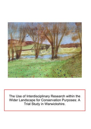
  • 2. 2 Acknowledgements This dissertation was carried out at the University of Durham as part of an undergraduate (Geography Bsc (Hons) degree. I would like to thank Dr. Jim Innes for his tutoring, guidance and support throughout the project. In particular I thank him for encouraging my interest in conservation. I would also like to thank Professor David Bridgland for his help with the Coulter Analyser and counsel regarding the levels of confidence that can be associated with environmental proxies. I am particularly grateful to Mrs Alison Clark and the Durham University Geography Department Laboratory Technicians for their assistance, guidance and time regarding the preparation of the environmental proxies. Cover Illustration: Artistic impression of the Wootton Wawen Investigation Site, 3rd April 2013. Produced by the author.
  • 3. 3 Contents 1. Introduction........................................................................................1 2. Literature Extracts.............................................................................1 3. Aims....................................................................................................2 4. Literature Review...............................................................................3 4.1Conservation..................................................................................3 4.2Global Cultural Systems.................................................................4 4.3Landscape Cultural Systems.........................................................5 4.4Ecological Systems.......................................................................6 4.5Environmental Reconstruction......................................................8 5. The Warwickshire Trial Study..........................................................9 5.1Location.........................................................................................9 5.2Quaternary History........................................................................10 5.3Cultural History..............................................................................11 6. Methodology.....................................................................................11
  • 4. 4 6.1Field Methodology.........................................................................11 6.2Laboratory Methodology................................................................14 6.3Limitations......................................................................................15 6.4Display............................................................................................16 7. Results................................................................................................17 7.1Environmental Proxy Diagrams......................................................17 7.2Descriptions....................................................................................20 8. Discussion..........................................................................................24 8.1 Discussion Structure.......................................................................25 8.2 Environmental Proxies....................................................................25 8.3 Place-name review..........................................................................28 8.4Field Survey......................................................................................29 9. The Application of Findings................................................................32 8.2General Conclusions for Modern Conservation................................32 8.3The Warwickshire Landscape...........................................................34
  • 5. 10. Bibliography.............................................................................................36 11.Appendix........................................................ ......................................44 11.1 Appendix 1 (Maps).......................................................................44 12.2 Appendix 2 (Field Survey Photographs)......................................50
  • 6. 6 List of Figures Figure 1 Anthropogenic transformation of the Global landscape................................... 4 Figure 2 Conception of an ecological basin of attraction.................................................7 Figure 3 Stages of ecosystem change............................................................................7 Figure 4 Constraining the site of the environmental reconstruction..............................13 Figure 5 Pollen diagram................................................................................................17 Figure 6 Fungal Spore and charcoal diagram...............................................................18 Figure 7 Deteriorated pollen diagram............................................................................18 Figure 8 Culmative particle-size distributions................................................................19 Figure 9 Catagorised particle-size distributions ...........................................................19 Appendix 1 (Maps) Figure 1 Map of the Arden landscape...........................................................................44 Figure 2 Map of the Heart of England Forest Estates...................................................45 Figure 3 Topographic sketch map of Willow-Brook catchment.....................................46 Figure 4 Ecologically related place-names of Willow-Brook catchment........................47 Figure 5 Areas of UK Coppiced woodland in 1905.......................................................48 Figure 6 Strategic Conservation overview of the Arden landscape..............................49 Appendix 2 (Field Survey Photographs) Figure 1 Pollen Site......................................................................................................50 Figure 2 Oak Tree Farm House Meadows SSSI..........................................................51 Figure 3 Bannam’s Wood............................................................................................52 Figure 4 Barnmoor Camp Wood..................................................................................53 Figure 5 Oversley Wood..............................................................................................54 Figure 6 Hayland Way Wood.......................................................................................55
  • 7. 7 1. Abstract The impact of human activity across the wider landscape is so significant that many scholars declare we have transitioned into a new global epoch - the Anthropocene. Within this epoch integration between human and ecological systems has created a cultural landscape within which social and economic demands comprise fundamental drivers for change. The growing deterioration in ecological systems is therefore blamed on the demands of rapid social and economic growth. However the role of social and economic systems within the landscape is mediated to a certain extent through the beliefs, values and meanings we cultivate through cultural norms which change over time. The need to address these demands therefore invites a look back at how past societies related with the landscape. This requires cooperation across the disciplines with archaeology, anthropology and ecology providing fundamental insights into cultural interaction with landscape for modern conservation purposes. Interdisciplinary research is carried out within the regional setting of Warwickshire, within which an extensive history of cultural and ecological interaction stretches across two millennia. An environmental reconstruction aims to understand the role of ecological systems within the landscape and relies on proxy-indicators including as pollen, fungal spores and charcoal. Further insight is given through a review of regional place-names, the use of historic documents and the undertaking of present-day field-surveys. It appears the historic landscape of Warwickshire witnessed a much closer degree of cooperation between its cultural and ecological systems. Sustainable management of the landscape was carried out to produce wood, bio-fuel and agricultural produce whilst retaining a high degree of diversity and consequently an inherent resilience across ecological systems. Furthermore this landscape appeared to retain these ecological qualities while supporting early modern industry. The findings of this study are applied to the modern conservation agenda in order to assess if previous forms of management can be once again undertaken throughout the landscape. It is suggested that within the regional setting an opportunity exists to restore a great degree of resilience and diversity across the landscape through the connection of ecological landscape ‘attractors’ with isolated refugia containing species of historic importance. The success of such a proposal would depend on restoring the meaning these ecological systems once contained to the local inhabitants. The potential of cultural landscape conservation is believed to be greatly increased through the aid of the many existing conservation schemes across the county.
  • 8. 1 2. Introduction ``It is possible for categories to become so fixed a part of the intellect that the mind finally becomes engaged in playing false to support them” (Bohm and Peat., 1987). The beliefs we cultivate for the natural world comprise a key driver of environmental change shaping the activities of societies through cultural norms (UNEP, 2012). In recognising this driver, it is thought the reliance of environmental research on large assemblages of quantitive data limits the sciences potential towards practical conservation (Boyd., 1990). A greater focus on culturally integrated, 'holistic' ecology is needed to increase the impact of conservation in cultural landscapes. This paper attempts to integrate ecological theory with recent cultural shifts in the twentieth and twenty-first centuries. It draws upon themes within archaeology, ecology and anthropology so that it may develop landscape conservation. The ideas are tested through reconstructing a pre-industrialised landscape which is thought to contain greater synthesis between its cultural and ecological elements through interdisciplinary research. The achievement of these aims has required the examination of particular themes within conservation, sociology, history and ecology and the expression of these themes though a common discourse. This has been reflected in the structure of the initial part of this paper which is divided into four key elements: conservation, the cultural and ecological contexts of landscape and environmental reconstruction. 3. Literature Extracts Throughout this paper extracts of literature aim to instil an appreciation of landscape into the fabric of the work, thereby actively demonstrating the significance of culture towards our perception of landscape. The role of beliefs in the natural world mean the emphasis on science in conservation often fails to engage people on a meaningful level because of an ignorance of the intrinsic narratives, metaphors and stories with which people experience the wider landscape (ARC, 2006). Language and literature are portrayed as the true expression of the natural world by anthropologist Jay Griffiths with ‘land seeming to cross- fertilise language and language the land in an intricate chiasmus of mind and wildness, each a simile for the other’ (Griffiths, 2006). Therefore using selected extracts of literature
  • 9. 2 will relate the reader to the landscape in a highly personal fashion, a necessary step for a real engagement in conservation. The recent degradation of the cultural landscape discussed in this paper has inevitably eroded the metaphors, allusion and poetry with which people once related to the natural world. The British poet John Clare who used local dialect in describing cultural landscapes in the early modern period was regarded as a subversive and eventually locked away (Griffiths, 2006). As such in recalling how the landscape has been immortalised in Shakespeare and idealised through the works of Grant an appreciation of the character of its past is achieved and that is arguably the ultimate aim of conservation. 4. Aims This interdisciplinary study will reconstruct past vegetation patterns and cultural meanings for the modern conservation agenda. It will present its findings in a framework inviting open discussion between land-owners, conservationists and economists in the hope of moving towards accumulative gains for both society and the environment. 1.) Reconstruct vegetation composition and past environments across the Late Holocene Warwickshire landscape. Evaluate the confidence attached to these proxies. - Pollen analysis - Pollen deterioration analysis - Fungal spore analysis - Charcoal analysis 2.) Reconstruct vegetation patterns and their chronology and cultural meanings across the Late Holocene Warwickshire landscape. - Place-name review - Field survey of modern landscape 3.) Examine the significance of past vegetation patterns and meanings for the modern conservation agenda. - Modern species survey - Literature review
  • 10. 3 5. Literature Review 5.1 Conservation “How to Conserve amid the creative play of a dynamic Universe?” (Naveh, 2000) Modern conservation schemes often gravitate towards the concept of biodiversity in seeking to define their aims. According to the Convention of Biological Diversity, whose advice is sought by current UK governance, biodiversity is defined as ‘the variability among living organisms from all sources and the ecological complexes of which they are part’ (DEFRA., 2011). This definition ignores the integration of anthropogenic systems into the wider landscape and ecology through what is reported as a non-linear interplay between elements such as climate, geology, ecology and society (Naveh., 1994; UNEP, 2012). These interactions collectively lead to additional structural and functional qualities within a particular system (Naveh., 2000). In reviewing this notion it soon becomes apparent that the feedbacks and synergies effecting ecology are not wholly appreciated by a study of ecology itself, especially when embedded within a contemporary 'cultural landscape' such as that of modern Britain. This shift in perspective focuses attention towards the structural and functional integration of the bio-, eco- and socio-spheres into a more coherent land-system (Palang et al., 2000). This shifts management attitudes away from ‘protecting’ a disembedded, fragile ecology towards restoring its proper integration with the surrounding landscape. Furthermore, it advocates the concept of ecosystem services, the provision of valuable monetary services to mankind by ecosystems, widening its appeal to land-owners, economists and policy makers (Rafelli, 2013). Ecologists have often shied away from ‘holism’ and regard it as a ‘soft’ philosophical term for which there is no room in a respectable ‘hard’ science. However as we progress into the twenty-first century and new demands are placed onto the environment – as new social, conservational and agricultural agendas emerge – so do the categories with which we capture them and it becomes increasingly important to take note of the complex interactions between cultural and natural systems in conservation,
  • 11. 4 5.2 Global Cultural Systems “I had grown used to tracking a wood or hedge through seven centuries, and on going to the spot being just in time for the dying embers of the bonfires in which it had been destroyed” (Rackham, 1990). There is significant quantitative evidence that human activity now impacts natural systems to such a degree as to warrant the creation of a new global epoch – the Anthropocene. The global population has doubled to 6 billion over the last fifty years, atmospheric C02 concentration will reach the unprecedented figure of 400ppm in 2013 (Vince, 2011), biodiversity is undergoing a sixth great extinction event (Steffen et al, 2007) and around three-quarters of terrestrial ecosystems have experienced transformation into anthropogenic systems (e.g. agriculture, settlement) (Figure 1) (Ellis, 2011). Within this context an increasing volume of research warns of the impact of ecological feedbacks whose consequences have been recently described as ‘geopolitical dynamite’ for the future management of the landscape (Rockstrom, 2013). For example, the recent inception of ‘planetary boundaries’ as ‘safe operating spaces for humanity’ indicates ecosystem functions embody two boundaries that have already been exceeded (rate of biodiversity loss and nitrogen cycle perturbation) and a third (land-system change) that is prone to regional breakdowns (Rockstrom et al, 2009). While the case for conserving ecological systems is made compelling through a consideration of genetic, medicinal, aesthetic and psychotherapeutic factors (UNEP, 2012) the corrosion of planetary Figure 1: A time-scale of anthropogenic transformation of the global landscape (Ellis, 2011).
  • 12. 5 thresholds calls into question our ability to meet basic development goals (e.g. Millennium Development Goals) and therefore represents a central challenge for the Anthropocene. The mismatch of human decision-making and environmental scales limits responses to address these challenges and therefore a need exists to focus conservation onto scales relevant to decision-making (Rockstrom, 2013). 5.3 Landscape Cultural Systems The historic UK landscape has demonstrated that cultural relations with ecological systems have not always been so one sided. In 1086 a ‘cultural landscape’ had established itself across the UK with documents expressing ecological systems in economic and social terms. For example, the utilisation of eleven acres of under-wood ‘to the value of 55 shillings without causing waste or destruction’ was the norm under the coppice-management of Heylewode, Cambridgeshire in 1356 (Rackham, 1990). This notion of sustainability was reinforced with the arrival of the early-modern Naval and Tanning industries of 1780-1850 which provided an economic rationale for the maintenance of native Oak woods across much of the landscape. Much woodland is preserved in past industrial heart-lands of the Weald, Lake District and Forest of Dean while in rural Nofolkshire, Montgomeryshire and the Dales these ecological systems were lost through a lack of relevance (Rackham, 2003). Indeed it can be said that the integration of society with the natural world has been a conservation success in such circumstances. The need to address current management practice therefore invites a look back at how our ancestors related with ecological systems. Indeed, this paper identifies two cultural shifts which happened relatively recently as an opportunity to restore biodiversity and ecological services through an environmental reconstruction. The first great shift was part of the ‘great acceleration’ of the Anthropocene. As the advent and wide scale adoption of industrialised agriculture in the twentieth century assimilated biodiversity within previously heterozygous landscapes the functioning of agrarian ecosystems collapsed (Benton et al., 2003). Additionally, the adoption of commercial forestry practice removed as much ancient woodland from 1945-1975 in the UK as in the previous four hundred years (Rackham, 1990). These ecosystems, having adapted to thrive in an anthropogenic landscape offer the most viable choice for modern conservation in a country where the population continues to increase and ‘true’ wilderness no longer
  • 13. 6 exists. The second shift, the recently growing desire, summarised in the government’s Environmental White Paper to 'safeguard and restore degraded ecosystems through integrated approaches’ (DEFRA., 2011) is based upon a greater awareness of the value of environmental services and their fragility. It is hypothesised that an environmental reconstruction of a pre twenty-first century 'culturally coherent and ecologically capable landscape' (Brown., 2010), one more reflective of modern aspirations as voiced in the recent government environmental ‘White Paper’ (DEFRA, 2011), may serve as a benchmark for assessing whether contemporary conservation is incorporating the opportunities created by new cultural shifts. To do this it is necessary to seek recognition of the principles discussed within the ecological literature in order to achieve a scientific basis for our proposals. 5.4 Ecological Context “I felt its urgent demand in the blood. The forest was a fiddler, wickedly good, eyes intense and shining with a fast dance..every leaf in every breeze dangerously mesmerising me” (Griffiths, 2006). The various forms of interplay outlined previously were initially conceptualised within ecology through the fuzzy term of ‘stability’, developed through ‘functional diversity’ and eventually ecosystem 'resilience', the latter being the most insightful (Lister., 1997). Ecosystem resilience is best understood through the concept of a ‘basin of attraction’ which describes an equilibrium state in which the system will be inclined to return after rapid changes and exploitation. This central state is defined as the ‘attractor’ while the basin comprises the wider environment and ecological assemblages that will respond to this attractor or the overall ‘stability landscape’ (Figure 2) (Walker et al., 2006).
  • 14. 7 It is therefore brought to attention that biodiversity per se does not sustain an ecosystem in a certain state, but rather it is the intrinsic interactions occurring between species and there environment which sustain its equilibrium. These interactions are achieved by species groupings, or 'functional groups', a term which encompasses the wider role they play within collective stability e.g. pollinators, nutrient transporters, predators (Folke., 2006). The function of a particular group may change over time with species fulfilling lesser roles in the system becoming critical in regeneration after disturbance (Folke., 2006). Therefore it is the functional groups of a particular ecosystem which constitute an overall ‘memory’ or the ability for the system to recover from exploitation, illustrated in Figure 3 (Folke et al., 2002). Figure 3: An ecosystem’s various stages of change demonstrating the availability of functional groups acts to dictate the trajectory of response. Adapted (Holling et al., 1995). Figure 2: A basin of attraction containing its change capacity or ‘Latitude’ along the horizontal plane, ‘Resistance’ along the vertical plane and ‘Precariousness’ comprising its current state. The shift from a degraded system to its more established state may confer a number of advantages regarding its ‘Resistance’, ‘Latitude’ and ‘Precariousness’ (Walker et al., 2004).
  • 15. 8 The structure of this paper draws attention to the impact of cultural factors on functional groups and therefore on ecosystem resilience. It asks as to whether the industrialisation of land practices in the twentieth century has removed certain functional groupings and the qualities they instil to the wider ecosystem, unnoticed to the casual observer. 5.5 Environmental Reconstruction And in this life, exempt from public haunt, find tongues in trees, books in the running brooks, sermons in stones, and good in everything. I would not change it" (Shakespeare, 1623). Despite the case for a greater adoption of interdisciplinary research by conservationists recent studies have drawn attention to a ‘fundamental disconnect’ existing between palaeoecology, archaeology and conservation (Brown., 2010, Willis and Birks., 2006). While the most viable ecological analogues for a sustainable cultural landscape are likely to be found in the recent past, even the more progressive studies have explored little of this applicability (Brown., 2010; Willis and Birks., 2006). An informed restoration may offer additional qualities that uncoordinated, piece-meal restoration attempts seeking to expand arbitrary biodiversity may not, such as resilience. The present situation may be partly due to the statement that ‘few are prepared to use the palaeoecological record to plan for an uncertain green house dominated future’ (Buckland, 1993). However I need look no further than the seminal classic of E.W Jones (1945) in which he proposed the natural periodicity of climate cycles has long been causing ‘an ever varying proportion of species to arise and replace each other as the result of some slight disturbance of balance’ within a natural climax community. He goes on to state such a community would consist of ‘a mosaic of communities, at least in time’ suggesting an inherent ability to adapt in the functioning climax (Jones, 1945). While some authors suggest continued degradation acts to promote the proportion of resilient taxa in the system (Darling., 2010) I stress a resilience to one type of exploitation does not confer resilience to another and the degraded system, lacking certain functional groupings, would in fact be less capable of responding to climate change than one restored of its ‘memory’. When reconstructing past environments the concept of palynology is of great use and will form the central part of this study. However poor representation of herbs within the record
  • 16. 9 and imprecise species identification, respectively due to low pollen values and generalised morphological characteristics limits its capability (Rackham., 1994). Therefore multiple evidence sources will extend the studies breadth and allow further conclusions to be drawn through comparison. Place-names, historical records and field evidence offer cultural as well as ecological information about past environments (Wager, 1998; Rackham, 1990). Through using a wide evidence basis the investigation will go beyond restoring a simplistic environmental ‘back clothe to human activity’ (Bell., 1990) and focus on the interaction between social and ecological systems. However it must be recognised that environmental and historical evidence are affected by biases, filters and discontinuities operating on different temporal and spatial scales (Davies and Watson., 2007). The tendency palaeoecologist’s have to ‘suck in and smear’ (Ballie., 1991) whereby they seek confirmation for known historical events in their diagrams rather than treating environmental proxies and historical documents as independent sources must be avoided. 6 The Warwickshire Trial Study “It was because he [Shakespeare] had seen the beauties of sunrise and sunset, the waxing and waning of the moon in beautiful Warwickshire that he was able to write not only as the poet of court, camp and grave but also as the poet of nature” (Grant, 1914). 6.1 Location It is pleasing to note Warwickshire is 'often regarded as a microcosm of national contrasts and variations' (Wager, 1998). Within these contrasts a site must be chosen which fulfils the aims of this investigation. Natural England's National Character Area’s (NCA’S) are determined by factors such as geodiversity, biodiversity and culture thereby presenting an appropriate framework for assessing the environmental history of the area. Natural England’s National Character Area’s (NCA’S) 97, known as the ‘Arden’ incorporates an ancient landscape in which environment and society have long been interwoven (Rackham, 1990) (Appendix 1, Figure 1). Extensive wood pastures which survived into the early Medieval period were subsequently incorporated into the range of ‘groves’, communal based coppices, pastures and parklands from the 11th century (Wager, 1998).
  • 17. 10 The Midlands have been described as palynologically empty' by Edwards (1999) due to the lack of preservation potential in the underlying Triassic mudstone. However 'environmental data in the form of macro-fossils and pollen [may] survive within dateable paleochannels' (Alexander, 2006). Furthermore, a recent county archaeological survey states the 'Alne is less affected by flood alleviation schemes' than other major rivers and is therefore likely to have continued to preserve environmental history into the present day. A meandering tributary of the Alne known locally as the 'Willow-Brook' found within the parish of Wootton Wawen was subsequently selected to accommodate this investigation. In further examinations we note the dominant land use of the present-day Arden area is grass and un-cropped land at 52% with 366 lowland grazing livestock holdings (31% of total farms) containing 119,500 sheep and 38,000 cattle which suggests intensive cereal agriculture is not as well developed in this county as others (DEFRA., 2010) (Natural England., 2012). This, along with the proximity of the large-scale broadleaved woodland restoration scheme known as the Heart of England Forest Project (Appendix 1, Figure 2) suggests potential for landscape conservation initiatives. 6.2 Quaternary History In order to determine the spatial and temporal resolution of the alluvial record a geomorphic survey of the surrounding landscape is carried out (Macklin, 1999). Geomorphic processes of the past are known to condition subsequent river sensitivity and therefore bias the alluvial sediment (Brown, 1989). This brief review outlines the relevance of geomorphic processes on the modern landscape. A trans-Pennine northwest ice sheet advance over the county around 450,000 years ago (MIS 12) is indicated by the clast lithology of ‘Thrussington Till’ at Wood Farm Quarry. Repeated ice retreats and re-advances impeded drainage of the ancient River Bytham, depositing glacio-fluvial and glacio-lacustrine sediments. The most recent Devensian ice sheet (MIS-2) did not travel further than the Pennies and Lincolnshire Wolds allowing Warwickshire a considerable period free from ice (Wymer 1999). During this time the post-glacial ‘competence limited’ channel began to gradually acquire the characteristics of a 'supply limited' system through the sustained action of biological, chemical and physical processes (Brown, 1989). The stark glacial geomorphology was replaced with gentler, rounded topographic features as the landscape underwent smoothing, illustrated in the topographical map of Appendix 1, Figure 3. The river has
  • 18. 11 therefore become increasingly sensitive to local environmental processes during the decoupling of slope-channel processes, suggesting its suitability for this study (Macklin, 1999). 6.3 Cultural History Two sources of historical evidence are used to support the selection the Willow-Brook site while further illuminating the local history. Firstly, a land grant states the land was given to a nobleman called Ethellric in 716AD by King Ethelbald of Mercia in the place called Uuidutuun (Wootton) near the river Alne. It describes a landscape of ‘fields’ ‘meadows’ and the word saltibus meaning 'upland wood', suggesting a mosaic of ecosystems existed within this cultural landscape from an early period, potentially providing significant value to modern conservation schemes (Wager, 1998). Second, the place-name Wootton combines wudu with tun (Uuidutuun in old English as per the grant), and when used as a suffix means the settlement “had a special function in relation to wood and its products” (Wager, 1998) suggesting the local inhabitants would have valued the sustainability of this ecosystem service (Rafelli, 2013). Further indications of the ecological significance the landscape had for its inhabitants is found in a review of local place-names illustrated in Appendix 1, Figure 4, which will be examined in later sections. 7 Methodology “Hath not old custom made this life more sweet than that of painted pomp? Are not these woods more free from peril than the envious court?" (Shakespeare, 1623). 7.1 Field Methodology: Environmental Proxies: The site which proved most successful in meeting the selection criteria is known as the Osiers and comprised of a half-mile stretch of Willow Carr and agricultural pasture along the undeveloped WillowBrook, a tributary of the Alne. Arial photographs in conjunction with an embankment walk identified a prominent meander feature suspected to have preserved a sequence of alluvial archaeology. A gauge corer extracted three cores at increasing distances from the channel in order to determine the deepest sequence of alluvial sediment. The boreholes continued into
  • 19. 12 minerogenic sediment until further penetration was impossible. The deepest sequence was found at the edge of alluvial sediment, 2.8m from the channel, illustrated in Figure 4. A Troels-Smith description was not required due to the later use of a Coulter Analyser. The core extended 2.59m in depth and was placed within plastic piping for transport with depth and location labelled. Place-name Review: An O:S Map of the WillowBrook catchment was reviewed prior to the field-work with names of significance to the ecological management of landscape chosen for inclusion in Appendix 1, Figure 4. Field Survey: The field surveys were carried out from 8th April- 9th April 2013. Six locations representative of the historic landscape and modern management were visited. Two ancient semi-natural woodlands, one commercial forest, one recently planted broad-leaved forest, a sequence of water-meadows and the local pollen site collectively provide much insight for this investigation. Upon arrival the sites were evaluated using the principles of historic ecological field-work laid out in Rackham (1990). Selections of photographs were taken in order to display any distinguishing features relevant for the investigation.
  • 21. 14 7.2 Laboratory Methodology: An initial twelve samples were extracted at regular intervals down the core, excluding the first 60cm because of the disturbance of bioturbation. The core was sampled at 16 cm intervals to a depth of 257cm with a narrow spatula being used to scoop up 0.5cm3 of sediment while minimising any contamination. The remaining twelve samples were used to increase the resolution to 8cm, with the taphonomic considerations of alluvial sediment, to be discussed later rendering further resolution at best unnecessary within the context of this studies objectives of and at worst misleading (Turner, 1985). Standard chemical procedures were followed to isolate the proxies of interest - palynomorphs, non pollen palynomorphs (NPP’s) and charcoal (Birks and Birks, 1980; Seppa, 2007). Additionally the application of hydrofluoric acid was required due to the high silica content of the sediment. As part of the procedure the samples were filtered under an 180um mesh with the excess being retained within 2cl water for macro-charcoal analysis. A 5-point scale (0-4) was used to determine macro-charcoal frequency as per Simmons and Innes (1996). The prepared samples were then stained with red dye safranin and placed on slides with the addition of silicane fluid to facilitate the dispersal and identification of proxies (Faegri and Iverson, 1989). A MOTIC BA3000 microscope was used at magnifications of x400 to count the macrofossils and microcharcoal quantities of each slide with a magnification of x600 to x1000 occasionally used for higher definition identifications (Moore et al, 1991). The slides were scanned at regular transects to reduce the effects of size specific grain migration and palynomorph accumulation (Brooks and Thomas, 1968). The taxonomic resolution extended to the genus/family level with further resolution rendered infeasible due to the similarities of pollen and the quality of the grains themselves. The poor preservation rates of microfossils meant 200 pollen grains were identified per slide, which is deemed to be sufficient for observing the trajectories of taxa over time. Four types of fungal spore were counted in addition to the pollen based on their environmental indicator value (van Geel, 2003). These proxies were counted within the same sample area of slide as the pollen grains for consistency. Fungal spore counts ranged from absent to 52 with micro-charcoal counts again ranging from absent to 62. The degree of variation is to be somewhat expected when analysing alluvial sediments exposed to rapid fluctuations in channel-deposition (Turner, 1985).
  • 22. 15 7.3Limitations: 1.) Evaluate the confidence of attached to these proxies. As per Turner (1985) it is noted geoarchaeological sites are especially prone to vertical and lateral differentiation in the quantity and quality of surviving microfossils. Furthermore a unknown number of hiatus’ may exist along the sequence which are hard to identify through a qualitative analysis and can render the interpretations meaningless. As such an attempt has been made to quantify the impact of these undesirable effects on the data and so avoid potentially misleading conclusions through two techniques. First, the degradation rate of selective pollen ‘indicators’ has been documented using the procedures outlined in Crushing (1967). These rates are then recorded as a relative frequency diagram of total pollen counts to provide an indication of the degree of microfossil deterioration across the sequence and any changes that occur therein (Figure 7). Higher deterioration rates imply lower confidence in the remaining sample accurately representing the wider environment. Second, as recommended in Turner (1985) the geochemical conditions in which the proxies were located have been quantitatively assessed through the use of a LS 13 320 Laser Diffraction Particle Size Analyser (Beckman Coulter Analyser). The Coulter Analyser measures the ‘Franunhofer’ diffraction pattern of the light emitted at a suspended sample of particles for each sample and collates these values to determine the nomenclature of each grain which is illustrated in Figures 8 and 9. The sequence stratification can then be used to make inferences about the palaeo-fluvial conditions under which deposition occurred, and possible re-working (Turner, 1985). The characteristics of the palynomorphs themselves may bias sampling with entomophilous species such as Tilia producing relatively few pollen grains (Rackham, 2006), perhaps accounting for its absence in this study. Meanwhile anemophilous species such as Pinus and Alnus are overrepresented within diagrams due to their efficient dispersal of large quantities of pollen (Innes, 2009). Additionally, within the grains themselves the amount of sporopellenin determines to a certain extent the preservation potential of the grain, meaning the data may be biased even after correcting for other factors (Turner, 1985). As such it is important to support conclusions from pollen analysis with other sources of evidence.
  • 23. 16 7.4 Display: The macrofossil and charcoal data is displayed using the stratigraphic diagrams available through the C2 software programme (Figures 5, 6 and 7) (Juggins, 2004). The Fungal Spores are plotted in a separate stratigraphic diagram (Figure 6) as are the deteriorated pollen counts (Figure 7).The taphonomic considerations associated with alluvial sediment suggest each sample represents a snapshot in time rather than continuity and therefore bars have been chosen over a continuous line as an appropriate means of representation (Hevly, 1981). The diagrams are an effective means of plotting complex, multi-taxa data in a way which highlights significant trends and therefore ecological trajectories over time.
  • 24. 17 57 67 77 87 97 107 117 127 137 147 157 167 177 187 197 207 217 227 237 Depth(cm) Zone A Zone B Zone C Zone D Zone E 0 20 Quercus 0 Ulmus 0 20 40 Alnus 0 Fraxinus 0 20 Betula 0 Pinus 0 20 Corylus 0 Ilex 0 Sorbus 0 20 Salix 0 20 40 60 Gramineae 0 Cereal 0 Pterdium 0 Plantago 0 Rumex0 Chenopodiaceae 0 Umbeliferae 0 Filipendula 0 Urica 0 Lythrum 0 Taraxacum 0 Rannuncules 0 Cyperacea 0 Succisa 0 Cirsium 0 Centaurea 0 Galium 0 Melampyrum 0 20 40 60 80 100 TAP:TNAP Arboreals Shrubs Herbs Figure 5: Stratigraphic diagram for pollen counts from the Willow-Brook alluvial site (65cm - 197cm). The use of zones which respond to overall ecological characteristics aids the interpretation of the diagram. 8. Results 8.1 Environmental Proxy Diagrams
  • 25. 18 57 67 77 87 97 107 117 127 137 147 157 167 177 187 197 207 217 227 237 Depth(cm) Zone A Zone B Zone C Zone D Zone E 0 20 D eteriorated Q uercus 0 20 40 D eteriorated A lnus 0 20 D eteriorated B etula 0 20 D eteriorated C orylus 0 20 40 60 D eteriorated G ram ineae 0 D eteriorated U m beliferae Arboreals Shrubs Herbs 57 67 77 87 97 107 117 127 137 147 157 167 177 187 197 207 217 227 237 Zone A Zone B Zone C Zone D Zone E 0.0 1.0 2.0 3.0 4.0 M acrocharcoal(>180um ) 0 20 40 60 M icrocharcoal(<180um ) 0 20 G elasinospora (Type 1 and 2) 0 20 N eurospora (Type 55C) 0 20 Podospora (Type 368) 0 20 40 Sporom iella (Type 113) 0 20 40 60 TotalSpore C ounts Fire Indicators Grazing Indicators Figure 6: Stratigraphic diagram for the macro- and micro- charcoal and Fungal spore counts from the Willow-Brook alluvial core (65cm - 197cm).The fungal spores are grouped according to indicator values. These environmental indicators demonstrate greater inconsistency than the pollen counts. Figure 7: Stratigraphic diagram of deteriorated pollen counts for selected species from the Willow-Brook alluvial core (65cm - 197cm). These species are chosen to represent wider pollen counts throughout the core and demonstrate pulses of increased degradation, thought to be correlated with fluvial energy levels.
  • 26. 19 Figure 8: Culmative Particle-size Distribution of samples from WillowBrook alluvial core (65cm - 197cm) displayed as per Bridgland et al (2011). The samples are categorised into four groups based on particle-size distribution characteristics to aid in interpretation. The particle-size group structure broadly corresponds with pollen zonatation suggesting a connection between channel energy, soil structure and pollen preservation, as was proposed in Turner (1985).  Figure 9: Catagorised Particle-size Distribution of samples. This figure is derived directly from culmative particle-size distribution data for more pronounced trends and is intended as a supplementary to aid in its interpretation.
  • 27. 20 8.2 Descriptions: "The land! Listen, listen to me! The blood of Kings lies in your hand, What came before and what shall be. Think on it. Seek to understand. Look at the earth" (Dennis, 2010a). 1.) Reconstruct vegetation composition and past environments across the Late Holocene Warwickshire landscape. Evaluate the confidence attached to these proxies. Due to the holistic structure of this paper the proxies are presented and reviewed for each group rather than each proxy, aiding in the holistic understanding of landscape. Zone E (244cm -200 cm): Pollen: The Arboreals exhibit consistency in both coverage (~40% TLP) and structure, that being of a mixed-deciduous woodland noted as characteristic for Warwickshire over the late Holocene (Wager, 1998). Quercus-Ulmus and Alnus all contribute significantly to the canopy, with Quercus and Alnus fluctuating ~10-20% of total land pollen (TLP) and Ulmus appearing steadily at ~5%TLP suggesting stability within arboreal species. The shrub layer is relatively vigorous ranging from 19-22% TLP and almost completely comprising of Corylus (17-21%TLP) which suggests active management of woodland to favour this species. Although the herbaceous layer appears relatively subdued (38- 42%TLP) it displays significant diversity with Melampyrum, Centaurea, Succisa, Galium and Rannuncules all making notable, albeit small appearances at (1-3%TLP) alongside the more usual herbs. Gramineae establishes an immediate abundance which continues to grow throughout the diagram, exhibiting an average value of 25% in Zone A. Overall each pollen group displays consistency and stability across a widespread diversity of species. Fungal Spores: The indicator of fire (Neurospora Type 55C) and dry conditions (Gelasinospora Type 1 and 2) increase to early respective peaks of 17 and 25 before becoming absent from the record at 212cm (van Geel et al, 2003). The indicator of light grazing (Podospora Type 36A) (Davies, 2006) and intensive grazing (Sporomiella (Type 113)) (van Geel et al, 2003) display continuity throughout the zone, peaking at the end with values of 16 and 19 respectively (Figure 6).
  • 28. 21 Charcoal: Microcharcoal counts rise to a peak of 37 in the initial section of this zone, before steadily declining to a count of 20. Macrocharcoal follows this trend, peaking at 4 (>50% coverage) early on before declining to 2 (2-10% coverage) (Figure 6). Particle-Sizes and Pollen Degradation: The particle-size distributions demonstrate fairly low proportions of silt (between 16-18%) with sand quantities comprising a further 29-33% of sediment. The majority of sediment is therefore >200µm making up ~50% of total. This suggests a relatively high energy fluvial system laid down these sediments however the impact on pollen degradation is fairly subdued with Betula grains demonstrating no deterioration (likely due to the low counts) and other species demonstrating ~a quarter of grains in deteriorated state (Figures 7 and 8). Zone D (200cm-160cm): Pollen: A significant disruption event between180-188cm is noted whereby the sudden absences of Quercus and Betula are accompanied by significant drops in Corylus (~20% - ~5%TLP) and a wide variety of herbs. In contrast to these declines peaks in Salix (16%TLP) and Alnus (33% TLP) occur, both favouring bank-side habitats. Despite the profound changes the overall assemblage exhibits an immediate recovery at 172cm to pre-disturbance abundances, implying taphonomic factors, likely a flood event entraining local pollen sources are the cause and further separation of zones is unjustified. External to this event a peak of Betula (16%TLP) is accompanied by appearances of both Illex (1- 2%TLP) and Sorbus (1%TLP) all indicators of disturbance (Godwin, 1984) suggesting a certain degree of change is occurring within the arboreals. These structural changes are not reflected in overall TAP extent which remains fairly consistent at 33-41%TLP. Gramineae increases to an average of 34%TLP, (30%TLP excluding the disturbance event) in the herbaceous layer amid an overall retention of diversity excluding losses of Galium and Melampyrum from the record. Fungal Spores: This zone is characterised by fluctuations and irregular appearance in all spores, except Sporomiella which is absent from the record. The disturbance event is recognised as impacting the Fungal spores with absences in all species at 172cm (Figure 6). Charcoal: Microcharcoal counts are sporadic, excluding the 172cm disturbance event absence and display an overall peak of 52 counts at the end of the zone. Macrocharcoal is characterised by two pulses of 4 at each end of the zone, corresponding with peaks in microcharcoal (Figure 6).
  • 29. 22 Particle-Sizes and Pollen Degradation: The disturbance event observed during the pollen and spore counts is firmly recognised in the sediment. Both silt and sand components drop to very low values (an aggregate of between 17% and 18% of total sediment). The vast majority of particles are between 212-100µm suggesting these high- energy conditions, possibly in single storm event, and justifying the separate particle-size distribution classification (Group C). Pollen degradation reaches its maximum values here with over half of grains demonstrating deterioration, supporting the notion that high channel energy is not conducive to pollen preservation (Figures 7 and 8). The loss of fungal spores at this point further demonstrates the impacts of high energy fluvial conditions. Zone C (160-128cm): Pollen: Further change throughout the arboreals characterise this zone. Previously key species such as Quercus and Ulmus continue to decline with the former not exceeding 10%TLP and the latter appearing sporadically at ~6%TLP. Corylus steadily declines from 17% to only 9%TLP at the top of the zone (140cm) causing the shrub layer to reach a low of 12%TLP from a high of 23%TLP in the previous zone. Earlier structural changes in the arboreals are finally impacting upon their extent with TAP reaching a low of 29%TLP at 128cm. Despite a general consistency in Gramineae further changes are observed in the herbaceous layer with taxa such as Rannuncules and Centaurea becoming extremely rare. The first appearance of Taraxacum is noted at 1%TLP. Fungal Spores: This zone is characterised by greater quantities of fungi with total counts reaching 180 spores. An absence of all spores except Sporomiella at 148cm suggests irregular taphonomic factors. Both indicators of fire demonstrate irregularity with counts between 10 and 20. Podospora continues to decline reaching 6 counts at 140cm (Figure 6). Charcoal: Microcharcoal exhibits a general decline from 37 to 8 counts across the zone, punctuated with an anomalous high of 46 counts at 108cm depth. Macrocharcoal values average 3 (10-50% coverage) throughout much of the zone (Figure 6). Particle-Sizes and Pollen Degradation: A relatively substantial silt component between 20-30% and the addition of sand accounting for an aggregate of ~45-50% total sediment accounts for classification under Zone B. Gravel clasts comprise the relatively small remainder with 70% measuring under 300µm. A reduction in fluvial energy is implied, correlating with lower pollen degradation counts (Figures 7 and 8).
  • 30. 23 Zone B (128-96cm): Pollen: This zone suggests stability has been reached in the arboreal community or perhaps a slow-down in exploitation with Ulmus continuing with sporadic appearances ~6%TLP alongside a flattening in the decline of Quercus at ~8%TLP. However the steady decline of Corylus causes the shrub layer to average 13%TLP. Significant change occurs in the herbaceous group with taxa such as Cirsium, Succisa, Rannunculus and Centaurea becoming absent from the record, replaced with species such as Urica, Lythrum and Taraxacum, indicating increased fertility (Godwin, 1984). Fungal Spores: The grazing indicators are absent in this zone apart from 108cm where Sporomiella reaches a peak of 34 counts alongside a count of 4 for Podospora with fire indicators echoing this irregularity (Figure 6). Charcoal: Microcharcoal exhibits great fluctuation amid no identifiable trend with counts ranging from 3 to 35. Macrocharcoal broadly corresponds with the seemingly random arrangement, with values ranging from 0-3 (Figure 6). Particle-Sizes and Pollen Degradation: Particle-size distributions are marked by a rapid increase in silt constitution, rising from ~30% at 110cm depth to ~55% at 95cm depth, signifying the start of particle-size Zone A. While the degree of sand within these sediments remains fairly constant the gravel component (>200µm) falls to between 20% and 40% of total. This impies further reduction in high energy fluvial events, corresponding well with pollen degradation trends (Turner, 1985) (Figures 7 and 8). Zone A (96-65cm): Pollen: The stability within TAP is proved to be short-lived in this zone reaching a new low of 31%TLP, as opposed to the herbaceous community which experiences a high of 62%TLP. Pinus at ~4%TLP combines with relatively large amounts of Betula, Ilex and Fraxinus pollen, peaking at 7%TLP, 2%TLP and 4%TLP respectively to imply significant structural change with woodlands likely opening up and/or regeneration. The shrub layer suffers the greatest decline with average values falling to 7%TLP caused by continued reduction in the previously abundant Corylus. Within the herbaceous layer greater abundance of species such as Gramineae (37%TLP) Pterdium (7%TLP) and Plantago (7%TLP) occur amid an reduction of diversity. Evidence of increased fertility is noted from relative abundances in Lythrum, Taraxacum and Urica (Godwin, 1984).
  • 31. 24 Fungal Spores: Indicators of fire display consistently high values while as does Sporomiella with an average of 13 counts. However Podospora continues to fall with a final appearance of 2 counts at 77cm. Overall the zone is quite populous with total spores reaching 192 (Figure 6). Charcoal: Microcharcoal exhibits a steady increase in values from 3 to 42 counts, yet drops off to 32 counts at 65cm. Macrocharcoal is more sporadic declining from 4 to 3 between 76-65cm, after an initial low of 2 (2-10% coverage) at 92cm (Figure 6). Particle-Size: These particle-size distributions comprise the siltiest section of the sequence (35-52%), correlating with low pollen deterioration and high fungal-spore readings (Figures 7 and 8). Synthesis: In general these proxies demonstrate a high degree of consistency in the quality of environmental information, and correlate as would be expected (Turner, 1985, van Geel, 2003). However the fungal spore and charcoal counts are more prone to inconsistencies and are therefore thought to be less useful in an alluvial context. When this is taken into account they can nonetheless supplement the pollen information and extend the breadth of this environmental reconstruction. Multiple proxies are also used to establish the cause of inconsistencies with a comparison of deteriorated pollen counts, fungal spores and particle-size distributions suggesting taphonomic considerations were to blame for a notable decline in the quality of information in Zone D and occasions of high fluvial energy reduced the preservation of environmental proxies. 9. Discussion: "There has always been in England an older England still, where Chaucer rode to Canterbury and Falstaff drank his fill" (Dennis, 2010a). 2.) Reconstruct vegetation patterns and their cultural meaning and chronology across the Late Holocene in the Warwickshire landscape.
  • 32. 25 9.1 Discussion Structure The pollen diagram comprises the principle basis for reconstructing vegatational changes throughout the core with further constraints given through fungal spore and microcharcoal counts where appropriate. The environmental proxies (Figure 5-9) offer a direct indication as to the structure and composition of palaeo-vegetation, as well as providing indirect suggestions about the vegetation patterning of the landscape and overall cultural meanings behind these patterns. This understanding of vegetation patterns and cultural meaning is then reinforced with a place-name review of the wider area (Appendix 1 Figure 4) and field-survey (Appendix 2). All research is evaluated within a framework of wider literature to increase the confidence and breadth of its conclusions. 9.2 Environmental Proxies: The earliest indications from the data-set suggest an ecological-system under stable management. The ground-flora displays significant diversity with species favouring both shade (Melampyrum) and open-spaces (Succisa) thereby implying a mosaic of habitats. The distribution of taxa within each vegatational group remains broadly consistent suggesting the vegetation is in equilibrium with the factors that control it. The Quercus-Alnus-Ulmus composition seems unlikely to be caused solely by environmental factors or natural variations as regional pollen records show the natural climax-community was that of Tilia (Rackham, 1990). Instead this suggests a system of coppiced management, common from the late medieval period. Within woodland environments trees are felled on a regular cycle and since many of them take several years to reach flowering size their expression in pollen diagrams is consequently limited (e.g. Fraxinus 2% TLP, Ulmus ~5% TLP, Acer - , Tilia - ) (Rackham, 2003). Meanwhile the value of Quercus was in its timber and as such it was often retained until full size as a ‘standard tree’ within the wood, allowing for a relatively vigorous expression in the pollen diagram. This practice would also promote the abundance of Corylus which produces little or no pollen under the shade of a closed canopy, yet can flower as soon as the second year after felling when exposed to light (Rackham, 1990). The successive sequence of habitats limits excessive competition within the herbaceous layer and would favour a rich and complex assemblage of taxa such as that displayed in Zone A.
  • 33. 26 However agricultural weeds such as Rannuncules, Succisa, Centaurea and Filipendula are far more evident of unimproved grasslands (Godwin,1984; Rackham, 1994) meaning culmative arboreal, shrub and herbaceous pollen counts indicate a patterned system of coppiced woodlands and pastoral-based agriculture. The remaining environmental proxies reaffirm this notion with vigorous amounts of burning typical of intensively managed woodland and abundant Podospora implying low intensity pastoral agriculture (Davies, 2006; van Geel et al, 2003) (Figure 6). Regional studies further constrain this research with a Roman archaeological site finding evidence of environmental management at this time in nearby Alcester (Grieg, 1994). A nearby Iron Age sequence implies a steady decline took place in the arboreals at the expense of pasture suggesting it pre-dates this sequence which displays an abundance of pastoralism and relatively subdued and stable arboreal community at the base of the core (38%TLP) (Smith et al, 2005). The extensive sequence of Kings Pool, Staffordshire ends with a relatively high number of diverse pastoral indicators (e.g. Rumex acetosa, Plantago lancelota) in 1050-1150AD, correlating with the base of this core and therefore implying a possible age marker (Bartley and Morgan, 1990). However a lack of regional palynological studies in the early and alter medieval periods limits the further application of regional comparisons. The existing coppicing hypothesis for the base of the core further suggests a post-1086 date before which coppiced systems were relatively rare, comprising just 8% of total woodland in the nearby county of Derbyshire and therefore agrees with this age-marker (Rackham, 2003). A longstanding notion that C. cyanus was rare or altogether absent in Europe until the late Middle Ages (Pals and van Geel, 1976) has been collaborated by recent studies which suggest changes in the agricultural regime led to significant appearances in the pollen record only after the 13th century (Bakels, 2012). This tentatively implies the occurrence of Centaurea at the base of the core forms an additional age-marker. However the course taphonomic resolution of this study does not does discount a likely alternative being C. nigra (representing no such chronological significance). Furthermore, the identification of small amounts (>2%) of C. cyanus in the Midlands at the Kings Pool, Stafford is dated to earlier Anglo-Saxon times (Bartley and Morgon, 1990). However Stafford was an early centre for the import of grain with the name coming from Stoeth (wharf) (Duignan, 2009). Isolated urban populations are thought to have preceded appearances in rural areas until
  • 34. 27 after agricultural changes favoured its expansion meaning this age-marker is open to debate (Bakels, 2012). Overlooking the anomalous disturbance event in Group D pioneers such as Betula, Sorbus and Illex are seen to gain greater abundance in this zone, all indicators of acidic conditions (Faulk, 2011) (Figure 5). Together with a noticeable albeit slight decline of Corylus this is also symptomatic of the start of a gradual lengthening of the coppice rotation, as was the fashion throughout the later medieval and early modern period. Changes in the preference of wood the building of chimneys, the colder winters of the 1500’s associated with the Little Ice and a rising population saw a real increase in price of logs over faggots. For example in Hayley Wood the fourteenth century ~7 year rotation lengthened to 10-11 years by 1584 and 15 years by 1765 (Rackham, 1990). This is further supported by increased occurrences of Illex whose presence was otherwise selected against in the coppice system (Faulk, 2011). Zone’s C and B continue the trend in less overall woodland management as well a compensating increase in agricultural intensity. This is principally observed through greater fluctuations across the arboreal community, more variations in the shrub layer and an overall restriction of herbaceous diversity (Figure 5). Fungal spores suggest a growing intensity in grazing, supporting the conclusions drawn from pollen evidence (van Geel, 2003) (Figure 6). Once common agricultural species become absent in Group B include Rannuncules, Succisa and Centaurea and imply a reduction in unimproved grasslands and open rides. Furthermore, the addition of Lythrum and Urica which are known to favour phosphate and nitrate conditions implies improvements in agricultural productivity (Godwin, 1984). A core community of herbs seem to continue unaffected by the proposed agricultural changes including Filipendula, Umbelliferae, Plantago and Rumex. One possibility for this lies in the immediate vicinity of the brook retaining a hedged framework of unimproved pasture which is evident to this day (Appendix 2, Figures 1 and 2). The next significant event in the diagram is the late onset of Pinus. This likely represents the large-scale soft-wood forestry programme undertaken by the Forestry Commission after WWI and throughout the twentieth century. Coppicing had fallen out of favour with the loss of ancient markets, import of foreign wood and cheap price of coal leaving only 1.65% of land under coppicing in 1905 (Appendix 1, Figure 5) (The Woodland Trust,
  • 35. 28 2005). However the need for a domestic timber source and greater employment saw the newly created commission purchase over 360,000 ha of land for planting by 1934 which further increased throughout the twentieth century (Atkinson and Townsend, 2011). This land was often the relatively unproductive sites of ancient woodland whose longstanding trees were grubbed up and removed. The relatively high amount of burning indicated by charcoal and fungal levels at this period could reflect such large scale vegatational changes at this time (Figure 6). New planting consisted of non-native conifer monocultures at a density of up to 2000 trees per hectare in some regions (Avery and Leslie, 1990). The loss of native-woodland is also implied in the continued decline of Quercus which reaches its lowest point in the diagram at~5%TLP whilst Pinus climbs to 7%TLP. A final indication of age is the near complete disappearance of Ulmus, the tree which once inspired the phrase ‘Leafy Warwickshire’ succumbed to the ravages of Dutch elm disease in the 1970’s (Faulk, 2011). 9.3 Place-Name Review The pollen evidence has so far provided a possible narrative about the structure and composition of vegetation within this cultural landscape. This is now tested through a review of place-names (Appendix 1, Figure 4) within the wider landscape which aims to decipher overall vegetation patterns, provide some indications about chronology and importantly deduce overall meanings attached to vegetation. Appendix 1, Figure 4 illustrates the place-names in the vicinity which are related to the landscape or its management. A total of twenty-two ‘woods’ and further twelve ‘coppice’ place-names which remain in current use confirm the historical wooded character of the region, supporting the notion that intensive woodland management was widespread. While establishing the chronology of countryside development does not by itself reveal the particular relations of mankind and the environment, it is a pre-requisite to interpreting it. Through an analysis of the roots of these names an inherent uncertainty in the chronologies of these place-names is somewhat overcome. Names which are of particular interest to the study are therefore identified and presented in order of their chronological meaning. ‘Chessets Wood’ contains the Anglo-Saxon ending – ett implying a singular type of wood, at odds with the overall character of Warwickshire’s woodlands (Wager, 1998). The Horse
  • 36. 29 Chestnut, introduced by the Romans to be cultivated in selective groves such as the surviving Stour Wood, Harwich seems a likely candidate (Rackham, 1994). It does not spread widely outside cultivation and therefore it’s Anglo-Saxon and possible Roman origin presents much chronological significance. Nearby 'Nuthurst' comes from the Anglo-Saxon hyrst or “Wooded Hill’ and indicates an ancient area of woodland which first appeared in a regional charter dating to 699-709AD (Wager, 1998). Another intriguing indication of continuity lies in 'Barnmoor Wood' which sits on the site of an Iron Age hill-fort. The woodlands steep slopes must have existed from 400BC-43AD onwards and being unsuitable for agriculture suggest the wood could be ~2000 years old. Further intrigue is found in the nearby ‘Bonehill Wood, so close to an Iron Age hill-fort could this mark the site of an ancient burial or long forgotten battlefield, the records being unclear at this point? The Norman-French language is well represented by Coppice demonstrating the post- conquest medieval period saw a great integration of ecological and cultural communities as is suggested in the pollen record. Further refinement of age is found in ‘Nunnery Coppice’ ‘Nunley Wood’ and ‘Priests Park Wood’ which must all date before the dissolution of the Monasteries in 1536, an event which occurred across the British Isles (Rackham, 1990). The arrival of early-modern industry and its positive role in ecological management is not forgotten in the naming of the regions woodland with ‘Brick Kiln Coppice’ and ‘Colley Irons Wood’ reflecting the brick and Iron Smelting industries prominent throughout the 1800’s. 9.4 Field Survey Field surveys are presented in Appendix 2 and used to identify modern analogues for the historic landscape, provide additional insight into vegatational compositions and management and therefore once again address the cultural meaning of the landscape. The initial survey of the pollen site (Appendix 2, Figure 1) revealed frequent stands of Alnus along the channel banks (1c). This was repeated in ‘Oak Tree Farm Meadows’ (Appendix 2, Figure 2) further upstream with frequent signs of coppicing on the Alnus’ (2b) suggesting these trees are long-standing features adjacent to the channel and likely account for the high counts in the pollen-diagram.
  • 37. 30 ‘Oak Tree Farm Meadows’ is a designated SSSI comprising a sequence of water meadows which would likely resemble large parts of the agricultural catchment prior to industrialised agriculture (2b;2d). Species recorded at present and found in the pollen diagram at genus level include Centaurea nigra, Rannunculus repens, Filipendula ulmaria and Rumex acetosa (Natural England, 2013a) suggesting this site acts as a refugia for once common agricultural species. Bannam’s Wood has received SSSI status in recognition of its ancient woodland heritage (Appendix 2, Figure 3) and is a legacy of previous coppice-systems (3b;3e). Primula vulgaris provides an indication of its longevity (3d). The role of past industry in sustainably management here receives further confirmation with a degraded out of place sophisticated road leading to the remains of a brick kiln in the heart of the wood (3c). Signs do exist that the land-owner is engaging in some form of coppicing (3a) however the suspected labour requirements are too great to warrant the scale needed for significant ecological impact without a proper economic rationale. Disrepair is therefore evident with many areas overgrown and numerous trees displaying the last signs of coppicing over a century ago (3b). A local naturalist states that many of the twenty-six butterfly species recorded during the recognition of its SSSI status have disappeared with the neglect of rides, footpaths, and coppicing (Bunchanam, 2011). Therefore while the original framework of the wood is retained this site demonstrates a lack of recognition as to the role of culture in ecological systems can cause a deterioration in functional groupings due to changes in the basin of attraction (Walker et al, 2006), regardless of designation of protection. The surveying of the ecologically and historically significant Barnmoor Wood revealed clear signs of a large hill-fort entrance to this day (Appendix 2, Figure 4). The longevity of the wood is supported by noticeable occurrences of Primula vulgaris (4d) however the majority of ‘standard trees’ appeared to be all Quercus of only ~150 year old age (4c). A previous land-owner may have felled past trees for immediate capital requirements and replanted with the commercially attractive Qeurcus. Overall the survey was inconclusive about the age of the wood, however a rotational land-slip visible along the outer edge exposes a poor, sandy soil (4h) meaning it is reasonable to assume the area has not been ploughed for the last 2000 years.
  • 38. 31 The commercial Oversley Wood is perhaps most indicative of the future of the regions woodlands (Appendix 2, Figure 5). Recently purchased by the Forestry Commission it has come under their regeneration of’ PAWS’ (planted ancient woodland site) scheme (Woodland Trust, 2005) (5e). While ancient coppice stands of the now-rare Ulmus may contain links to the wildwood (5d) much of the 220 ha is planted with Corsican Pine and Western Red Cedar, typical of many of the surviving woodlands referred to in place-names (5e). The FC is beginning to selectively remove these in a controlled fashion with the aim of reverting back to 80% mixed-broadleaf cover for public recreational, conservational and heritage purposes (5e). However the deadline for this restoration has not been given and recent statements by the Woodland Trust call for greater accountability in this applaudable but ambiguous endeavour (Holden, 2013) Haydon Way Wood is a prime example of the broadleaf afforestation drive unique across Warwickshire (Appendix 2, Figure 6; 6a). It is perhaps not so remarkable that a planting scheme impacting the landscape to such a degree is not related to the government reports stressing the need for such activity today (DEFRA, 2011). One is reminded of the environmental implications of the statement by Sir Barnett Cocks, ex-clerk to the House of Commons “the committee is a cul-de-sac down which ideas are lured and promptly strangled” (Dennis, 2010b). This tendency must be guarded against in modern conservation as too often seemingly pleasing dialogue is not followed up by action and environmental agencies occupying a fairly peripheral role in decision-making (Hulme, 2013). The future structure of this plantation will closely reflect the semi-natural climax environment described in E.W. Jones (1945). Opportunists such as Betula are planted alongside climax species such as Qeurcus in order to create a wide array of functional groupings, increase overall resilience and prove robust against modern day pressures such as disease and climate change (Walker et al, 2006) (6b).
  • 39. 32 10. The Application of Findings “In Warwickshire nature is never far distant. She lifts her veil shyly and blushingly to those who would look upon here chaste face.” (Grant, 1914). 3.) Examine the significance of past vegetation patterns and meanings in the Warwickshire landscape for the modern conservation agenda. 10.1 General Conclusions for Modern Conservation The environmental proxies, place-name review and field survey all support the notion that extensive ecological management took place across the landscape with Industrial coppicing, long term investment in timber and unimproved grasslands all common features. Furthermore, these sources indicate various changes took place in this management over time that reduced ecological diversity, degraded cultural meanings and decoupled human and environmental systems. Places named for provision of ecosystem- services now display neglect or a form of commercialised monoculture removed from the wider landscape (Woodland Trust, 2005). Pollen records demonstrate a correlation between the intensification of agriculture and progressive reduction of herbaceous floral diversity. The Interdisciplinary research suggests the meaning of the landscape has been restricted and degraded and this has impacted negatively on ecological systems. Economic necessity has driven land-owners to increase output over time at the expense of existing vegatational patterns, diversity, and sustainability. Common Agricultural Policy (CAP) frameworks and super-market oligopolies have reinforced this process through subsidising high-yield crops and forcing lower prices for low-intensity production methods such as dairy farming (Hart and Baldock, 2011).However economic rationale is gradually changing with recent reforms ‘greening’ CAP ‘Pillar 1’policies through increasing set-aside farmland and emphasising rural development in ‘Pillar 2’ through linking 30% of payments with sustainable environmental management (Harrabin, 2013). The UK government has demonstrated leadership in this area with the Environmental Stewardship scheme offering incremental funding for environmental management which recognises local circumstances (Natural England, 2013b).
  • 40. 33 For example, in 2011 James Atkins purchased 32ha of semi-improved grassland in Stoke- on-Trent in order to establish a large mixed broadleaved woodland. Initial costs of £100,000 were covered with a Woodland Grant Scheme of £106,400 and a further £8,400 contribution from the Farm Woodland Premium Scheme which is part of the England Rural Development Programme (ERDP) leaving a windfall of £14,800. Future management costs (estimated at £18,000) are to be met with a combination of grants and projected bio- fuel income amounting to £18,800, leaving the project with a net profit of £15,600.00 over twenty years (Homes, 2011). This may seem relatively small for such a duration however only recently are such schemes becoming commercially viable for land-owners, providing tremendous potential for the future of the countryside. While some land-owners are wary about the future security of such grants, governmental discourse suggests these will very much remain in favour (DEFRA, 2011). The challenge lies in identifying markets for rural products and establishing enough security for land-owners to feel confident enough to invest forms of production which generate ecological feedbacks. Proposals land owners look at ways to diversify their estates should go hand in hand with services aimed at locating markets for potential products and connecting buyers and sellers. The National Forest Company in nearby Derbyshire has been promoting wood products and rural niche markets, establishing links between market outlets and the hardwood timber industry and developing a rural skill-base since 1995 in order to integrate its pilot scheme with the local economy (Clarke, 2004). Similar schemes in nearby counties stand to benefit from its focus on supply-chains and rural skill-bases. These recent economic developments are beginning to create a host of private custodians such as James Atkins throughout the British countryside, each of whom have a vested interest in the management of such woods, echoing cultural considerations of the past. This is where archaeology, ecology and anthropology can make a real impact to land management. Cooperation across the disciplines is required to inform local managers and land-owners of the state of the local landscape. To connect buyers with sellers in rural markets, to join modern forests with ancient ecological ‘attractors’ (facilitating greater ecosystem resilience) (Walker et al, 2006) and ensure modern conservation efforts become embedded within the cultural landscape requires an appreciation of all landscape elements.
  • 41. 34 In conclusion the social realm of conservation has been extensively emphasised in recent years with the global, spiritual and moral values of ecosystems under much discussion (UNEP, 2012). However interdisciplinary perspectives support the notion that economic and social meanings have proven most important in the protection and resilience of ecological systems within cultural landscapes over time. Therefore conservation should approach its challenges by enquiring how to create economic value within ecological systems. How can it offer value to the farmer, the urbanite, the politician and the private land-owner through the landscape? Over twelve million pheasants are killed in the UK each year and yet it is one of the most ecologically successful species in the country. It is estimated 33% of land-owners have planted or retained tree belts for pheasants (Bealey and Robertson, 1992) while 30%of game estates carrying out some form of coppicing, thereby increasing the ecological value of these areas (Ludolf et al, 1989). This is because of the value and income it generates for the rural economy. It literally ‘pays its own way’ in and that is what conservationists needs to focus on to ensure the continuation of ecological systems across the cultural landscape of Britain. The conclusions of this report are now applied in a regional landscape setting as per the political considerations of Rockstrom (2013) and attempt to offer a potential road-map for cultural landscape conservation within Warwickshire. 10.2 The Warwickshire Landscape An analysis of ten SSSI's encompassing the Heart of England Forest Estates reveals surviving populations of historic species which are no longer apparent in the wider landscape (Appendix 2, Figure 6). Earlier reviews of literature suggest the new plantations will fulfil future roles as ecological ‘attractors’ in the landscape (Walker et al, 2006) with the establishing climax-communities providing biodiversity strongholds, biosphere feedbacks and ecosystem services to the wider landscape. Therefore the framework of ‘outposts’ surrounding this ‘ecological attractor’ which presently functions as refugia for ‘functional groupings’ (Folke, 2006) are selected as potential focal points for expanding the impact of these plantations. It is noted the addition of large quantities of nitrate and phosphate through agricultural fertilisers has resulted in a semi-permanent increase in fertility across large parts of Warwickshire, reflecting transgression of the global ‘nitrogen cycle’ boundary (Rockstrom et al, 2009). Therefore species which once thrived in unimproved pastures (e.g. Succisa
  • 42. 35 pratensis) will remain limited in scope due to greater competition pressures from opportunists. However populations of many species are suffering only from the intensity of current control-methods (e.g. Rannuncules arvensis, Rannuncules parviflorus) and these present ideal candidates for recolonisation (Godwin, 1984; Greig, 1994). The integration of multiple plant communities stands to take advantage of the funding, guidance and experience of the many existing conservation strategies and will increase the resilience of the wider social, commercial and ecological systems against climate change and disease. These initiatives include the Warwickshire Wildlife Trust's Living Landscapes Project, Natural England's Biodiversity Action Plan, Environmental Stewardship Scheme and its long awaited 'landscape' approach which aims to encourage private-public partnerships (DEFRA, 2011). The potential of the Heart of England Forest is then expanded as the forerunner of 'cultural landscape conservation' in the UK. The necessary experience to handle the scale of such an initiative exists in the management of a 39km stretch of the River Blythe designated as an SSSI since 1989 (Boon, 2010). In light of this it is thought the WillowBrook catchment could provide an immediate framework for landscape restoration with current understanding being used to improve functional qualities such as ecosystem services, ecological resilience and income diversification in the catchment, connecting functional groupings within the SSSI's of Oak Tree Farm Meadows and Brook Meadows.
  • 43. 36 11. Bibliography Alexander, M. (2008) Archaeological Resource Assessment of the Aggregates Producing areas of Warwickshire and Solihull, Warwickshire County Council , Warwick. Alliance of Religions and Conservation (2006) “ARC's Vision and Strategy” In: Hulme, M (2013) “A safe operating space for humanity’: Do people’s beliefs need to change? - Global Change and Biosphere Interactions” British Ecological Society, University of York, April 8th 2013, Lecture. Avery, M. and Leslie, R. (1990) Birds and Forestry, A & C Black, London. Bartley, D. Morgan, A. (1990) The palynological record of Kings Pool, Stafford, England, New Phytologist 116 (1), pp. 177-194. Bakels, C. (2012) The early history of Cornflower (Centaurea cynaus L.) in the Netherlands, Acta Palaeobotanica 52 (1), pp. 25-31. Bealey, C. Robertson, P. (1992). Coppice management for pheasants. In: Buckley, G.P. (ed.) Ecology and Management of Coppice Woodlands, pp.193-210. Chapman and Hall, London. Bell, M. (1990) Cultural landscapes: some thoughts stimulated by Bill Boyd’s paper: Towards a conceptual framework for environmental archaeology: environmental archaeology as a key to past geographies, Circaea, The Journal of the Association for Environmental Archaeology 7: (2) pp. 69-70. Benton, T. Vickery, J. Wilson, J. (2003) Farmland biodiversity: is habitat heterogeneity the key? Trends in Ecology and Evolution, 18:4, pp. 182-188. Birks, H.J.B. Birks H.H. (1980) Quaternary palaeoecology, London, Edward Arnold viii. Bohm, D. Peat, D. (1984) Dialouge and Culture, Science, Order, and Creativity,New York, pp. 240-47.
  • 44. 37 Boon, P. (2010) The Role of Special Scientific Interest (SSSIs) in the conservation of British Rivers, Conservation of Rivers - Short Articles and Reviews, pp. 95-108. Boyd, W. (1990) Towards a conceptual framework for environmental archaeology: environmental archaeology as a key to past geographies, Circaea, The Journal of the Association for Environmental Archaeology 7: (2) pp. 63-69. Bridgland, D. Innes, J. Long, A. Mitchell, W. (2011) Late Quaternary Landscape Evolution of teh SWwale-Ure Washlands, North Yorkshire, Oxbow Books, Oxford. Brookes,D. Thomas,K.W. (1968) The distribution of pollen grains in microscope slides – the non-randomness of the distribution, Pollen and Spores 9, pp. 621-630. Brown, A. (2010) Pollen analysis and planted ancient woodland restoration strategies: a case study from the Wentwood, southeast Wales, UK, Vegetation History and Archaeobotany 19 (2), pp. 79-90. Buchanan, M. (2011) “Bannams Wood (Rant Warning!)” (http://venor.wordpress.com/2011/02/23/bannams-wood-rant-warning/, 11th April, 2013) Buckland, P. (1993) Peatland archaeology: a conservation resource on the edge of extinction, Biodiversity and Conservation 2, pp. 513-527. Clarke, R. (2004) The National Forest – the strategy 2004-2014, The National Forest Company, Derbyshire. Crushing, E.J. (1967) Evidence for differential pollen preservation in late Quaternary sediments in Minnesota, Review of Palaeobotany and Palynology 4, pp. 87-101. Davis, O. (2006) Sporomiella fungal spores, a palynological means of determining herbivore density. Palaeogeography, Palaeoclimatology, Palaeoecology 237, pp. 40-50. Davies, A. Watson, F. (2007) Understanding the changing value of natural resources: an integrated palaeoecological–historical investigation into grazing–woodland interactions by Loch Awe, Western Highlands of Scotland, Journal of Biogeogprahy 34, pp. 1777-1791.
  • 45. 38 Dennis, F (2010a) Tales from the Woods, Ebury Press, London Dennis, F. (2010b) 88 The Narrow Road: A Brief Guide to the Getting of Money, Vermilion, London Department for Environment, Food and Rural Affairs (2010) June Census for Agriculture: Land use and Livestock on Agricultural Holdings at 1st June 2010, England Final Results. Department for Environment, Food and Rural Affairs (2011) The natural choice: securing the value of nature, The Stationary Office, London. Duignan, W. (2009) Notes on Staffordshire Place Names, BiblioBazaar, Charleston. Edwards, K. (1999) Palynology and People: Observations on the British Record, Quaternary Proceedings 7, pp.531-54. Ellis, C. (2011) Anthropogenic transformation of the terrestrial biosphere, Transactions of the Royal Society 369, pp. 1010-1035. Faegri, K. Iverson, J. (1989) Textbook of Pollen Analysis, John Wiley & Sons, New York. Faulk, S. (2011) The trees of Warwickshire, Coventry and Solihull Part 1 – Introduction, Catalogue of Warwickshire, Coventry and Solihull Trees, pp. 1-34. Folke, C. Colding, J. Berkes, F. (2002) Building resilience for adaptive capacity in social- ecological systems. In: Berkes F., J. Colding, and C. Folke (eds). Navigating Social- Ecological Systems: Building Resilience for Complexity and Change, Cambridge University Press, Cambridge. Folke, C. (2006) Resilience: The emergence of a perspective for social–ecological systems analyses, Global Environmental Change 16 pp. 253-267. Godwin, (1984) History of the British Flora: A Factual Basis for Phytogeography, Cambridge University Press, Cambridge.
  • 46. 39 Graff, A. (2002) Lower and Middle Palaeolithic Leicestershire and Rutland: progress and potential, Leicestershire Archaeological History Society 76, pp.1-46. Grant, A. (1914) In the old paths: memories of literacy pilgrims, Houghton Mifflin Company, Boston & New York. Greig, J. (1993) A possible hedgerow flora of Iron Age date from Alcester, Warwickshire, Circaea, The Journal of the Association for Environmental Archaeology 11 (1) pp. 7-16. Griffiths, J. (2006) Wild: An Elemental Journey, Penguin, London. Grundy, D. (2005) From Plantation Developer to Steward of the Nation’s Forests: the UK. In Garfroth, M. Mayers, J. Plantations, Privatisation, Poverty and Power. Changing Ownership and Management of State Forests, Earthscan, London, UK. Hart, K. Baddock, D. (2011) Greening the CAP: Delivering Environmental Outcomes through Pillar One, Institute for European Environmental Policy, pp. 1-26. Harrabin, 2013 “Euro MPs reject radical CAP farm subsidy reforms” (http://www.bbc.co.uk/news/world-europe-21776782, 7th April, 2013). Hevly, R. (1981) Pollen Production, Transport and Preservation: Potentials and Limitations in Archaeological Palynology (1981) Journal of Ethnobiology 1, pp. 39-54. Holden, S. (2013) “Woodland Trust reaction to Government announcement on policy for England's forests woods and trees” The Woodland Trust Official Homepage, (http://www.woodlandtrust.presscentre.com/News-Releases/Woodland-Trust-reaction-to- Government-announcement-on-forests-d57.aspx12th April, 2013). Holling, C. S., Schindler, D. W., Walker, B. W. and Roughgarden, J.: 1995, Biodiversity in the Functioning of Ecosystems: An Ecological Synthesis, in: Lister, N (1997) A systems approach to Biodiversity Conservation Planning, Environmental Monitoring and Assessment 49: (2-3) pp. 123-155.
  • 47. 40 Holmes, P. (2011) Woodland creation case study: Ridgeway Wood, The Woodland Trust, Lincolnshire. Hulme, M. (2013) “A Safe Operating Space for Humanity – Do people’s beliefs need to change? - Global Change and Biosphere Interactions” British Ecological Society, University of York, April 8th 2013, Lecture. Ihse, M. Lindahl, C. (2000) A holistic model for landscape ecology in practice: the Swedish survey and management of ancient meadows and pastures, Landscape and Urban Planning 50, pp. 59-84. Innes, J.B. Bridgland, D.R. Mitchell, W. Rutherford, M. O'Brien, C. Long, A. (2009) Late Devensian environments in the Vale of Mowbray, North Yorkshire, UK: evidence from palynology, Proceedings of the Geologists’ Association 120, pp.199-208. Jones, E. W. (1945) The Structure and Reproduction of the Virgin Forest of the North Temperatre Zone, New Phytologist 44 (2), pp. 130-148. Juggins, S. (2010) C2 Version 1.6.7: software for ecological and palaeoecological data analysis and visualization [program] Newcastle: University of Newcastle available from: http://www.staff.ncl.ac.uk/staff/stephen.juggins/software/code/C2.pdf Lister, N (1997) A systems approach to Biodiversity Conservation Planning, Environmental Monitoring and Assessment 49: (2-3) pp. 123-155. Ludolf, I.Robertson, P. Payne, S. (1989) The Effect of Pheasant Release Pens and Strawed Feed Rides on the Ground Flora of Ancient Woodlands, Nature Conservancy Council, Peterborough. Macarthur, R. Wilson, E. (2001) The Theory of Island Biogeography, Princeton, Princeton Univesity Press. Natural England (2012) National Character Area Profile 97. Arden, Natural England, London.
  • 48. 41 Natural England (2013a) “Sites of Special Scientific Interest Reports and statistics” (http://www.sssi.naturalengland.org.uk/Special/sssi/report.cfm?category=N April 4th , 2013) Natural England (2013b) “The Environmental Stewardship Scheme” Official homepage (http://www.naturalengland.org.uk/ourwork/farming/funding/es/default.aspx 2nd April, 2013) Naveh, Z. Lieberman, A. (1994) Landscape Ecology: Theory and Application, Springer- Verlag, New York. Naveh, Z. (2000) What is holistic landscape ecology? A conceptual introduction, Landscape and Urban Planning 50, pp.7-26. Pals, J.P. van Geel, B. (1976) Rye cultivation and the presence of cornflower (Centaurea cynus) Berichten van de Rijksdienst voor het Oudheidkundig Bodemonderzoek, 26, pp. 199-203. Palang, H. Mander, U. Naveh, Z. (2000) Holistic landscape ecology in action, Landscape and Urban Planning¸50 pp.1-6. Rackham, O. (1990) Trees and Woodland in the British Landscape: The complete History of Britain’s Trees, Woods and Hedgerows, Phoenix Press, London. Rackham, O. (1994) The Illustrated History of the Countryside, Phoenix Illustrated, London. Rackham, O. (2003) Ancient Woodland: Its History, Vegetation and Uses in England, Castlepoint Press, Essex. Rackham, O. (2006) Woodlands, Harper Publishings Limited, London. Radley, J. (2009) The Geological Evolution of Warwickshire, Mercian Geologists 17 (2), pp. 75-85.
  • 49. 42 Raffaelli, D. (2013) “Protecting ecosystem services in the face of global change - Global Change and Biosphere Interactions” British Ecological Society, University of York, April 8th 2013, Lecture. Rockstrom, Johan “Planetary Thresholds - Global Change and Biosphere Interactions” British Ecological Society, University of York, April 8th 2013, Lecture. Rockström, J. Steffen, K. Noone, Å. Persson, F. Chapin, E. Lambin, T. Lenton, M. Scheffer, C. Folke, H. Schellnhuber, B. Nykvist, C. De Wit, T. Hughes, S. van der Leeuw, H. Rodhe, S. Sörlin, P. Snyder, R. Costanza, U. Svedin, M. Falkenmark, L. Karlberg, R. Corell, V. Fabry, J. Hansen, B. Walker, D. Liverman, K. Richardson, P. Crutzen, J. Foley. (2009) Planetary boundaries: exploring the safe operating space for humanity, Ecology and Society 14 (2) pp. 1-33. Ross, A. (2008) Modern Interpretations of Sustainable Development, Journal of Law and Society 36: (1), pp.32-54. Sage, R. Ludolf, C. Robertson, P. (2005) The ground flora of ancient semi-natural woodlands in pheasant release pens in England, Biological Conservation 122, pp. 243- 252. Short, J. (1991) Imagined Country: Environment, Culture and Society, London, Routledge. Seppä, H. (2007) Pollen Analysis, Principles, Encyclopedia of Quaternary Science, pp. 2486-2497. Shakespeare, W. (1623) As you Like it, Mr William Shakespeares Comedies, Histories, & Tragedies: First Folio, Heminges and Condell, London. Simmons, I. G. Innes, J. B. (1996) Prehistoric charcoal in peat profiles at North Gill, North Yorkshire Moors, England, Journal of Archaeological Science 23, pp.193-197. Steffen, W. Crutzen, P. McNeill, J. (2007) The Anthropocene: Are Humans Now Overwhelming the Great Forces of Nature? Ambio 36 (8), pp. 614-621.
  • 50. 43 The Woodland Trust (2005) The conservation and restoration of plantations on Ancient Woodland Sites, The Woodland Trust, Lincolnshire Turner, C. (1985) Problems and Pitfalls in the Application of Palynology to Pleistocene Archaeological Sites in Western Europe, Notes et Monographies Techniques, pp. 347- 373. United Nations Environment Programme. (2012). Global Environment Outlook 5: GEO5: environment for the future we want, Progress Press Ltd, Malta. Van Geel, B. Buurman, J. Brinkkemper, O. Schelvis, K. Aptroot, A. VAN Reenan, G. Hakbijl, T. (2003) Environmental reconstruction of a Roman period setllemetent in Uitgeest (the Netherlands) with special reference to coprophilous fungi, Journal of Archaeological Science 30, pp. 873-883. Van Geel, B. (2006) Quaternary non-pollen palynomorphs deserve our attention! Review of Palaeobotany and Palynology 141 vii-viii. Vince, G. (2011) A Global Perspective on the Anthropocene, Science 334 pp. 34-35. Wager, S. (1998) Woods, Wolds and Groves: The Woodland of Medieval Warwickshire, Archeopress, Oxford. Walker, B. Holling, C. Carpenter, S. Kinzig, A (2004) Resilience, adaptability and transformability in social–ecological systems, Ecology and Society 9: (2)pp. 5. [online] URL: http://www.ecologyandsociety.org/vol9/iss2/art5/ Warwickshire County Council (1993) “Warwickshire Landscape Guidelines” (http://www.warwickshire.gov.uk/landscapeguidelines, November 31st , 2012) Willis, K. Birks, H. (2006) What Is Natural? The Need for a Long-Term Perspective in Biodiversity Conservation, Science 314 (5803), pp. 1261-1265.
  • 51. 44 12. Appendix 12.1 Appendix 1 (Maps) 1.)...Map of the Arden landscape classified according to its present-day natural characteristics (Warwickshire County Council., 1993). 10.)
  • 52. 45 2.) A map portraying the current lands of the Heart of England Forest Ltd. To date 1900ha has been planted with broadleaf forest. The aim is to create 30,000 acres of ‘forest’ embedded within a cultural landscape. The Wooten Wawen pollen site is identified for reference purposes.
  • 53. 46 3.) A topographic sketch map of the Willow-Brook catchment based on reviews of the OS map for the region.
  • 54. 47 4.) A sketch map illustrating modern-day place-names with ecological connections, based on reviews of the OS map for the region.
  • 55. 48 5.) Coppiced woodland extent in the UK in 1905AD. Each black spot is ten times the area of coppice-wood in the county at the scale of the map. Warwickshire is highlighted green and retains a relatively substantial area of coppice-wood. The concentration is substantially higher in the Arden as the majority of woodland exists in the North-West Arden region of the county (Rackham, 1990).
  • 56. 49 6.) An illustration of ten SSSI’s in favourable condition (blue) around the Heart of England Forest Estates (Green) and those of unfavourable condition (orange) for comparative purposes. The pollen site is shown in pink. Species of conservation value are displayed for each site with those found in the pollen record appearing in red (Natural England, 2013a). It is envisaged these species may spread from the isolated pockets through a restoration of the cultural landscape centring on the pollen site at Wotton Wawen.
  • 57. 50 12.2 Appendices 2 (Field Surveying Photographs) All photographs have been taken by the author on 8th – 9th April 2013. 1.),,Pollen Site (Wooton Wawen). A – The brook at the location of the pollen-site. B – The extensively meandering nature of the brook from which core was taken. C – Stands of Alnus are common throughout. D – A broad overview of the pollen site.
  • 58. 51 2.) Oak Tree Farm Meadows SSSI. This site comprises a series of water-meadows which would have been typical of the flood-plain during the medieval period. A – The intensive nature of meandering is vital for preserving alluvial archaeology. B – Previous signs of Alnus coppicing demonstrate these trees had value to past inhabitants and have been established for some time. C – The deposition of current alluvial geo-archaeology on the inside of a meander. D – Evidence of old levees exist in the topography, demonstrating considerable investment into therefore value the site had to the local inhabitants (as part of a ‘cultural landscape’).
  • 59. 52 3.) Bannam’s Wood. Ancient semi-natural coppiced woodland designated as an SSSI. A – Signs of present-day coppicing carried out by the local land-owner. B – Across much of the site neglect is evident with many trees reaching full height since last coppicing. C- An old brick path leading to the centre where a ruined bricks-work demonstrates the past value of the site. D – The ancient nature of woodland is discerned through its floral make-up with a Primula vulgaris indicating longevity. E – Ancient signs of woodland management include pollarding and coppicing.
  • 60. 53 4.) Barnmoor Camp Wood covers what was once an Iron Age hill-fort. A – The wood rests on the outline of the hill. B – The ancient gateway to the fort is visible inbetween the earthen rampart, now the centre of the wood. C – The earthen rampart stretches around a small wood of relatively young trees. D - Primula vulgaris indicates the longevity of the woodland ecosystem. E – The still steep nature of the ditch and rampart likely saved the wood by making it unsuitable for agriculture. F – Trees retain the steep topography G – Further indications of the ditch and rampart system. H – A rotational slip reveals poor, sandy soil further suggesting agriculture development has never occurred.
  • 61. 54 5.) Oversley Wood. A – the site is a commercial forest under the management of the Forestry Commission. B – it contains rare mosses and liverworts preserved in the woodland environments. C – Conservation initiatives by the FC include the creation of small ponds along the periphery. D – Ancient lime coppice stools in the Midlands imply links with the wildwood of the early and mid Holocene (Rackham, 1994).E – The large coverage of foreign conifers is gradually being overcome by the FC with selective felling of the most intrusive in areas associated with public access and active conservation. F – Arboreal pollen whose predecessors may line the current pollen site.
  • 62. 55 6.)..Hayland Way Wood. A - The site is a prime example of the broadleaved forest regeneration undertaken by the Heart of England Forest Ltd. B – Species include pioneers such as Betula aswell as climax species to recreate a natural climax-community as envisaged by E.W. Jones (1945). C – The cultural landscape is evident through multiple uses of land adjacent to the forest e.g. horse paddocks. D – Stands and open rides are built into the plantations to retain an open character for public appreciation and mosaic of ecosystems for ecological value,