
Recomendados
Recomendados
Mais conteúdo relacionado
Mais procurados
Mais procurados (19)
Destaque
Destaque (11)
Semelhante a Deriving Geomorphological Regions of Cotopaxi Province
Semelhante a Deriving Geomorphological Regions of Cotopaxi Province (20)
Mais de Greg Burton
Mais de Greg Burton (20)
Deriving Geomorphological Regions of Cotopaxi Province
- 1. Deriving the Geomorphological Regions In Cotopaxi Province, Ecuador. April 2004 W. Greg Burton 0348090 Suzanne Vijfhuizen 0019224
- 2. Introduction Course Description As part of the GIS-course, Geografische Informatie Systemen: Theorie en Praktijk, a case study was conducted to demonstrate knowledge of GIS processes using ESRI® ArcGIS™ with a study project being assigned to evaluate the geomorphology within the Cotopaxi province, Ecuador using these techniques (Verkuijlen & Seijmonsbergen 2004). Project Area Ecuador is located on the northwest coast of South America between approximately 1o north latitude and 5o South latitude; and lies between Peru to the south and Colombia to the north and east. Ecuadorian elevations range from 0 meters at sea level to 6267 meters atop Mt. Chimborazo. Residing on the equator, the climate of Ecuador varies from Tropical Rainforest in the Amazon Basin east of the Andes Mountains to Tropical Monsoon on the western side of the Andes (EcuadorExploer 2004). The geology of Ecuador comprises three main regions: the coastal plain, the two Andean ranges, and the upper Amazon Basin. These three regions represent the fore-arc, volcanic arc, and back-arc regions of subduction of the Nazca Plate (Pacific Ocean) beneath the South America Plate (Alvarado, et al 2003). Cotopaxi Province straddles the crests of the Cordillera Occidental (western Andes) and the Cordillera Oriental (eastern Andes); and is a major source of the drainage basins that empty into the Pacific Ocean in the west and the Amazon Basin to the east. It is here in the Andes that one can find specialized elevation-related climates of Temperate Humid, Temperate Dry, and even an Arid climate found between the crests of the Cordillera Occidental (western Andes) and the Cordillera Oriental (eastern Andes). This area of the Andes contains many of the active volcanoes of the world including: Cayambe, Reventador, Gaugua Pichincha, Antisana, Sumaco, Tungurahua, Sangay, Chacana, and Cotopaxi. Cotopaxi, at 5911 meters is the tallest active volcano in the world (University of North Dakota 2004). In fact, the highway between Quito to the north and the city of Latacunga, located in the subduction valley between the west and east Andes, is referred to as “volcano alley”. The project area is centered on the Quilotoa volcano, which last erupted 800 years ago. The Quilotoa volcano caldera contains a 3500-meter level, brilliantly emerald-colored, alkaline lake. Project Description The geomorphology evaluation for the Cotopaxi Province was based on an unsupervised classification using ArcGIS Spatial Analyst™ and morphometric criteria. Lack of time, the size of the Cotopaxi province, and lack of data made a supervised classification, using an enhanced ERDAS imagery problematic. 2
- 3. The project solution was to define the geomorphological regions within the Cotopaxi Province, and then establish a focus area around the Quilotoa Caldera located in the central highlands of the province to assemble the derived spatial data available. Using this focus area, this study could determine the accuracy of the unsupervised classification for geomorphologic regions involved. The classification of the geomorphologic regions is based on morphometric data: elevation and slope angle. The resulting derived raster data map was then integrated with the other derived spatial data, including a 3D-image environment, using ESRI ArcScene™, and evaluated using knowledge of geomorphological surfaces processes, knowledge of the areas and landforms found in the Andes of central Ecuador, and derived spatial data for precipitation and soils. Project Spatial Data The spatial data for the project was obtained from EcoCienca: Quito, Ecuador. Other data evaluated was obtained from Dr. Marc Souris at the Asian institute of Technology, Thailand, which provides for a small Ecuadorian dataset online. These datasets provided the basis for our work, and was processed using ESRI® ArcGIS™ 8.3 software. The basic idea of working with a GIS package and base data is to manipulate, analyze, and visualize data to obtain new data and new provocative ways of evaluating environmental issues (Burroughs 1998)(Gregory 2004). The processes involved in this case study involved integrating the data obtained, visualizing the data, establishing a workable study area, extracting and deriving data to meet the criteria established by the geomorphological criteria, and then comparing available datasets defined within the sample area to establish corollary accuracy of these geomorphological criteria. Suzanne Vijfhuizen, Greg Burton April 30, 2004. 3
- 4. Table of Contents Introduction 2 • Course Description 2 • Project Area 2 • Project Description 2 • Project Spatial Data 3 Table of Contents 4 Methodology: Creating the Geomorphological Map 5 • Spatial Database Overview and Integration 5 • Choosing the Project Area 5 • Deriving Spatial Data 5 Methodology: Project Area Correlation 12 • Derived Spatial Data 12 • Correlating Geomorphology with Soils and Precipitation 12 • Visualizing Topography 19 Results and Discussion 21 • Project Constraints 21 • Morphometric Constraints Revisited 21 • Soil and Precipitation Correlation 22 Conclusion 23 References 24 • Bibliography 24 • List of Figures 26 • List of Tables 26 • List of Charts 27 Map Appendix 28 1. Masked Elevation Grid Cotopaxi Province 28 2. Masked Slope Grid Cotopaxi Province 29 3. Quilotoa Geomorphology & Soils 30 4
- 5. Methodology: Creating the Geomorphological Map Spatial Database Overview and Integration The spatial data used for this project came from dr. R. Coppus working at EcoCienca, Quito, Ecuador. The database contained various shapefiles, coverages, and images (rectified and unrectified) representing the Cotopaxi Province of Ecuador. These spatial data files represented cities, small villages, soils, point-vegetation files, point- precipitation, contour interval polylines, and mosaiced ERDAS and tiff images of differing time intervals. Other datasets explored was the dataset from the Asian Institute of Technology (Dr. Marc Souris), which contained shapefiles representing Ecuadorian provinces, cities, volcanoes, erosion, and unmosaiced DEMs with a spatial resolution of 50 meters. These datasets were viewed in ESRI® ArcGIS 8.3™ and ESRI® 3D Analyst™ and ArcScene™. For this project, as the data provided was represented by shapefiles, coverages, and images of various formats and projections, these spatial data were re- projected into a standard UTM zone 17 South projection using ERSI ArcCatalog™. The unmosaiced DEMs provided by the Asian institute of Technology were converted reprojected, and mosaiced using ESRI® ArcToolbox™. The ERDAS image provided was viewed in ERDAS Imagine™. As none of the datasets provided contained Metadata, a rudimentary metadata was created for those datasets used for this project. Thumbnails were also created for all provided and extracted datasets used for this project. Choosing the Project Area Due to the time limits of the project, the nature of some of the data provided (mosaiced, unenhanced ERDAS image, lack of metadata and attribute information); it was decided that data provided for the project by EcoCienca was used, as this data was from a known source associated with the University of Amsterdam. Using this dataset it was decided that an unsupervised classification of the geomorphology of the Cotopaxi province could be attempted, with accuracy assessed correlating this classification technique with other data provided. However, due to apparent limitations of ArcScene in drawing the larger TIN dataset derived for the Cotopaxi Province contour-interval polylines shapefile, it was thought that a smaller project area could be chosen from which an accuracy correlations could be determined more quickly. Therefore, a project area around Lake Quilotoa was chosen as the test area, as it contained apparent volcanic, glacial, alluvial, and mass movement features. Additionally, soil characteristic upon which a correlation could be attempted could be well defined for this project. Deriving Spatial Data For creating a map with main geomorphologic features of the landscape only morphometric data was used. The choice for an unsupervised classification was made due 5
- 6. to short time available for the project. This part deals with the individual steps that have to be made to derive the resulting map as in figure 1. Figure 1: Geomorphological Map of Cotopaxi Province, Ecuador. To find classes for geomorphology purely based on morphometry elevation and slope angle are needed. Combining these data makes it possible to classify an area into the next classes, based on processes: alluvial, aeolian, volcanic, mass movement, glacial or stable areas. The final legend includes, next to processes, also current landforms that result from prevailing (comparable) processes. 6
- 7. As can be seen in table 1 several combinations of both elevation and slope derive the same geomorphology. The geomorphologic parameters designated simulate the specific environment needed for these processes (Summerfield, 1996) but still are some arbitrary and in the field these geomorphology-classes will often turn out to be a combination of several processes. Height (meters) Height- code Slope (degrees) Slope- code Geomorphology 0 - 400 1 0 – 15 1 Alluvial 15 – 25 2 Stable area 25 – 35 3 Stable area 35 - 86 4 Mass movement 400 - 800 2 0 – 15 1 Alluvial 15 – 25 2 Stable area 25 – 35 3 Stable area 35 - 86 4 Mass movement 800 - 1200 3 0 – 15 1 Alluvial 15 – 25 2 Stable area 25 – 35 3 Stable area 35 - 86 4 Mass movement 1200 – 1600 4 0 – 15 1 Alluvial 15 – 25 2 Stable area 25 – 35 3 Stable area 35 - 86 4 Mass movement 1600 – 2000 5 0 – 15 1 Alluvial 15 – 25 2 Alluvial 25 – 35 3 Mass movement / alluvial 35 - 86 4 Mass movement 2000 – 2400 6 0 – 15 1 Alluvial / Aeolian 15 – 25 2 Alluvial 25 – 35 3 Mass movement / alluvial 35 - 86 4 Mass movement 2400 – 2800 7 0 – 15 1 Alluvial / Aeolian 15 – 25 2 Alluvial 25 – 35 3 Mass movement / alluvial 35 - 86 4 Mass movement 2800 - 3200 8 0 – 15 1 Alluvial / Aeolian 15 – 25 2 Alluvial 25 – 35 3 Mass movement / alluvial 35 - 86 4 Mass movement 3200 – 3600 9 0 – 15 1 Alluvial / Aeolian 15 – 25 2 Glacial 25 – 35 3 Mass movement / alluvial 35 - 86 4 Mass movement 7
- 8. 3600 – 4000 10 0 – 15 1 Alluvial / Aeolian 15 – 25 2 Glacial 25 – 35 3 Mass movement/ alluvial 35 - 86 4 Mass movement 4000 – 4400 11 0 – 15 1 Alluvial / Aeolian 15 – 25 2 Glacial 25 – 35 3 Volcanic 35 - 86 4 Mass movement / volcanic 4400 – 4800 12 0 – 15 1 Alluvial / Aeolian 15 – 25 2 Glacial 25 – 35 3 Volcanic 35 - 86 4 Mass movement / volcanic 4800 – 5200 13 0 – 15 1 Alluvial / Aeolian 15 – 25 2 Glacial 25 – 35 3 Volcanic 35 - 86 4 Mass movement / volcanic 5200 - 5600 14 0 – 15 1 Aeolian 15 – 25 2 Glacial 25 – 35 3 Volcanic 35 - 86 4 Mass movement / volcanic 5600 – 6000 15 0 – 15 1 Aeolian 15 – 25 2 Glacial 25 – 35 3 Volcanic 35 - 86 4 Mass movement / volcanic Table 1: Morphometric Standards for Cotopaxi Geomorphology. With the ArcGIS Spatial Analyst™ raster calculator conversions were made to combine the elevation map and the slope map. The calculations are according to table 1. For creating an elevation and slope map some standard calculations are used. The elevation map could be extracted directly from the original data and the slope map was calculated from the elevation map. For the elevation map a TIN was made from the available contour map. The creation of a TIN file is a predefined calculation in the ESRI® 3D Analyst™. This TIN file however is very large and therefore not useful for processing. From this TIN file a grid file can be created with ESRI® Arc Toolbox™, just for decreasing the size of the file. After reclassification (ArcGIS Spatial Analyst™ ) the grid file is used for deriving a slope map with the slope-function (ArcGIS Surface Analyses™) in Spatial Analyst™ or 3D- Analyst™. With both the slope map and the grid file a reclassification was made to derive few classes in height and slope, instead of individual values. The classes for elevation (from the grid file) are steps of 400 meters, with a range from 0 – 6000, Map Appendix: 1. Masked Elevation Grid Cotopaxi Province. The slopes were divided in classes of 0 – 15, 8
- 9. 15 – 25, 25 – 35 and 35 - 86 degrees, see Map Appenidx 2: Masked slope grid Cotopaxi Province. A mathematical property of the TIN-function is that it creates triangles to form a 3D image. Because our contour image was clipped from a larger file some lines had open ends. The open ends are combined in one triangle when using the TIN function. The border of the TIN map is therefore not realistic and with all the resulting maps a mask had to be put over it to give a correct view without border-bias. The reclassification is necessary to be able to have only few legend units for the geomorphologic map. The total amount of possible legend units is calculated by multiplying the legend units of both elevation and slope map. In this case already 60 possible units are generated. The legend for the elevation map was chosen arbitrary, 15 units with equal intervals. For the slope map was chosen to have non-equal intervals. The decision was based on knowledge of the processes that occur in the area rather than distribution or other information. The 0 – 15 degrees interval is supposed to link processes that are not forced by gravity. This refers to alluvial processes, aeolian processes and with higher elevation also to glacial and volcanic processes. The reason why later two are not found in table 1, as a combination of high elevation and low slope angle, is due to a (assumed) secondary influence on the landscape. For the 25 – 35 degrees interval it is most important that this class makes the difference between accumulation and transport because 30 degrees is the rest-angle for loose material. All steeper slopes have processes that are the result of gravity. The 35 – 86 degrees interval is therefore dominated by mass movement processes. The 15 – 25 degrees interval was the result of the 3 choices described above. This class can represent several processes: however aeolian processes are excluded because it is assumed that they occur only on flat surfaces. Also mass movement does not appear in this class, however can be combined with alluvial processes. From an elevation of 3200 meters glacial processes take place. This refers to landforms/remains of prevailing processes/glaciations as well as to active processes. From the same height alluvial processes still take place because it is assumed that water and ice coexist. ArcGIS Spatial Analyst™ calculates the total number of raster-cells each geomorphological region contains within the Cotopaxi Province. Based on the information that each cell is 45 meters on a side, the total area for each geomorphological region type can be calculated (Table 2). Table 2 indicates that the alluvial and alluvial processes dominated in the unsupervised classification method used for this study. 9
- 10. Cell-Value Geomorphology Raster-cell Count Area (sq-meters) 2 Alluvial 616133.00 1247669325 3 Alluvial/Aeolian 1049800.00 2125845000 4 Glacial 348054.00 704809350 5 Mass Movement 276019.00 558938475 6 Alluvial/Mass Movement 399665.00 809321625 7 Stable 228803.00 463326075 8 Volcanic 42737.00 86542425 9 Volcanic Mass Movement 9254.00 18739350 10 Aeolian 10.00 20250 Table 2: Geomorphological Regions within Cotopaxi Province Except for the raster calculation it would have been another option to combine elevation and slope with a union-Overlay (Arc Toolbox™). For this method polygon-coverages are required that can be generated again in Arc Toolbox™. However this method generates lots of polygons and thereby a large file. The result would be over 20 000 polygons to classify. Subsequently, This larger image was clipped to represent the study area established for the project (Figure 2). This image was created using the raster calculator and the polygon shapefile created for the Quilotoa study area in ESRI® ArcCatalog™ and ESRI® ArcEditor™. Additionally, a custom-clipping tool was created and experimented with for this project. This tool was based on a script download from The ESRI scripts pages located on the website: http//arcscripts.esri.com/details.asp?dbid=13043. This tool, customized through the ArcGIS interface, can be used to clip ESRI grids, and tiff and ERDAS images. 10
- 11. Figure 2: Geomorphologic Map of the Quilotoa Study Area. Table 3 displays the results of the relative areas calculated for the different geomorphological regions around lake Quilotoa. Cell-Value Geomorphology Raster cell-Count Area (sq-meters) 2 Alluvial 1892 3831300 3 Alluvial/Aeolian 22362 45283050 4 Glacial 14891 30154275 5 Mass Movement 4573 9260325 6 Alluvial/Mass Movement 11034 22343850 Table 3: Geomorphological Regions Lake Quilotoa 11
- 12. Methodology: Project Area Correlation Derived Spatial Data Once the area around Lake Quilotoa was chosen, spatial data representing streams, contours-intervals, rainfall, lakes, and soils were clipped using ArcGIS Geoprocessor. The soil shapefile underwent substantial modification, updating its attribute table to reflect current USDA Soil Taxonomy. Other shapefiles were created to represent the project areas under consideration were created using ESRI® ArcEditor™. Additionally, the precipitation point file provided by Universidad de Amsterdam – IBED, in Quito was interpolated into a raster image, creating continuous surface rainfall data. Correlating Geomorphology with Soils and Precipitation Geomorphology is the study of surfaces processes and landforms, with the processes responsible for the earth’s features being weathering, mass wasting, alluvial, glacial, aeolian, volcanism and tectonics (Easterbrook 1999). The processes that result in soils formation are integrated with geomorphology (parent material, climate, topography, biota, and time), as soil-forming factors are a subset to these processes (USDA 1999). The Quilotoa Soil Map in Figure 3 indicates that the area soils are composed of Andepts (Andisols), which are derived from weathered volcanic rock. 12
- 13. Figure 3: Soil Map of the Quilotoa Study Area. As the major surface land feature of the Cotopaxi region is active volcanic landforms one would surmise that the major soil order indicative of these volcanic processes would be young Andisol soils of recent volcanic origin. Further, since the major climatic types for the highlands region is Temperature Humid, Temperate Dry, and Arid one could predict preponderance of alluvial processes and soils moisture regimes that reflect these climates, drainage, and elevations, with the predominant soil parent material being volcanic rock. 13
- 14. Figure 4: Quilotoa Precipitation (transparency)/Soil Map As can be seen in Figure 4, the precipitation trend in the Quilotoa area is decreasing from southwest to northeast, which would reflect the tropical monsoonal, orographic flow that predominates in the area. This phenomena is reflected in the Andisol soil moisture regimes reflected in the soil Great Group nomenclature: the predominant soil Great Group to the west are the Dystrandepts, which are characterized by high weathering and leaching, reflective of a humid precipitation regime. To the east the soils are dominated by the Eutrandepts, which are Andisols that are subjected to a more ustic aridic climate and thus are not as weathered and register a higher base saturation (less leaching). In the center of the map are located the soil Great Group vitrandepts and exposed unweathered rock. Vitrandepts are young, unweathered soils, having a higher base saturation (less leaching), and contain much volcanic glass. Since the center of the Quilotoa area is also dominated by exposed volcanic rock, it can be assumed that the exposed volcanic rock and vitrandepts might be indicative of the recent eruption of Quilotoa, just 800 years previously. 14
- 15. A Further confirmation of these phenomena can be the existence of the soil Great Group Ustpsamments, which appears just to the northwest of the Quilotoa caldera. As these Ustpsamments are sandy volcanic soils with an ustic moisture regime, one might postulate, due to the adjacency to the caldera and drainage system, that these young volcanic sandy soils might represent a weathering papilli field. This would have to be checked with fieldwork or a supervised ERDAS classification. Below are two charts, Chart 1 and Chart 2, prepared in Microsoft Excel, indicating the percentage of soil Great Groups and geomorphology for the Quilotoa study area. Quilotoa Soils Vitrandepts 35% Eutrandepts 11% Exposed Rock 44% Dystrandepts 8% Ustpsamments 2% Cryandepts 0% Vitrandepts Eutrandepts Exposed Rock Dystrandepts Ustpsamments Cryandepts Chart 1: Quilotoa Soils Quilotoa Geomorphology Alluvial 3% Alluvial/Aeolian 42% Alluvial/Mass Movement 20% Glacial 27% Mass Movement 8% Alluvial Alluvial/Aeolian Alluvial/Mass Movement Glacial Mass Movement Chart 2: Quilotoa Geomorphology 15
- 16. By comparing the percentage land units between soils and derived geomorphology, it is readily seen that the unclassified derived geomorphology for the Quilotoa region misses the impact that volcanism has had on the region. The soil layer derived from the EcoCienca, spatial data clearly shows that the predominate units, vitrandepts and exposed volcanic rock, clearly implicate recent volcanic processes on the land; but the derived geomorphological classification scheme misses volcanism entirely. This is most likely a reflection of the classification scheme being based on current surface climatic configurations (elevation/slope), and not the recent underlying endogenous processes that result in manifestations of volcanism. Another problematic finding is the derived presence of glacial geomorphological processes (27%). Whereas it is unlikely that the area was not subject to continental glaciations due to its latitude, with only one small soil unit reflecting a cryic temperature regime (cryandepts), any sign of glaciations was mostly likely destroyed by the five eruptions of Quilotoa within the last 40,000 years, the last one occurring only 800 years ago. Despite these findings, the calculated presence of alluvial, alluvial/aeolian, alluvial/mass movement, and mass movement are clearly indicated by the young soils, and the presence of the drainage basin systems that resides on both sides of the Andean divide. To provide a more quantitative method for evaluating soils versus geomorphology, the raster image that defined geomorphologic regions within the Quilotoa study area was converted to a vector shapefile in ESRI® Spatial Analyst™, and then using the ArcGIS Geoprocessor, these two vector files were Intersected, with the soil types of each geomorphological category being joined into one record (See Map Quilotoa Geomorphology & Soils in Map Appendix). The total percentage for each soil type in its geomorphological region was then charted in Microsoft Excel to study whether the prevailing surface process and soil categories were related. Chart 3 displays the percentages of soils types versus the prevailing surface process derived for this landscape unit. Alluvial Soil Types Exposed Rock 55% Vitrandepts 21% Dystrandepts 9% Eutrandepts 15% Exposed Rock Vitrandepts Dystrandepts Eutrandepts Chart 3: Alluvial Soil Types 16
- 17. As Chart 3 indicates that the predominate “soil” type is exposed rock, perhaps this contraindicates the alluvial process, but perhaps this phenomena is more related to recent volcanic activity and erosion than any soil building component of alluvial processes. Alluvial/Aeolian Soils Exposed Rock 31% Vitrandepts 50% Dystrandepts 8% Eutrandepts 10% Ustpsamments 1% Cryandepts 0% Exposed Rock Vitrandepts Dystrandepts Eutrandepts Ustpsamments Cryandepts Chart 4: Alluvial/Aeolian Soil Types Chart 4 may be more indicative weathering related to soil building as these soils are in more moderate slope areas, with 69% of the landscape unit containing developing soils. Although the role of aeolian processes in unclear within this unit, soil is developing in situ. Alluvial/Mass Movement Soils Vitrandepts 23% Exposed Rock 59% Eutrandepts 9% Dystrandepts 6% Ustpsamments 3% Cryandepts 0% Vitrandepts Exposed Rock Eutrandepts Dystrandepts Ustpsamments Cryandepts Chart 5: Alluvial/Mass Movement Soil Types Chart 5 makes a correlation between Alluvial/Mass Movement processes as exposed rock accounts for 59% of the landscape units “soils”. 17
- 18. Mass Movement Soils Vitrandepts 19% Exposed Rock 77% Dystrandepts 1% Eutrandepts 2% Ustpsamments 1% Vitrandepts Exposed Rock Dystrandepts Eutrandepts Ustpsamments Chart 6: Mass Movement Soil Types As could be predicted, the Mass Movement process unit contains more “soils” correlated with mass movement, i.e. exposed rock (77%), and is consistent with Chart 5. Glacial Soils Exposed Rock 42% Vitrandepts 28% Eutrandepts 17% Dystrandepts 10% Ustpsamments 3% Cryandepts 0% Exposed Rock Vitrandepts Eutrandepts Dystrandepts Ustpsamments Cryandepts Chart 7: Glacial Soil Types As indicated previously, there is no substantiative case for glacial landforms given the latitude and geologically recent processes (volcanism). However, it is interesting that exposed rock accounts for 42% of the “soils” in this process unit. 18
- 19. Visualizing Topography The next three figures: Figure 5, Figure 6, and Figure 7 depict 3D images of elevation, geomorphology, and soils for the Quilotoa study area. Figure 5: Quilotoa 3D Elevation 19 N N
- 20. Figure 6: Quilotoa 3D Geomorphology Figure 7: Quilotoa 3D Soils These images were rendered in ESRI® ArcScene™, using the TIN model and shapefiles derived for the Quilotoa study area. When comparing the topography of the 3D image of Quilotoa Elevation with Quilotoa Geomorphology, one can readily see that the derived geomorphology for alluvial, alluvial mass movement, and mass movement are well predicted using the unsupervised classification scheme derived for the study. Although, at present, there is not enough information about the area to determine whether wind provides any substantial geomorphological process to the study area, it is apparent that the alluvial aeolian processes land classification corresponds to areas of soil development in situ. One can easily see that the derived geomorphology matches that found within the deeply incised canyon that contains Rio Zimbagua and Rio Toachi where one would expect to find alluvial and mass movement processes. 20 N
- 21. Results and Discussion Project Constraints The original goal of this study was to develop an erosion hazards map for the Cotopaxi Province of Ecuador. This hazards map could have been based on a soil database for the area, landuse, vegetation map, precipitation and climate data, and geomorphology. However due to short time available, processing speed, and the incomplete dataset (spatial data was missing, ERDAS image needed enhancement, thematic data incomplete) it was decided that an attempt would be made to derive a geomorphological map based on morphometric constraints, correlated with available and derived data within a geomorphological region that allowed a timely, somewhat complete review of the resources made available. A technical problem while creating a vegetation map was the resolution of the satellite image. This resolution is lower than the resolution of the created geomorphological map. Combining information from both maps is therefore very hard because it results in a low resolution map. This low resolution would be transferred to all other created maps and will thereby reduce the information value of the maps. Morphometric Constraints Revisited The geomorphological map as in figure 1 has only small areas with volcanic properties. The Andes however is an active volcanic area. It could be a better classification if some areas that are currently classified as glacial would become volcanic. The easiest solution to this problem seems to take a higher elevation for the base of glacial morphology. The remaining areas can than be classified as volcanic. In retrospect, is problematic that volcanic processes can be confined to any elevation and slope category; because volcanism might not be predicted based on geographic criteria that influences local climate and thereby those geomorphological processes influence by local climate. Perhaps geomorphological processes could be categorized by type (geographic, endogenous) and then combined yielding more accurate results. Further, since geomorphological processes can occur simultaneously, and on differing time-scales could integrating several raster layers of differing morphometric constraints yield more reliable results? Unfortunately, these are questions that cannot be addressed in the time frame for this study. 21
- 22. Soil and Precipitation Correlation Fortunately, data was available to could be used to correlate this morphometric study and give some insight into the efficacy of the derivation of geomorphology via these morphometric constraints. This correlation with soils and precipitation highlight the deficiency of predicting volcanic regions reliably, but did indicate that other geomorphological land units could be predicted with somewhat reliable results. 22
- 23. Conclusion Though the derived unsupervised classification was found to be not always accurate, especially within the volcanic and glaciation processes units, other derived processes were found to correspond to the right geomorphology, especially those areas derived as alluvial, alluvial mass movement, and mass movement. When considering Alluvial/Aeolian it is not clear what role wind erosion plays in the Quilotoa Study area, but at 69% soil, this landscape unit has more developing soil in situ than the other geomorphologic layer soils. When considering geomorphology one must always keep in mind that this science is about competing complex processes of building up and wearing down; processes that occur over extremely long geologic time scales; and with different geomorphological processes occurring on the same landscape unit simultaneously. Within the current context, we are dealing with a very young landscape where derived concepts of surface processes that are only restricted to slope and elevation may not be able to account for time scales that too short for these competing simultaneous processes to express themselves completely in this limited derived setting. 23
- 24. References Bibliography Alvarado, A., Eguez, A., Yepes, H., Dart, R., Machette, M., 2003, Map of Quaternary Faults and Folds of Ecuador and Its Offshore Regions, National Polytechnical School Quito, Ecuador and the U.S. Geological Survey, Denver, Colorado, http://pubs.usgs.gov/of/2003/ofr-03-289/. IBID, 2003, Alvarado, A., Costa, C., Eguez, A., Yepes, H., Dart, R., Machette, M., 2003, Database and Map of Quaternary faults and folds of Ecuador and its offshore regions, National Polytechnical School Quito, Ecuador and the U.S. Geological Survey, Denver, Colorado, http://pubs.usgs.gov/of/2003/ofr-03-289/. Booth, B., 2000, Using ArcGIS 3D Analyst, ESRI Press, Redlands, California. Booth, B. & Mitchell, A., 2001, Getting Started With ArcGIS, ESRI Press, Redlands, California. Burroughs, P.A. and McDonnell, A., 1998, Principles of Geographical Information Systems, Oxford: Oxford University Press. Coppus, R., 2004, working at EcoCienca: Quito, Ecuador: Personal Communication. EcuadorExploer, 2004, Ecuador Map Center, http://www.ecuadorexplorer.com/html/map_center.html Easterbrook, D., 2nd Edition, 1999, Surface Processes and Landforms, Prentice- Hall, New Jersey. Fritz, S., 2003, Reconstruction of Late Glacial cirque and valley glaciers and modelling changes of the Equilibrium Line Altitude with GIS software, Universiteit van Amsterdam, Amsterdam, Netherlands. Gregory, I., 2004, Fundamentals of GIS: What is a GIS, University of Portsmouth, United Kingdom, http://ahds.ac.uk/documents/gis_fundamentals.ppt McCoy, J. & Johnston, K., 2002, Using ArcGIS Spatial Analyst, ESRI Press, Redlands, California. Perry-Castaneda Library Map Collection, Ecuador Maps, University of Texas at Austin, http://www.lib.utexas.edu/maps/ecuador.html. Shaner, J. & Wrightsell, J., 2000, Editing in ArcMap, ESRI Press, Redlands, California. 24
- 25. Summerfield, M.A., 1996, Global Geomorphology, an introduction to the study of landforms, Addison-Wesley Pub Company. Tucker, C., 2002, Using ArcToolbox, ESRI Press, Redlands, California. Turishaven, 2004, Quilotoa Volcano, http://ww.turishaven.com/paginas/quiltoa_volcano.htm USDA Soil Survey Staff, 1999, Soil Taxonomy, 2nd Edition, NRCS Agricultural Handbook 436, United States Department of Agriculture, Washington, D.C. 20402. USGS, 2004, Ecuador Volcanoes and Volcanics, http://vulcan.wr.usgs.gov/Volcanoes/Ecuador/Maps/map_ecuador_volcanoes.html University of North Dakota, 2004, Volcanoes in South and Central America, Ecuador, http://volcano.und.edu/vwdocs/volc_images/south_america/south_america.html Verkuijlen & Seijmonsbergen, 2004, Personal Communication, Universiteit van Amsterdam, Amsterdam. Vienneau, A., 2001, Using ArcCatalog, ESRI Press, Redlands, California. 25
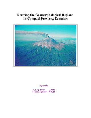
- 26. List of Figures Front Page: Marcano, J.E., 2004,Cotopaxi Volcano, El Planet Tierra, http://jmarcano.topcities.com/graficos/fotos/cotopaxi.jpg Figure 1: Vijfhuizen, S. & Burton G., 2004, The Geomorphologic Map of Cotopaxi Province, ArcGIS project quilotoa_geomorphology.mxd, UvA. Figure 2: Vijfhuizen, S. & Burton G., 2004, The Geomorphologic Map of Quilotoa Study Area, ArcGIS project quilotoa_geomorphology.mxd, UvA. Figure 3: Vijfhuizen, S. & Burton, G., Soil Map of the Quilotoa Study Area, ArcGIS project quilotoa_geomorphology2.mxd Figure 4: Vijfhuizen, S. & Burton, G., 2004, Quilotoa Precipitation (transparency)/Soil Map, ArcGIS project quilotoa_geomorphology2.mxd Figure 5: Vijfhuizen, S. & Burton, G., 2004, Quilotoa 3D Elevation, ArcGIS project quilotoa_view01.sxd Figure 6: Vijfhuizen, S. & Burton, G., 2004, Quilotoa 3D Geomorphology, ArcGIS project quilotoa_view01.sxd Figure 7: Vijfhuizen, S. & Burton, G., 2004, Quilotoa 3D Soils, ArcGIS project quilotoa_view01.sxd List of Tables Table 1: Vijfhuizen, S., 2004, Morphometric Standards for Geomorphology. Table 2: Burton, G., 2004, Geomorphological Regions within Cotopaxi Province. Source: Microsoft Excel spreadsheet file: cotopaxi_geomorphology.xls. Table 3: Burton, G., 2004, Quilotoa Regions within Cotopaxi Province. Source: Microsoft Excel spreadsheet file: quilotoa_geomorphology.xls. 26
- 27. List of Charts Chart 1: Burton, G., 2004,Quilotoa Soils, Source Microsoft Excel, soils_table1.xls. Chart 2: Burton, G., 2004, Quilotoa geomorphology, Source: Microsoft Excel, geomorphology_table1.xls. Chart 3: Burton, G., 2004, Alluvial Soil Types, Source: Microsoft Excel, alluvial_soils1.xls. Chart 4: Burton, G., 2004, Alluvial/Aeolian Soil Types, Source: Microsoft Excel, alluvial_aeolian_soils1.xl. Chart 5: Burton, G., 2004, Alluvial/Mass Movement Soil Types, Source: Microsoft Excel, alluvial_massmovemnt_soils1.xl. Chart 6: Burton, G., 2004, Mass Movement Soil Types, Source: Microsoft Excel, massmovemnt_aeolian_soils1.xl. Chart 7: Burton, G., 2004, Glacial Soil Types, Source: Microsoft Excel, glacial_soils1.xl. 27
- 28. Map Appendix 1. Vijfhuizen, S., Burton, G., Masked Elevation Grid Cotopaxi Province, ArcGIS project cotopaxi_1.mxd. 28
- 29. 2. Vijfhuizen, S., Burton, G., Masked Slope Grid Cotopaxi Province, ArcGIS project reclass_slope.mxd. 29
- 30. 3. Vijfhuizen, S., Burton, G., Quilotoa Geomorphology & Soils, ArcGIS project Quilotoa_geomorphology2.mxd. 30