Mountain Reservoir Hazards
•Transferir como PPT, PDF•
3 gostaram•1,477 visualizações

Lake reservoirs in mountainous areas can act as sources of catastrophic events such as flash floods, landslides, avalanches, and tsunamis if they rupture, similar to dam failures causing valley tsunamis. Sediment deposits in these reservoirs add uncertainty about their water volumes and depths, increasing flood risks, especially during heavy rainfall that can cause the reservoirs to overflow or interconnect. Past mock disaster drills in Uttarakhand revealed discrepancies but did not necessarily predict the deadly 2013 flood, showing the challenges of forecasting hazards from mountain lake systems.

Recomendados
Mais conteúdo relacionado
Semelhante a Mountain Reservoir Hazards
Semelhante a Mountain Reservoir Hazards (20)
Mais de BUSINESS INNOVATION RESEARCH DEVELOPMENT (BIRD)
Mais de BUSINESS INNOVATION RESEARCH DEVELOPMENT (BIRD) (20)
Último
Último (20)
Mountain Reservoir Hazards
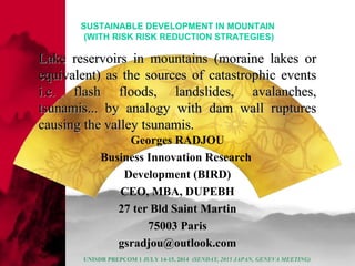
- 1. Lake reservoirs in mountains (moraine lakes orLake reservoirs in mountains (moraine lakes or equivalent) as the sources of catastrophic eventsequivalent) as the sources of catastrophic events i.e. flash floods, landslides, avalanches,i.e. flash floods, landslides, avalanches, tsunamis... by analogy with dam wall rupturestsunamis... by analogy with dam wall ruptures causing the valley tsunamis.causing the valley tsunamis. Georges RADJOU Business Innovation Research Development (BIRD) CEO, MBA, DUPEBH 27 ter Bld Saint Martin 75003 Paris gsradjou@outlook.com SUSTAINABLE DEVELOPMENT IN MOUNTAIN (WITH RISK RISK REDUCTION STRATEGIES) UNISDR PREPCOM 1 JULY 14-15, 2014 (SENDAY, 2015 JAPAN, GENEVA MEETING)
- 2. HH AA ZZ AA RR DD SS UNISDR PREPCOM 1 JULY 14-15, 2014 (SENDAY, 2015 JAPAN, GENEVA MEETING)
- 3. Lake reservoir hazards (List of hazards found in Uttarakhand river catchment) Uttarakhand valley river hazard Flood Physical Chemical Sediments Arsenic Lake reservoirs Unwanted Materials Tsunami Flash flood Water elevation (h) The reservoir network UNISDR PREPCOM 1 JULY 14-15, 2014 (SENDAY, 2015 JAPAN, GENEVA MEETING)
- 4. Source: internetUNISDR PREPCOM 1 JULY 14-15, 2014 (SENDAY, 2015 JAPAN, GENEVA MEETING)
- 5. II MM PP AA CC TT SS UNISDR PREPCOM 1 JULY 14-15, 2014 (SENDAY, 2015 JAPAN, GENEVA MEETING)
- 6. Table 2: Few figures on international disasters 2009: 55 millions people suffer severe stresses with disasters (Mr J. M. Jarraud, WMO President, Ref: WMO website)2008: -214 millions humans affected by natural disasters, -235 000 killed ones -Total Billing: $190 billions in damages -Disaster Costs increase since 1960 -Number of dead stabilized at: 200000/year -United Nations warned to take specific actions since 2005, if not there is a risk to jeopardize development Environment Research « Le Monde, Special Science » ,Nov-Dec 2009 UNISDR PREPCOM 1 JULY 14-15, 2014 (SENDAY, 2015 JAPAN, GENEVA MEETING)
- 7. Table 3: International community tools against disasters Satellites: -give the alert (raise the alarm)-inform the rescuers of disaster places-play a major role in dispatching the aids Computers:-phenomenal speeds of the calculators help to deal with the need to treat huge flux of data. – (For instance Meteo France 2007, Net SX 6R, treats 2300 billions of operations per second.)Satellite network:250 satellites with tools to observe the Earth –up to 10 tools-Forecast improvement: A 4 day forecast is equivalent to a 1 day forecast , 15 years ago Environment Research « Le Monde, Special Science » ,Nov-Dec 2009 p-42) UNISDR PREPCOM 1 JULY 14-15, 2014 (SENDAY, 2015 JAPAN, GENEVA MEETING)
- 8. II SS SS UU EE (S)(S) UNISDR PREPCOM 1 JULY 14-15, 2014 (SENDAY, 2015 JAPAN, GENEVA MEETING)
- 9. Fig. 10 : Classification model for emergencies Decision center Event or threats Mobilization Measures Studies Technical measures Eploitaton measures Danger level 1- Very Likely to be controlled Acute/reinforced surveillance Technical measures Exploitaton measures Danger level 2 Uncontrollability due to uncertainties Alert in stand-by Pre-alert & partial emergency evacuation Danger level 3 Not predictable Rupture (total or partial) Evacuation (Source :author from Claude March, Barrages, crues et protection civile, press Interantionales, Polytechnique/ dams and civilian protection p. 276) UNISDR PREPCOM 1 JULY 14-15, 2014 (SENDAY, 2015 JAPAN, GENEVA MEETING)
- 10. UNISDR PREPCOM 1 JULY 14-15, 2014 (SENDAY, 2015 JAPAN, GENEVA MEETING)
- 11. 3000 m 214 kms Devaprayag Alaknanda Ganga x Gangotri temple 16 kms x Gomukh Pilgrims Haridawar (dam) 253 kms and 312 m from sea level Hindustan plain Yamuna Allahabad 455 kms GANGA : 2510 KMS (1,560 Miles) long Bhagirathi river from ice cave 3,139 m fall 67 m 1 km (Snowfield : Gangotri Glacier) They are 3 peaks over 6,706 m 2817 m 11 m 1 km Himalaya, bird view map (author map), with the main geography features i.e. highest peaks, rivers, slopes, pilgrim flocking road, importnt cities, dam, Hindustan plain. From the time the Himalaya river (Ganga, Yamuna) become visible at Gomukh (spring of the river Ganga) it will tavel down to the Himalaya after reaching the Hindustan plain to end in the se. The river journey is a 2,510 kms length Source: author adpated from Google map UNISDR PREPCOM 1 JULY 14-15, 2014 (SENDAY, 2015 JAPAN, GENEVA MEETING)
- 12. Tsunami hazards in Himalaya mountains Lake and river reservoirs Sediment deposits ''Size of the layer'' (y) Reservoir size Elevation of the wall (Y) Cloud Outbursts Snowmelt (Himalaya ice layer size) Uttarakhand water hazard June 16, 2013 Physical Chemical Q (m³) Volume of the clouds Buffering action ( delay the rainfall Flows in the reservoirs) Erosions Pollutions UNISDR PREPCOM 1 JULY 14-15, 2014 (SENDAY, 2015 JAPAN, GENEVA MEETING)
- 13. Himalaya Mountains Uttarakhand Valley Mountain peaks Mandakini river Mandakini river Forest Kedarnath Temple Lakes reservoirs slopes slopes slopes Chorabari glacier Companion glacier Chorabari lake Sharaswati river Mandakini river UNISDR PREPCOM 1 JULY 14-15, 2014 (SENDAY, 2015 JAPAN, GENEVA MEETING)
- 14. When I talked about the reservoirs in mountains. In a wider extend I referred to the salvages of environmental buffers that are Himalaya snow and lakes, which were stabilizing the moutain regions by preventing the catastrophic events. buffers 2 cloud outbursts (asian Monsoon) Lake reservoirs Frozen snow Man made activities Tsunami salvages reservoirclouds tsunami UNISDR PREPCOM 1 JULY 14-15, 2014 (SENDAY, 2015 JAPAN, GENEVA MEETING)
- 15. Flood links/risks are directly links between clouds outbursts and filled reservoir lakes with the same beats (pulsation or frequency) cloud outbursts are coupled with reservoir lakes, but there is no systematically disasters, because the couplage is natural, and a natural valley with reservoirs are natural addaption in the Himalaya landscape. (System clouds+ reservoirs° cloud Lake reservoir Cloud outburst Risk of reservoir lake outbursts / ruptures Increase volumes of THE RESERVOIR THE CLOUDS THE SEA UTTARAKHNAD VALLEY RIVER FLOW MAXIMALISM REGIME (SATURATION) NO CONNECTION BETWEEN THE RESERVOIR AND THE SEA EXCEPT IN CASE OF RESERVOIR RUPTURES Normal clouds outburst(s) floows River (uttarakhand valley) Neglected in the modeling, because not relevant to the flood formation) A branch of the physical water river basin (Uttarakhaand basin) Direct couplage reservoir -clouds Decouplage river and sea Potentail flood risks and disater UNISDR PREPCOM 1 JULY 14-15, 2014 (SENDAY, 2015 JAPAN, GENEVA MEETING)
- 16. UNISDR PREPCOM 1 JULY 14-15, 2014 (SENDAY, 2015 JAPAN, GENEVA MEETING)
- 17. a ) L a b 1 : T h e f l o o d c o n c e p t ( S o u r c e : W M O f l o o d p r o g r a m m e ) T h e r a i n R u n - o f f s P o l l u t i o n s F l o o d s S e d i m e n t s T h e l a n d T h e r i v e r T h e S e a [ S o u r c e a d a p t a t i o n : W M O F l o o d p r o g r a m ] F L O O D I S G O O D F L O O D A N D / O R B A D FLOOD CONCEPT (WORLD METEOROLOGICAL ORGANIZATION AND IGREEN WATER PARTNERSHIP UNISDR PREPCOM 1 JULY 14-15, 2014 (SENDAY, 2015 JAPAN, GENEVA MEETING)
- 18. LevelLevel of understandingof understanding (Project ''How'')(Project ''How'')
- 19. UNISDR PREPCOM 1 JULY 14-15, 2014 (SENDAY, 2015 JAPAN, GENEVA MEETING)
- 20. UNISDR PREPCOM 1 JULY 14-15, 2014 (SENDAY, 2015 JAPAN, GENEVA MEETING)
- 21. At width constante, one can measure the lake reservoir surfaces (m2) in order to have the volumes of water outflows from the inflows per second I think it is much easier to assess the surface of the lake rather than the depth because of the sediment deposit accumulations inside the lake reservoir in mountains Shape of the lake reservoir xmaxymax zmax Certainty (controllabity) Uncertainty (uncontrollability) SEDIMENT DEPOSITS Zmin ΔZ = Zmax – Zmin Uncertainty (uncontrollability) Lake without sediments ? (rare) Lake with sediments (frequent) UNISDR PREPCOM 1 JULY 14-15, 2014 (SENDAY, 2015 JAPAN, GENEVA MEETING)
- 22. Himalaya moutain tsunami risk Sediment deposits y Y (reservoir size) Y/y Ratio (Y/y) sediment layer size(s) per /reservoir size(s) Flow in (flow of rupture or running over the reservoir wall (reservoir size) / size of the reservoir Rainfalls (cloud volumes) (Q) Qo Q – Qo > Σδqi +ΣΔpi Lakes/river reservoirs Uncertainty On reservoirsΣΔqi Uncertainty on sediments UNISDR PREPCOM 1 JULY 14-15, 2014 (SENDAY, 2015 JAPAN, GENEVA MEETING)
- 23. BUSINESS CASE- (AND STRATEGY CASE) → PROJECT ECONOMY Disaster Recovery Operations Mock drills failures Cost benefit analysis and cost sensity analysis Costs (losses) Costs (opportunities) reservoir Tsunami Risk UNISDR PREPCOM 1 JULY 14-15, 2014 (SENDAY, 2015 JAPAN, GENEVA MEETING)
- 24. Not all the elements of the water supply are exposed to the same hazard (Pan WHO latina America) Uttarakhand communities may have not been exposed to the same hazards (A1, A2,... Aj) which is the floods Uttarakhand flood river A1 A2 A j cause(s) (causes) (causes) cause(s) = potential cause(s) Issues : how to eliminate real (physical) sources from virtual (not physical sources) U1 Uk Uncertainties (1 and k) SUk (a) SUk (b) Uncertainties sources river UNISDR PREPCOM 1 JULY 14-15, 2014 (SENDAY, 2015 JAPAN, GENEVA MEETING)
- 25. Profile of a river bed channel (natural or artificial), which can explained violent flows in Uttarakhand valley are not steady (this is already seen in case of a sharp slope). (It can be source of lake reservoirs in case with river beds in flat slope mountain or flood plain, too) Small pocket of water (a small reservoir or a small lake) Big pocket of water (a large reservoir or a large lake) Tiny pocket of water ( a micro reservoir or a micro lake) 3 lake reservoirs in Himalaya mountains, which are not able to exchange unless there a rainfall. (scenario of continuity of reservoirs in an interconnected networks of lakes Water levelling in lake reservoir in mountains H1 = H2 = H3 = H H H1 H2 H3 Source : author / BIRD adapted from Hydraulics in civil and environmental engineering, A Spon Book soil PRESENTATION OF THE LAKES OR RIVER BED RESERVOIRS IN MOUNTAINS I.E. UTTARAKHAND VALLEY (S) Fig. 2 : the lake/river reservoirs in moutains When there is an important rainfall the 3 reservoirs/lakes are communicating and adding their flows to make the tsunami in moutain with the action of the gravity force and the rubbles River boulder size (moraine size) TSUNAMI UNISDR PREPCOM 1 JULY 14-15, 2014 (SENDAY, 2015 JAPAN, GENEVA MEETING)
- 26. Fig.5: Transport of the load in the river. I have introduced the uncertainty based on the water quality and the water elevation in the reservoirs. These sources of uncertainties/uncertainties are likely to be the risk source. The more important are the uncertainties and the morerlikely is the flood risk as direct relationship between the reservoir deposit and the tsunami (see also, figure 1 i.e. value chain and balance to assess unwanted materials (UMS)... V2 V1 V3 River bed Unwanted materials Water elevation Water River flows Uncertainty 1 (water volume)Uncertainty 2 (water quality)Unwanted materials Water surface Source: author / BIRD UNISDR PREPCOM 1 JULY 14-15, 2014 (SENDAY, 2015 JAPAN, GENEVA MEETING)
- 27. When the media told these was a failed mock drill 2 in 2011- For sure it does not mean that either the flood was predicted or one cannot ignored the discrepancies that could have led to Uttarakhand disaster. Noneless to say, the flood was branded. T = 16 June 2013 Brand schock (flood disaster) occurred T = 2011 Mock drill failures T= T – X T = 0 T + a T + a² Hypothesis : brand schock ? What has became public or will become public at T + a² Awarness of the brand schock QUESTIONWHAT ARE THE VALUE OF X AND A ? IN UTTARAKHAND CASE UNISDR PREPCOM 1 JULY 14-15, 2014 (SENDAY, 2015 JAPAN, GENEVA MEETING)
- 28. India Uttarakhand GDP% / km 9 4 2 6 Uttarakhand Mock drill failures Himalaya 8 2011 2013 Himalaya Uttarakh and flood disaster Uttarakhand India India International diplomacy line – media, blogs, social media.... Poliitic Economy Society Tourism Disaster Election T – X UNISDR PREPCOM 1 JULY 14-15, 2014 (SENDAY, 2015 JAPAN, GENEVA MEETING)
- 29. Mountain wall (Himalaya) ( 3000 m)Temple Houses road Up-hill Down-hill River stream (dry) Risk zone ? The risk reduction is based on IWRM (Integrated Water Resource Management) Recharge Restock Restore Refill Replenish Re-use A 4R management plan program will help Uttarakhand to move out of poverty and Indian stakeholders have already started- I do not beleive the Dam which has been built is causing the disaster, but the water Interagtion in Himalay is far form being complete- in fact, it has jsut started UNISDR PREPCOM 1 JULY 14-15, 2014 (SENDAY, 2015 JAPAN, GENEVA MEETING)
- 30. General Equation of lake/river reservoir in mountains in out k1 k2 k3 k4 q1 q4 q3 q2 Qo ko q4 = (k4/K3) Q3 + (K 3/K2) Q2 + (K2/K1) Q1 + (K1/Ko) Qo q5 = Σ Δqi Qo = q4 + q5 q5 UNISDR PREPCOM 1 JULY 14-15, 2014 (SENDAY, 2015 JAPAN, GENEVA MEETING)
- 31. A network (nodes + connections) of the lake reservoirs in Uttarakhand Valley (Himalaya mountains) A node (a single lake reservoir) Connectors (surface run-offs) Connectors (underground run- offs) UNISDR PREPCOM 1 JULY 14-15, 2014 (SENDAY, 2015 JAPAN, GENEVA MEETING)
- 32. Flood as process ''double risk blackbox'' Lake / river reservoirs in mountain Flow in (Fin) Flow out (Fout) sedimentsf(in) f(out) Qo/T= ΣKij S1 +ΣΔqi Qn/T= ΣΔqiQo/T= ΣKij S1 +ΣΔqi Qo – Qn = Σkij x S1 Monitor flow entry in the first lake Monitor flow entries in the first lake Monitor flow exits in the last lake Tsunami flow risk =ΣΔqi F(water) + f (sediment) f (in) = Po / T f(out) = Σδpi Total tsunami flow risks : TTFR = Qn/T + Pn / T = ΣΔ qi + ΣΔpi Tsunami flow risk =ΣΔqi Water risk Sediment risks UNISDR PREPCOM 1 JULY 14-15, 2014 (SENDAY, 2015 JAPAN, GENEVA MEETING)
- 33. UNISDR PREPCOM 1 JULY 14-15, 2014 (SENDAY, 2015 JAPAN, GENEVA MEETING)
- 34. Scheme of the lake reservoirs in the reservoir network (sample of a network with 4 interconnected reservoirs) Y V1 V2 V3 V4 Vo Network of 4 reservoirs / lakes in mountains Flow in Flow out River regime Vo/T = Fo (flow in) V1 > 4Vo 1 1 + 0.5 1.5 (3/2) 0.66 2/3 0.5Vo (1/2) V1 + (V1 + ½ V1) + (V1 + ½ V1 + 2/3 3/2 V 4Vo 6 Vo4Vo Q4 = k43 x Q3 + k32 x Q2 + k2k1 x Q1 + k1/ko x Qo k4k3 k3k2 k1 k2 ko k1 K1/ k2 = K12 Q = F x T UNISDR PREPCOM 1 JULY 14-15, 2014 (SENDAY, 2015 JAPAN, GENEVA MEETING)
- 35. i 0 1 2 3 i j kn J i+1 1 2 3 4 j j+1 Kn+1 K ij K01 K12 K23 K 34 Ki,,j Kj, j+1 Kn,n+1 S1 a1 a1 a1 a1 a1 a1 a1 Si a1 a2 a3 a4 ai aj ak Sj/Si a1/a1 a2/a1 a3/a2 a4/a 3 Q4 = ΣKij x S1 + I = 0,...3 J= 1,...4 K = j+1,...n ΣΔqi S1 N = 3 ( k = j+1,...n) UNISDR PREPCOM 1 JULY 14-15, 2014 (SENDAY, 2015 JAPAN, GENEVA MEETING)
- 36. A network (nodes + connections) of the lake reservoirs in Uttarakhand Valley (Himalaya mountains) A node (a single lake reservoir) Connectors (surface run-offs) Connectors (underground run- offs) ? Small or large reservoirs does not matter so much as 88% of total victims are made by the reservoir ruptures, which are not in the inventories and 99% of these same victims are within 24 kilometers downhill from the lakes...(I did not verify this formula of number of deads for the mountain lakes- I have assumed the same rules applied for lake reservoir in mountains Reservoir rupture Origin of the source of the tsunami flows Uttarakhand Valley 24 kilometers down hill 24 kilometers Up hillDisaster range 24 kms Kerbanath temple (tsunami disaster) UNISDR PREPCOM 1 JULY 14-15, 2014 (SENDAY, 2015 JAPAN, GENEVA MEETING)
- 38. Fig. 8: Instant flood wall. This is an effective model that I have seen at work during a meeting in Paris of flood stakeholders (Previrsiq, EU and city resilience project, Park Floral, France 2010) The Australian firm, which was manufactruing the item, was a small business full with entrpreneurship ideas. A folded carpet could be rolled accross a river flow materializing the flood trajectories and the flood stream. V1 Frontline of the flood rope rolled geo- membrane Canal width (10 meters) 2-3 meters River channel crossed with a folded geo-membrane reinforcement Vo Water flow penetrations Geo-membrane starts to raise with the water flow penetrations inside the membrane Source : author / BIRD UNISDR PREPCOM 1 JULY 14-15, 2014 (SENDAY, 2015 JAPAN, GENEVA MEETING)
- 39. Flowing water Water stored behind the geo-membrane Resistive plastic membrane Security/safety rope Pressure(s) (P) Vo River bed 2.50 m 0.30 mV1 V2 1.80 m Flood screenReal elevation (2.50 m) of flood water before the screen Same flood with a lesser elevation (0.70 m) after the flood screen Micro waterfall Steady flows Turbulent flows Fig. 9 : acting flood wall showing the flow reduction/cut by the size of the screen. The screen, which is built with a geo-mebrane acting on the flood as a discharge and preventing the flood risk to create more damages. Source : author /BIRD UNISDR PREPCOM 1 JULY 14-15, 2014 (SENDAY, 2015 JAPAN, GENEVA MEETING)
- 40. UNISDR PREPCOM 1 JULY 14-15, 2014 (SENDAY, 2015 JAPAN, GENEVA MEETING)
- 41. Proposed Solution UNISDR PREPCOM 1 JULY 14-15, 2014 (SENDAY, 2015 JAPAN, GENEVA MEETING)
- 42. Dry canal Wet canal Danger (flood prone canal) (Uttarakhand) If there is a monsoon, the regime inthe dry canal will varied in an uncontrollable way, also,because it is dry, it is perceive as a dormant canal. Poeple do not fear becaus there is no water The behavior of this canal is known because it is not dormant, water in part of the canal network- there aremore controllabilty in case of flood-because of less unknowns THE LONG TERM SUSTAINABILITY OF THE INDIA PROJECT AGAINST FLOOD RIVER BRANCHES IS INDIA CANAL LEVELLING (constant highr river regime (canal c) is better than important river variability (canal b)-due to the flood risk issue. Canal A (flood unsafe canal) Canal B 100 km Flood safe canal Water transferred Water transferred Canal C Water Donor canal UNISDR PREPCOM 1 JULY 14-15, 2014 (SENDAY, 2015 JAPAN, GENEVA MEETING)
- 43. Dry canal Wet canal Danger (Uttarakhand) If there is a monsoon, the regime inthe dry canal will varied in an uncontrollabl e way, also,because it is dry, it is perceive as a dormant canal. Poeple do not fear becaus there is no water The behavior of htis canal is known because it is not dormant, water in part of the canal network- there aremore controllabilty in case of flood-because of less unknowns THE LONG TERM SUSTAINABILITY OF THE INDIA PROJECT AGAINST FLOOD RIVER BRANCHES IS INDIA CANAL LEVELLING (constant highr river regime (canal c) is better than important river variability (canal b)-due to the flood risk issue. Canal A (flood safe canal Canal B 100 km Flood safe canal Water transferred Water transferred Canal C Water Donor canal UNISDR PREPCOM 1 JULY 14-15, 2014 (SENDAY, 2015 JAPAN, GENEVA MEETING)
- 44. RISK TRIANGLE AND DECISION MAKING IN THE SUSTAINABLE DEVELOPMENT Low cost Intervention if the risk can be reduced High risk No intervention Cost too important intervention Cost acceptable Low risk Excessive cost No intervention Intermediate risk Intervention assessment Cost assessment Relation between the levels of the risks and the needed investments to prevent or reduce these risk occurrences (bearing in mind that no risk is 100% reductable) (Sustain,ble development in disater management '' risk 0'', and the precautionary measures apply) UNISDR PREPCOM 1 JULY 14-15, 2014 (SENDAY, 2015 JAPAN, GENEVA MEETING)