SlideShare uma empresa Scribd logo
1 de 10
Baixar para ler offline
”Big Data - SubSea, SubSurface and Seismic Data in GIS”
Stavanger May 28th 2014
Morten Tønnesen, Managing Director, Geocap AS
Requirements for a Shared Earth Model
• Manage Big Data
• Open System
• Scalable
• Data Management System
• Support Sharing and Collaboration
• Cost efficient Solution
Key Question:
Why do you need this ?
The Need for a Shared Earth Model
Subsurface Exploration, Field Development
and Production • Exploration, Field Development and Production Planning
• Calculate Oil and Gas In Place Volumes
• Assess Subsurface Risk and Uncertainty
• Input to History Matching and Production Forecasting
• Input to Wellplanning and Drilling Operations
• Quick Look Studies and Data Room Visits
• Input to License Round /APA Applications
Big Data:
- 2D,3D&4D Seismic Data , 1 GB > 1000 GB
- 2D Interpretations and Grids, 1 MB > 10 GB
- Well and Production Data , 1 > 100,000 Wells
- NPD and Cultural GIS Data
The Need for a Shared Earth Model
Subsea Offshore Installations and
Infrastructure
• Field Development and Production Planning
• High Quality Bathymetry, Geophysical & Geological Maps
• Assess Subsurface Risk and Uncertainty
• Input to Wellplanning and Drilling,
• Find and Optimize Exact Safe Locations of Installations
• Plan and Monitor Engineering – Dredging
• Input to License Round Applications
Big Data:
- Shallow Seismic & Interpretations , 1 > 1000 GB
- Multibeam, Sidescan, Magnetometry , 1 – 1000 GB
- Water Column Data , > 1 TB
- Lidar and Laser Data , > 1 TB
- NPD and Cultural GIS Data
The Need for a Shared Earth Model
Environmental Management & Surveillance
• Field Development and Production Planning
• High Quality Bathymetry , Geophysical & Geological Maps
• Assess Subsurface Risk and Uncertainty
• Input to Wellplanning, Drilling and Operations
• Find and Optimize Exact Safe Locations of Installations
• Plan and Monitor Engineering – Dredging
• Input to License Round Applications
Big Data:
- Shallow Seismic & Interpretations , 1 > 1000 GB
- Multibeam, Sidescan, Magnetometry , 1 – 1000 GB
- Water Column Data , > 1 TB
- Lidar/Laser Data, > 1 TB
- NPD , Mareano and GIS Cultural Data
The Need for a Shared Earth Model
Management of the Continental
Shelf and Maritime Zones
• High Quality Bathymetry , Geophysical & Geological Maps
• Assess Subsurface Risk and Uncertainty
• Find and Calculate Exact Locations of Foot of Slope and
Critical Points for Maritime Boundaries according to UNCLOS
• Marine Spatial Planning
• Input to Nations planning for License Round Applications
Big Data:
- Shallow 2D Seismic & Interpretations , 1 > 1000 GB
- Multibeam, Sidescan, Magnetometry , 1 – 100 GB
- Government and GIS Cultural Data
Sub-Sea and Sub -Surface
Expert Systems
ArcGIS
GeocapDataLinkforArcGIS
Mobile GIS
Desktop
Web
Spatial
Datawarehouse
for ArcGIS
Toolbox
Server
Sharing Portal
Breaking down the barriers between Expert
Interpretation Systems and GIS
i.e Shape files & Interpretations
The Shared Earth Model in ArcGIS in 3D – for Real
We Give You:
 Integrated Vizualisation and Interpretation
in ArcGIS
 Sharing and Collaboration of Big Data
 Integrated Workflows in ArcGIS
 Access to Your already Existing Databases
and Expert Tools
 No Duplication of Big Data
 Cost Efficient Solutions
New Releases Available Now:
Geocap Ground Model for ArcGIS
Geocap Seismic Explorer for ArcGIS

Mais conteúdo relacionado

Semelhante a Petroleum seminar 28

Resume Stephen Kuhlman 05 17 2012 EP
Resume Stephen Kuhlman 05 17 2012 EPResume Stephen Kuhlman 05 17 2012 EP
Resume Stephen Kuhlman 05 17 2012 EPskuhlman
 
Empowering institutions and stakeholders for spatial planning - Dr. Nagaraj R...
Empowering institutions and stakeholders for spatial planning - Dr. Nagaraj R...Empowering institutions and stakeholders for spatial planning - Dr. Nagaraj R...
Empowering institutions and stakeholders for spatial planning - Dr. Nagaraj R...NeGD Capacity Building
 
Navigating the Marine Geophysical Data Life Cycle
Navigating the Marine Geophysical Data Life CycleNavigating the Marine Geophysical Data Life Cycle
Navigating the Marine Geophysical Data Life CycleVicki Ferrini
 
Pillar 4 Information and Data
Pillar 4 Information and DataPillar 4 Information and Data
Pillar 4 Information and DataStankovic G
 
Introduction to the U.S. Geological Survey and USGS-GCD Cooperative Studies, ...
Introduction to the U.S. Geological Survey and USGS-GCD Cooperative Studies, ...Introduction to the U.S. Geological Survey and USGS-GCD Cooperative Studies, ...
Introduction to the U.S. Geological Survey and USGS-GCD Cooperative Studies, ...Texas Alliance of Groundwater Districts
 
Mark Thomas_A digital soil mapping approach for regolith thickness in the com...
Mark Thomas_A digital soil mapping approach for regolith thickness in the com...Mark Thomas_A digital soil mapping approach for regolith thickness in the com...
Mark Thomas_A digital soil mapping approach for regolith thickness in the com...TERN Australia
 
An Introduction to DI Play Assessments
An Introduction to DI Play AssessmentsAn Introduction to DI Play Assessments
An Introduction to DI Play AssessmentsDrillinginfo
 
2016 GMekong Forum - Session 6 - Intro to SERVIR Mekong and dam inundation pr...
2016 GMekong Forum - Session 6 - Intro to SERVIR Mekong and dam inundation pr...2016 GMekong Forum - Session 6 - Intro to SERVIR Mekong and dam inundation pr...
2016 GMekong Forum - Session 6 - Intro to SERVIR Mekong and dam inundation pr...Water, Land and Ecosystems (WLE)
 
Geocap seismic oil and gas for ArcGIS- Oil and Gas seminar October 10th
Geocap seismic oil and gas for ArcGIS- Oil and Gas seminar October 10thGeocap seismic oil and gas for ArcGIS- Oil and Gas seminar October 10th
Geocap seismic oil and gas for ArcGIS- Oil and Gas seminar October 10thGeodata AS
 
The Bundarra project case study
The Bundarra project case studyThe Bundarra project case study
The Bundarra project case studyKenex Ltd
 
20131030 baid nssi_briefing
20131030 baid nssi_briefing20131030 baid nssi_briefing
20131030 baid nssi_briefingProper Printshop
 
Easter Desert Project
Easter Desert ProjectEaster Desert Project
Easter Desert ProjectIwl Pcu
 
Coastal Landcover Trends & Applications in the NW
Coastal Landcover Trends & Applications in the NWCoastal Landcover Trends & Applications in the NW
Coastal Landcover Trends & Applications in the NWEric Morris
 
Mining and artificial intelligence - a new paradigm growing!
Mining and artificial intelligence - a new paradigm growing!Mining and artificial intelligence - a new paradigm growing!
Mining and artificial intelligence - a new paradigm growing!Stig-Arne Kristoffersen
 
Mineral potential mapping
Mineral potential mappingMineral potential mapping
Mineral potential mappingKenex Ltd
 
Modern mining
Modern miningModern mining
Modern miningarabnubia
 

Semelhante a Petroleum seminar 28 (20)

Resume Stephen Kuhlman 05 17 2012 EP
Resume Stephen Kuhlman 05 17 2012 EPResume Stephen Kuhlman 05 17 2012 EP
Resume Stephen Kuhlman 05 17 2012 EP
 
Gis in urban
Gis in urbanGis in urban
Gis in urban
 
Empowering institutions and stakeholders for spatial planning - Dr. Nagaraj R...
Empowering institutions and stakeholders for spatial planning - Dr. Nagaraj R...Empowering institutions and stakeholders for spatial planning - Dr. Nagaraj R...
Empowering institutions and stakeholders for spatial planning - Dr. Nagaraj R...
 
Navigating the Marine Geophysical Data Life Cycle
Navigating the Marine Geophysical Data Life CycleNavigating the Marine Geophysical Data Life Cycle
Navigating the Marine Geophysical Data Life Cycle
 
Pillar 4 Information and Data
Pillar 4 Information and DataPillar 4 Information and Data
Pillar 4 Information and Data
 
Data, Tools, Training, and Technical Assistance
Data, Tools, Training, and Technical AssistanceData, Tools, Training, and Technical Assistance
Data, Tools, Training, and Technical Assistance
 
Introduction to the U.S. Geological Survey and USGS-GCD Cooperative Studies, ...
Introduction to the U.S. Geological Survey and USGS-GCD Cooperative Studies, ...Introduction to the U.S. Geological Survey and USGS-GCD Cooperative Studies, ...
Introduction to the U.S. Geological Survey and USGS-GCD Cooperative Studies, ...
 
Mark Thomas_A digital soil mapping approach for regolith thickness in the com...
Mark Thomas_A digital soil mapping approach for regolith thickness in the com...Mark Thomas_A digital soil mapping approach for regolith thickness in the com...
Mark Thomas_A digital soil mapping approach for regolith thickness in the com...
 
Sarah eason
Sarah easonSarah eason
Sarah eason
 
An Introduction to DI Play Assessments
An Introduction to DI Play AssessmentsAn Introduction to DI Play Assessments
An Introduction to DI Play Assessments
 
2016 GMekong Forum - Session 6 - Intro to SERVIR Mekong and dam inundation pr...
2016 GMekong Forum - Session 6 - Intro to SERVIR Mekong and dam inundation pr...2016 GMekong Forum - Session 6 - Intro to SERVIR Mekong and dam inundation pr...
2016 GMekong Forum - Session 6 - Intro to SERVIR Mekong and dam inundation pr...
 
Geocap seismic oil and gas for ArcGIS- Oil and Gas seminar October 10th
Geocap seismic oil and gas for ArcGIS- Oil and Gas seminar October 10thGeocap seismic oil and gas for ArcGIS- Oil and Gas seminar October 10th
Geocap seismic oil and gas for ArcGIS- Oil and Gas seminar October 10th
 
The Bundarra project case study
The Bundarra project case studyThe Bundarra project case study
The Bundarra project case study
 
20131030 baid nssi_briefing
20131030 baid nssi_briefing20131030 baid nssi_briefing
20131030 baid nssi_briefing
 
Easter Desert Project
Easter Desert ProjectEaster Desert Project
Easter Desert Project
 
Coastal Landcover Trends & Applications in the NW
Coastal Landcover Trends & Applications in the NWCoastal Landcover Trends & Applications in the NW
Coastal Landcover Trends & Applications in the NW
 
Mining and artificial intelligence - a new paradigm growing!
Mining and artificial intelligence - a new paradigm growing!Mining and artificial intelligence - a new paradigm growing!
Mining and artificial intelligence - a new paradigm growing!
 
Mineral potential mapping
Mineral potential mappingMineral potential mapping
Mineral potential mapping
 
Hedrick_Poster
Hedrick_PosterHedrick_Poster
Hedrick_Poster
 
Modern mining
Modern miningModern mining
Modern mining
 

Mais de Geodata AS

Øvelse Oslofjord - BK2016
Øvelse Oslofjord  - BK2016Øvelse Oslofjord  - BK2016
Øvelse Oslofjord - BK2016Geodata AS
 
Kartlegging av flomveier i Oslo - BK2015
Kartlegging av flomveier i Oslo - BK2015Kartlegging av flomveier i Oslo - BK2015
Kartlegging av flomveier i Oslo - BK2015Geodata AS
 
Imagery and beyond - BK 2016
Imagery and beyond - BK 2016Imagery and beyond - BK 2016
Imagery and beyond - BK 2016Geodata AS
 
ArcGIS i samferdselsplanlegging - BK2016
ArcGIS i samferdselsplanlegging - BK2016ArcGIS i samferdselsplanlegging - BK2016
ArcGIS i samferdselsplanlegging - BK2016Geodata AS
 
Disrupt or be disrupted - BK 2016
Disrupt or be disrupted - BK 2016Disrupt or be disrupted - BK 2016
Disrupt or be disrupted - BK 2016Geodata AS
 
ArcGIS Server og FME som duo i dokumentproduksjon - BK2016
ArcGIS Server og FME som duo i dokumentproduksjon - BK2016ArcGIS Server og FME som duo i dokumentproduksjon - BK2016
ArcGIS Server og FME som duo i dokumentproduksjon - BK2016Geodata AS
 
Workflow manager - Kystverkets bruk og erfaringer - BK2016
Workflow manager - Kystverkets bruk og erfaringer - BK2016Workflow manager - Kystverkets bruk og erfaringer - BK2016
Workflow manager - Kystverkets bruk og erfaringer - BK2016Geodata AS
 
Workflow manager – hva er det og hva kan det brukes til - BK2016
Workflow manager – hva er det og hva kan det brukes til - BK2016Workflow manager – hva er det og hva kan det brukes til - BK2016
Workflow manager – hva er det og hva kan det brukes til - BK2016Geodata AS
 
ArcGIS Portal og sharepoint - en fleksibel kombinasjon - BK2016
ArcGIS Portal og sharepoint - en fleksibel kombinasjon - BK2016ArcGIS Portal og sharepoint - en fleksibel kombinasjon - BK2016
ArcGIS Portal og sharepoint - en fleksibel kombinasjon - BK2016Geodata AS
 
Enkel tilgang på live trafikkinformasjon - BK2016
Enkel tilgang på live trafikkinformasjon - BK2016Enkel tilgang på live trafikkinformasjon - BK2016
Enkel tilgang på live trafikkinformasjon - BK2016Geodata AS
 
Anvendelse av ArcGIS-plattformen for planlegging gjennomføring - BK2016
Anvendelse av ArcGIS-plattformen for planlegging gjennomføring - BK2016Anvendelse av ArcGIS-plattformen for planlegging gjennomføring - BK2016
Anvendelse av ArcGIS-plattformen for planlegging gjennomføring - BK2016Geodata AS
 
Dynamisk ressurs modellering - miljørisikoanalyse for arktiske olje og gass a...
Dynamisk ressurs modellering - miljørisikoanalyse for arktiske olje og gass a...Dynamisk ressurs modellering - miljørisikoanalyse for arktiske olje og gass a...
Dynamisk ressurs modellering - miljørisikoanalyse for arktiske olje og gass a...Geodata AS
 
Arctic Risk Map - kommuniserer regionens sikkerhet og miljø risiko - BK2016
Arctic Risk Map -  kommuniserer regionens sikkerhet og miljø risiko - BK2016Arctic Risk Map -  kommuniserer regionens sikkerhet og miljø risiko - BK2016
Arctic Risk Map - kommuniserer regionens sikkerhet og miljø risiko - BK2016Geodata AS
 
Tilstandsregistrering av landbruksveger i Hedmark ved hjelp av collector for ...
Tilstandsregistrering av landbruksveger i Hedmark ved hjelp av collector for ...Tilstandsregistrering av landbruksveger i Hedmark ved hjelp av collector for ...
Tilstandsregistrering av landbruksveger i Hedmark ved hjelp av collector for ...Geodata AS
 
Bruks av ArcGIS Online som samhandlingsplattform i beredskap og krise - BK2016
Bruks av ArcGIS Online som samhandlingsplattform i beredskap og krise - BK2016Bruks av ArcGIS Online som samhandlingsplattform i beredskap og krise - BK2016
Bruks av ArcGIS Online som samhandlingsplattform i beredskap og krise - BK2016Geodata AS
 
Kom i gang med ArcGIS Pro
Kom i gang med ArcGIS ProKom i gang med ArcGIS Pro
Kom i gang med ArcGIS ProGeodata AS
 
ArcGIS en plattform for hele virksomheten - BK2016
ArcGIS  en plattform for hele virksomheten - BK2016ArcGIS  en plattform for hele virksomheten - BK2016
ArcGIS en plattform for hele virksomheten - BK2016Geodata AS
 
Geografiske analyser i ArcGIS - BK 2016
Geografiske analyser i ArcGIS - BK 2016Geografiske analyser i ArcGIS - BK 2016
Geografiske analyser i ArcGIS - BK 2016Geodata AS
 
Skredregistrering.no og norsk skreddatabase - BK2016
Skredregistrering.no og norsk skreddatabase - BK2016Skredregistrering.no og norsk skreddatabase - BK2016
Skredregistrering.no og norsk skreddatabase - BK2016Geodata AS
 
Laserskanning av skog fra drone gir nye muligheter - BK2016
Laserskanning av skog fra drone gir nye muligheter - BK2016Laserskanning av skog fra drone gir nye muligheter - BK2016
Laserskanning av skog fra drone gir nye muligheter - BK2016Geodata AS
 

Mais de Geodata AS (20)

Øvelse Oslofjord - BK2016
Øvelse Oslofjord  - BK2016Øvelse Oslofjord  - BK2016
Øvelse Oslofjord - BK2016
 
Kartlegging av flomveier i Oslo - BK2015
Kartlegging av flomveier i Oslo - BK2015Kartlegging av flomveier i Oslo - BK2015
Kartlegging av flomveier i Oslo - BK2015
 
Imagery and beyond - BK 2016
Imagery and beyond - BK 2016Imagery and beyond - BK 2016
Imagery and beyond - BK 2016
 
ArcGIS i samferdselsplanlegging - BK2016
ArcGIS i samferdselsplanlegging - BK2016ArcGIS i samferdselsplanlegging - BK2016
ArcGIS i samferdselsplanlegging - BK2016
 
Disrupt or be disrupted - BK 2016
Disrupt or be disrupted - BK 2016Disrupt or be disrupted - BK 2016
Disrupt or be disrupted - BK 2016
 
ArcGIS Server og FME som duo i dokumentproduksjon - BK2016
ArcGIS Server og FME som duo i dokumentproduksjon - BK2016ArcGIS Server og FME som duo i dokumentproduksjon - BK2016
ArcGIS Server og FME som duo i dokumentproduksjon - BK2016
 
Workflow manager - Kystverkets bruk og erfaringer - BK2016
Workflow manager - Kystverkets bruk og erfaringer - BK2016Workflow manager - Kystverkets bruk og erfaringer - BK2016
Workflow manager - Kystverkets bruk og erfaringer - BK2016
 
Workflow manager – hva er det og hva kan det brukes til - BK2016
Workflow manager – hva er det og hva kan det brukes til - BK2016Workflow manager – hva er det og hva kan det brukes til - BK2016
Workflow manager – hva er det og hva kan det brukes til - BK2016
 
ArcGIS Portal og sharepoint - en fleksibel kombinasjon - BK2016
ArcGIS Portal og sharepoint - en fleksibel kombinasjon - BK2016ArcGIS Portal og sharepoint - en fleksibel kombinasjon - BK2016
ArcGIS Portal og sharepoint - en fleksibel kombinasjon - BK2016
 
Enkel tilgang på live trafikkinformasjon - BK2016
Enkel tilgang på live trafikkinformasjon - BK2016Enkel tilgang på live trafikkinformasjon - BK2016
Enkel tilgang på live trafikkinformasjon - BK2016
 
Anvendelse av ArcGIS-plattformen for planlegging gjennomføring - BK2016
Anvendelse av ArcGIS-plattformen for planlegging gjennomføring - BK2016Anvendelse av ArcGIS-plattformen for planlegging gjennomføring - BK2016
Anvendelse av ArcGIS-plattformen for planlegging gjennomføring - BK2016
 
Dynamisk ressurs modellering - miljørisikoanalyse for arktiske olje og gass a...
Dynamisk ressurs modellering - miljørisikoanalyse for arktiske olje og gass a...Dynamisk ressurs modellering - miljørisikoanalyse for arktiske olje og gass a...
Dynamisk ressurs modellering - miljørisikoanalyse for arktiske olje og gass a...
 
Arctic Risk Map - kommuniserer regionens sikkerhet og miljø risiko - BK2016
Arctic Risk Map -  kommuniserer regionens sikkerhet og miljø risiko - BK2016Arctic Risk Map -  kommuniserer regionens sikkerhet og miljø risiko - BK2016
Arctic Risk Map - kommuniserer regionens sikkerhet og miljø risiko - BK2016
 
Tilstandsregistrering av landbruksveger i Hedmark ved hjelp av collector for ...
Tilstandsregistrering av landbruksveger i Hedmark ved hjelp av collector for ...Tilstandsregistrering av landbruksveger i Hedmark ved hjelp av collector for ...
Tilstandsregistrering av landbruksveger i Hedmark ved hjelp av collector for ...
 
Bruks av ArcGIS Online som samhandlingsplattform i beredskap og krise - BK2016
Bruks av ArcGIS Online som samhandlingsplattform i beredskap og krise - BK2016Bruks av ArcGIS Online som samhandlingsplattform i beredskap og krise - BK2016
Bruks av ArcGIS Online som samhandlingsplattform i beredskap og krise - BK2016
 
Kom i gang med ArcGIS Pro
Kom i gang med ArcGIS ProKom i gang med ArcGIS Pro
Kom i gang med ArcGIS Pro
 
ArcGIS en plattform for hele virksomheten - BK2016
ArcGIS  en plattform for hele virksomheten - BK2016ArcGIS  en plattform for hele virksomheten - BK2016
ArcGIS en plattform for hele virksomheten - BK2016
 
Geografiske analyser i ArcGIS - BK 2016
Geografiske analyser i ArcGIS - BK 2016Geografiske analyser i ArcGIS - BK 2016
Geografiske analyser i ArcGIS - BK 2016
 
Skredregistrering.no og norsk skreddatabase - BK2016
Skredregistrering.no og norsk skreddatabase - BK2016Skredregistrering.no og norsk skreddatabase - BK2016
Skredregistrering.no og norsk skreddatabase - BK2016
 
Laserskanning av skog fra drone gir nye muligheter - BK2016
Laserskanning av skog fra drone gir nye muligheter - BK2016Laserskanning av skog fra drone gir nye muligheter - BK2016
Laserskanning av skog fra drone gir nye muligheter - BK2016
 

Último

8447779800, Low rate Call girls in Tughlakabad Delhi NCR
8447779800, Low rate Call girls in Tughlakabad Delhi NCR8447779800, Low rate Call girls in Tughlakabad Delhi NCR
8447779800, Low rate Call girls in Tughlakabad Delhi NCRashishs7044
 
Global Scenario On Sustainable and Resilient Coconut Industry by Dr. Jelfina...
Global Scenario On Sustainable  and Resilient Coconut Industry by Dr. Jelfina...Global Scenario On Sustainable  and Resilient Coconut Industry by Dr. Jelfina...
Global Scenario On Sustainable and Resilient Coconut Industry by Dr. Jelfina...ictsugar
 
Traction part 2 - EOS Model JAX Bridges.
Traction part 2 - EOS Model JAX Bridges.Traction part 2 - EOS Model JAX Bridges.
Traction part 2 - EOS Model JAX Bridges.Anamaria Contreras
 
Annual General Meeting Presentation Slides
Annual General Meeting Presentation SlidesAnnual General Meeting Presentation Slides
Annual General Meeting Presentation SlidesKeppelCorporation
 
India Consumer 2024 Redacted Sample Report
India Consumer 2024 Redacted Sample ReportIndia Consumer 2024 Redacted Sample Report
India Consumer 2024 Redacted Sample ReportMintel Group
 
NewBase 19 April 2024 Energy News issue - 1717 by Khaled Al Awadi.pdf
NewBase  19 April  2024  Energy News issue - 1717 by Khaled Al Awadi.pdfNewBase  19 April  2024  Energy News issue - 1717 by Khaled Al Awadi.pdf
NewBase 19 April 2024 Energy News issue - 1717 by Khaled Al Awadi.pdfKhaled Al Awadi
 
MAHA Global and IPR: Do Actions Speak Louder Than Words?
MAHA Global and IPR: Do Actions Speak Louder Than Words?MAHA Global and IPR: Do Actions Speak Louder Than Words?
MAHA Global and IPR: Do Actions Speak Louder Than Words?Olivia Kresic
 
International Business Environments and Operations 16th Global Edition test b...
International Business Environments and Operations 16th Global Edition test b...International Business Environments and Operations 16th Global Edition test b...
International Business Environments and Operations 16th Global Edition test b...ssuserf63bd7
 
8447779800, Low rate Call girls in Rohini Delhi NCR
8447779800, Low rate Call girls in Rohini Delhi NCR8447779800, Low rate Call girls in Rohini Delhi NCR
8447779800, Low rate Call girls in Rohini Delhi NCRashishs7044
 
Marketplace and Quality Assurance Presentation - Vincent Chirchir
Marketplace and Quality Assurance Presentation - Vincent ChirchirMarketplace and Quality Assurance Presentation - Vincent Chirchir
Marketplace and Quality Assurance Presentation - Vincent Chirchirictsugar
 
Call Us 📲8800102216📞 Call Girls In DLF City Gurgaon
Call Us 📲8800102216📞 Call Girls In DLF City GurgaonCall Us 📲8800102216📞 Call Girls In DLF City Gurgaon
Call Us 📲8800102216📞 Call Girls In DLF City Gurgaoncallgirls2057
 
Future Of Sample Report 2024 | Redacted Version
Future Of Sample Report 2024 | Redacted VersionFuture Of Sample Report 2024 | Redacted Version
Future Of Sample Report 2024 | Redacted VersionMintel Group
 
2024 Numerator Consumer Study of Cannabis Usage
2024 Numerator Consumer Study of Cannabis Usage2024 Numerator Consumer Study of Cannabis Usage
2024 Numerator Consumer Study of Cannabis UsageNeil Kimberley
 
Organizational Structure Running A Successful Business
Organizational Structure Running A Successful BusinessOrganizational Structure Running A Successful Business
Organizational Structure Running A Successful BusinessSeta Wicaksana
 
APRIL2024_UKRAINE_xml_0000000000000 .pdf
APRIL2024_UKRAINE_xml_0000000000000 .pdfAPRIL2024_UKRAINE_xml_0000000000000 .pdf
APRIL2024_UKRAINE_xml_0000000000000 .pdfRbc Rbcua
 
Youth Involvement in an Innovative Coconut Value Chain by Mwalimu Menza
Youth Involvement in an Innovative Coconut Value Chain by Mwalimu MenzaYouth Involvement in an Innovative Coconut Value Chain by Mwalimu Menza
Youth Involvement in an Innovative Coconut Value Chain by Mwalimu Menzaictsugar
 
Digital Transformation in the PLM domain - distrib.pdf
Digital Transformation in the PLM domain - distrib.pdfDigital Transformation in the PLM domain - distrib.pdf
Digital Transformation in the PLM domain - distrib.pdfJos Voskuil
 

Último (20)

8447779800, Low rate Call girls in Tughlakabad Delhi NCR
8447779800, Low rate Call girls in Tughlakabad Delhi NCR8447779800, Low rate Call girls in Tughlakabad Delhi NCR
8447779800, Low rate Call girls in Tughlakabad Delhi NCR
 
Global Scenario On Sustainable and Resilient Coconut Industry by Dr. Jelfina...
Global Scenario On Sustainable  and Resilient Coconut Industry by Dr. Jelfina...Global Scenario On Sustainable  and Resilient Coconut Industry by Dr. Jelfina...
Global Scenario On Sustainable and Resilient Coconut Industry by Dr. Jelfina...
 
Traction part 2 - EOS Model JAX Bridges.
Traction part 2 - EOS Model JAX Bridges.Traction part 2 - EOS Model JAX Bridges.
Traction part 2 - EOS Model JAX Bridges.
 
Annual General Meeting Presentation Slides
Annual General Meeting Presentation SlidesAnnual General Meeting Presentation Slides
Annual General Meeting Presentation Slides
 
India Consumer 2024 Redacted Sample Report
India Consumer 2024 Redacted Sample ReportIndia Consumer 2024 Redacted Sample Report
India Consumer 2024 Redacted Sample Report
 
NewBase 19 April 2024 Energy News issue - 1717 by Khaled Al Awadi.pdf
NewBase  19 April  2024  Energy News issue - 1717 by Khaled Al Awadi.pdfNewBase  19 April  2024  Energy News issue - 1717 by Khaled Al Awadi.pdf
NewBase 19 April 2024 Energy News issue - 1717 by Khaled Al Awadi.pdf
 
MAHA Global and IPR: Do Actions Speak Louder Than Words?
MAHA Global and IPR: Do Actions Speak Louder Than Words?MAHA Global and IPR: Do Actions Speak Louder Than Words?
MAHA Global and IPR: Do Actions Speak Louder Than Words?
 
Call Us ➥9319373153▻Call Girls In North Goa
Call Us ➥9319373153▻Call Girls In North GoaCall Us ➥9319373153▻Call Girls In North Goa
Call Us ➥9319373153▻Call Girls In North Goa
 
International Business Environments and Operations 16th Global Edition test b...
International Business Environments and Operations 16th Global Edition test b...International Business Environments and Operations 16th Global Edition test b...
International Business Environments and Operations 16th Global Edition test b...
 
8447779800, Low rate Call girls in Rohini Delhi NCR
8447779800, Low rate Call girls in Rohini Delhi NCR8447779800, Low rate Call girls in Rohini Delhi NCR
8447779800, Low rate Call girls in Rohini Delhi NCR
 
Marketplace and Quality Assurance Presentation - Vincent Chirchir
Marketplace and Quality Assurance Presentation - Vincent ChirchirMarketplace and Quality Assurance Presentation - Vincent Chirchir
Marketplace and Quality Assurance Presentation - Vincent Chirchir
 
No-1 Call Girls In Goa 93193 VIP 73153 Escort service In North Goa Panaji, Ca...
No-1 Call Girls In Goa 93193 VIP 73153 Escort service In North Goa Panaji, Ca...No-1 Call Girls In Goa 93193 VIP 73153 Escort service In North Goa Panaji, Ca...
No-1 Call Girls In Goa 93193 VIP 73153 Escort service In North Goa Panaji, Ca...
 
Call Us 📲8800102216📞 Call Girls In DLF City Gurgaon
Call Us 📲8800102216📞 Call Girls In DLF City GurgaonCall Us 📲8800102216📞 Call Girls In DLF City Gurgaon
Call Us 📲8800102216📞 Call Girls In DLF City Gurgaon
 
Future Of Sample Report 2024 | Redacted Version
Future Of Sample Report 2024 | Redacted VersionFuture Of Sample Report 2024 | Redacted Version
Future Of Sample Report 2024 | Redacted Version
 
2024 Numerator Consumer Study of Cannabis Usage
2024 Numerator Consumer Study of Cannabis Usage2024 Numerator Consumer Study of Cannabis Usage
2024 Numerator Consumer Study of Cannabis Usage
 
Organizational Structure Running A Successful Business
Organizational Structure Running A Successful BusinessOrganizational Structure Running A Successful Business
Organizational Structure Running A Successful Business
 
APRIL2024_UKRAINE_xml_0000000000000 .pdf
APRIL2024_UKRAINE_xml_0000000000000 .pdfAPRIL2024_UKRAINE_xml_0000000000000 .pdf
APRIL2024_UKRAINE_xml_0000000000000 .pdf
 
Corporate Profile 47Billion Information Technology
Corporate Profile 47Billion Information TechnologyCorporate Profile 47Billion Information Technology
Corporate Profile 47Billion Information Technology
 
Youth Involvement in an Innovative Coconut Value Chain by Mwalimu Menza
Youth Involvement in an Innovative Coconut Value Chain by Mwalimu MenzaYouth Involvement in an Innovative Coconut Value Chain by Mwalimu Menza
Youth Involvement in an Innovative Coconut Value Chain by Mwalimu Menza
 
Digital Transformation in the PLM domain - distrib.pdf
Digital Transformation in the PLM domain - distrib.pdfDigital Transformation in the PLM domain - distrib.pdf
Digital Transformation in the PLM domain - distrib.pdf
 

Petroleum seminar 28

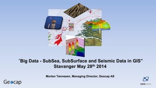
  • 1. ”Big Data - SubSea, SubSurface and Seismic Data in GIS” Stavanger May 28th 2014 Morten Tønnesen, Managing Director, Geocap AS
  • 2. Requirements for a Shared Earth Model • Manage Big Data • Open System • Scalable • Data Management System • Support Sharing and Collaboration • Cost efficient Solution
  • 3. Key Question: Why do you need this ?
  • 4. The Need for a Shared Earth Model Subsurface Exploration, Field Development and Production • Exploration, Field Development and Production Planning • Calculate Oil and Gas In Place Volumes • Assess Subsurface Risk and Uncertainty • Input to History Matching and Production Forecasting • Input to Wellplanning and Drilling Operations • Quick Look Studies and Data Room Visits • Input to License Round /APA Applications Big Data: - 2D,3D&4D Seismic Data , 1 GB > 1000 GB - 2D Interpretations and Grids, 1 MB > 10 GB - Well and Production Data , 1 > 100,000 Wells - NPD and Cultural GIS Data
  • 5. The Need for a Shared Earth Model Subsea Offshore Installations and Infrastructure • Field Development and Production Planning • High Quality Bathymetry, Geophysical & Geological Maps • Assess Subsurface Risk and Uncertainty • Input to Wellplanning and Drilling, • Find and Optimize Exact Safe Locations of Installations • Plan and Monitor Engineering – Dredging • Input to License Round Applications Big Data: - Shallow Seismic & Interpretations , 1 > 1000 GB - Multibeam, Sidescan, Magnetometry , 1 – 1000 GB - Water Column Data , > 1 TB - Lidar and Laser Data , > 1 TB - NPD and Cultural GIS Data
  • 6. The Need for a Shared Earth Model Environmental Management & Surveillance • Field Development and Production Planning • High Quality Bathymetry , Geophysical & Geological Maps • Assess Subsurface Risk and Uncertainty • Input to Wellplanning, Drilling and Operations • Find and Optimize Exact Safe Locations of Installations • Plan and Monitor Engineering – Dredging • Input to License Round Applications Big Data: - Shallow Seismic & Interpretations , 1 > 1000 GB - Multibeam, Sidescan, Magnetometry , 1 – 1000 GB - Water Column Data , > 1 TB - Lidar/Laser Data, > 1 TB - NPD , Mareano and GIS Cultural Data
  • 7. The Need for a Shared Earth Model Management of the Continental Shelf and Maritime Zones • High Quality Bathymetry , Geophysical & Geological Maps • Assess Subsurface Risk and Uncertainty • Find and Calculate Exact Locations of Foot of Slope and Critical Points for Maritime Boundaries according to UNCLOS • Marine Spatial Planning • Input to Nations planning for License Round Applications Big Data: - Shallow 2D Seismic & Interpretations , 1 > 1000 GB - Multibeam, Sidescan, Magnetometry , 1 – 100 GB - Government and GIS Cultural Data
  • 8. Sub-Sea and Sub -Surface Expert Systems ArcGIS GeocapDataLinkforArcGIS Mobile GIS Desktop Web Spatial Datawarehouse for ArcGIS Toolbox Server Sharing Portal Breaking down the barriers between Expert Interpretation Systems and GIS i.e Shape files & Interpretations
  • 9. The Shared Earth Model in ArcGIS in 3D – for Real We Give You:  Integrated Vizualisation and Interpretation in ArcGIS  Sharing and Collaboration of Big Data  Integrated Workflows in ArcGIS  Access to Your already Existing Databases and Expert Tools  No Duplication of Big Data  Cost Efficient Solutions
  • 10. New Releases Available Now: Geocap Ground Model for ArcGIS Geocap Seismic Explorer for ArcGIS