

Recomendados
Mais conteúdo relacionado
Mais procurados
Mais procurados (18)
Semelhante a NRSC... from the surface down
Semelhante a NRSC... from the surface down (20)
Mais de EDAFO2014
Mais de EDAFO2014 (15)
Último
Último (20)
NRSC... from the surface down
- 1. United States Department of Agriculture Natural Resources Conservation Service From the Surface Down An Introduction to Soil Surveys for Agronomic Use Second Edition
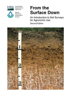
- 2. Credits Cover photo courtesy of Frankie F. Wheeler and Larry Ratliff, retired soil scientists. Figures 1, 2, 12, 21, 22, 23, 27, and 28 created by the U.S. Department of Agriculture, Natural Resources Conservation Service (or Soil Conservation Service). Figures 3, 4, 5, 6, 7, 8, 13, 14, 15, and 20 reprinted from Soils of the Great Plains, by Andrew R. Aandahl, by permission from the University of Nebraska Press. Copyright 1982 by the University of Nebraska Press. Figures 9 and 19 courtesy of Edgar White, Natural Resources Conservation Service, Harrisburg, PA. Figure 10 courtesy of John Kimble, retired soil scientist. Figures 11, 16, 17, 18, and 25 are from the author’s (William Broderson’s) collection. Figure 24 created from Evaluating Missouri Soils, by Dr. C.L. Scrivner and James C. Baker. Circular 915, Extension Division, University of Missouri-Columbia. Figure 26 courtesy of Douglas Wysocki, Natural Resources Conservation Service, Lincoln, NE. Cover Profile of Segno fine sandy loam, a Plinthic Paleudalf. Note the characteristic blocks of plinthite at a depth of 30 inches. Nondiscrimination Statement The U.S. Department of Agriculture (USDA) prohibits discrimination in all its programs and activities on the basis of race, color, national origin, age, disability, and where applicable, sex, marital status, familial status, parental status, religion, sexual orientation, genetic information, political beliefs, reprisal, or because all or a part of an individual’s income is derived from any public assistance program. (Not all prohibited bases apply to all programs.) Persons with disabilities who require alternative means for communication of program information (Braille, large print, audiotape, etc.) should contact USDA’s TARGET Center at (202) 720-2600 (voice and TDD). To file a complaint of discrimination, write to USDA, Director, Office of Civil Rights, 1400 Independence Avenue, S.W., Washington, D.C. 20250-9410 or call (800) 795-3272 (voice) or (202) 720-6382 (TDD). USDA is an equal opportunity provider and employer. First edition printed in1991; revised in1994, 2001, and 2003 Second edition printed in 2010
- 3. Contents Introduction.....................................................................................................................1 Section 1: What are soil horizons?.............................................................................2 Section 2: How is soil formed?...................................................................................7 Section 3: What are the soil-forming processes?.....................................................11 Soil survey information.................................................................................................14 Section 4: Soil properties.........................................................................................14 Section 5: Management interpretations...................................................................20 Section 6: General soil information..........................................................................23 Section 7: Detailed soil information..........................................................................26 Location of information.................................................................................................27 Section 8: Location of soil properties and interpretations........................................27 References...................................................................................................................30
- 5. M any of our life’s activities and pursuits are related to and influenced by the behavior of the soil around our houses, roads, septic and sewage disposal systems, airports, parks, recreation sites, farms, forests, schools, and shopping centers. What is put on the land should be guided by the soil that is beneath it. Like snowflakes, no two soils are exactly the same. Surface and subsurface soil features change across landscapes (fig. 1). A grouping of soils having similar properties and similar behavioral characteristics is called a series. A series generally is named for a town or local landmark. For example, the Mexico series is named for a town in north-central Missouri. More than 21,300 soil series and 285,200 soil map units have been named and described in the United States, and more are being defined each year. When soils are mapped, soil series are further divided into phases according to properties that are important to soil use, such as texture of the surface layer and slope. These phases of soil series all have a characteristic behavior. The behavior of the individual phase is applicable no matter where the soil is observed. One of the main references that can help land users determine the potentials and limitations of soils is a soil survey. The “List of Surveys by State” (http:// soils.usda.gov/survey/printed_surveys/) indicates the availability of soil survey information in paper copies, in PDF files on CD or on the Web, and in tables and reports in Web Soil Survey (http://websoilsurvey.nrcs. usda.gov/). A soil survey is prepared by soil scientists who determine the properties of soil and predict soil behavior for a host of uses. These predictions, often called soil interpretations, are developed to help users of soils manage the resource. A soil survey generally includes soils data for one county, parish, or other geographic area. During a soil survey, soil scientists walk over the landscapes, bore holes with soil augers, and examine cross sections of soil profiles. They determine the texture, color, structure, and reaction of the soil and the relationship and thickness of the different soil horizons. Some soils are sampled and tested at soil survey laboratories for certain soil property determinations, such as cation- exchange capacity and bulk density. The intent of this publication is to increase user understanding of soils and of the content of soil surveys and supplemental interpretations that are important to agronomic programs. Proficiency in using soil survey data requires a basic understanding of the concepts of soil development and of soil-landscape relationships. These topics are covered briefly in the next three sections. From the Surface Down An Introduction to Soil Surveys for Agronomic Use, Second Edition United States Department of Agriculture, Natural Resources Conservation Service, Soil Survey Staff 1 1 First edition (1991) by William D. Broderson, retired soil scientist. Sections 7 and 8 in the second edition (2010) by Jim R. Fortner, soil scientist, USDA, Natural Resources Conservation Service, National Soil Survey Center, Lincoln, Nebraska. Introduction Figure 1.—Facts about soil.
- 6. Section 1: What are soil horizons? S oils form in bedrock residuum or in material deposited by ice, wind, water, or gravity. Layers, called horizons, form over time in the soils. These layers are evident where roads have been cut through hills or streams have scoured through valleys and in other areas where the soil is exposed. Where soil-forming factors are favorable, five or six master horizons may be in a mineral soil profile (fig. 2). Each master horizon is subdivided into specific layers that have a unique identity. The thickness of each layer varies with location. Under disturbed conditions, such as intensive agriculture, or where erosion is severe, not all horizons will be present. Young soils have fewer major horizons. An example is the bottom-land soil in figure 12 (shown in section 2, page 7) and the deep loess soil in figure 3. The uppermost layer in an undisturbed soil may be an organic horizon, or O horizon. It consists of fresh and decaying plant residue from such sources as leaves, needles, twigs, moss, lichens, and other organic material. Some organic materials were deposited under water (figs. 4 and 5). The subdivisions Oa, Oe, and Oi are used to identify levels of decomposition. The O horizon is dark because of large amounts of accumulated humus. Below the O horizon is the A horizon. The A horizon is mainly mineral material. It is generally darker than the lower horizons because of varying amounts of humified organic matter (figs. 6 and 7). This horizon is where most root activity occurs and generally is the most productive layer of soil. It may be referred to as a surface layer in a soil survey. An A horizon thatFigure 2.—A soil profile with five major horizons. Figure 3.—Somewhat excessively drained Colby soil formed in loess. A horizon (0 to 8 inches) of grayish brown silt loam; AC horizon (8 to 16 inches) of pale brown silt loam; C horizon (below 16 inches) of pale brown silt loam. Aridic Ustorthent. Western Nebraska, eastern Colorado, Kansas, South Dakota, and Wyoming.
- 7. has been buried beneath more recent deposits is designated as an “Ab” horizon (fig. 4). The E horizon generally is bleached or whitish (figs. 8, 9, and 10). As water moves down through this horizon, soluble minerals and nutrients dissolve and some dissolved materials are washed (leached) out. The main feature of this horizon is the loss of silicate clay, iron, aluminum, humus, or some combination of Figure 4.—Poorly drained Cathro soil.Thick Oa and Oe horizons (0 to 37 inches) of organic material developed from a continuous high water table. A buried 2Ab horizon (37 to 45 inches) of black loam.Terric Haplosaprist. Northeastern Minnesota, northern Wisconsin, northern Michigan, and upper New England. these, leaving a concentration of silica sand and silt particles. Below the A or E horizon is the B horizon, or subsoil (figs. 6 and 8). The B horizon generally is lighter colored, denser, and lower in content of organic matter than the A horizon. It commonly is the zone where leached materials accumulate. The B horizon is further characterized by the materials that make up the accumulation. In a Bt horizon, for example, clay has accumulated. This accumulation is indicated by the letter “t” in the horizon designator. Other illuvial concentrations or accumulations include iron, aluminum, humus, carbonates, gypsum, and silica. A B horizon that does not have recognizable concentrations but has color or structure different from those of adjacent horizons is called a Bw horizon. Still deeper in the profile is the C horizon, or substratum (fig. 3). The C horizon may consist of material with less clay than the overlying horizons, or it may consist of other less weathered sediments. Partially disintegrated parent material and mineral particles are in this horizon. Some soils have a soft bedrock horizon that is given the designation Cr (fig. 11). A C horizon described as 2C consists of different material, generally of an older age than the horizons that overlie it. The lowest horizon, the R horizon, is bedrock (fig. 11). Bedrock can be within a few inches of the surface or many feet below the surface. Where bedrock is very deep and below the normal depths of observation, an R horizon is not described. Figure 5.—Surface of a very poorly drained soil that has many depressions.
- 8. Figure 6.—Moderately well drained Pawnee soil formed in till. The A horizon is 14 inches thick.The Bt horizon, between depths of 14 and 32 inches, is dark brown clay that has prismatic structure. Pockets of white, soft lime are at a depth of 53 inches. Oxyaquic Vertic Argiudoll. Nebraska and northeastern Kansas. Figure 7.—Well drained Ferris soil.The A horizon is olive clay about 6 inches thick. Pale olive clay is between depths of 6 and 60 inches. Cracks are filled with surface soil material to a depth of 24 inches. Chromic Udic Haplustert. Texas and Oklahoma.
- 9. Figure 9.—Moderately well drained Exum soil formed in loamy Coastal Plain sediments. A grayish brown A horizon (0 to about 6 inches); a light brownish gray E horizon (6 to 10 inches); thick, yellowish brown, very strongly acid Bt horizons to a depth of 6 feet. Aquic Paleudult. Maryland, North Carolina, South Carolina, and Virginia. Figure 8.—Well drained Wallace soil formed in sandy deposits on old sand dunes, lake benches, and outwash plains. This soil has an A horizon (0 to about 2 inches) of dark grayish brown sand; an E horizon (2 to 10 inches) of white sand; and a Bhsm horizon (10 to 26 inches) of dark reddish brown, brown, and yellowish brown, massive and cemented ortstein.The B horizon has illuvial concentrations of organic matter, aluminum, and iron. Typic Durorthod. Northern Michigan and New York.
- 10. Figure 10.—Poorly drained Felda soil formed in sandy marine material. A grayish brown and light gray E horizon is between depths of 5 and 24 inches. An irregular boundary is between the E horizon and the Bt horizon, which is at a depth of 24 inches. Arenic Endoaqualf. Florida. Figure 11.—Well drained Hambright soil formed in amorphous material derived from basic igneous rocks.The content of rock fragments is about 50 percent to the Cr horizon, at a depth of 15 inches. Fractured basalt (R horizon) is at a depth of 19 inches. Lithic Haploxeroll. California.
- 11. Section 2: How is soil formed? F igure 12 shows common landscapes. Soils form through the interactions of climate, living organisms, and landscape position as they influence the decomposition and transformation of parent material over time. Figure 12 shows how soil profiles change from weakly developed to well developed with time. Generally, soils on older terraces or second bottoms have a developed B horizon, unlike recent soils on first bottoms. The recent soils may have strata varying in thickness, texture, and composition and may have begun accumulating humus in the surface layer. Differences in climate, parent material, landscape position, and living organisms from one location to another and the amount of time the material has been in place all influence the soil-forming process. Five soil-forming factors Parent material Climate Living organisms Landscape position Time Parent material Parent material refers to the great variety of unconsolidated organic material (such as fresh peat) and mineral material in which soil formation begins. Mineral material includes partially weathered rock; ash from volcanoes; sediments moved and deposited by wind, water, or gravity; and ground-up rock deposited by glacial ice. The material has a strong effect on the type of soil that forms and the rate at which it forms. Soil formation may take place more quickly in materials that are more permeable to water (fig. 8). Dense, massive, clayey materials can be resistant to the processes of soil formation (fig. 7). In soils that formed in sandy material, the A horizon may be a little darker than its parent material, but the B horizon tends to have a similar color, texture, and chemical composition (fig. 13). Climate Climate is a major factor in determining the kind of plant and animal life on and in the soil. It determines the amount of water available for weathering minerals and for transporting the minerals and elements released. Figure 12.—Landscape position, climate, time, living organisms, and parent material influence soil formation.
- 12. The soil in figure 14 formed in drier regions than the soil in figure15. Through its influence on soil temperature, climate determines the rate of chemical weathering. Figure 13.—Well drained Brownfield soil formed in old eolian material. Light brown fine sand (0 to 30 inches) over red and yellowish red sandy clay loam (30 to 60 inches). Arenic Aridic Paleustalf. New Mexico and Texas. Figure 14.—Well drained Clovis soil formed in thick, loamy sediments on fans and plains of old alluvium. The accumulation of calcium carbonate increases with depth, beginning at a light brown loam Bk horizon at 10 inches. Ustic Calciargid. New Mexico, east-central Arizona, and southwestern Utah.
- 13. Figure 15.—Well drained Olton soil formed in mixed alluvial and eolian material. Ap horizon (0 to 6 inches) of brown loam; Bt horizon (6 to 32 inches) of reddish brown clay loam; whitish calcium carbonate below the Bt horizon. Aridic Paleustoll.Texas and New Mexico high plains. Warm, moist climates encourage rapid plant growth and thus high organic-matter production. Also, they accelerate organic-matter decomposition. The opposite is true for cold, dry climates. Under the control of climate, freezing, thawing, wetting, and drying break parent material apart. Rainfall causes leaching. Rain dissolves some minerals, such as carbonates, and transports them deeper into the soil. Some acid soils formed in parent material that originally contained limestone. Rainfall can also be acid, especially downwind from industrial processes. Living organisms Plants affect soil formation by supplying upper layers with organic matter, recycling nutrients from lower to upper layers, and helping to control erosion. In general, deep-rooted plants contribute more to soil formation than shallow-rooted plants because the passages they create allow greater water movement, which in turn aids in leaching. Leaves, twigs, and bark from large plants fall onto the soil and are broken down by fungi, bacteria, insects, earthworms, and burrowing animals. These organisms eat and break down organic matter, releasing plant nutrients. Some change certain elements, such as sulfur and nitrogen, into usable forms for plants. Microscopic organisms and the humus they produce act as a kind of glue, holding soil particles together in aggregates. Well-aggregated soil provides the right combination of air and water to plant roots. Landscape position Landscape position causes local changes in moisture and temperature. When rain falls on a landscape, water begins to move downward by the force of gravity, either through the soil or across the surface to a lower elevation. In an area where climate, living organisms, parent material, and time are held constant, the drier upslope soils may be quite different from the wetter soils at the base of the slope, where water accumulates. The wetter soils may have reducing conditions that will inhibit proper root growth for plants that require a balance of soil oxygen, water, and nutrients. The steepness, shape, and length of slopes are important because they influence the rate at which water flows into or off the soil. If unprotected, the more sloping soils may become eroded and thus have a thinner surface layer. Eroded soils tend to be less fertile and have less available water than uneroded soils of the same series.
- 14. 10 Aspect affects soil temperature and moisture. In most of the continental United States, soils on north- facing slopes tend to be cooler and wetter than soils on south-facing slopes. These differences affect seedling emergence and the rate of plant growth. Soils on north-facing slopes tend to have thicker A and B horizons. Time Time is required for horizon formation. The longer a soil surface has been exposed to soil-forming agents, such as rain and growing plants, the greater the development of the soil profile. Soils in areas of recent alluvial or windblown material and soils on steep slopes where erosion has been active may show very little evidence of horizon development (fig. 3). Soils on the older, stable surfaces generally have well defined horizons because the rate of soil formation has exceeded the rate of geologic erosion or deposition (fig. 6). As soils age, many original minerals are destroyed. Many new ones are formed. Soils become more leached, more acid, and more clayey. In many well drained soils, the B horizons tend to become redder as iron accumulates with time (figs. 8 and 15).
- 15. 11 T he four major processes that change parent material into soil are additions, losses, translocations, and transformations. Section 3: What are the soil-forming processes? Additions The most obvious addition is the accumulation of organic matter. As soon as plants begin to grow in fresh parent material, organic matter begins to accumulate. Organic matter gives a black or dark brown color to the surface layer (fig. 6). Even young soils may have a dark surface layer (fig. 3). Most additions of organic matter to the surface increase the cation-exchange capacity and the supply and availability of plant nutrients. Additions may occur during periods of rainfall or during periods when eolian (windblown) material is deposited (fig. 13). On the average, rainfall adds about 5 pounds of nitrogen per acre per year. It also adds other elements and fine mineral particles. By causing rivers to flood, rainfall is indirectly responsible for the addition of new sediment to the soil on a flood plain. Other additions occur via gravity in areas where soils creep or are eroded. Soil material from these areas is deposited in downslope areas. Losses Most losses occur through leaching. Water moving through the soil dissolves certain minerals and transports them into deeper layers. Some materials, especially sodium salts, gypsum, and calcium carbonate, are relatively soluble (figs. 14, 15, and 16). They are removed early during soil formation. Carbonates generally are removed from the upper horizons of soils in humid regions or are leached out of the soils entirely. Quartz, aluminum, iron oxides, and kaolinitic clay weather slowly. They become the main components of highly weathered soil. Fertilizers are relatively soluble, and many, such as nitrogen and potassium, are readily lost through Processes of soil formation Additions Losses Translocations Transformations leaching caused either by natural rainfall or by irrigation water. Long-term use of fertilizers based on ammonium may acidify the soil and contribute to the loss of carbonates in some areas. Oxygen is a gas that is released into the atmosphere by growing plants. Carbon dioxide is consumed by the growing plants, but it is lost from the soil as fresh organic matter decays. When soil is wet, nitrogen can be changed to a gas and lost to the atmosphere. Solid mineral and organic particles are lost through erosion. Such losses can be serious because the material lost is generally from the most productive part of the soil profile. On the other hand, the sediment Figure 16.—Somewhat poorly drained Salmo soil, which has strata of alluvial material with textures of fine sandy loam and silt loam (0 to 18 inches) and has an accumulation of soluble salts at a depth of 24 inches. Cumulic Endoaquoll. South Dakota and Nebraska.
- 16. 12 relocated to the lower slope positions or deposited on bottom lands can increase or decrease the productive use of the soils in those areas. Translocations Translocation is the movement of soil material from one place to another. In areas of low rainfall, leaching often is incomplete. Water starts moving down through the soil, dissolving soluble minerals as it goes. There is not enough water, however, to move the minerals all the way through the soil. When the water stops moving and then evaporates, salts are left behind. Soil layers with accumulations of calcium carbonate or other salts form in this way. If this cycle occurs enough times, a calcareous hardpan can form. Upward translocation and lateral movement occur in some soils. Low-lying soils can have a high water table, even if they are in dry areas. Evaporation at the surface causes water to move upward (fig. 16). Salts are dissolved on the way. They are deposited on the surface as the water evaporates (fig. 17). Transformations Transformations are changes that take place in the soil. Micro-organisms that live in the soil feed on fresh organic matter and change it into humus. Chemical weathering changes the parent material. Some minerals are destroyed completely. Others are changed into new minerals. Many of the clay-sized particles in soil are actually new minerals that form during soil development. Other transformations can change the form of certain materials. Iron oxides (ferric form) usually give soils a yellowish or reddish color. In waterlogged soils, however, iron oxides lose some of their oxygen and are considered reduced. The reduced form of iron (ferrous) is easily removed from the soil through leaching. After the iron is gone, the leached zone generally is grayish or whitish (fig. 8). Repeated cycles of saturation and drying create mottles (splotches of colored soil in a matrix of a different color). Part of the soil is gray because iron oxide is reduced or lost, and the part in which the iron oxide is not removed or reduced is browner (figs. 18 and 19). During long periods of saturation, gray-lined root channels develop. These may indicate a possible loss of iron caused by enhanced microbial activity following an addition of humus from decayed roots. Figure 17.—Salinity-alkalinity problem caused by poor internal soil drainage. California. Figure 18.—Munsell soil color.The soil block on the left has gray reduced colors.The one on the right has reddish oxidized colors.
- 17. 13 Figure 19.—Moderately well drained Mattapex soil, wet phase, formed in marine sediments. Dark grayish brown A horizon (0 to 6 inches); brown BE horizon (6 to 12 inches); yellowish brown, strongly acid Bt horizon (12 to 36 inches). Common light brownish gray mottles are in the part of the Bt horizon between depths of 21 and 36 inches. A C horizon is at a depth of 36 inches. Aquic Hapludult. Maryland, Delaware, Virginia, and New Jersey.
- 18. 14 Section 4: Soil properties S oil survey publications describe a number of properties that pertain to agriculture. Some properties, such as slope gradient and factors K and T, relate to erosion. Others relate to plant growth. These include depth to layers that restrict root development, available water capacity, salinity, and the capacity of the soil to retain and release plant nutrients. Some properties relate to the ability of the soil to retain soluble substances that may cause pollution of ground water. These include organic matter and pH, which affects the need for additions of lime. Alteration of some properties, such as slope, can improve the suitability of a site. For example, properly constructed terraces can shorten the slope length and thus reduce the hazard of erosion or the grade for irrigation. The following paragraphs describe the major soil properties that affect the suitability of a soil for a number of specific uses. Available water capacity (AWC) Available water capacity is an estimate of how much water a soil can hold and release for use by most plants, measured in inches of water per inch of soil. AWC is influenced by soil texture, content of rock fragments, depth to a root-restrictive layer, organic matter, and compaction. It is used in scheduling irrigation and in determining plant populations. The type of soil structure can influence the availability of water to plants and the rate at which water is released to plant roots. A soil with a tillage pan may not allow roots to penetrate and extract the deeper water. Bedrock and other restrictive layers There are 20 kinds of restrictive layers recognized in soil surveys. Examples are cemented pans, permafrost, dense layers, layers with excessive sodium or salts, and bedrock. Bedrock is the solid rock under the soil and parent material (fig. 11). In areas where it is exposed at the surface, it is referred to as rock outcrop. The depth from the soil surface to bedrock influences the potential of the soil for plant growth and agronomic practices. Soft bedrock consists of material that can be ripped. A shallow depth to bedrock results in a lower available water capacity and thus drier conditions for plants. It also restricts the rooting depth. Five depth classes are defined for use in soil surveys (table 1). Table 1.—Depth classes Very shallow................................. Less than 10 inches Shallow.................................................10 to 20 inches Moderately deep...................................20 to 40 inches Deep.....................................................40 to 60 inches Very deep.....................................More than 60 inches Calcium carbonate Calcium carbonate (CaCO3 ) influences the availability of plant nutrients, such as phosphorus and molybdenum. Iron, boron, zinc, and manganese deficiencies are common in plants grown in soils that have significant levels of calcium carbonate equivalent, especially in the surface layer. Soil texture influences the levels at which these deficiencies commonly occur. Sensitive crops may show deficiencies even at low levels (0.5 to 2.0 percent). Cation-exchange capacity (CEC) Cation-exchange capacity is the ability of a soil to hold and exchange cations. It is one of the most important chemical properties in soil and generally is closely related to soil fertility. A few of the plant nutrient cations include calcium, magnesium, potassium, iron, and ammonium. Generally, as CEC levels decrease, more frequent and smaller applications of fertilizer are desirable. Smaller applications of fertilizer on soils that have low CEC levels may reduce fertilizer loss to surface and ground waters, lessening the impact on water quality. In many highly weathered, naturally acid soils, CEC is lower when pH is lower and higher when pH is higher. Drainage class (natural) Drainage class refers to the depth, frequency, and duration of periods of saturation or partial saturation during soil formation. Seven classes of natural drainage are used in soil surveys. They range from excessively drained to very poorly drained (fig. 5). Erosion factor (K) The soil erosion factor (Kf and Kw) is a relative index of the susceptibility of bare, cultivated soil to particle detachment and removal and transport by rainfall. It can be computed from particle size, organic matter, saturated hydraulic conductivity, and structure. K values range from 0.02 to 0.64 or more. The higher the value, the greater the susceptibility. Soils Soil Survey Information Sections 4 through 7 describe the agronomic soil information published in soil surveys or contained in the Field Office Technical Guide of the Natural Resources Conservation Service.
- 19. 15 that have more silt and very fine sand are generally more erodible than other soils because of weaker bonding. Kf is adjusted downward for the percent of rock fragments in each layer. Kf values are calculated values that indicate the erodibility of the fine-earth fraction, or the material less than 2 millimeters in size. They are used in the Revised Universal Soil Loss Equation2 (RUSLE2). Kw estimates indicate the erodibility of the whole soil, including the rock fragments. Kw criteria are used in the determination of important farmland, including prime farmland. Erosion factor (T) The T factor is the soil loss tolerance used in the RUSLE2. It is defined as an estimated maximum rate of annual soil erosion that will permit crop productivity to be sustained economically and indefinitely. The five classes of T factors range from 1 ton per acre per year for very shallow soil to 5 tons per acre per year for very deep soil, which can more easily sustain productivity than shallower soils. Flooding Inundation by overflowing streams (fig. 20) or runoff from nearby slopes may damage crops or delay their planting and harvesting. Scouring can remove favorable soil material. Deposition of soil material can be beneficial or detrimental. Soil stratification (fig. 16) is an indication of deposition by flooding. Long periods of flooding reduce crop yields. Table 2 gives the frequency and duration classes used in soil surveys. Table 2.—Flooding frequency and duration classes Flooding frequency classes None: Near 0 percent chance in any year, or less than 1 time in 500 years Very rare: Less than 1 time in 100 years but more than 1 time in 500 years Rare: Nearly 1 time to 5 times in 100 years Occasional: 5 to 50 times in 100 years Frequent: More than 50 times in 100 years but less than a 50 percent chance in all months of any year Very frequent: More than a 50 percent chance in all months of any year Flooding duration classes Extremely brief: 0.1 hour to 4.0 hours Very brief: 4 to 48 hours Brief: 2 to 7 days Long: 7 days to 30 days Very long: 30 days Onsite investigation may indicate that a map unit described as subject to flooding has areas that are now protected against flooding. Potential for frost action Potential for frost action is the likelihood of upward or lateral movement of soil through the formation of ice lenses. Estimates are made from soil temperature, particle size, and soil water states. Frost can break compact and clayey layers into more granular forms. It can also break large clay aggregates into smaller aggregates that are more easily transported by water and wind. Frost heaving can harm improperly designed conservation structures and can destroy taprooted perennial crops. High water table A seasonal high water table is the highest average depth of free water during the wettest season. The ground water level, or water table, may be high year round or just during periods of heavy rainfall. How high the water table rises and how long it stays at that height affect the use of the soil. A perched water table usually occurs in areas where a hardpan, claypan, or other dense layer retards deeper water penetration. A water table that rises above the surface is considered ponding. Organic matter The content of organic matter is estimated for each soil layer. A content of 1 percent organic matter is equivalent to 0.6 percent organic carbon. Organic matter promotes granulation, good tilth, and water infiltration; increases porosity; lowers bulk density; reduces plasticity and cohesion; and increases the available water capacity. It has a high cation-adsorption capacity, and it releases nitrogen, phosphorus, and sulfur as it decomposes.
- 20. 16 Permeability Permeability refers to the ability of soil to transmit water or air. In soil surveys, the term “permeability” indicates saturated hydraulic conductivity, which is influenced by texture, structure, bulk density, and large pores. Soil structure influences the rate of water movement through saturated soil, in part, by the size and shape of pores. Granular structure readily permits downward water movement, whereas platy structure requires water to flow more slowly over a much longer path (fig. 21). Permeability affects drainage design, irrigation scheduling, and many conservation practices. Permeability classes are shown in table 3. Table 3.—Permeability classes Class Rate (in/hr) Impermeable...................................................0.0015 Very slow...................................................0.0015-0.06 Slow.................................................................0.06-0.2 Moderately slow.................................................0.2-0.6 Moderate...........................................................0.6-2.0 Moderately rapid................................................2.0-6.0 Rapid..................................................................6.0-20 Very rapid...............................................................20 Figure 20.—Flooding along the Missouri River. Reaction Soil pH is an expression of the degree of acidity or alkalinity of a soil. It influences the availability of plant nutrients. Compared to a neutral soil (pH 7.0), a very acid soil (pH less than 5.0) typically has lower levels of nitrogen, phosphorus, calcium, and magnesium available for plants and higher levels of available aluminum, iron, and boron. At the other extreme, if the pH is too high, the levels of available iron, manganese, copper, zinc, and especially phosphorus and boron may be low. A pH above 8.3 may indicate a significant level of exchangeable sodium. Rock fragments The size and percentage of rock fragments in the soil are important to land use. Rock fragments reduce the amount of water available to plants and may restrict some tillage operations. Particles larger than 2 millimeters in diameter are called rock fragments. Those 2 millimeters to 3 inches in diameter are called pebbles or gravel; those 3 to 10 inches in diameter are called cobbles; and those more than 10 inches in diameter are called stones or boulders.
- 21. 17 Root-restrictive layers Some soils have layers that roots and water cannot easily penetrate. Physical root restriction may be expected in hard or soft bedrock (fig. 11) and in some soil layers, such as a fragipan or cemented hardpan. Intensive management may be required to reduce the effects of a poor rooting depth, a high water table, and a lower available water capacity. Ripping a cemented pan or some other restrictive layers allows deeper root and water penetration. The physical root restrictions in many other layers, however, generally cannot be alleviated. For example, a change from a favorable particle size to sand, gravel, cobbles, stones, or boulders may indicate a zone of root restriction that cannot be alleviated. If the soil layer is massive or has a weak or platy structure, resistance to root penetration generally is high for the combinations of texture and bulk density shown in table 4. Salinity Salts, mainly sodium, magnesium, calcium, and chloride or sulfate, may interfere with the absorption of water by plants. They also create a nutrient imbalance in some plants. Soils in which the electrical conductivity in the soil solution is greater than 2 mmhos/cm are considered saline (fig. 16). Figure 21.—Water movement through granular, prismatic, subangular blocky, and platy soils, respectively. Sodium adsorption ratio (SAR) SAR is a measure of the activities of sodium relative to calcium and magnesium in the soil solution. In soil that has an SAR value as low as 6 and has low salinity, dispersion of clay may be increased, resulting Table 4.—Bulk density/root-restriction in most soils Average Texture bulk density Coarse sand, sand, loamy coarse sand, loamy sand, fine sand, and loamy fine sand...............................................1.85 Very fine sand, loamy very fine sand, fine sandy loam, coarse sandy loam, very fine sandy loam, sandy loam, loam that has an average of 18 percent clay ..........1.8 Loam, sandy clay loam, clay loam that has an average of 18 to 35 percent clay...........1.7 Silt, silt loam, silty clay loam that has an average of 35 percent clay .............................1.6 Clay loam, sandy clay, clay, silty clay loam, silty clay that has an average of 35 to 59 percent clay (30 percent in Vertisols)..............1.5 Clay that has an average of 60 percent clay, except in Vertisols...........................................1.35
- 22. 18 in reduced aeration and permeability and increased susceptibility to erosion. Higher values may indicate surface conditions that take on a puddled appearance. Amendments, such as gypsum (CaSO4 ), along with irrigation and drainage can improve the unfavorable soil condition in many areas. Slope Slope is the gradient of an elevation change. A rise of 10 feet in a horizontal distance of 100 feet is a slope of 10 percent. Ranges of slope assigned to map units represent practical breaks on the landscape that are important for the use and management of the survey area (fig. 22). Terraces, irrigation, and tillage practices are all considered. For example, terraces can help to control erosion in some areas where slope is more than about 1 or 2 percent; thus, a separation of 0 to 2 percent and more than 2 percent for the same kind of soil may be used in mapping. Slope classes are not site specific, however, and for conservation planning, onsite investigation is necessary to determine the slope. Soil texture (USDA) Texture is determined according to the relative proportions of sand, silt, and clay in the soil (fig. 23). Figure 24 illustrates the relative sizes of the three major soil particles. Sandy soils tend to be characterized by low strength and a greater susceptibility to wind erosion and less water available to plants than soils of other textures. In addition, trenches and banks are highly susceptible to caving, which may pose a safety hazard. Water may pipe through terraces and other water impoundments. Clayey soils generally have more available water than sandy soils. Loamy very fine sands and loamy fine sands, however, can hold moderate amounts of available water. Generally, the cation-exchange capacity increases with increases in content of clay and organic matter. Soils that have large amounts of clay fix more phosphorus than soils that have less clay. The type of clay also affects phosphorus fixation. Clayey soils that are high in content of montmorillonite tend to have the greatest capacity to shrink and swell (figs. 7 and 25). They retain large quantities of water, which affect tillage practices and can contribute to soil creep or landslides in sloping areas. Montmorillonitic Figure 22.—Slope classes. Figure 23.—USDA soil texture classes. Figure 24.—The relative sizes of sand, silt, and clay.
- 23. 19 or other smectitic clays also have strong adhesive properties that bond particles together. Silty soils have a higher available water capacity than sandy soils. In the absence of clay particles, silty soils have lower adhesive properties. Piping through terraces, levees, and pond embankments can be a problem. Trenches may cave, particularly in saturated soils. In organic soils the term “muck” or “peat” is used in place of textural class names (fig. 4). Muck is well decomposed organic soil, and peat is raw, undecomposed material. The word “mucky” is used as an adjective to modify a texture class. An example is “mucky loam.” Adjectives describing rock fragments also are used to modify a texture. For example, some Hambright soils (fig. 11) have very cobbly layers. Subsidence Organic soils often subside when drained because of shrinkage from drying; loss of ground water, which physically floats the organic material; soil compaction; and oxidation of the material. Subsidence creates an uneven surface. Periodic surface smoothing or grading may be needed to maintain adequate irrigation systems. Draining and oxidation of the organic Figure 25.—Deep, wide cracks are common during dry periods in Vertisols. Maxwell soil.Typic Haploxerert. California. material contribute large amounts of carbon to the atmosphere. Some mineral soils subside because of lowering of ground water tables; removal of zones of soluble salts, such as gypsum and calcium carbonate, through leaching; and melting of ice lenses in frozen soils. Wind erodibility group (WEG) and wind erodibility index (I) WEG is a general grouping of soils with similar properties affecting their resistance to soil blowing. Soil texture, size of soil aggregates, presence of carbonates, and the degree of decomposition in organic soils are the major criteria used in grouping the soils. The groups are numbered 1 through 8. The number 1 represents sandy soils, which are the most susceptible to wind erosion (fig. 26), and the number 8 represents gravelly or wet soils that are not subject to soil blowing. The wind erodibility index (I) is an estimate of soil loss in tons per acre per year. It is one of the criteria used in the determination of important farmland, including prime farmland. Figure 26.—Evidence of erosion on a sandy soil partially protected by surface gravel.
- 24. 20 Section 5: Management interpretations S oil surveys commonly identify the more important soil characteristics that determine the soil-related limitations that affect farming. Interpretations for farming include soil productivity, placement of the soil in management groups, and presentation and evaluation of a number of soil properties affecting use. The interpretations are designed to warn of possible soil-related hazards in an area. Table 5 displays important soil property information related to agronomic interpretations. The following paragraphs describe some of the major agricultural interpretations. Soil productivity Productivity of the soil is the output or yield per acre of a specified crop or pasture species under a defined set of management practices. If the land is irrigated, yields are provided for irrigated and nonirrigated conditions. Management practices are usually defined for each class. A “high” level of management provides necessary drainage, erosion control, protection from flooding, proper planting rates, suitable high-yielding varieties, appropriate and timely tillage, and control of weeds, plant diseases, and harmful insects. This management also includes favorable pH and optimal levels of plant nutrients; appropriate use of crop residue, manure, and green manure crops; and harvesting methods that ensure the smallest possible loss. For irrigated crops, the irrigation system is adapted to the soil and crops and good-quality irrigation water is uniformly applied as needed. Irrigation For most crops, the most favorable soils for irrigation are deep, nearly level, and well drained. They are characterized by good surface permeability and a high available water capacity. Irrigation water or rainwater can perch on a tillage pan, reducing the amount of oxygen in the root zone and increasing the amount of nitrogen lost to the atmosphere. Important considerations affecting the design of irrigation systems are feasible water application rates, ease of land leveling, drainage if necessary and its effect on the soil, the hazard of erosion, equipment limitations caused by steep slopes or rock fragments, and flooding. Slope affects the performance of an irrigation system. Flood or furrow irrigation is used mainly on soils having slopes of less than 3 percent. Wheel lines and center pivots work well on slopes of as much as 7 percent but with increasing difficulty. Drip systems work well even on steep slopes. Most irrigated crops grow well if the rooting depth exceeds about 40 inches. A shallower root zone has a lower amount of available water, thus requiring more care in crop management and irrigation. Shallow soils, sandy soils, and soils that have rock fragments require more frequent irrigation than deep and finer textured soils. Frequent, light irrigation on fine textured soils helps to prevent cracking and thus reduces the amount of water lost through evaporation (fig. 25). Chemical characteristics can be important. Salinity is particularly a problem where drainage conditions are unfavorable for the removal of soluble salts by flushing. Where only small differences in slope and elevation occur, salt-laden water can increase salinity and alkalinity in low areas (fig. 17). Drainage Drainage is the removal of excess water from soil. Determination of which soils meet the definition of “hydric soil” and “wetland” is needed to prevent draining of wetlands. Soils that have intermediate saturated hydraulic conductivity (permeability) respond well to subsurface drains, open ditches, or a combination of these. In areas that have large amounts of excess water, drainage can be improved by smoothing or shaping the surface of the soil, provided that traffic-induced surface compaction is remedied. Smoothing or shaping increases runoff and reduces the amount of water to be disposed of by internal water movement. Stoniness, slope, silty soil low in content of clay, and physical soil barriers affect the installation and functioning of the drainage system. Caution is needed in areas of unstable soils. Silty soil material low in content of clay tends to move into and clog subsurface drains that are not adequately protected by filters. Coarse textured soils are unstable and may be droughty after drainage. Some wet soils have sulfides that oxidize on exposure to air, causing extreme acidity after drainage. Drainage water high in reduced
- 25. 21 iron may precipitate a “slime” that plugs drainage lines. Wet organic soils subside after drainage. The effective rooting depth is an indicator of the depth to which soils can be drained. In deep soils without root-restrictive layers, depth is not a limitation. If a massive clayey layer or other root-restrictive layer occurs in the soil, effective drainage is more difficult. If drainage is impaired by a restrictive layer, trenching and installation of drain tiles are needed. Erosion-control practices The need for erosion control depends on the hazard of erosion and the cultivars grown. Some crops, such as hay and pasture, protect against erosion. For others, such as row crops, specific management practices are needed. The practices to be used should be selected only after onsite inspection. In some areas adequate erosion control can be achieved by simple application of one of the general practices. In other areas two or three different practices may be needed. In addition to cover crops, stripcropping, conservation tillage, terraces, diversions, and grassed waterways, other measures may be appropriate. Other management interpretations Some soil surveys, or addenda to the surveys, have special tables on important agronomic soil interpretations. A few tables show the potential of soils for a specified use, such as the potential for cropland. Table 5 identifies soil properties that influence agronomic uses. Soil properties Agronomic use Organic matter Flooding Texture Bedrock or pan pH Subsid- ence Cation- exchange capacity CaCO3 Slope Bulk density Perme- ability Potential for frost action Available water capacity Salinity/ alkalinity Water table Wind erodibility group Erosion factors K and T Tillage suitability • • • • • • • •Plant adaptability • • • • • • • • • • • • • •Erodibility: Wind Water • • • • • • • • •Irrigation • • • • • • • • • • • • • •Drainage • • • • • • • • •Crop yield productivity • • • • • • • • • • • • •Conservation practices • • • • • • • • • • • • • • • •Land use capability • • • • • • • • • • • • A bullet (•) indicates that the soil property affects the selected agronomic use. Table 5.—Soil survey information that influences agronomic uses
- 26. 22 Some tables group soils for specific programs, such as hydric soils, highly erodible lands, land capability classification, and prime or unique farmland. Hydric soils formed under conditions of saturation, flooding, or ponding long enough during the growing season to develop anaerobic conditions (lack of oxygen) in the upper part (6 to 10 inches). The presence of hydric soils is one of three parameters needed for a site to be considered a wetland for Federal wetland protection programs and legislation. The presence of hydric soils can also be used to identify areas suitable for wetland restoration. Soil features that occur because of anaerobic conditions are used to confirm that a soil is hydric. The national hydric soils list identifies map units that have components of hydric soils. A copy of the official hydric soils list can be downloaded from the following Web site: http://soils.usda.gov/use/hydric/. An interpretive map based on the hydric soils list can be created for an area of interest (AOI) in Web Soil Survey. After creating an AOI, click on the Soil Map tab. From the Soil Data Explorer tab, click on Suitabilities and Limitations for Use. Open Land Classifications, and select Hydric Rating by Map Unit. Highly erodible soil and potentially highly erodible soil are listed in Section II of the NRCS Field Office Technical Guide. The criteria used to group highly erodible soils were formulated using the Universal Soil Loss Equation and the wind erosion equation. The criteria are in the National Food Security Act Manual. Soil use, including tillage practices, is not a consideration. Areas defined as highly erodible can be held to an acceptable level of erosion by following approved practices in a conservation plan. Various conservation practices, such as crop residue management, reseeding to grasses, contour farming, and terraces, are used in conservation planning to reduce soil loss, maintain productivity, and improve water quality. Land capability classes and, in most cases, subclasses are assigned to each soil. They suggest the suitability of the soil for field crops or pasture and provide a general indication of the need for conservation treatment and management. Capability classes are designated by either Arabic or Roman numerals (I through VIII), which represent progressively greater limitations and narrower choices for practical land use (fig. 27). Capability subclasses are soil groups within one class. They are designated by adding a small letter, e, w, s, or c, to the class numeral, for example, IIe. The letter e shows that the main hazard is the risk of erosion unless close-growing plant cover is maintained; w shows that water in or on the soil interferes with plant growth or cultivation (in some soils the wetness can be partly corrected by artificial drainage); s shows that the soil is limited mainly because it is shallow, droughty, stony, saline, or sodic; and c, used in only some parts of the United States, shows that the chief limitation is climate that is very cold or very dry. In class I there are no subclasses because the soils of this class have few limitations. Prime farmland and other important farmland are identified by map unit name in the table “Prime Farmland and Other Important Farmlands” in Web Soil Survey. Prime farmland is land that has the best combination of climatic, physical, and chemical characteristics and landscape features for producing food, feed, forage, fiber, and oilseed crops. Unique farmland is land other than prime farmland that has the soil and climate characteristics needed for the production of specific high-value crops, such as citrus, tree nuts, olives, cranberries, fruit, and vegetables. Nearness to markets is needed. Farmlands of statewide and local importance are used for the production of food, feed, fiber, forage, and oilseed crops. They do not meet the criteria for prime farmland or unique farmland. Figure 27.—Landscape with land capability classes outlined.
- 27. 23 Section 6: General soil information A general soil map is included in hard copies of most traditional soil surveys but is not available in Web Soil Survey. Different colors on this map show associations (or groupings) of the major soils in the survey area. Soils within an association may vary greatly in slope, depth, drainage, and other characteristics that affect management. Descriptions of the associations are included in a section called “General Soil Map Units.” The general soil map can be used to compare the suitability of large areas for general land uses. Because of the scale, it is not intended to be used to make management decisions on specific sites. Each color-coded area on the map has a corresponding description. For example, on the general soil map of Gentry County, Missouri, on page 24, areas coded 1 and shaded light yellow designate the Lamoni-Shelby association. As the name of the association implies, Lamoni and Shelby soils are the major soils in this association. Some soil surveys include block drawings depicting the relationships of soils, parent material, and landscape positions. Figure 28 illustrates the dominant Lamoni and Shelby soils and the minor Sharpsburg, Grundy, and Colo soils as they occur in association 1 in Gentry County. Note the relationships of parent material and landscape positions to the different soils. Refer to section 2 (“How is soil formed?”), including figure 12, for additional insights into these relationships. Figure 28.—Relationship of soils, topography, and parent material in the Lamoni-Shelby association in Gentry County, Missouri.
- 28. 24 Each area outlined on this map consists of more than one kind of soil. The map is thus meant for general planning rather than a basis for decisions on the use of specific tracts.
- 29. 25 Legend LAMONI-SHELBY association: Deep, moderately sloping to moderately steep, somewhat poorly drained and moderately well drained soils that formed in glacial till; on uplands NODAWAY-ZOOK association: Deep, nearly level, moderately well drained and poorly drained soils that formed in alluvium; on flood plains GRUNDY association: Deep, gently sloping and moderately sloping, somewhat poorly drained soils that formed in loess; on uplands GARA-ARMSTRONG-VANMETER association: Deep and moderately deep, moderately sloping to very steep, moderately well drained and somewhat poorly drained soils that formed in glacial till or residuum of shale; on uplands Compiled 1983 U.S. Department of Agriculture Natural Resources Conservation Service Missouri Agricultural Experiment Station GENERAL SOIL MAP GENTRY COUNTY MISSOURI General Soil Map
- 30. 26 Section 7: Detailed soil information T he Web Soil Survey (WSS) at http:// websoilsurvey.nrcs.usda.gov/app/ provides the public with access to the most current official soil survey information. This Web application accesses the national SSURGO data in the Soil Data Mart. WSS users can outline their local area of interest (AOI) within a survey area or can select the whole soil survey area as the area of interest. If necessary, the AOI can cross traditional soil survey area boundaries. Various navigation tools are available to help the users navigate to the general area of their AOI. WSS also allows the users to import an AOI boundary from their local Geographic Information System (GIS). Recent aerial photography is used as the background for displaying the soil survey data in WSS. After selecting an AOI, the user has the option of viewing the soil map and list of map units for the AOI. The list includes the acreage and percent of the AOI for each map unit. The user has the option to display either the traditional local map unit symbol or a nationally unique map unit symbol on the maps and in generated reports. A description of each map unit is available in WSS. Areas delineated on the soil maps are not necessarily made up of just one type of soil but generally include smaller areas of contrasting soil types. The composition of each map unit is shown in the map unit description. Thematic maps can be displayed for a variety of soil properties and interpretive ratings for the delineated soils. Maps of interpretive ratings display the limitations or suitability of each map unit for a particular land use. For each map displayed, a summary table showing the results is generated. The underlying SSURGO data can be downloaded for the defined AOI in standard format. Standard tabular soil reports also can be generated for the AOI. These reports look much like the tables that have been included in the traditional hard copy soil survey publications. The various maps and tabular reports that the user selects can be printed individually or compiled into a Custom Soil Resource Report via the Shopping Cart option. The output reports are compiled into a standard PDF file for download to the user’s local computer. The maps can be printed at various scales and on various sizes of paper, depending on what printer options the user has locally. Larger AOIs can be tiled to multiple pages for printing. This capability allows users to get just the content that they want or need to answer their particular resource management questions. Soil surveys provide sufficient information for the development of resource plans, but onsite investigation is needed to plan intensive uses of small areas. Some useful information that is not included in WSS is available in Section II of the NRCS Field Office Technical Guide (FOTG). The electronic version of the FOTG can be accessed at http://www.nrcs. usda.gov/technical/efotg/.
- 31. 27 Included are a variety of national interpretations as well as various state-specific interpretations. Not all interpretations are included for all areas of the nation. Some may not be applicable to all areas. Also, not all soil properties are populated for all areas. For example, information about salinity likely is not included for an area where salinity is not an issue. Generated ratings that can be displayed as thematic maps in WSS are organized in a series of folders on the Suitabilities and Limitations tab. S pecific soil properties or interpretations are sometimes difficult to locate within the Web Soil Survey (WSS) application. To assist the user, WSS includes a search function that allows the user to type in a soil property name or keyword. The tool returns a series of links that the user can click on to go directly to the desired information. The links may include general descriptive information, thematic maps, or tabular reports, as shown in the following image. Section 8: Location of soil properties and interpretations Location of Information Section 8 describes where soil information can be found.
- 32. 28 The Soil Properties and Qualities tab has a similar arrangement of folders and individual themes that allows the user to generate a thematic map of an individual soil property or quality. Each folder has one or more interpretive ratings, as shown for Building Site Development in the following image.
- 33. 29 The Soil Reports tab is organized in a similar fashion. These reports are tabular soil reports with formats similar to those that have traditionally been included in published hard copy soil surveys.
- 34. 30 References Andrew R. Aandahl. 1982. Soils of the Great Plains. University of Nebraska Press. Huddleston, J. Herbert, and Gerald F. King. 1984. Manual for Judging Oregon Soils. Oregon State University Extension Service, Extension Manual 6. Scrivner, C.L., and J.C. Baker. 1975. Evaluating Missouri Soils. Circular 915, Extension Division, University of Missouri-Columbia. Smith, C.W. 1989. The Fertility Capability Classification System (FCC): A Technical Classification System Relating Pedon Characterization Data to Inherent Fertility Characteristics. Doctoral Thesis. Department of Soil Science, North Carolina State University, Raleigh, North Carolina. Soil Survey Division Staff. 1993. Soil Survey Manual. Soil Conservation Service. U.S. Department of Agriculture Handbook 18. Available online (http://soils.usda.gov/ technical/manual/). United States Department of Agriculture, Natural Resources Conservation Service. National Soil Survey Handbook, title 430-VI. Available online (http://soils.usda. gov/technical/handbook/). Accessed 1/20/2010. United States Department of Agriculture. 1988. From the Ground Down: An Introduction to Soil Surveys. Soil Conservation Service. Columbia, Missouri.