Bringing Innovation to Global Humanitarian Efforts through Human Geography & Predictive Analytics
•Transferir como PPT, PDF•
1 gostou•1,090 visualizações

This presentation, "Bringing Innovation to Global Humanitarian Efforts through Human Geography & Predictive Analytics," was presented at Esri UC 2012 by Ben Holland, GeoEye Geospatial Analyst

Recomendados
Mais conteúdo relacionado
Destaque
Destaque (18)
Mais de DigitalGlobe
Mais de DigitalGlobe (13)
Último
Último (20)
Bringing Innovation to Global Humanitarian Efforts through Human Geography & Predictive Analytics
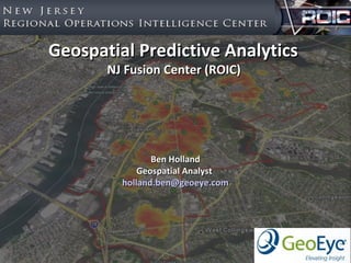
- 1. Geospatial Predictive Analytics NJ Fusion Center (ROIC) Ben Holland Geospatial Analyst holland.ben@geoeye.com
- 2. GeoEye Analytics NJ Fusion Center (ROIC) Project • Geospatial predictive analytics applies advanced statistical analysis and modeling techniques to Outside spatial relationships Agencies (e.g., FBI, Jersey City PD) • To answer questions such as: Sub j Ma ect tte Exp ert r ion – Where is something most likely to occur? ise at rm g fo Tra In arin dec Sh raf – Where is the greatest risk? t Sof – How should I best deploy my resources? t wa re
- 3. Geospatial Predictive Analytics with Signature Analyst Jersey City Area of Interest (AOI) Geospatial Predictive Analytics Predictive Assessment Past Events GIS Factor Data
- 4. Discovering New Locations of Concern Identifying geospatially similar areas Density Map Predictive Assessment
- 8. Staten Island, NY Serial Burglary Pattern: January 2012 Past Related Burglary Likelihood of Future Burglary Highest High
- 9. “all crimes, all hazards, all threats, all the time”
- 10. “all crimes, all hazards, all threats, all the time”
- 11. Convenience Store Robberies Assessment Twelve past robberies used to build the predictive assessment
- 12. Convenience Store Robberies Assessment Identifying which convenience stores are most likely to be targeted next by the robber Subsequent robb
- 15. Area of apprehension e r rd mu e nt ec tr os M
Notas do Editor
- More on the software, we see here the initial pieces of geospatial factor data that we use. The first being the area of interest that we are trying to predict in. The shape you see there is Jersey City. The second piece is the event data, the crimes or threats to critical infrastructure that we are trying to predict. And the final and most vital is the geospatial factor data. This consists of layers of data which include demographics, city infrastructure, property value, locations of business and services, pretty much anything you can capture geospatially. We input all this data into the system which uses geospatial predictive modeling to find correlations between the events and the factors within the area of interest. The output is a predictive hotspot map which shows areas and neighbors that are geospatial similar to past events in order to identify to areas of concern.
- Here is a better example of a predictive assessment. The density map on the left shows a traditional analysis used to identify hotspots. The predictive map on the right discovers new areas of concern where future events are most likely to occur. The value in this has been for law enforcement deployment planning and as actionable intelligence to decision makers.