
Recomendados
Recomendados
Mais conteúdo relacionado
Mais procurados
Destaque
Destaque (17)
Semelhante a Open geographic data - Tina Svan Colding
Semelhante a Open geographic data - Tina Svan Colding (20)
Mais de Digisam
Mais de Digisam (20)
Último
Último (20)
Open geographic data - Tina Svan Colding
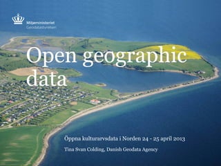
- 1. Open geographic data Öppna kulturarvsdata i Norden 24 - 25 april 2013 Tina Svan Colding, Danish Geodata Agency
- 2. PAGE 2 1. Basic data programme 2. The agreement 3. The road to open geographic data 4. Respons on open data 5. The future? Outline
- 4. PAGE 4 Basic public data
- 10. PAGE 10 Danish Geodata Agency gives open access to • current and historical topographic data • cadastral map • Danish Elevation Model - updated Danish Geodata Agency income from the private sector will be financed by the Min. of Finance Public sector agreements adjusted (funding transferred) The data should be open for everybody by Jan. 1st 2013 Nautical charts are not included Content
- 11. PAGE 11 The road to open geographic data
- 12. PAGE 12 The Bill ammending the Act on the Danish Geodata Agency was unanimously passed at the Danish Parliament (the Folketing) on December 19th, 2012 The Act on the Danish Geodata Agency
- 13. PAGE 13 “Conditions for use of open geographic data” • Open commercialisation + distribution to third party • Acknowledgement of Danish Geodata Agency Huge change and simplification of Danish Geodata Agency data rights... Conditions
- 14. PAGE 14 More than 400 contracts have been terminated and credited The contracts
- 15. PAGE 15 open data = new users -> new needs; new communication; new access ..... => two different distribution channels Data and access to data
- 16. PAGE 16 Broad understanding of accessibility – access not enough Transparency Comprehensibility Usability Accessibility
- 17. PAGE 17 Digital Map Supply/Download
- 18. PAGE 18 Digital Map Supply/Services + +
- 19. PAGE 19 3 Principles • Channel strategy • Transparency (on-going dialogue to match expectations) • Communication strategy ’relatively reactive’ Phase 1. Inform using newly designed gst.dk – targeted at the public, developers, enterprises and the public sector Strategically - how do we position the Danish Geodata Agency in relation to open data? Phase 2. Proactive communication initiatives – increased awareness of open data Communication
- 20. PAGE 20 Growth, efficiency and transparency in public administration Measuring the effect
- 21. PAGE 21 Respons on open data?
- 22. PAGE 22 Treasure to be found in open Cadastral Map (Sille Wulff Mortensen) ” Joy over government’s data bonanza: breakthrough with open access to Central Business Register and cadastral numbers (Henrik Nordstrøm Mortensen) ” …growth adventure waiting for Danish enterprises... (Jakob Chor) ” Reactions ?
- 23. SIDE 23 Map distribution service (download) - 4000 new users How many?
- 24. How many? Map distribution service (WMS)
- 25. SIDE 25 Who?
- 30. SIDE 30 Kortforsyningen/Download – 15.000 datasets How many datasets?
- 31. SIDE 31 Who download data?
- 32. SIDE 32 Datasæt downloads DEM 4066 DEM contour lines 1571 DEM terrain 1313 DEM surface 691 DEM point cloud 491 Cadastral map 2271 DTK/Kort25 1599 FOTkort10 804 FOT 792 DAGI (administrative boundaries) 602 Kort10 600 Popular dataset?
- 34. PAGE 34 All actors in the geodata field have just recieved a large gift from the government - a gift that improves the competitiveness of Danish enterprises, stimulates innovation, and creates more efficient public-sector service. We just have to dare to think in a new way. (Allan J. Christensen) ” ” …need for change management in public sector before digital benefits (efficiency gains) can be harvested.... (Ejvind Jørgensen) Challenges
- 35. Why are you doing it and for whom? Analyse the user groups (communication, distribution) User registration Raw data or selected data – distribution It’s not rocket science – but don’t underestimate the workload Recommendations
- 36. PAGE 36 Danish Geodata Agency in new role in relation to partners and users • New models for cooperation with partners • Private sector - trade organisations and enterprises • Public sector – prioritised users • Communication • Digital Map Supply/Download v.2 Open data – so what now?
- 37. SIDE 37 ….og spørgsmålet er M A N I F E S T tisha@gst.dk Contact: Questions? Foto: Colourbox.com