SlideShare uma empresa Scribd logo
1 de 32
Baixar para ler offline
the
              Survivor
The quarterly journal of Desert Survivors • Experience, Share, Protect • Winter 2002
Letter from the Editor
By Jessica Rothhaar, Communications Director


T
        his issue, we continue our "deserts of the world" series with articles by two DS members who have traveled in the deserts of
        Namibia and Morocco, and a review of a recent book about Africa. In the next issue, we plan to have some articles about the
        Atacama desert in Chile, by DS members who have lived and traveled there. If you’ve traveled through foreign deserts (Gobi
or Takla Makan, anyone?) and would like to write about your experience for the Survivor, or share your photographs with us, please
let us know.

This issue also highlights the increasing pressure being placed on desert water by population growth in Southern California, with two
articles about Cadiz and the Mojave River. The authors of these carefully researched and well-written pieces, Li Miao and Joe
Pendleton, will both speak at the first Desert Survivors Annual Conference on October 26. Li will lead a focus group to discover
how we can do a better job of involving members in desert issues and advocacy, and Joe will give a short presentation on the effects
of suburban sprawl in southern California.

I am in a bit of a time warp; as I write this, we are preparing for the first Annual Conference in a few weeks. We will hold publication
of the Survivor until after the Conference, however, in order to include a report on the Conference. We hope and expect that this
first Annual Conference will be a terrific success. The Board’s goals are for at least 50 members to attend, and for those in attendance
to feel educated and inspired by the program. I have to wait, but you don’t, to see whether we achieved those goals.


How to reach us:
Managing Editor:                     Jessica Rothhaar…….....      (510) 525-4921, JesseRoth@aol.com
Art Director:                        Hall Newbegin………...          (510) 845-1418, hall@juniperridge.com
Membership Inquiries:                Steve Tabor…….............   (510) 769-1706, StevTabor@aol.com
DS on the web:                       www.desert-survivors.org


    Submissions and Letters for Next Survivor
    Deadline for submissions for the Spring 2003 issue is February 1. Articles are subject to editing; please read the Submission
    Guidelines at www.desert-survivors.org before submitting your article. Letters to the Editor should be 200 words or less and are
    subject to editing. Articles and letters should be emailed to JesseRoth@aol.com; please include your full name, city and state of
    residence and phone number. Photos, maps and line drawings should be emailed or snail mailed to Hall Newbegin,
    Hall@JuniperRidge.com, 3032 Tremont Street, Berkeley, CA 94703; hard copy will be returned to you if you include your name


                                     Cover photo: trip leader Craig Deutsche at Font’s Point in Anza-Borrego state park, February 2002
                                                                                                                  photo by Eric Rorer

2                                                                                                                The Survivor Fall 2002
and will not share, trade or sell our mem-
Short Takes                                     bers e-mail addresses to any other organiza-
                                                tion.
Congratulations!
Desert Survivor members Spencer Berman
and Lois Grunwald were married May 22
of this year in a small campground in the
Owens Valley. Spencer and Lois met on a
Desert Survivor three-day backpack led by
Steve Tabor in the Marble Mountains in the
spring of 1998 and, by chance, met up
again on another Desert Survivor hike in
Joshua Tree on Thanksgiving that same
year. Spencer and Lois, who lived at oppo-
site ends of the state, spent the next year
commuting to the desert and the Central
Coast for weekend hikes, including several
on the Desert Trail. They now reside
together in Ventura County.


Web Master
Wanted
Desert Survivors urgently needs a web
master to take charge of our website. A
redesign of the website is in the works and,
with luck, will be final by the time you read
this. But we need someone to put in 10-20
hours every month to keep the website
content updated, to "webbify" the trip
schedules and selected articles and illustra-
tions from the Survivor – in short, to bring
DS into the 21st century! Ideally, this
would be someone with experience in both
web design and content. But we’ll take
anyone who knows how to webbify text
and images and wants to put in the time,
working closely with the board and other
interested members. A number of board
members would be quite interested in
working with the webmaster to create a
really useful, up-to-the-minute issues sec-
tion. You’ll learn a lot, have something to
put on your resume, and gain enormous
satisfaction. We’ll finally have a website
worth publicizing. What a deal.

[Box Ad]

Policy wonk? Gear head? Want to get
more involved with desert protection? Join
the hardcore: sign-up for the Desert
Survivors listserv and join the in-crowd.
To subscribe, or for more information,
send an e-mail to tortoise@desert-sur-
vivors.org. Please Note: Desert Survivors
has adopted a formal e-mail privacy policy

The Survivor Summer 2002                                                                       3
F E AT U R E S

                 Namibia: The Other Promised Land
                 By Judith L. Kendall, Berkeley, CA
                 Country Overview                                                                    gained its independence on March 21, 1990.

                 Namibia, called South West Africa prior to 1968, shares borders with                Nevertheless, Namibia remains very much dependent on South Africa for its
                 Angola and Zimbabwe to the north, Botswana to the east, and South Africa            resources. Indeed, the South African currency, the Rand, is used interchange-
                 to the south. It is a country double the size of California, with a population      ably with Namibia’s own Dollar and the currency value matches the Rand.
                 of just 1.6 million. The Khoisan-speaking tribes now called the San                 The country is rich in minerals (25% of the GDP comes from mining inter-
                 (Bushmen), the Damara, and the Nama (Hottentot) were once its sole inhabi-          ests) and 60% of its labor resources is committed to agriculture, but because of
                 tants. Their rock paintings in the northwestern stretch of the country date         water constraints, most of the agricultural product is allocated to subsistence
                 their presence back 20,000 years. These were, and some still are, hunters and       farming.
                 gatherers. They are small people, most standing only a little over 5 feet tall, a
                 feature that cost them in their many battles for the rule of more fertile lands.    For a country as youthful as is Namibia, one would never suspect a thriving,
                 They now represent only about 15% of the population, grossly outnumbered            smooth running government to be in power. In fact, Namibia’s government is
                 by the taller and heavier Bantu-speaking tribes: the Owambo (50%), Kavango          considered a model democracy. It offers its citizens freedom of speech, freedom
                 (10%), Herero (8%), Caprivian (4%), and Himba (1%). The Bantu                       of the press, the right of association and religious affiliation. It has a bicam-
                 migrated from the northeastern reaches of the African continent and arrived         eral Westminster-style parliament, regular elections for the House of
                 in Namibia only about 500 years ago.                                                Parliament and National Assembly, and, until recently, a two-term limit for
                                                                                                     the presidency. Approximately 89% of school-aged children attend school and
                 In 1884, a German investor named Luderitz bought up much of the south-              the country’s literacy rate is a healthy 40% - impressive given the sparse rural
                 ern coastal lands and later sold it to his countrymen for colonization under the    population and the challenging cross-tribal issues. English is the country’s offi-
                 name of South West Africa. Diamonds were discovered in 1908 while a                 cial language, so all scholastic and tertiary instruction is conducted in English,
                 railway was being built, and the boom hit. After World War I, South Africa          although German is primarily spoken in Windhoek and Swakopmund, and
                 administered the country under a mandate from the League of Nations but             Afrikaans is the dominant language for the older generations. Many of the
                 ignored instructions by the UN in the late 1940s to relinquish control and          tribal people remain grateful to Christian missionaries, who provided them
                 grant South West Africa its independence. In 1966 the South West African            with food, clothing and shelter while they attended mission schools and learned
                 Peoples’ Organization (SWAPO) began its fight for freedom. In 1968 the              to read. Between 80% and 90% of the country is Christian or a mottled
                 UN declared the South African occupation illegal and accepted the name              blend of it coupled with a tribal religion.
                 Namibia in place of the one that had implied annexation. Namibia formally


                 4                                                                                                                                        The Survivor Fall 2002
I arrived in Namibia for the first time in April of 1999 with an


                                                                                                                                                F E AT U R E S
American music-teaching colleague, with whom I worked in South
Africa as a counselor at the international school. We joined up
with one other traveler, a young Swiss welder, and our intrepid
guide, Andrew Holmboe, at the Chameleon Backpackers’ Lodge,
for an 8-day private tour of Kaokoland, the northwestern region,
by Land Rover. Little did I know then that Kaokoland would
become the new love of my life, and that I would cast aside all
plans of returning to the US in favor of a grandiose plan to immi-
grate to Namibia. From November 1999 to July 2000, I lived an
itinerant life in Namibia in a vain attempt to obtain a work permit.
Though I could not obtain one and eventually had to leave, I
became more and more enchanted with what I saw of this remote
jewel of a country tucked away on the other side of existence.

South from Windhoek

Namibia’s central plateau runs longitudinally along the spine of the
country and is flanked by deserts: the Namib Desert along the
Atlantic coast and the Kalahari Desert, which Namibia shares with
Botswana and South Africa, along the eastern border. The Namib
Desert competes with the Atacama Desert of South America for
the title of being the oldest desert on the planet. It covers an
enormous expanse (50,000 sq kms), the size of Maryland and New
Jersey combined. Its scenery varies from gray gravel moonscape
to lone mountains projecting up from hundreds of miles of bisque
flats, to elegant drapes of ruby-lipped apricot dunes that peak at a
magnificent 800 feet. The southern portion of the Namib Desert
is a highly restricted area. It is owned by Consolidated Diamond
Mines (CDM), a powerful Southern African mining company.
Entering these "forbidden zones" without a permit is a sure way to
end one’s life, and obtaining a permit is just shy of impossible. In
the early part of the 20th century, beachcombers could become
wealthy in a day, as diamonds were strewn everywhere along the
sandy shores of the Atlantic Coast. Don’t book your ticket yet,
                                                                       surface allows for virtually no water to be retained. Even so, the
though: CDM tidied that mess long ago.
                                                                       Kalahari’s sand dunes are vegetated and offer nourishment to an
Two prominent coastal towns mark the Namib-Naukluft National           unusual collection of creatures. The gemsbok, or oryx, is specially
Park’s northern and southern boundaries. Swakopmund, to the            adapted to survive the desert heat. Its skull carries an insulating
north, feels like a beach town with cafes and restaurants, B&Bs        layer of water that protects the brain from being cooked by soar-
and hotels, and an adventure shop that will take the young and         ing temperatures of 120 degrees. Some of the Kalahari reptiles
restless sandboarding in the park. Although I didn’t get the           can be found nowhere else in the world.
opportunity to venture out on the boards, videos assure the adven-
                                                                       Southern Namibia has another fascinating geological wonder: the
turous a grand time of mouthfuls and bottoms-full of the pulver-
                                                                       Fish River Canyon. This canyon is purported to be the second
ous stuff. Instead, I ventured off to Cape Cross Seal Colony to be
                                                                       largest in the world, second only to our very own Grand. As hik-
awestruck by 50,000 seals barking and crying about territories or
                                                                       ers descend toward the Fish River at the canyon’s base, they walk
lost young ones, and by the stench of those young who never did
                                                                       back in geological time, passing periods of erosion, faults, glaciers,
reunite with their mothers.
                                                                       fractures in conglomerates of limestone and other sediments
Luderitz, on the southern edge of the park (about 250 miles from       deposited by a sea, metamorphic rock that had been heated and
Swakopmund), is a quirky but charming little German town that          compressed more than a billion years ago, and finally to the bowels
seems completely unaware of the tourists who contribute hand-          of Namibian earth, where lava, shale, and sandstone date back to
somely to its fishing-dependent economy. A half-hour’s drive           1.8 billion years.
inland is a ghost mining town called Kolmanskop that was the cen-
                                                                       Climbing down to the canyon’s bottom, wading in its cool river
ter of the 1908-1915 diamond boom, that today has been all but
                                                                       and climbing back out is a full day’s excursion, but most opt to
swallowed up by the sands of the Namib.
                                                                       hike a 5-day route along the canyon floor. I’ve heard harrowing
The Kalahari Desert commences due east of the central plateau, at      stories of those who took this route in the middle of summer,
an elevation of 1,000 meters. The Kalahari is a desert not because     when temperatures reach 120 degrees, and barely survived. I’ve
of its annual rainfall, which is over 100mm, but because its sandy     also heard flip-side stories of those who found frozen water bot-


The Survivor Fall 2002                                                                                                                     5
remember the discovery of the south-facing plateau
F E AT U R E S

                                                                                                     walls, coated with the vibrant colors of over 150 dif-
                                                                                                     ferent types of lichen that flourish from moisture
                                                                                                     seeping through the porous sandstone to the grounds
                                                                                                     below. Every 20 feet I was awestruck by another bril-
                                                                                                     liant work of nature’s art.

                                                                                                     A few hours further north is the entrance to one of
                                                                                                     the three best wildlife parks in the whole of Africa:
                                                                                                     Etosha National Park (the others being Kruger
                                                                                                     National Park in South Africa and the Serengeti
                                                                                                     Plains of Tanzania and Kenya). The defining feature
                                                                                                     of Etosha Park is the expansive Etosha Pan.
                                                                                                     Measuring approximately 40 miles long by 65 miles
                                                                                                     wide, this salty pan is the remnant of a dried lake that
                                                                                                     evaporated 12 million years ago, when a continental
                                                                                                     shift altered the slope of the land and the direction of
                                                                                                     its contributing rivers’ flow. The pan now holds
                                                                                                     water only for a few months after the December-
                                                                                                     March rainy season. Then a collection of contact
                                                                                                     springs, water-level springs, and artesian springs
                                                                                                     quench the thirsts of the region’s lions, giraffes, hye-
                                                                                                     nas, cheetahs, elephants, zebras, black rhino, several
                                                                                                     species of antelope and over 340 species of birds.

                                                                                                     After many months of dry, parching heat, the water-
                                                                                                     ing holes are the central marketplace for the wild. A
                                                                                                     visitor cannot walk or hike in Etosha Park for safety
                                                                                                     reasons, but sitting in a car at a water hole is suffi-
                                                                                                     cient to view all of Etosha’s proliferation of wildlife.
                                                                                                     After a day’s viewing, spectators sitting around the
                                                                                                     campfire tell many tales of death and survival wit-
                                                                                                     nessed at the holes. You’ll leave Etosha with buckets
                                                                                                     full of film rolls, a heavy coating of white salty pan
                                                                                                     dust, and an expression of deep wonder on your face.

                                                                                                     To the north and west of Etosha lies the land I fell in
                                                                                                     love with, Kaokoland, one of the most exquisite and
                                                                                                     remote reaches of Southern Africa. Kaokoland is
                                                                                                     hostile to civilization: it fights every way we mortals
                                                                                                     attempt to leash it. This hostility is Kaokoland’s sav-
                                                                                                     ior, and its fragility is its beauty.
                 tles at their sides as they awakened from a semi-hardened state
                 themselves. The Fish River Canyon backpack/hike is challenging,
                 but wonderfully rewarding.
                                                                                        Beautiful
                 North from Windhoek
                                                                                        • Pretty yellow wildflowers blanket the white rocky ground
                 Driving north from Windhoek along the central plateau’s veldt, a       • The Kunene River flows ever so serenely within its banks.
                 first overnight spot after a 4-hour drive might be the 250-meter-      • The jungle life along the Kunene’s banks is beautifully lush.
                 high Waterberg Plateau. This is a lovely mecca of birds (I spotted
                 my first pair of Meyers Parrots right in the campground), flora        • You’re free to travel anywhere you like: there are no fences,
                 (from lush fig tree forests to acacia bush, to grasslands), and           walls, or trespassing laws.
                 wildlife (hyenas, rhinos, kudu and even leopards inhabit the plateau   • The mopane trees have lovely butterfly-shaped pairs of leaves.
                 itself, while a pair of nearly tame, greyhound-sized duikers tip-toe   • Mopane worms are edible to the Himba and quite nutritious.
                 around the wooded campground on their dainty hooves, giving coy
                 blinks with their enormous black eyes and long frilly eyelashes).
                 The campground is situated at the base of the plateau and is a per-
                                                                                        Hostile
                 fect embarkation point for a 5-day safari hike onto the plateau, or
                 for brief day-hikes to the face of the plateau. I will always            • That yellow wildflower is called Devil’s Thorn. It’s not edible

                 6                                                                                                                  The Survivor Fall 2002
even to goats.                                                        providing smaller male seeds.


                                                                                                                                                   F E AT U R E S
  • The Kunene is filled with crocodiles.
                                                                          One last plant holds a special place in my heart. Every evening in
  • Malaria                                                               the fall months at Etendeka, as I walked along the red gravel path
  • The quicksand here can swallow an entire car. Flash floods            from my cabin to the dining area of the camp, I smelled a deli-
    wash out the roads and leave behind boulders and axle-                cious and powerful fragrance that permeated the valley. The
    crunching, oil-pan-punching rocks.                                    owner had never identified it in his 10 years there, and only
  • Mopane trees bring mopane worms, two inches long and half             shrugged it off as the desert grasses at dusk. My persistence paid
    an inch thick.                                                        off. On my way from cabin to dinner one night, I caught a sniff
                                                                          of the lovely mystery perfume. I stopped dead in my tracks and
  • Mopane worms bring snakes with deadly neurotoxic venoms.              insisted that my flashlight reveal the source of such delight.
    If a snake out here bites you, you’ll die. There are no doctors       There, in the midst of nowhere-and-nothing, was a single wispy
    or hospitals for hours or even days.                                  foot-high thread of a plant with about three quarter-inch wide
The Himba people of Kaokoland are striking. They’re still living          beige blossoms, much like baby’s breath. When I bent down to
with their tribal traditions as they have for hundreds or thousands       interrogate it with my nose, it announced with full-trumpeted sym-
of years. They’ve only been exposed to modern society since the           phony that IT was the source of the glorious desert perfume!
1980’s, and still used stone tools until recently. The Himba still        Monsonia, that wonderful little ugly duckling, turned into desert
wear their traditional dress. The women have beautiful, ornately          glory. Monsonia, I’ll forever love its fragrance at Etendeka,
braided extensions and decorative cowhide hairpieces; they adorn          Damaraland.
themselves with lovely, handmade ostrich-shell jewelry and for
clothing they wear merely a leather skirt. They coat their bodies         I have many tales to tell around the campfire from my time at
with ochre paste that tints their skin a glowing orange. Sadly, the       Etendeka, from surviving elephant and black rhino attacks, to fol-
tribal leaders believe that they will be the last generation to live by   lowing the first migration of lions to the camp in 10 years; from
their customs. Many of the young Himba are leaving for jobs and           tracking collared lions by microlight to the death of my best friend
the excitement of the cities. Lighter, cooler Western fabrics are         there.
replacing the leather skirts.
                                                                          The African desert is the Biblical wilderness, the wilderness of
For three months, I lived and worked south of Kaokoland and               Moses, of Isaac, of Jesus. That wilderness brought me back to the
east of Etosha, at Etendeka Mountain Camp in Northern                     essence of my purpose on this planet: the wilder-ness. There I
Damaraland. This land is capped with one of the largest stretches         found a loneliness that felt more robust and alive than any of my
of lava in the world, from eruptions 300 million years ago. As far        happiest moments in the "civilized" world. That wilderness is the
as the eye can see, from mountaintops and escarpments to low              birthplace of creation. There I could really hear, could really
plains, the terrain is covered with oxidized, highly ferrous (and         breathe in my presence on Earth and my connection with life.
therefore red) rock. Ferocious seasonal winds from the southeast          Nothing is senseless or meaningless or cruel there; it all has a life-
blow away any dust, soil, or chips from the larger volcanic rocks,        giving purpose. There is order in wilderness, the order of nature.
leaving behind densely scattered, stumbling stones that twist the         It is still alive…in A-FRI-CA….
heartiest of hikers’ ankles and force all two-legged creatures to
stick to the beaten paths. Low rainfall, coupled with this inhos-         Judy Kendall will be leading a private 2_ week tour of Namibia in
pitable soil, prevent grasses and other less hearty vegetation from       April, 2003, dates to be determined with participants. Interested
taking root here. Instead, the landscape is dotted with with pale,
dusty-green Euphorbia Damarana bushes that provide stark con-
trast to the burgundy magma. These large, dense bushes, perhaps
2 meters high by 4 meters wide, are wonderful safe havens for
smaller desert life like honey badgers, monitor lizards and desert
hares. Their spiny stems, when snapped off, ooze with a poiso-
nous sticky milk that is inedible to all but kudu and black rhino. A
half-crushed Euphorbia bush is an instant giveaway that either a
rhino or an elephant softened its night’s sleep with it; how recent a
sleep it was can be determined by the freshness of the milky sap at
the tips of the broken branches. The desert elephants will travel
up to 70 kms to reach a water source and are a special treat to spot
during dry seasons.

The "elephant" of flora is the renowned Welwitschia Mirabilis
plant found in some hidden spots around Damaraland. These
plants are ancient beasts of 1000 years or more. They are not in          parties may e-mail her at jkendallinafrica@yahoo.com or phone
the aloe or cactus families as might be suspected, but of the             her at (510)612-8710. Space is limited, but preference will be given
conifer family. Thumbnail-sized charcoal black cones are sprinkled        to Desert Survivors members.
around the split between its two broad gnarled and twisted aloe-
like leaves, often 12 feet long. Survival depends on a mate nearby

The Survivor Fall 2002                                                                                                                        7
F E AT U R E S

                 Five Days in the Moroccan Desert
                 By Ron Cohen, San Francisco, CA                                         three p.m. we started to walk again, and walked until 6 p.m. The
                                                                                         sun was setting and the air felt cool and dry on our parched skin.
                                                                                         We had completed a day’s journey, about 10 miles. The terrain was
                                                                                         typical Mojavian in appearance, smooth substrate in some areas,
                                                                                         rocky and erratic in others, but it was flat. There were no washes,
                                                                                         alluvial fans or bajadas, and few animals or plants, but it was still
                                                                                         beautiful, tranquil and romantic.

                                                                                         In our camp in the middle of nowhere, Zayaid prepared a wonder-
                                                                                         ful dinner, complete with Moroccan mint tea. The tea ritual was
                                                                                         fascinating. Skillful preparation produced a delicious but very
                                                                                         sweet tea. Zayaid adjusted the flavor four times before he was sat-
                                                                                         isfied that the correct balance of sweetness and mint flavor had
                                                                                         been achieved.

                                                                                         It was time to put a glorious day to rest. Overhead, millions of
                                                                                         stars filled the heavens. No tent, no sounds, no bugs, no airplanes:
                                                                                         pure silence. By the light of the moon, I could see the camels

                 T
                        he share taxi was to leave in about ten minutes for the four
                        hour ride to the very small town of Zagora, the entrance to      reclining on their haunches to enjoy their rest in the tranquility of
                        the Atlas Mountains of Morocco. Here we would spend              the desert night.
                 five days trekking in the desert, a desert very similar in appearance
                 and character to the Mojave of California. The Atlas Mountains          Our third day proved to be the most interesting and challenging
                 eventually merge with the enormous, majestic, barren dunes of the       for us. We were very low on water and had, at most, one day’s
                 Sahara. From Zagora, one could embark on a journey all the way          water left. Running out of water in this dry, hot desert would be a
                 to Timbuktu , in the country of Mali, many hundreds of miles            disaster. Our inability to communicate with Zayaid now seemed to
                 from here.                                                              threaten our survival, and we had to trust him. In about two
                                                                                         miles, Zayaid led us to a true desert oasis, complete with trees for
                 This desert trek had not been on our itinerary but, with indepen-       shade and a well for water -- we were saved! However, when we
                 dent travel, the unexpected arrives. Jan met the owners of a            drew the water from the well, we found it was extremely cloudy
                 trekking company in a café while I was out looking for our night’s      and had particulate matter floating in it. Zayaid filled four 5-gallon
                 lodging. On my return, I was informed of the impending trip,            bottles with this water. We motioned to him that we could not
                 which would begin in two days. That night we went to town to            drink this water, that it would make us extremely ill. He did not
                 purchase provisions such as fuel, flour, fruit, vegetables, cookies,    seem to understand and I thought we were finished. I wanted to
                 sugar, mint leaves for tea and, most importantly, water.                pour out the water to make a statement, something to convince
                                                                                         Zayaid of our dilemma. We deliberated what to do, but we did not
                 The next morning at 6 a.m., we meet our three camels and guide          want to anger him because we needed him, and we also needed
                 Zayaid. Zayaid had the most beautiful dark skin, with wrinkles of       clear water to drink. We continued to walk and, after another mile,
                 life on his face, each one with a tale of his nomadic existence.        came to another group of trees with another well. Out of the
                 During the next five days we would realize how kind, caring and         ground we drew crystal clear water. Zayaid had known all the time,
                 gentle his soul was, rare amongst humans. Born in a family of           we realized: he knew what we had been trying to communicate
                 nomadic travelers, the desert was his home, and he knew its topog-      and he also knew that we would find this liquid gold of the desert
                 raphy, its bends and curves, better than anyone. We needed no           just one mile ahead. I again showed Zayaid that the water in the
                 compasses or topo maps, just Zayaid’s knowledge and his special         old bottles would make us sick and he started to laugh, and laugh
                 connection to the desert.                                               hard. Then he showed us that the dirty water was for washing the
                                                                                         camels, not to drink. I am sure he thought us ignorant, two people
                 We mounted the camels, our desert taxis for the next five days.         with no idea of where they were going next. Re-stocked with plen-
                 Adorned with saddlebags carrying all we needed for survival, we         ty of water to finish the trip, we made camp a few hours later, now
                 began to ride. After one mile our camel riding days were over, now      relaxed and feeling secure.
                 only forty-nine miles left to walk. The motion of riding made us
                 sea sick, where no ocean was to be found. Zayaid was astonished          The scenery on days four and five was delightfully picturesque,
                 that we wanted to walk. I forgot to mention that Zayaid did not         with panoramic views. As the trip came to an end and we saw our
                 communicate in any language that could be understood by Jan or          home in the distance, we realized we had become enamored with
                 I. Over the next five days we would become very articulate in the       the desert and our guide. Five days in a beautiful barren land and
                 silent language of pantomime.                                           yet, as we all know, the desert is really very lush. It is amazing how
                                                                                         the desert has the ability to invade your soul with its silence,
                 On our first day, we walked a total of 6 miles in an easterly direc-    expansive space, majestic mountains and mystery.
                 tion, from 7 a.m. to 11 a.m. The heat of the sun and sand seared
                 our souls, and we stopped for a long siesta. We rested in what little   The memories of those five days are eight years old, yet they con-
                 shade we could find created by small trees and brush. At about          tinue to excite me. I know I will never forget that journey.

                 8                                                                                                                    The Survivor Fall 2002
degrees F. all year round. Below, we could see the white ice across
Lava Beds Carcamp


                                                                                                                                              TRIP REPORTS
                                                                       the bottom. A twelve-foot wide hole had melted in the center.
June 28-30, 2002, Tulelake, Northeastern CA                            Park officials measure the changes from year to year, but can really
                                                                       do nothing to stop the melting. It was thought that too frequent
By Steve Tabor, Alameda, CA                                            visitation may have done some of the damage, so now only a cou-
                                                                       ple of tours are conducted each week. Also interesting were stains

W
           ith twenty participants, the Lava Beds Carcamp was
           another popular trip to a popular place. We did several     high above near the ceiling, marks left by the ice when it once
           hikes in the National Monument, then spent the third        filled the cave to its brim, probably during the "Little Ice Age"
day in higher country near Medicine Lake. The air was hot, but         from
not unbearably so, and cool breezes helped quite a bit in mid-after-
noon.                                                                  1600 to 1840 A.D.

We met at the Visitor Center near the main caves loop, then did        On the second day, we set up a car shuttle at Hospital Rock at the
short hikes in the well-lit caves nearby: Mushpot Cave and Indian      north end of the Monument, then drove back to Skull Cave for a
Well. Mushpot exhibited most of the elements of lava tubes in the      9.4 mile hike across the plateau in the Monument's vast eastern
park, all within a very short distance. We saw "frozen" lava spat-     Wilderness Area. The whole group was involved in this, and we
ters (cooled in place), sweeping lava flow marks along the walls,      quickly split up into a fast faction intent on lots of hiking, and a
dripstone on the ceiling, and rubble rafted along on the bottom,       slow group interested in photography and wildflowers. I led the
now solid. We followed the curving tube to its end,                    slow group. The first group got to the end by 1:00 pm. The rest
where the lava had ponded behind a roof cave-in, then
disappeared down a hole. No way to follow it, so we
turned back.

Indian Well Cave across the road was a giant window,
opened out by a cave-in. Its bottom was a jumble of
rock. We could have followed into it, but we were slat-
ed to do a ranger-led walk a few minutes later. The
mouth of the cave was populated with some very fra-
grant specimens of "desert sweet," a white-flowered
shrub with pungent leaflets loaded with volatile oils.
Wildflowers were blooming in the open.

We then drove to Skull Cave Road and joined a volun-
teer ranger on a hike to two more caves: Big Painted
Cave and Symbol Bridge. The ranger filled us in on the
common names for many of the plants and explained
the Monument's volcanic history. Both caves had
Indian pictographs on the walls, mostly abstract design.
They were likely used in ceremonies, though their sig-
nificance has been lost. It is even possible that they
had been painted by tribes other than those living in
the area when Europeans invaded.

In the afternoon, we drove to Merrill Ice Cave for a
ranger-led tour. Unfortunately, we had not signed up at
the Visitor Center, but the ranger graciously allowed
some of our group in while I led the rest on a two-
hour jaunt on the Whitney Butte Trail. The trail gave
us a good look at the sagebrush-juniper ecosystem that
currently prevails on top of the rolling lava plateau.
Occasional lava rims poked through, most more than
50,000 years old. Hiking these trails on the open
plateau gives one a feeling of space and possibility.

When we returned to Merrill Cave, the ranger did a
special tour for those of us who remained. Merrill is
an ice cave that has lost a great deal of its ice in the
past few years, and no one seems to know why. A
winding staircase leads down into the cave, which is
very deep. The temperature hovers around 32-34

The Survivor Fall 2002                                                                                                                    9
of us arrived at
F E AT U R E S

                                                                                           Waucoba Peak Backpack
                 5:30 pm. Which group of hikers enjoyed themselves more is a               July 4-7, 2002, Inyo Mountains, CA
                 subjective question.
                                                                                           By Paul Menkes, Berkeley, CA
                 As the six or eight of us lollygagged along on the trail, we noted

                                                                                           B
                                                                                                  ristlecone Pines, steep and rough mountains and awesome
                 many wildflowers, including various buckwheats, various                          vistas were the main pleasures on this trip to the Inyo
                 Pentstemons and Phacelias, locoweeds, pincushion flowers,                        Mountains, led by David Halligan. Eight Survivors enjoyed
                 lupines, and the rarest of all, Mariposa lilies. The latter were strik-   what turned out to be a moderately paced four-day trip.
                 ingly beautiful! Also nice were the grasses: native bunchgrasses
                 like needlegrass and grama, and good stands of foxtail grass.             We met high up on the Badger Flat plateau in the Inyo. It was very
                 Junipers gave ample shade when we needed it. Open views were              dry. From Badger Flat we hiked east into Tamarack Canyon, fol-
                 inspiring at all times. With temperatures in the high 70s F. and a        lowing the remains of an old four wheel drive road. We hiked
                 stiff breeze, who could ask for more?                                     slowly, pausing often to look at plants. One small tree excited a lot
                                                                                           of interest. Grant thought it might be a ribes of some sort, as did
                 In the early evening, a small group of us headed for Schonchin            Dave M. Dina later did some research and concluded it was a
                 Butte, a nearby cinder cone, for a long view out over the                 mountain maple (acer glabrum var. diffsum). We also started look-
                 Monument's center. Schonchin is isolated and elevated, and has a          ing at the first examples of bristlecone and limber pines. We would
                 lookout cabin on top. From the top, you can see the anatomy of            be spending the next four days amidst their splendor.
                 the eruption below, where fresh basalt lava emitted from the base
                 of the cone in two places and spread out over the landscape. We           Eventually we left the canyon and started trending south-south-
                 were late enough to see and photograph long shadows over the              east. The track here gets faint to non-existent. But we did not have
                 lava rims to the north and west, but too early for the sunset, which      to think about where were heading, thanks to Grant, who was very
                 some of the group interpreted as an oversight in planning. Later,         familiar with the route. He got us right on track to a canyon where
                 other hikers did Schonchin at sunset and enjoyed a colorful sky           there is a ruined log cabin. It is not marked on the 7.5-minute map
                 show.                                                                     (though it is marked on the old 15-minute map).
                 The next day, some of the hikers went back home. The rest of us           We kept hiking until we reached a saddle at the head of Waucoba
                 packed up, got in the cars, and headed toward Medicine Lake on            Canyon. There we camped in the bristlecone pines, near an old
                 the forested plateau to the south. At 6000-7000 feet in elevation,        cow camp. We had plenty of flat spots and lots of bristle duff,
                 this plateau would be cooler than where we'd been so far. It also         which made for lovely sleeping, and had easy access to many lovely
                 exhibited its own volcanic features to explore. We stopped at the         vistas, both east towards Waucoba Peak and Waucoba Canyon, and
                 north end of the Medicine Lake lava flow, actually a plug dome of         west looking at the steep bristlecone woodlands.
                 black and grey rhyolite, some of it glassy obsidian. We climbed
                 around on the rock awhile, noting the huge trees growing on it,           The next morning we hiked up to Waucoba Peak. The mountain
                 most from cracks in the rock. Western white pine and lodgepole            lies east of the main crest. We followed another old road (this one
                 pine were the main trees, with some ponderosa also. Mountain              in much better shape) along the ridgeline towards the peak. Along
                 shrubs like chinquapin, cinquefoil and mountain spray grew in the         the way we passed by many lovely stands of mountain mahogany.
                 rocks, along with a different kind of Penstemon and other wild-           We saw mountain bluebirds and pinyon jays. And we saw cows.
                 flowers. From the top of the flow, we had a view out over the             While Waucoba lies in designated wilderness, it still has a substan-
                 lake to the south and to forested crests all around its small basin.      tial grazing allotment within it.
                 The rest of the flow was too blocky and unstable for further hikes,
                 so we went back to the cars and drove to Medicine Lake for lunch.         The top of the peak is spectacular. It is a large, broad hump with
                                                                                           bristlecones at the edges. Mathilde, a brand-new member from
                 At the lakeshore, we ate lunch and enjoyed the ambience: deep             Paris, France, on her first desert trip, was especially excited by the
                 green trees, wide blue water, a bluer sky above. After lunch we           summit views. We could see the Eureka and Saline mountains, up
                 swam awhile in the lake. The water was warm and quite refresh-            and down the spine of the White-Inyo range, the Sierra Nevada,
                 ing. My car mates and I started back early, though others drove           and more besides. We spent a long time on the summit before
                 further to the east and investigated another rhyolite-obsidian flow,      heading back.
                 Glass Mountain.
                                                                                           Back at the saddle by Waucoba Canyon, we took a detour down to
                 Lava Beds is a good place for car campers who like their exploring        Sidehill Spring, which is a 700-foot descent. After getting water, we
                 laid-back and easy. The campground is open most all of the year,          hauled ourselves back up to camp and enjoyed our dinner.
                 and birding is reputed to be good at Tule Lake to the north in
                 mid-winter. The Visitor Center offers so much information that            The next day everybody but me headed south along the crest to
                 you can plan your own ambience, and you can skip the Happy                Blue Peak. I went back to Waucoba Peak to recover my camera left
                 Hour disputations.                                                        on the summit. Even though I had just hiked it the day before it
                                                                                           was an interesting walk. The peak was quiet and lovely. An added
                                                                                           bonus was seeing three bighorn near the summit.


                 10                                                                                                                      The Survivor Fall 2002
After the rest of the group visited Blue Peak, David H. and              and we lost no time getting started.


                                                                                                                                                  F E AT U R E S
Mathilde headed back to camp, while Greg, Dina, Bob, Grant, and
Dave M. continued south on the ridgeline. They came across a             On this first part of day one, we were walking away from the sun.
long ridge that is unnamed on the maps and heavily wooded with           The greenery in the vegetation convinced me that a thunderstorm
bristlecones. At the highpoint they found a summit register with a       had passed this way recently. In a normal year, the brush would be
few names in it. The informal name is Paradise Peak and, from all        dry this late in the season and would have lost its leaves, but even
reports, it is quite wonderful, with great views and a lovely bristle-   the greasewood was bright green. We found traces of human set-
cone forest. The enthusiasm of everyone who went made three of           tlement in odd places on the fan, probably left over from some
us plan to come back again next year and explore the eastside            gold rush or other.
canyons and visit the peak.
                                                                         We rested at the base of the hills, then hiked farther in, choosing a
That evening we headed down to the saddle to watch the sunset            gulch that drained the west side of Emigrant. By now, we were
over the Sierra Nevada. I have personally never seen a sunset so         feeling the heat. Nobody had much energy for a peak climb. In
over the top as that one. After the sun sank behind clouds, then         fact, we were frantically looking for a shady place to cool our
behind Mt. Humphreys on the Sierra Crest, rays shot in an arc            heels. In doing so, we hiked up into and out of several gulches in
upward, as if it were a gigantic laser show, and the gray clouds         colorful mudhills. The hills were dominated by a rich rust-red
became yellow and pink. The entire group spent 30 minutes ooh-           color, but there were also black, grey, brown and cream-colored
ing and ahh-ing until the last bit of color left the sky.                hills. The color was even better than I'd expected. Getting on top
                                                                         for a view, we saw a blocky outcrop with a narrow shade strip
Our trip ended the next day by heading back via Tamarack                 below a vertical cliff. We headed for it quickly, intent on a drink, a
Canyon. We had all connected or reconnected to the Inyo, the             bite and a snooze. We enjoyed all three, and none too soon either!
spiritual home to Desert Survivors and a very special place.
                                                                         After lunch, we hiked around to the south side of the outcrop and
                                                                         dropped down the red shale slope behind to the gulch below.
Rhyolite Ridge Carcamp                                                   That gulch and the fan beyond comprised our route back to the
                                                                         cars. In the bottom, we hiked through volcanic rock into lime-
                                                                         stone and shale, passing a band of curious crystalline rock, felsite
                                                                         or granite, below the sedimentaries. Soon we were out in the
                                                                         open, hiking southwest into the sun. It was hot on our bodies,
                                                                         and got hotter as we descended the fan. We hiked quickly, intend-
                                                                         ing to spend as little time in the sunshine as possible. I walked
                                                                         with my thermometer out. The temperature fluctuated between
                                                                         96 and 104 degrees F. It was hard to tell which was accurate; if it
                                                                         was 104 F., that would be a record for my trips. It certainly felt
                                                                         that hot. By the time we reached the cars, the pretty red volcanic
                                                                         outcrops were a distant memory, replaced by a desire for shade
                                                                         and coolness.

                                                                         We drove as rapidly as possible to Fish Lake Hot Springs for a dip.
                                                                         I was really looking forward to it. The air temperature was 96 F.
                                                                         The hot pool, the one with the concrete tub, was 106 F. The two
                                                                         ponds adjacent were 95 F. and 83 F. respectively. The lower pools
July 26-28, 2002, Western NV                                             collect runoff from the hot pool and are subject to cooling from
                                                                         the air, so the water temperatures fluctuate with the seasons. We
By Steve Tabor, Alameda, CA                                              spent most of our time in the cooler pools, with their populations
                                                                         of bright orange carp and razor sharp water weeds that made

T
       his three-day carcamp to the Silver Peak Range east of
       Yosemite was a hot one. Hot air drained our energy                swimming difficult.
       throughout, especially on the first day, when we enjoyed
only meager shade. The warm pools at Fish Lake Hot Spring pro-           Refreshed and cooled, we drove southeast across the valley on the
vided welcome relief when we needed it, and                              graded dirt Mineral Ridge Road. On the way, we passed wild hors-
                                                                         es grazing out in the saltgrass. The road led us into Cave Spring
old trails from yesteryear made for intriguing route-finding, tweak-     Canyon on a pleasant drive, no problem even for passenger cars.
ing my curiosity for more visitation in the years to come.               Ten miles from the hot tub, we came to Cave Spring Cowcamp. It
                                                                         was an intriguing place for a camp, barren of vegetation due to
I had long been intrigued by the colorful volcanic rock west of          intensive cattle grazing, stripped of all edible plants and covered
Emigrant Peak, which is visible from a long way off. On the first        over with pulverized dried cow manure. Still, it was interesting for
day, we met on U.S. Route 6 north of Fish Lake Valley, then drove        its old stone cabin, dynamic cliff rock, and flowing spring. The
on a dirt road west of the north end of the range. We parked by          camp was right in the blazing sun, without even a single tree for
the side of the road, then took off across the fan in a northerly        shade, but a quick reconnaissance upstream had produced nothing
direction. It was two and one-half miles to the base of the hills,       better.

The Survivor Fall 2002                                                                                                                      11
We hid behind the vehicles for shade, then cooked dinner. The         Big Smoky Valley below. And smoky it was! Visibility was poor,
F E AT U R E S

                 sun finally set, but by that time nobody felt like a campfire. We     less than twenty miles, partly from California fires and partly from
                 needed the cool air of night, not the warmth of flames. We sat        a curious temperature inversion that made the air murky and
                 around candle lanterns and retired early. Tomorrow would be a         heavy. We rested here for more than an hour, exhausted by the
                 long day.                                                             heat and the sun's rays. It was good to lay down.

                 In the morning, we began a circumnavigation of Rhyolite Ridge by      Later, we hiked south around the next rock knob and obtained a
                 climbing a high bank to the east. We ended up in a narrow defile      view of the ridges to the southeast and south. I pointed out an
                 ending at a series of high cliffs peeling off the top of the ridge.   old jeep trail that would take us back to Cave Spring, but when we
                 There was no spring despite the map's allegation, so we continued     started in that direction, I saw an old trail at the base of Rhyolite
                 across the base of the ridge to the next drainage, a huge trench      Ridge that led
                 cutting back into the ridge with willows and wild roses in two
                 places. We bypassed this and headed farther along to the main         around to the southwest. I said, "Let's take it! Let's see where it
                 wash that led east.                                                   goes!" If it didn't pan out, we could modify our route to go the
                                                                                       other way.
                 These first two hours, we were in deep shade. Now, as the sun
                 rose, we were in trouble. It was hot hiking in loose sand and peb-    We were not disappointed. This was a great trail, put in probably
                 bles. We stopped for a rest, then hiked farther up, taking an early   by prospectors or the Army in the 1800s, kept open since by deer
                 lunch under a huge juniper. Here near the head of the canyon, we      and wild horses. The trail led under a magnificent arch, then
                 were in Utah-style                                                    across terraces and hillsides, into gulches and back out. We lost it
                                                                                       once, then regained it. It stayed high above the base of the
                 terrain, surrounded by red and black and cream-colored outcrops       mountain, where we had excellent views. While on the trail, we
                 draped with dark green junipers and pinyon. We turned up the          looked down and saw a couple of four-wheel-drives on the jeep
                 right fork, passing a beautiful cream and yellow buttress that        trail. What a boring plod that would have been, compared to our
                 looked for all the world like the Navajo Sandstone, complete with     current brush with history! We were in the tracks of the old ones
                 green trees growing in cracks and exfoliating rinds of rock peeling   and the wild horses now, much superior to the jeep track showing
                 off rounded surfaces. Following the drainage, we achieved the         on the map.
                 canyon head with a view down off the east side of the range to


                 12                                                                                                                 The Survivor Fall 2002
We followed the trail through the trees and brush. It led, as I sus-      peak; he was fresh and strong, not having done the thirteen-mile


                                                                                                                                                   TRIP REPORTS
pected, right to the next water source, North Spring, halfway down        hike of the previous day. The rest of us retraced our tracks to the
off the mountain at 7100'. The spring supported a small meadow.           cars.
Water ran from a pipe into a small wooden trough. A couple of
us sampled the water and it was good. Wild horse tracks were all          On the way out, we stopped at the hot springs again for a swim, as
over the place. I noted it on the map, possibly for a future back-        refreshing as ever. Then we headed home, enjoying fresh air blow-
pack trip. It would be especially good if this trail linked up with       ing over us through the car windows. We'd experienced enough
another that I suspect runs (or ran) right across the valley to the       heat for the weekend.
opposite rim.
                                                                          The Silver Peak Range offers lots of hiking opportunities. Most
From North Spring, we had a long view across the open inner val-          of it is good even in summer because of the ample shade. The
ley at the head of Cave Spring Creek. Red Mountain (8957')                Desert Trail passes through the western half, but this eastern half
anchors the ridge to the south. A long ridge runs along the east          also has its charms. Someday I'll be back to do the mystery trails
side culminating in a peak at elevation 8380'. The valley is a rec-       on a backpack, to see where they go. There is ample water at sev-
tangle roughly two miles on a side. Only Mineral Ridge Road and           eral of the springs, which makes even midsummer backpacking
a couple of spurs running through it mar the sense of open wild-          easier. On the topos I can see a long looping route that passes
ness, and most persons driving through don't even get out of their        through North
cars. The view of Red Mountain, sticking way up, is especially
impressive.                                                               Spring and over the windswept ridges west of Piper Peak, right
                                                                          along the crestline. I think I'll get out my map measurer and cal-
The hike after North Spring was an anti-climax. We went back to           culator to find out just how feasible it is, how many ups and
the cars as fast as we pleased, knowing it was all downhill, and tak-     downs, and how long. As for the views from the ridgeline, it's
ing our shade where we could. The north side of Rhyolite Ridge            futile to try measuring
along the road was photogenic also, with the same Utah-esque
landforms, with colorful yellow, lavender and grey rhyolite in place      those, except in units of inspiration.
of sandstone. Rock layers were horizontal, stacked on top of one
other, extending out into the canyon in rounded buttresses, punc-
tuated by sharp cliffs and deep clefts interrupted by little dry falls.   Bodie Ghost Town
This day's hike made me nostalgic for Utah in its early days, before
the off-roaders took over, before the hordes of hikers brought on         August 16-18, 2002, Bodie, CA
by Michael Kelsey and his never-ending series of saturation-level
hiking guides.                                                            By Jessica A. Ward


                                                                          N
                                                                                    ine Desert Survivors met in the Bodie parking lot and
We headed for higher country on the last day, as we had done on                     waited patiently for our trip leader, Bob, to show up. Ten
the Lava Beds trip. Some of the hikers left. The rest of us drove                   minutes passed, then twenty, then thirty, and finally forty.
to Coyote Summit on Mineral Ridge Road for a climb of Red                 The Survivors who were there -- Allan and his daughter Angela,
Mountain. We started up the ridge on the south side of the peak,          Kelly, Loretta, and Loretta’s grandchildren Cody, Denver, Lil' Jess,
but soon ran out of energy. There was little enthusiasm for a             Warren and me, were wondering where Bob was and whether or
long, tough hike after the previous day's exertions so, when we           not to start without him. Finally, we spotted Bob’s Volkswagen
found a trail cutting across the peak's west side, we took it. This       Bus and the trip officially started.
was another old trail with brush and mature trees growing across
and even in it. It almost assuredly belonged to the 19th century,         We debated whether we should explore the ghost town or find a
and I couldn't help thinking that it may have been the continuation       campsite first. We decided that we would find our campsite first
of the trail we had been on as we skirted Rhyolite Ridge. That            due to the fact that a large group of historical preservationists,
would be a treat, to connect the two up someday.                          nicknamed the Red Shirts, were also in Bodie and we didn't want
                                                                          our spot taken. We drove about two and a half miles on the road
We struggled through dense trees, losing the trail, then regaining it.    to Mesonic and then took the first left turn up a dirt road. We had
At one point, we became separated, and had to call for each other         to get up a sandy hill, which was difficult for some of the cars.
through the trees. We came upon a lovely little rattlesnake in the        After we all got up the hill, we had to drive over a rocky area,
woods, curled around a stump. It even rattled, a rarity nowadays.         which also didn't agree with some of the vehicles. We marked our
At 8200', it was one of the highest elevation rattlers I've encoun-       territory by parking the cars and setting up a tent.
tered. We found many cut stumps from the old mining days, when
wood was used in the mining camps for heating and for the                 After that we ate lunch and Bob talked to everyone about rat-
smelters. We reached timberline on the ridge just below the huge          tlesnakes, ticks, and other dangers. Bob then asked who would be
bulk of Red Mountain. We were above the trees in Nevada's                 taking notes to write the trip description, and Loretta volunteered
upper sagebrush community, windblown and barren, too dry for              me. Around 1:30, when everyone was finished eating and every-
ponderosa pine and too cold for pinyons. We stopped for a short           thing was put up and away, we drove back to Bodie to explore the
lunch and enjoyed the view across the inner valley toward Rhyolite        town. We went off in a couple different groups and observed the
Ridge. Craig King decided to go back to the cars by climbing the          aged buildings. Although none of us went, there was also a tour to
                                                                                            Paul Menkes taking a break in Ash Meadows

The Survivor Fall 2002                                                                                                                        13
explore a stamp mill. When everyone met up again, we drove back         and go the way we'd come. The trip back was less eventful and the
TRIP REPORTS

               to the campsite where it was decided that we would go on a small        dust and heat were something of a torture to a few of us. As we
               three-mile hike to a river.                                             neared the Volkswagen, a couple people began to get low on
                                                                                       water, but we made it back without anyone keeling over from
               Bob and Mari drove the Bus to the river while the rest of us            dehydration.
               walked along the dirt road. When we were almost there, Bob and
               Mari drove back and told us they couldn't find any water. So we all     Everyone rode in the Volkswagen back to camp, where some of
               piled into the bus and rode back to the campsite. The kids rock         the adults rested, some talked, and the kids played on the rocks
               climbed for a while and then a fire was started and the kids sat        again. That night was pretty much the same; the kids went to bed
               around it and told scary (disturbing and grotesque) stories, while      after dinner, and the adults talked around the campfire. They chat-
               eating dinner. The adults then took over the campfire and talked        ted, once more, about many different things, until Bob fell asleep
               about several different things when the kids went to sleep. They        at the fire. The next morning consisted of everyone packing his or
               dispersed at about 10:30 when they began to get tired.                  her things and getting ready to leave, and saying goodbye.

               Getting up the next morning was very slow and it took everyone          Jessica Ward, 14, has been on half a dozen DS trips with her
               awhile to get their food, water, and everything else together for the   grandmother, Loretta Bauer. This is her first contribution to the
               hike. When everyone was ready, a couple of us walked down the           Survivor.
               hill and waited for everyone else to come down in Bob’s bus.
               When they didn't come down, Warren and Loretta went ahead,
               while Alan, Angie, Kelly and I waited a little longer for the bus.
               After a couple minutes cloud of dust was seen and Bob's
                                                                                       Lunar Crater Carcamp
               Volkswagen started down the hill. They picked up those who had
               waited at the bottom of the hill, and then proceeded to pick up
               Warren and Loretta.

               Trying to find the trailhead, Bob drove down a somewhat steep
               incline and Loretta started to panic. It wasn't until we got down
               the incline that Bob realized it wasn't the right road, and turned
               around to go back up. Loretta was terrified as the bus started back
               up and, when it got stuck, she flung herself out of the vehicle.
               The Volkswagen got up without mishap and, leaving Angie and
               Loretta who wanted to walk, drove further up the road. Bob and
               Mari dropped the rest of us off there and then went to park the
               Volkswagen further up the road.

               Those of us who had gotten dropped off waited for Loretta and           August 31-September 1, 2002, Central NV
               Angie. When they caught up, we all proceeded down a hill, where
               we were supposed to meet Bob and Mari. When we got there, we            By Steve Tabor
               waited for a while thinking that Bob and Mari hadn't gotten there

                                                                                       T
                                                                                               his carcamp to an exotic terrain in Central Nevada was a
               yet. After about twenty minutes we decided to go on ahead. About                showcase of volcanic geology. We witnessed two genera-
               a mile up the trail, we ran into Bob who had just started back to               tions of eruptions: an early rhyolite sequence, now much
               look for us. He took us back to where Mari was waiting, and after       cut by basin and range faults, and a more recent sequence of
               a quick break we continued on our way.                                  explosion pits ("maars") and cinder cones with basalt lava. A pair
                                                                                       of geology maps and a short monograph helped with the interpre-
               We walked until we found a nice spot by the stream where we ate         tation. Benign weather also helped; the intense heat of summer
               lunch and some of the hikers dipped their feet in the water. The        was largely gone.
               trail and lunch stop were very dusty and bug infested. After we fin-
               ished eating we continued walking. As we went on, we began to           We did our first hike up a gentle trail to the rim of Easy Chair.
               see paw prints on the trail. It took us awhile to figure it out, but    The crater was about one-third of a mile wide, and had a flat floor
               we (mainly Bob) came to the conclusion that it was a bear print,        with a small clay pan in the center. The interior was fairly steep,
               unusual for that area. As we neared the point where we were sup-        but only a little bit cliffy. There was no lava at the base, nor were
               posed to make the loop back around, we spotted an old cabin and         their any cinders on the sides. These are characteristics of maars,
               went to explore it. The cabin was in bad shape, the wood was rot-       which are formed during steam explosions, not traditional erup-
               ted and one of the walls had fallen apart. Outside the cabin, there     tions. The theory is that hot gasses rise on fissures into a moist
               were a couple trees with writing carved into the bark; we came to       subsurface, causing steam to form and vent explosively.
               the assumption that it was a sheepherder's shack.
                                                                                       In the case of both Easy Chair and Lunar, the explosions tore
               We went on ahead but, after we'd climbed down a rocky incline           through the valley floor and lava beds just beneath, showering the
               and walked alongside the water, we realized the underbrush was          surrounding area with debris derived from the older flows. Once
               too thick to continue. We decided that it was best to turn around       the steam is vented, the event has ended. The only lava exposed is

               14                                                                                                                  The Survivor Fall 2002
what shows in the sides of the pit from the previous eruption.              rim, was off to the southwest, where a gulch had formed due to


                                                                                                                                                    TRIP REPORTS
Both craters are aligned along fissures and are backed by cinder            flood waters breaking through both the black basalt and the pink
cones aligned on the same fissures. At Easy Chair, we hiked up              rhyolite underneath. The maar explosion had blown all the way
the cinder cone adjoining the west rim and climbed to the top,              through both. We headed there to find a way out, and also to get
where we had a great view of the volcanic field to the east, south          into the shade of the cool vertical walls drained by the gulch. We
and west. Both east and west were long linear ridges of 25-mil-             rested in the shade partway up the wall, enjoying conversation and
lion-year-old rhyolite, separated by faults that are parallel to the fis-   the cool water we'd brought. A half hour later, we started up the
sures aligning the cindercones and maars, roughly at 40 degrees             sides, aiming for a ledge cutting across the next to topmost layer.
east of north. Also to the east, we could see the bright white              It was a huffer and puffer for me I took short steps and rested
expanse of Lunar Lake, which would later be the site of our camp.           frequently. The crux of the climb was the narrow two foot wide
To the west was Palisade Mesa, where we would hike two days                 ledge near the top. Once past that, we were okay. On the last rise,
hence. Directly south was Lunar Crater, at the base of another              I climbed over the rim, stumbled, and put my left hand right into
cinder cone. Its rim could just barely be seen.                             one of the few small cacti present. Ten minutes later, I had gotten
                                                                            out most of the thirty spines embedded in my hand, using tweez-
After gazing at the scenery to the south, we walked north along             ers. The rest are still there three weeks later, festering under tiny
the ridge for a short distance to look out over the plain. On the           calluses. At the rim, 430 feet from the bottom, we rested awhile,
other side of Route 6 was a fresher basalt flow and cone, probably          then hiked around the rim to our cars on the north side. As we
only a few thousand years old. We could also see the northern               did so, some antelope passed by in the valley to our left. Other
part of the Pancake Range, the site of my late September fossil             hikers had seen them in the bottom of the crater. Along the way,
hunt in the limestones. In late morning, we hiked down off the              we found obsidian shards on the rim and many fragments of pink
cinder cone onto the east rim of Easy Chair. It was a steep bear            rhyolite blown out of the crater from the throat of the pit below.
to descend. We were slipping and sliding on loose cinders, round            It must have been quite an explosion! The geological monograph
volcanic bombs and rubble.                                                  tells of a fragment of granite found here also, probably from sev-
                                                                            eral thousand feet down.
When we reached the cars, we drove back out to the main graded
road and headed south to Lunar Crater. We ate lunch on the rim,             In late afternoon, we drove eastward toward The Wall, our hiking
right out in the sun without trying to hide from it. The tempera-           destination the following day. Farther on, we turned a corner to
ture was a balmy 86 F. at an elevation of 6002'. In the afternoon,          go north on the graded road. Soon after, we ran into a dust pit
we hiked down into the crater on a rough route discovered by hik-           occupying the entire width of the road. It was seemingly bottom-
ers Bob Wallace and Alan Brown. They'd dived right into the
crater without eating
lunch. Afterward, most
of the rest of us followed
them. The route went
down through a loose and
rubbly crack in the main
flow around the rim,
dropping over short rock
cliffs and loose talus. We
had to be careful, moving
through one at a time. At
length, we got to easier
terrain and dropped to
the bottom, which was
occupied by a mud flat
grown to a healthy stand
of four-wing saltbush. It
was good to be on stable
ground. It was an eerie
feeling to be at the bot-
tom of the crater, which
was completely enclosed
and rimmed round by
basalt cliffs in almost a
perfect circle. The cliff
was broken in only a few
places; I began to look
for ways out. The most
likely exit, and the most
interesting part of the

The Survivor Fall 2002                                                                                                                        15
less and we were submerged in billowing clouds of dust that cas-         thirteen and one-half miles; they'd hiked sixteen. A weary group
TRIP REPORTS

               caded down all the windows. We were driving through an extend-           of hikers sat down to eat that night.
               ed part of the bed of Lunar Lake without even knowing it! I
               prayed that we would not hit a rock or bust a wheel rim in an            On the last day, we drove to Palisade Mesa for a half day hike to
               unseen hole, but there was nothing for it but to continue. If we         Sandy Summit Spring. This misnamed spring is actually four miles
               stopped, we might run aground or get stuck in the soft stuff. An         from Sandy Summit, which is on the highway. We hiked a mile to
               eighth of a mile later (it seemed longer), we hit hard dirt again,       the spring, which was located in a narrow cleft cut into the mesa.
               and I breathed a sigh of relief.                                         It was a healthy jaunt, mostly on animal trail, to the lower spring,
                                                                                        marked by a swatch of willows. Farther up was another spring
               I saw a short road on a beach berm that led to Lunar Lake. I got         with a larger willow patch, where water bubbled out of the
               out at the lake shore and tested the surface of the playa, which         ground. The drainage had been swept over by a flashflood that
               looked wet. It was okay, so this would be our camp. Nearby was a         summer. We hiked another half mile up onto the rim, where we
               little pool of water! It must have rained sometime in the summer,        had a great view back down the cleft and out over the desert. The
               probably the same rain that had greened up the greasewood in the         top of the plateau was a hardscrabble surface of bare rock with
               Silver Peak Range in July. Fresh coyote, kit fox and antelope tracks     juniper trees growing out of fissures. Across the cleft, huge fins
               were impressed in the soft mud. This was a true, if temporary,           and convoluted erosional forms bend down to the edge, the tops
               desert oasis!. As we were leaving the next morning, four antelope        of pinnacles resembling the "beehive" erosional form of Utah
               came down to drink at the pool. It was a good sendoff.                   sandstone, like those on The Wall. In her zeal for exploration, one
                                                                                        of the hikers, 15-year-old Dafna Bitton, strayed into difficult ter-
               The Saturday hike, to the top of The Wall and along its crest, was       rain, testing her climbing skills as she rose higher. By the time
               a long convoluted one that lasted all day and into the night. We         we'd reached the top, she looked very small amidst all the fins and
               hiked up a canyon that led to the rim of The Wall, diving behind         cliff faces. When we started back, she came down to meet us,
               rocks for shade from time to time. It felt hotter because we were        reporting on her adventure. Partway up was a cave with owl drop-
               hiking directly into the sun. Early morning is always the worst          pings and bones. The climbing had not been that difficult, she
               time to be in the desert when you're traveling east. We got to the       said. After watching Dafna, both I and her mother were glad that
               crest and spent the rest of the day on it, with great views in all       her 11-year-old sister had stayed with the group. The younger girl,
               directions. Up at this level, above 6500', we had plenty of trees for    Ayelet, had been with us through the length of the previous day,
               shade, but the hike was overlong, drawn-out, and too stressful for       on the thirteen-miler. The 600-foot climb this last day was, there-
               some of the hikers. The farthest point at the south end of the           fore, no big deal for her. Both girls had lots of energy. I'm
               ridge was too difficult to get to, and we had to give it up, as we ran   already lobbying them to become trip leaders.
               out of time in the afternoon. As it was, some of us didn't make it
               back until after dark (a practice not unknown on DS hikes in the         In our three days, we witnessed most of the elements of the Lunar
               winter, but rarer in the summer when the days are fourteen hours         Crater Geological Area. It's a great place for a car camp. The
               long).                                                                   roads are in pretty good shape: we encountered difficulty only at
                                                                                        the dust pit. Both The Wall and Palisade Mesa are Wilderness
               I remember much about the hike: the great views, looking down            Study Areas, as are the many square miles of mesas to the south.
               on the slanted and fault-cut mesas to the north and southwest,           A through road, rough in spots, divides the two. There is plenty
               beautiful stands of junipers on the plateau top, isolated specimens      of room to explore. Even the BLM recommends both for
               of Mojave mound cactus scattered here and there in the rocks,            Wilderness, probably because the rock is all volcanic and has "no
               standing on top of cliff faces trying to figure out the intricate        mineral potential."
               courses of canyons that may or may not go through. At one
               point, we were forced down between giant fins of rhyolite and            For information, call or write the Bureau of Land Management,
               around bulbous masses of rock heavily cut by fissures. Both the          PO Box 911, Tonopah, NV 89049-0911, tel: (775) 482-7800. The
               top and sides of the rim had been eroded into fantastic shapes.          geology maps are U.S.G.S. Maps I-700 and I-719. There is an
               The place reminded me of Arches National Park with its sand-             excellent monograph, U.S.G.S. Professional Paper 599-I.
               stone fins, dry falls, domes and pinnacles. Many of the plants we
               saw would be more at home in the higher mountains to the north,
               in the Park or Hot Creek Ranges. At one point, we found a single
               mountain ball cactus. It looked like a baseball, 7/8ths buried in
               the dirt and covered with short spines.                                  A Tale of Two (Nevada)
               Once I'd decided to return to the cars, we hiked as fast as we           Springs
               could to get off the rim. Being out all day, some of us had taken
               on a lot of heat and sun. Hikers were slowing down, and we had
               to wait for them. It was sunset before we emerged from the last          By Bill Johansson, Stockton, CA


                                                                                        T
               canyon, and a merciful sunset it was! Partway down, I'd sent the                he very first desert spring I "discovered" was Pigeon
               faster hikers ahead to see if we'd be stopped by dry falls. They                Spring, west of Lida, Nevada in Esmeralda County. Since
               never came back, so I surmised that they'd made it through. That                then I have hiked to several other springs, including Indian
               group made it back to the cars early, and one of them came back          Spring, which is near Pigeon Spring, and Daylight Spring in
               with his car to pick up the rest of us. By that time, we'd hiked         California. It is a fascinating hobby, shared I’m sure by other

               16                                                                                                                   The Survivor Fall 2002
desert lovers.


                                                                             TRIP REPORTS
The highlights of my latest trip to Nevada were two springs,
Powell Canyon Spring and Double Spring.

In the driest part of summer, in the month of September, my
friend Louie and I headed through the sagebrush of southern
Mineral County in the Nevada desert to find Powell Canyon
Spring. The area we explored is in the Humboldt-Toiyabe National
Forest, south of Hawthorne. We knew we had found the spring
when we saw the lush vegetation. We could not see water, but
there might have been some hidden in the brambles. We hiked up
the main canyon for a while, then we followed a tributary. On the
way back I tried again to find water at the surface, to no avail. The
sun broke out for a while, then partly hid behind the clouds.

We later went to find Double Spring, located in Douglas County,
Nevada, south of Gardnerville. Despite the name, there are actual-
ly three small springs almost right next to each other. The area was
trampled by cows, but there was water! I took a sample from the
middle spring. There is a Nevada Historical Marker just south of
the springs.


The Survivor Fall 2002                                                  17
Winter 2002 The Survivior Newsletter ~ Desert Survivors

Mais conteúdo relacionado

Semelhante a Winter 2002 The Survivior Newsletter ~ Desert Survivors

Gem 2017 Black History Month
Gem 2017 Black History MonthGem 2017 Black History Month
Gem 2017 Black History MonthBeatrice Watson
 
south america demo presentation.ppt
south america demo presentation.pptsouth america demo presentation.ppt
south america demo presentation.pptMarlonIGabato
 
IBMA 2016 - B. Arntzen, A. Sotherden - 10 Things to Know about Indigenous Peo...
IBMA 2016 - B. Arntzen, A. Sotherden - 10 Things to Know about Indigenous Peo...IBMA 2016 - B. Arntzen, A. Sotherden - 10 Things to Know about Indigenous Peo...
IBMA 2016 - B. Arntzen, A. Sotherden - 10 Things to Know about Indigenous Peo...K-12 STUDY CANADA
 
Essay On Team Spirit In Hindi
Essay On Team Spirit In HindiEssay On Team Spirit In Hindi
Essay On Team Spirit In HindiTiffany Rodriguez
 
Chapter 7 Key Issue 1
Chapter 7 Key Issue 1Chapter 7 Key Issue 1
Chapter 7 Key Issue 1montathomas
 
Outline For A 10 Page Paper. Research Paper Ou
Outline For A 10 Page Paper. Research Paper OuOutline For A 10 Page Paper. Research Paper Ou
Outline For A 10 Page Paper. Research Paper OuCandace Garcia
 
Native American People: Pomo Indian Tribe
Native American People: Pomo Indian TribeNative American People: Pomo Indian Tribe
Native American People: Pomo Indian TribeEdice Pachikerl
 
Tribal african society
Tribal african societyTribal african society
Tribal african societyClaire James
 
Us midwest & farwest: social and linguistic issues
Us midwest & farwest: social and linguistic issuesUs midwest & farwest: social and linguistic issues
Us midwest & farwest: social and linguistic issuesElhassan ROUIJEL
 
Gwendolyn midlo hall slavery and african ethnicities in the americas restori...
Gwendolyn midlo hall slavery and african ethnicities in the americas  restori...Gwendolyn midlo hall slavery and african ethnicities in the americas  restori...
Gwendolyn midlo hall slavery and african ethnicities in the americas restori...Humberto Borges
 
History of Comanche Indians
History of Comanche IndiansHistory of Comanche Indians
History of Comanche IndiansAnarschaSH
 
Native Americans Introduction
Native Americans IntroductionNative Americans Introduction
Native Americans IntroductionMarissa Engelhard
 

Semelhante a Winter 2002 The Survivior Newsletter ~ Desert Survivors (20)

Gem 2017 Black History Month
Gem 2017 Black History MonthGem 2017 Black History Month
Gem 2017 Black History Month
 
south america demo presentation.ppt
south america demo presentation.pptsouth america demo presentation.ppt
south america demo presentation.ppt
 
IBMA 2016 - B. Arntzen, A. Sotherden - 10 Things to Know about Indigenous Peo...
IBMA 2016 - B. Arntzen, A. Sotherden - 10 Things to Know about Indigenous Peo...IBMA 2016 - B. Arntzen, A. Sotherden - 10 Things to Know about Indigenous Peo...
IBMA 2016 - B. Arntzen, A. Sotherden - 10 Things to Know about Indigenous Peo...
 
Essay On Team Spirit In Hindi
Essay On Team Spirit In HindiEssay On Team Spirit In Hindi
Essay On Team Spirit In Hindi
 
Chapter 7 Key Issue 1
Chapter 7 Key Issue 1Chapter 7 Key Issue 1
Chapter 7 Key Issue 1
 
Ch 11
Ch 11Ch 11
Ch 11
 
Essay On Khoikhoi
Essay On KhoikhoiEssay On Khoikhoi
Essay On Khoikhoi
 
webquest USA
webquest USAwebquest USA
webquest USA
 
Outline For A 10 Page Paper. Research Paper Ou
Outline For A 10 Page Paper. Research Paper OuOutline For A 10 Page Paper. Research Paper Ou
Outline For A 10 Page Paper. Research Paper Ou
 
Native American People: Pomo Indian Tribe
Native American People: Pomo Indian TribeNative American People: Pomo Indian Tribe
Native American People: Pomo Indian Tribe
 
Tribal african society
Tribal african societyTribal african society
Tribal african society
 
The Culture Of The Dominican Republic
The Culture Of The Dominican RepublicThe Culture Of The Dominican Republic
The Culture Of The Dominican Republic
 
Us midwest & farwest: social and linguistic issues
Us midwest & farwest: social and linguistic issuesUs midwest & farwest: social and linguistic issues
Us midwest & farwest: social and linguistic issues
 
Chapter 11
Chapter 11Chapter 11
Chapter 11
 
North America
North America North America
North America
 
Gwendolyn midlo hall slavery and african ethnicities in the americas restori...
Gwendolyn midlo hall slavery and african ethnicities in the americas  restori...Gwendolyn midlo hall slavery and african ethnicities in the americas  restori...
Gwendolyn midlo hall slavery and african ethnicities in the americas restori...
 
History of Comanche Indians
History of Comanche IndiansHistory of Comanche Indians
History of Comanche Indians
 
Portfolio
PortfolioPortfolio
Portfolio
 
Chapter11
Chapter11Chapter11
Chapter11
 
Native Americans Introduction
Native Americans IntroductionNative Americans Introduction
Native Americans Introduction
 

Winter 2002 The Survivior Newsletter ~ Desert Survivors

  • 1. the Survivor The quarterly journal of Desert Survivors • Experience, Share, Protect • Winter 2002
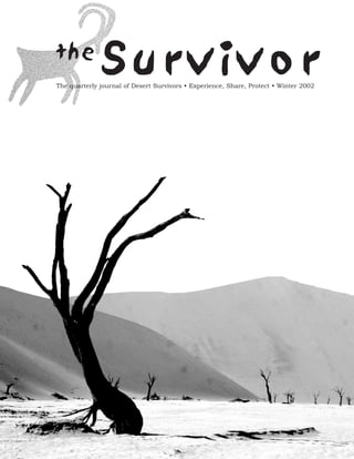
  • 2. Letter from the Editor By Jessica Rothhaar, Communications Director T his issue, we continue our "deserts of the world" series with articles by two DS members who have traveled in the deserts of Namibia and Morocco, and a review of a recent book about Africa. In the next issue, we plan to have some articles about the Atacama desert in Chile, by DS members who have lived and traveled there. If you’ve traveled through foreign deserts (Gobi or Takla Makan, anyone?) and would like to write about your experience for the Survivor, or share your photographs with us, please let us know. This issue also highlights the increasing pressure being placed on desert water by population growth in Southern California, with two articles about Cadiz and the Mojave River. The authors of these carefully researched and well-written pieces, Li Miao and Joe Pendleton, will both speak at the first Desert Survivors Annual Conference on October 26. Li will lead a focus group to discover how we can do a better job of involving members in desert issues and advocacy, and Joe will give a short presentation on the effects of suburban sprawl in southern California. I am in a bit of a time warp; as I write this, we are preparing for the first Annual Conference in a few weeks. We will hold publication of the Survivor until after the Conference, however, in order to include a report on the Conference. We hope and expect that this first Annual Conference will be a terrific success. The Board’s goals are for at least 50 members to attend, and for those in attendance to feel educated and inspired by the program. I have to wait, but you don’t, to see whether we achieved those goals. How to reach us: Managing Editor: Jessica Rothhaar……..... (510) 525-4921, JesseRoth@aol.com Art Director: Hall Newbegin………... (510) 845-1418, hall@juniperridge.com Membership Inquiries: Steve Tabor……............. (510) 769-1706, StevTabor@aol.com DS on the web: www.desert-survivors.org Submissions and Letters for Next Survivor Deadline for submissions for the Spring 2003 issue is February 1. Articles are subject to editing; please read the Submission Guidelines at www.desert-survivors.org before submitting your article. Letters to the Editor should be 200 words or less and are subject to editing. Articles and letters should be emailed to JesseRoth@aol.com; please include your full name, city and state of residence and phone number. Photos, maps and line drawings should be emailed or snail mailed to Hall Newbegin, Hall@JuniperRidge.com, 3032 Tremont Street, Berkeley, CA 94703; hard copy will be returned to you if you include your name Cover photo: trip leader Craig Deutsche at Font’s Point in Anza-Borrego state park, February 2002 photo by Eric Rorer 2 The Survivor Fall 2002
  • 3. and will not share, trade or sell our mem- Short Takes bers e-mail addresses to any other organiza- tion. Congratulations! Desert Survivor members Spencer Berman and Lois Grunwald were married May 22 of this year in a small campground in the Owens Valley. Spencer and Lois met on a Desert Survivor three-day backpack led by Steve Tabor in the Marble Mountains in the spring of 1998 and, by chance, met up again on another Desert Survivor hike in Joshua Tree on Thanksgiving that same year. Spencer and Lois, who lived at oppo- site ends of the state, spent the next year commuting to the desert and the Central Coast for weekend hikes, including several on the Desert Trail. They now reside together in Ventura County. Web Master Wanted Desert Survivors urgently needs a web master to take charge of our website. A redesign of the website is in the works and, with luck, will be final by the time you read this. But we need someone to put in 10-20 hours every month to keep the website content updated, to "webbify" the trip schedules and selected articles and illustra- tions from the Survivor – in short, to bring DS into the 21st century! Ideally, this would be someone with experience in both web design and content. But we’ll take anyone who knows how to webbify text and images and wants to put in the time, working closely with the board and other interested members. A number of board members would be quite interested in working with the webmaster to create a really useful, up-to-the-minute issues sec- tion. You’ll learn a lot, have something to put on your resume, and gain enormous satisfaction. We’ll finally have a website worth publicizing. What a deal. [Box Ad] Policy wonk? Gear head? Want to get more involved with desert protection? Join the hardcore: sign-up for the Desert Survivors listserv and join the in-crowd. To subscribe, or for more information, send an e-mail to tortoise@desert-sur- vivors.org. Please Note: Desert Survivors has adopted a formal e-mail privacy policy The Survivor Summer 2002 3
  • 4. F E AT U R E S Namibia: The Other Promised Land By Judith L. Kendall, Berkeley, CA Country Overview gained its independence on March 21, 1990. Namibia, called South West Africa prior to 1968, shares borders with Nevertheless, Namibia remains very much dependent on South Africa for its Angola and Zimbabwe to the north, Botswana to the east, and South Africa resources. Indeed, the South African currency, the Rand, is used interchange- to the south. It is a country double the size of California, with a population ably with Namibia’s own Dollar and the currency value matches the Rand. of just 1.6 million. The Khoisan-speaking tribes now called the San The country is rich in minerals (25% of the GDP comes from mining inter- (Bushmen), the Damara, and the Nama (Hottentot) were once its sole inhabi- ests) and 60% of its labor resources is committed to agriculture, but because of tants. Their rock paintings in the northwestern stretch of the country date water constraints, most of the agricultural product is allocated to subsistence their presence back 20,000 years. These were, and some still are, hunters and farming. gatherers. They are small people, most standing only a little over 5 feet tall, a feature that cost them in their many battles for the rule of more fertile lands. For a country as youthful as is Namibia, one would never suspect a thriving, They now represent only about 15% of the population, grossly outnumbered smooth running government to be in power. In fact, Namibia’s government is by the taller and heavier Bantu-speaking tribes: the Owambo (50%), Kavango considered a model democracy. It offers its citizens freedom of speech, freedom (10%), Herero (8%), Caprivian (4%), and Himba (1%). The Bantu of the press, the right of association and religious affiliation. It has a bicam- migrated from the northeastern reaches of the African continent and arrived eral Westminster-style parliament, regular elections for the House of in Namibia only about 500 years ago. Parliament and National Assembly, and, until recently, a two-term limit for the presidency. Approximately 89% of school-aged children attend school and In 1884, a German investor named Luderitz bought up much of the south- the country’s literacy rate is a healthy 40% - impressive given the sparse rural ern coastal lands and later sold it to his countrymen for colonization under the population and the challenging cross-tribal issues. English is the country’s offi- name of South West Africa. Diamonds were discovered in 1908 while a cial language, so all scholastic and tertiary instruction is conducted in English, railway was being built, and the boom hit. After World War I, South Africa although German is primarily spoken in Windhoek and Swakopmund, and administered the country under a mandate from the League of Nations but Afrikaans is the dominant language for the older generations. Many of the ignored instructions by the UN in the late 1940s to relinquish control and tribal people remain grateful to Christian missionaries, who provided them grant South West Africa its independence. In 1966 the South West African with food, clothing and shelter while they attended mission schools and learned Peoples’ Organization (SWAPO) began its fight for freedom. In 1968 the to read. Between 80% and 90% of the country is Christian or a mottled UN declared the South African occupation illegal and accepted the name blend of it coupled with a tribal religion. Namibia in place of the one that had implied annexation. Namibia formally 4 The Survivor Fall 2002
  • 5. I arrived in Namibia for the first time in April of 1999 with an F E AT U R E S American music-teaching colleague, with whom I worked in South Africa as a counselor at the international school. We joined up with one other traveler, a young Swiss welder, and our intrepid guide, Andrew Holmboe, at the Chameleon Backpackers’ Lodge, for an 8-day private tour of Kaokoland, the northwestern region, by Land Rover. Little did I know then that Kaokoland would become the new love of my life, and that I would cast aside all plans of returning to the US in favor of a grandiose plan to immi- grate to Namibia. From November 1999 to July 2000, I lived an itinerant life in Namibia in a vain attempt to obtain a work permit. Though I could not obtain one and eventually had to leave, I became more and more enchanted with what I saw of this remote jewel of a country tucked away on the other side of existence. South from Windhoek Namibia’s central plateau runs longitudinally along the spine of the country and is flanked by deserts: the Namib Desert along the Atlantic coast and the Kalahari Desert, which Namibia shares with Botswana and South Africa, along the eastern border. The Namib Desert competes with the Atacama Desert of South America for the title of being the oldest desert on the planet. It covers an enormous expanse (50,000 sq kms), the size of Maryland and New Jersey combined. Its scenery varies from gray gravel moonscape to lone mountains projecting up from hundreds of miles of bisque flats, to elegant drapes of ruby-lipped apricot dunes that peak at a magnificent 800 feet. The southern portion of the Namib Desert is a highly restricted area. It is owned by Consolidated Diamond Mines (CDM), a powerful Southern African mining company. Entering these "forbidden zones" without a permit is a sure way to end one’s life, and obtaining a permit is just shy of impossible. In the early part of the 20th century, beachcombers could become wealthy in a day, as diamonds were strewn everywhere along the sandy shores of the Atlantic Coast. Don’t book your ticket yet, surface allows for virtually no water to be retained. Even so, the though: CDM tidied that mess long ago. Kalahari’s sand dunes are vegetated and offer nourishment to an Two prominent coastal towns mark the Namib-Naukluft National unusual collection of creatures. The gemsbok, or oryx, is specially Park’s northern and southern boundaries. Swakopmund, to the adapted to survive the desert heat. Its skull carries an insulating north, feels like a beach town with cafes and restaurants, B&Bs layer of water that protects the brain from being cooked by soar- and hotels, and an adventure shop that will take the young and ing temperatures of 120 degrees. Some of the Kalahari reptiles restless sandboarding in the park. Although I didn’t get the can be found nowhere else in the world. opportunity to venture out on the boards, videos assure the adven- Southern Namibia has another fascinating geological wonder: the turous a grand time of mouthfuls and bottoms-full of the pulver- Fish River Canyon. This canyon is purported to be the second ous stuff. Instead, I ventured off to Cape Cross Seal Colony to be largest in the world, second only to our very own Grand. As hik- awestruck by 50,000 seals barking and crying about territories or ers descend toward the Fish River at the canyon’s base, they walk lost young ones, and by the stench of those young who never did back in geological time, passing periods of erosion, faults, glaciers, reunite with their mothers. fractures in conglomerates of limestone and other sediments Luderitz, on the southern edge of the park (about 250 miles from deposited by a sea, metamorphic rock that had been heated and Swakopmund), is a quirky but charming little German town that compressed more than a billion years ago, and finally to the bowels seems completely unaware of the tourists who contribute hand- of Namibian earth, where lava, shale, and sandstone date back to somely to its fishing-dependent economy. A half-hour’s drive 1.8 billion years. inland is a ghost mining town called Kolmanskop that was the cen- Climbing down to the canyon’s bottom, wading in its cool river ter of the 1908-1915 diamond boom, that today has been all but and climbing back out is a full day’s excursion, but most opt to swallowed up by the sands of the Namib. hike a 5-day route along the canyon floor. I’ve heard harrowing The Kalahari Desert commences due east of the central plateau, at stories of those who took this route in the middle of summer, an elevation of 1,000 meters. The Kalahari is a desert not because when temperatures reach 120 degrees, and barely survived. I’ve of its annual rainfall, which is over 100mm, but because its sandy also heard flip-side stories of those who found frozen water bot- The Survivor Fall 2002 5
  • 6. remember the discovery of the south-facing plateau F E AT U R E S walls, coated with the vibrant colors of over 150 dif- ferent types of lichen that flourish from moisture seeping through the porous sandstone to the grounds below. Every 20 feet I was awestruck by another bril- liant work of nature’s art. A few hours further north is the entrance to one of the three best wildlife parks in the whole of Africa: Etosha National Park (the others being Kruger National Park in South Africa and the Serengeti Plains of Tanzania and Kenya). The defining feature of Etosha Park is the expansive Etosha Pan. Measuring approximately 40 miles long by 65 miles wide, this salty pan is the remnant of a dried lake that evaporated 12 million years ago, when a continental shift altered the slope of the land and the direction of its contributing rivers’ flow. The pan now holds water only for a few months after the December- March rainy season. Then a collection of contact springs, water-level springs, and artesian springs quench the thirsts of the region’s lions, giraffes, hye- nas, cheetahs, elephants, zebras, black rhino, several species of antelope and over 340 species of birds. After many months of dry, parching heat, the water- ing holes are the central marketplace for the wild. A visitor cannot walk or hike in Etosha Park for safety reasons, but sitting in a car at a water hole is suffi- cient to view all of Etosha’s proliferation of wildlife. After a day’s viewing, spectators sitting around the campfire tell many tales of death and survival wit- nessed at the holes. You’ll leave Etosha with buckets full of film rolls, a heavy coating of white salty pan dust, and an expression of deep wonder on your face. To the north and west of Etosha lies the land I fell in love with, Kaokoland, one of the most exquisite and remote reaches of Southern Africa. Kaokoland is hostile to civilization: it fights every way we mortals attempt to leash it. This hostility is Kaokoland’s sav- ior, and its fragility is its beauty. tles at their sides as they awakened from a semi-hardened state themselves. The Fish River Canyon backpack/hike is challenging, but wonderfully rewarding. Beautiful North from Windhoek • Pretty yellow wildflowers blanket the white rocky ground Driving north from Windhoek along the central plateau’s veldt, a • The Kunene River flows ever so serenely within its banks. first overnight spot after a 4-hour drive might be the 250-meter- • The jungle life along the Kunene’s banks is beautifully lush. high Waterberg Plateau. This is a lovely mecca of birds (I spotted my first pair of Meyers Parrots right in the campground), flora • You’re free to travel anywhere you like: there are no fences, (from lush fig tree forests to acacia bush, to grasslands), and walls, or trespassing laws. wildlife (hyenas, rhinos, kudu and even leopards inhabit the plateau • The mopane trees have lovely butterfly-shaped pairs of leaves. itself, while a pair of nearly tame, greyhound-sized duikers tip-toe • Mopane worms are edible to the Himba and quite nutritious. around the wooded campground on their dainty hooves, giving coy blinks with their enormous black eyes and long frilly eyelashes). The campground is situated at the base of the plateau and is a per- Hostile fect embarkation point for a 5-day safari hike onto the plateau, or for brief day-hikes to the face of the plateau. I will always • That yellow wildflower is called Devil’s Thorn. It’s not edible 6 The Survivor Fall 2002
  • 7. even to goats. providing smaller male seeds. F E AT U R E S • The Kunene is filled with crocodiles. One last plant holds a special place in my heart. Every evening in • Malaria the fall months at Etendeka, as I walked along the red gravel path • The quicksand here can swallow an entire car. Flash floods from my cabin to the dining area of the camp, I smelled a deli- wash out the roads and leave behind boulders and axle- cious and powerful fragrance that permeated the valley. The crunching, oil-pan-punching rocks. owner had never identified it in his 10 years there, and only • Mopane trees bring mopane worms, two inches long and half shrugged it off as the desert grasses at dusk. My persistence paid an inch thick. off. On my way from cabin to dinner one night, I caught a sniff of the lovely mystery perfume. I stopped dead in my tracks and • Mopane worms bring snakes with deadly neurotoxic venoms. insisted that my flashlight reveal the source of such delight. If a snake out here bites you, you’ll die. There are no doctors There, in the midst of nowhere-and-nothing, was a single wispy or hospitals for hours or even days. foot-high thread of a plant with about three quarter-inch wide The Himba people of Kaokoland are striking. They’re still living beige blossoms, much like baby’s breath. When I bent down to with their tribal traditions as they have for hundreds or thousands interrogate it with my nose, it announced with full-trumpeted sym- of years. They’ve only been exposed to modern society since the phony that IT was the source of the glorious desert perfume! 1980’s, and still used stone tools until recently. The Himba still Monsonia, that wonderful little ugly duckling, turned into desert wear their traditional dress. The women have beautiful, ornately glory. Monsonia, I’ll forever love its fragrance at Etendeka, braided extensions and decorative cowhide hairpieces; they adorn Damaraland. themselves with lovely, handmade ostrich-shell jewelry and for clothing they wear merely a leather skirt. They coat their bodies I have many tales to tell around the campfire from my time at with ochre paste that tints their skin a glowing orange. Sadly, the Etendeka, from surviving elephant and black rhino attacks, to fol- tribal leaders believe that they will be the last generation to live by lowing the first migration of lions to the camp in 10 years; from their customs. Many of the young Himba are leaving for jobs and tracking collared lions by microlight to the death of my best friend the excitement of the cities. Lighter, cooler Western fabrics are there. replacing the leather skirts. The African desert is the Biblical wilderness, the wilderness of For three months, I lived and worked south of Kaokoland and Moses, of Isaac, of Jesus. That wilderness brought me back to the east of Etosha, at Etendeka Mountain Camp in Northern essence of my purpose on this planet: the wilder-ness. There I Damaraland. This land is capped with one of the largest stretches found a loneliness that felt more robust and alive than any of my of lava in the world, from eruptions 300 million years ago. As far happiest moments in the "civilized" world. That wilderness is the as the eye can see, from mountaintops and escarpments to low birthplace of creation. There I could really hear, could really plains, the terrain is covered with oxidized, highly ferrous (and breathe in my presence on Earth and my connection with life. therefore red) rock. Ferocious seasonal winds from the southeast Nothing is senseless or meaningless or cruel there; it all has a life- blow away any dust, soil, or chips from the larger volcanic rocks, giving purpose. There is order in wilderness, the order of nature. leaving behind densely scattered, stumbling stones that twist the It is still alive…in A-FRI-CA…. heartiest of hikers’ ankles and force all two-legged creatures to stick to the beaten paths. Low rainfall, coupled with this inhos- Judy Kendall will be leading a private 2_ week tour of Namibia in pitable soil, prevent grasses and other less hearty vegetation from April, 2003, dates to be determined with participants. Interested taking root here. Instead, the landscape is dotted with with pale, dusty-green Euphorbia Damarana bushes that provide stark con- trast to the burgundy magma. These large, dense bushes, perhaps 2 meters high by 4 meters wide, are wonderful safe havens for smaller desert life like honey badgers, monitor lizards and desert hares. Their spiny stems, when snapped off, ooze with a poiso- nous sticky milk that is inedible to all but kudu and black rhino. A half-crushed Euphorbia bush is an instant giveaway that either a rhino or an elephant softened its night’s sleep with it; how recent a sleep it was can be determined by the freshness of the milky sap at the tips of the broken branches. The desert elephants will travel up to 70 kms to reach a water source and are a special treat to spot during dry seasons. The "elephant" of flora is the renowned Welwitschia Mirabilis plant found in some hidden spots around Damaraland. These plants are ancient beasts of 1000 years or more. They are not in parties may e-mail her at jkendallinafrica@yahoo.com or phone the aloe or cactus families as might be suspected, but of the her at (510)612-8710. Space is limited, but preference will be given conifer family. Thumbnail-sized charcoal black cones are sprinkled to Desert Survivors members. around the split between its two broad gnarled and twisted aloe- like leaves, often 12 feet long. Survival depends on a mate nearby The Survivor Fall 2002 7
  • 8. F E AT U R E S Five Days in the Moroccan Desert By Ron Cohen, San Francisco, CA three p.m. we started to walk again, and walked until 6 p.m. The sun was setting and the air felt cool and dry on our parched skin. We had completed a day’s journey, about 10 miles. The terrain was typical Mojavian in appearance, smooth substrate in some areas, rocky and erratic in others, but it was flat. There were no washes, alluvial fans or bajadas, and few animals or plants, but it was still beautiful, tranquil and romantic. In our camp in the middle of nowhere, Zayaid prepared a wonder- ful dinner, complete with Moroccan mint tea. The tea ritual was fascinating. Skillful preparation produced a delicious but very sweet tea. Zayaid adjusted the flavor four times before he was sat- isfied that the correct balance of sweetness and mint flavor had been achieved. It was time to put a glorious day to rest. Overhead, millions of stars filled the heavens. No tent, no sounds, no bugs, no airplanes: pure silence. By the light of the moon, I could see the camels T he share taxi was to leave in about ten minutes for the four hour ride to the very small town of Zagora, the entrance to reclining on their haunches to enjoy their rest in the tranquility of the Atlas Mountains of Morocco. Here we would spend the desert night. five days trekking in the desert, a desert very similar in appearance and character to the Mojave of California. The Atlas Mountains Our third day proved to be the most interesting and challenging eventually merge with the enormous, majestic, barren dunes of the for us. We were very low on water and had, at most, one day’s Sahara. From Zagora, one could embark on a journey all the way water left. Running out of water in this dry, hot desert would be a to Timbuktu , in the country of Mali, many hundreds of miles disaster. Our inability to communicate with Zayaid now seemed to from here. threaten our survival, and we had to trust him. In about two miles, Zayaid led us to a true desert oasis, complete with trees for This desert trek had not been on our itinerary but, with indepen- shade and a well for water -- we were saved! However, when we dent travel, the unexpected arrives. Jan met the owners of a drew the water from the well, we found it was extremely cloudy trekking company in a café while I was out looking for our night’s and had particulate matter floating in it. Zayaid filled four 5-gallon lodging. On my return, I was informed of the impending trip, bottles with this water. We motioned to him that we could not which would begin in two days. That night we went to town to drink this water, that it would make us extremely ill. He did not purchase provisions such as fuel, flour, fruit, vegetables, cookies, seem to understand and I thought we were finished. I wanted to sugar, mint leaves for tea and, most importantly, water. pour out the water to make a statement, something to convince Zayaid of our dilemma. We deliberated what to do, but we did not The next morning at 6 a.m., we meet our three camels and guide want to anger him because we needed him, and we also needed Zayaid. Zayaid had the most beautiful dark skin, with wrinkles of clear water to drink. We continued to walk and, after another mile, life on his face, each one with a tale of his nomadic existence. came to another group of trees with another well. Out of the During the next five days we would realize how kind, caring and ground we drew crystal clear water. Zayaid had known all the time, gentle his soul was, rare amongst humans. Born in a family of we realized: he knew what we had been trying to communicate nomadic travelers, the desert was his home, and he knew its topog- and he also knew that we would find this liquid gold of the desert raphy, its bends and curves, better than anyone. We needed no just one mile ahead. I again showed Zayaid that the water in the compasses or topo maps, just Zayaid’s knowledge and his special old bottles would make us sick and he started to laugh, and laugh connection to the desert. hard. Then he showed us that the dirty water was for washing the camels, not to drink. I am sure he thought us ignorant, two people We mounted the camels, our desert taxis for the next five days. with no idea of where they were going next. Re-stocked with plen- Adorned with saddlebags carrying all we needed for survival, we ty of water to finish the trip, we made camp a few hours later, now began to ride. After one mile our camel riding days were over, now relaxed and feeling secure. only forty-nine miles left to walk. The motion of riding made us sea sick, where no ocean was to be found. Zayaid was astonished The scenery on days four and five was delightfully picturesque, that we wanted to walk. I forgot to mention that Zayaid did not with panoramic views. As the trip came to an end and we saw our communicate in any language that could be understood by Jan or home in the distance, we realized we had become enamored with I. Over the next five days we would become very articulate in the the desert and our guide. Five days in a beautiful barren land and silent language of pantomime. yet, as we all know, the desert is really very lush. It is amazing how the desert has the ability to invade your soul with its silence, On our first day, we walked a total of 6 miles in an easterly direc- expansive space, majestic mountains and mystery. tion, from 7 a.m. to 11 a.m. The heat of the sun and sand seared our souls, and we stopped for a long siesta. We rested in what little The memories of those five days are eight years old, yet they con- shade we could find created by small trees and brush. At about tinue to excite me. I know I will never forget that journey. 8 The Survivor Fall 2002
  • 9. degrees F. all year round. Below, we could see the white ice across Lava Beds Carcamp TRIP REPORTS the bottom. A twelve-foot wide hole had melted in the center. June 28-30, 2002, Tulelake, Northeastern CA Park officials measure the changes from year to year, but can really do nothing to stop the melting. It was thought that too frequent By Steve Tabor, Alameda, CA visitation may have done some of the damage, so now only a cou- ple of tours are conducted each week. Also interesting were stains W ith twenty participants, the Lava Beds Carcamp was another popular trip to a popular place. We did several high above near the ceiling, marks left by the ice when it once hikes in the National Monument, then spent the third filled the cave to its brim, probably during the "Little Ice Age" day in higher country near Medicine Lake. The air was hot, but from not unbearably so, and cool breezes helped quite a bit in mid-after- noon. 1600 to 1840 A.D. We met at the Visitor Center near the main caves loop, then did On the second day, we set up a car shuttle at Hospital Rock at the short hikes in the well-lit caves nearby: Mushpot Cave and Indian north end of the Monument, then drove back to Skull Cave for a Well. Mushpot exhibited most of the elements of lava tubes in the 9.4 mile hike across the plateau in the Monument's vast eastern park, all within a very short distance. We saw "frozen" lava spat- Wilderness Area. The whole group was involved in this, and we ters (cooled in place), sweeping lava flow marks along the walls, quickly split up into a fast faction intent on lots of hiking, and a dripstone on the ceiling, and rubble rafted along on the bottom, slow group interested in photography and wildflowers. I led the now solid. We followed the curving tube to its end, slow group. The first group got to the end by 1:00 pm. The rest where the lava had ponded behind a roof cave-in, then disappeared down a hole. No way to follow it, so we turned back. Indian Well Cave across the road was a giant window, opened out by a cave-in. Its bottom was a jumble of rock. We could have followed into it, but we were slat- ed to do a ranger-led walk a few minutes later. The mouth of the cave was populated with some very fra- grant specimens of "desert sweet," a white-flowered shrub with pungent leaflets loaded with volatile oils. Wildflowers were blooming in the open. We then drove to Skull Cave Road and joined a volun- teer ranger on a hike to two more caves: Big Painted Cave and Symbol Bridge. The ranger filled us in on the common names for many of the plants and explained the Monument's volcanic history. Both caves had Indian pictographs on the walls, mostly abstract design. They were likely used in ceremonies, though their sig- nificance has been lost. It is even possible that they had been painted by tribes other than those living in the area when Europeans invaded. In the afternoon, we drove to Merrill Ice Cave for a ranger-led tour. Unfortunately, we had not signed up at the Visitor Center, but the ranger graciously allowed some of our group in while I led the rest on a two- hour jaunt on the Whitney Butte Trail. The trail gave us a good look at the sagebrush-juniper ecosystem that currently prevails on top of the rolling lava plateau. Occasional lava rims poked through, most more than 50,000 years old. Hiking these trails on the open plateau gives one a feeling of space and possibility. When we returned to Merrill Cave, the ranger did a special tour for those of us who remained. Merrill is an ice cave that has lost a great deal of its ice in the past few years, and no one seems to know why. A winding staircase leads down into the cave, which is very deep. The temperature hovers around 32-34 The Survivor Fall 2002 9
  • 10. of us arrived at F E AT U R E S Waucoba Peak Backpack 5:30 pm. Which group of hikers enjoyed themselves more is a July 4-7, 2002, Inyo Mountains, CA subjective question. By Paul Menkes, Berkeley, CA As the six or eight of us lollygagged along on the trail, we noted B ristlecone Pines, steep and rough mountains and awesome many wildflowers, including various buckwheats, various vistas were the main pleasures on this trip to the Inyo Pentstemons and Phacelias, locoweeds, pincushion flowers, Mountains, led by David Halligan. Eight Survivors enjoyed lupines, and the rarest of all, Mariposa lilies. The latter were strik- what turned out to be a moderately paced four-day trip. ingly beautiful! Also nice were the grasses: native bunchgrasses like needlegrass and grama, and good stands of foxtail grass. We met high up on the Badger Flat plateau in the Inyo. It was very Junipers gave ample shade when we needed it. Open views were dry. From Badger Flat we hiked east into Tamarack Canyon, fol- inspiring at all times. With temperatures in the high 70s F. and a lowing the remains of an old four wheel drive road. We hiked stiff breeze, who could ask for more? slowly, pausing often to look at plants. One small tree excited a lot of interest. Grant thought it might be a ribes of some sort, as did In the early evening, a small group of us headed for Schonchin Dave M. Dina later did some research and concluded it was a Butte, a nearby cinder cone, for a long view out over the mountain maple (acer glabrum var. diffsum). We also started look- Monument's center. Schonchin is isolated and elevated, and has a ing at the first examples of bristlecone and limber pines. We would lookout cabin on top. From the top, you can see the anatomy of be spending the next four days amidst their splendor. the eruption below, where fresh basalt lava emitted from the base of the cone in two places and spread out over the landscape. We Eventually we left the canyon and started trending south-south- were late enough to see and photograph long shadows over the east. The track here gets faint to non-existent. But we did not have lava rims to the north and west, but too early for the sunset, which to think about where were heading, thanks to Grant, who was very some of the group interpreted as an oversight in planning. Later, familiar with the route. He got us right on track to a canyon where other hikers did Schonchin at sunset and enjoyed a colorful sky there is a ruined log cabin. It is not marked on the 7.5-minute map show. (though it is marked on the old 15-minute map). The next day, some of the hikers went back home. The rest of us We kept hiking until we reached a saddle at the head of Waucoba packed up, got in the cars, and headed toward Medicine Lake on Canyon. There we camped in the bristlecone pines, near an old the forested plateau to the south. At 6000-7000 feet in elevation, cow camp. We had plenty of flat spots and lots of bristle duff, this plateau would be cooler than where we'd been so far. It also which made for lovely sleeping, and had easy access to many lovely exhibited its own volcanic features to explore. We stopped at the vistas, both east towards Waucoba Peak and Waucoba Canyon, and north end of the Medicine Lake lava flow, actually a plug dome of west looking at the steep bristlecone woodlands. black and grey rhyolite, some of it glassy obsidian. We climbed around on the rock awhile, noting the huge trees growing on it, The next morning we hiked up to Waucoba Peak. The mountain most from cracks in the rock. Western white pine and lodgepole lies east of the main crest. We followed another old road (this one pine were the main trees, with some ponderosa also. Mountain in much better shape) along the ridgeline towards the peak. Along shrubs like chinquapin, cinquefoil and mountain spray grew in the the way we passed by many lovely stands of mountain mahogany. rocks, along with a different kind of Penstemon and other wild- We saw mountain bluebirds and pinyon jays. And we saw cows. flowers. From the top of the flow, we had a view out over the While Waucoba lies in designated wilderness, it still has a substan- lake to the south and to forested crests all around its small basin. tial grazing allotment within it. The rest of the flow was too blocky and unstable for further hikes, so we went back to the cars and drove to Medicine Lake for lunch. The top of the peak is spectacular. It is a large, broad hump with bristlecones at the edges. Mathilde, a brand-new member from At the lakeshore, we ate lunch and enjoyed the ambience: deep Paris, France, on her first desert trip, was especially excited by the green trees, wide blue water, a bluer sky above. After lunch we summit views. We could see the Eureka and Saline mountains, up swam awhile in the lake. The water was warm and quite refresh- and down the spine of the White-Inyo range, the Sierra Nevada, ing. My car mates and I started back early, though others drove and more besides. We spent a long time on the summit before further to the east and investigated another rhyolite-obsidian flow, heading back. Glass Mountain. Back at the saddle by Waucoba Canyon, we took a detour down to Lava Beds is a good place for car campers who like their exploring Sidehill Spring, which is a 700-foot descent. After getting water, we laid-back and easy. The campground is open most all of the year, hauled ourselves back up to camp and enjoyed our dinner. and birding is reputed to be good at Tule Lake to the north in mid-winter. The Visitor Center offers so much information that The next day everybody but me headed south along the crest to you can plan your own ambience, and you can skip the Happy Blue Peak. I went back to Waucoba Peak to recover my camera left Hour disputations. on the summit. Even though I had just hiked it the day before it was an interesting walk. The peak was quiet and lovely. An added bonus was seeing three bighorn near the summit. 10 The Survivor Fall 2002
  • 11. After the rest of the group visited Blue Peak, David H. and and we lost no time getting started. F E AT U R E S Mathilde headed back to camp, while Greg, Dina, Bob, Grant, and Dave M. continued south on the ridgeline. They came across a On this first part of day one, we were walking away from the sun. long ridge that is unnamed on the maps and heavily wooded with The greenery in the vegetation convinced me that a thunderstorm bristlecones. At the highpoint they found a summit register with a had passed this way recently. In a normal year, the brush would be few names in it. The informal name is Paradise Peak and, from all dry this late in the season and would have lost its leaves, but even reports, it is quite wonderful, with great views and a lovely bristle- the greasewood was bright green. We found traces of human set- cone forest. The enthusiasm of everyone who went made three of tlement in odd places on the fan, probably left over from some us plan to come back again next year and explore the eastside gold rush or other. canyons and visit the peak. We rested at the base of the hills, then hiked farther in, choosing a That evening we headed down to the saddle to watch the sunset gulch that drained the west side of Emigrant. By now, we were over the Sierra Nevada. I have personally never seen a sunset so feeling the heat. Nobody had much energy for a peak climb. In over the top as that one. After the sun sank behind clouds, then fact, we were frantically looking for a shady place to cool our behind Mt. Humphreys on the Sierra Crest, rays shot in an arc heels. In doing so, we hiked up into and out of several gulches in upward, as if it were a gigantic laser show, and the gray clouds colorful mudhills. The hills were dominated by a rich rust-red became yellow and pink. The entire group spent 30 minutes ooh- color, but there were also black, grey, brown and cream-colored ing and ahh-ing until the last bit of color left the sky. hills. The color was even better than I'd expected. Getting on top for a view, we saw a blocky outcrop with a narrow shade strip Our trip ended the next day by heading back via Tamarack below a vertical cliff. We headed for it quickly, intent on a drink, a Canyon. We had all connected or reconnected to the Inyo, the bite and a snooze. We enjoyed all three, and none too soon either! spiritual home to Desert Survivors and a very special place. After lunch, we hiked around to the south side of the outcrop and dropped down the red shale slope behind to the gulch below. Rhyolite Ridge Carcamp That gulch and the fan beyond comprised our route back to the cars. In the bottom, we hiked through volcanic rock into lime- stone and shale, passing a band of curious crystalline rock, felsite or granite, below the sedimentaries. Soon we were out in the open, hiking southwest into the sun. It was hot on our bodies, and got hotter as we descended the fan. We hiked quickly, intend- ing to spend as little time in the sunshine as possible. I walked with my thermometer out. The temperature fluctuated between 96 and 104 degrees F. It was hard to tell which was accurate; if it was 104 F., that would be a record for my trips. It certainly felt that hot. By the time we reached the cars, the pretty red volcanic outcrops were a distant memory, replaced by a desire for shade and coolness. We drove as rapidly as possible to Fish Lake Hot Springs for a dip. I was really looking forward to it. The air temperature was 96 F. The hot pool, the one with the concrete tub, was 106 F. The two ponds adjacent were 95 F. and 83 F. respectively. The lower pools July 26-28, 2002, Western NV collect runoff from the hot pool and are subject to cooling from the air, so the water temperatures fluctuate with the seasons. We By Steve Tabor, Alameda, CA spent most of our time in the cooler pools, with their populations of bright orange carp and razor sharp water weeds that made T his three-day carcamp to the Silver Peak Range east of Yosemite was a hot one. Hot air drained our energy swimming difficult. throughout, especially on the first day, when we enjoyed only meager shade. The warm pools at Fish Lake Hot Spring pro- Refreshed and cooled, we drove southeast across the valley on the vided welcome relief when we needed it, and graded dirt Mineral Ridge Road. On the way, we passed wild hors- es grazing out in the saltgrass. The road led us into Cave Spring old trails from yesteryear made for intriguing route-finding, tweak- Canyon on a pleasant drive, no problem even for passenger cars. ing my curiosity for more visitation in the years to come. Ten miles from the hot tub, we came to Cave Spring Cowcamp. It was an intriguing place for a camp, barren of vegetation due to I had long been intrigued by the colorful volcanic rock west of intensive cattle grazing, stripped of all edible plants and covered Emigrant Peak, which is visible from a long way off. On the first over with pulverized dried cow manure. Still, it was interesting for day, we met on U.S. Route 6 north of Fish Lake Valley, then drove its old stone cabin, dynamic cliff rock, and flowing spring. The on a dirt road west of the north end of the range. We parked by camp was right in the blazing sun, without even a single tree for the side of the road, then took off across the fan in a northerly shade, but a quick reconnaissance upstream had produced nothing direction. It was two and one-half miles to the base of the hills, better. The Survivor Fall 2002 11
  • 12. We hid behind the vehicles for shade, then cooked dinner. The Big Smoky Valley below. And smoky it was! Visibility was poor, F E AT U R E S sun finally set, but by that time nobody felt like a campfire. We less than twenty miles, partly from California fires and partly from needed the cool air of night, not the warmth of flames. We sat a curious temperature inversion that made the air murky and around candle lanterns and retired early. Tomorrow would be a heavy. We rested here for more than an hour, exhausted by the long day. heat and the sun's rays. It was good to lay down. In the morning, we began a circumnavigation of Rhyolite Ridge by Later, we hiked south around the next rock knob and obtained a climbing a high bank to the east. We ended up in a narrow defile view of the ridges to the southeast and south. I pointed out an ending at a series of high cliffs peeling off the top of the ridge. old jeep trail that would take us back to Cave Spring, but when we There was no spring despite the map's allegation, so we continued started in that direction, I saw an old trail at the base of Rhyolite across the base of the ridge to the next drainage, a huge trench Ridge that led cutting back into the ridge with willows and wild roses in two places. We bypassed this and headed farther along to the main around to the southwest. I said, "Let's take it! Let's see where it wash that led east. goes!" If it didn't pan out, we could modify our route to go the other way. These first two hours, we were in deep shade. Now, as the sun rose, we were in trouble. It was hot hiking in loose sand and peb- We were not disappointed. This was a great trail, put in probably bles. We stopped for a rest, then hiked farther up, taking an early by prospectors or the Army in the 1800s, kept open since by deer lunch under a huge juniper. Here near the head of the canyon, we and wild horses. The trail led under a magnificent arch, then were in Utah-style across terraces and hillsides, into gulches and back out. We lost it once, then regained it. It stayed high above the base of the terrain, surrounded by red and black and cream-colored outcrops mountain, where we had excellent views. While on the trail, we draped with dark green junipers and pinyon. We turned up the looked down and saw a couple of four-wheel-drives on the jeep right fork, passing a beautiful cream and yellow buttress that trail. What a boring plod that would have been, compared to our looked for all the world like the Navajo Sandstone, complete with current brush with history! We were in the tracks of the old ones green trees growing in cracks and exfoliating rinds of rock peeling and the wild horses now, much superior to the jeep track showing off rounded surfaces. Following the drainage, we achieved the on the map. canyon head with a view down off the east side of the range to 12 The Survivor Fall 2002
  • 13. We followed the trail through the trees and brush. It led, as I sus- peak; he was fresh and strong, not having done the thirteen-mile TRIP REPORTS pected, right to the next water source, North Spring, halfway down hike of the previous day. The rest of us retraced our tracks to the off the mountain at 7100'. The spring supported a small meadow. cars. Water ran from a pipe into a small wooden trough. A couple of us sampled the water and it was good. Wild horse tracks were all On the way out, we stopped at the hot springs again for a swim, as over the place. I noted it on the map, possibly for a future back- refreshing as ever. Then we headed home, enjoying fresh air blow- pack trip. It would be especially good if this trail linked up with ing over us through the car windows. We'd experienced enough another that I suspect runs (or ran) right across the valley to the heat for the weekend. opposite rim. The Silver Peak Range offers lots of hiking opportunities. Most From North Spring, we had a long view across the open inner val- of it is good even in summer because of the ample shade. The ley at the head of Cave Spring Creek. Red Mountain (8957') Desert Trail passes through the western half, but this eastern half anchors the ridge to the south. A long ridge runs along the east also has its charms. Someday I'll be back to do the mystery trails side culminating in a peak at elevation 8380'. The valley is a rec- on a backpack, to see where they go. There is ample water at sev- tangle roughly two miles on a side. Only Mineral Ridge Road and eral of the springs, which makes even midsummer backpacking a couple of spurs running through it mar the sense of open wild- easier. On the topos I can see a long looping route that passes ness, and most persons driving through don't even get out of their through North cars. The view of Red Mountain, sticking way up, is especially impressive. Spring and over the windswept ridges west of Piper Peak, right along the crestline. I think I'll get out my map measurer and cal- The hike after North Spring was an anti-climax. We went back to culator to find out just how feasible it is, how many ups and the cars as fast as we pleased, knowing it was all downhill, and tak- downs, and how long. As for the views from the ridgeline, it's ing our shade where we could. The north side of Rhyolite Ridge futile to try measuring along the road was photogenic also, with the same Utah-esque landforms, with colorful yellow, lavender and grey rhyolite in place those, except in units of inspiration. of sandstone. Rock layers were horizontal, stacked on top of one other, extending out into the canyon in rounded buttresses, punc- tuated by sharp cliffs and deep clefts interrupted by little dry falls. Bodie Ghost Town This day's hike made me nostalgic for Utah in its early days, before the off-roaders took over, before the hordes of hikers brought on August 16-18, 2002, Bodie, CA by Michael Kelsey and his never-ending series of saturation-level hiking guides. By Jessica A. Ward N ine Desert Survivors met in the Bodie parking lot and We headed for higher country on the last day, as we had done on waited patiently for our trip leader, Bob, to show up. Ten the Lava Beds trip. Some of the hikers left. The rest of us drove minutes passed, then twenty, then thirty, and finally forty. to Coyote Summit on Mineral Ridge Road for a climb of Red The Survivors who were there -- Allan and his daughter Angela, Mountain. We started up the ridge on the south side of the peak, Kelly, Loretta, and Loretta’s grandchildren Cody, Denver, Lil' Jess, but soon ran out of energy. There was little enthusiasm for a Warren and me, were wondering where Bob was and whether or long, tough hike after the previous day's exertions so, when we not to start without him. Finally, we spotted Bob’s Volkswagen found a trail cutting across the peak's west side, we took it. This Bus and the trip officially started. was another old trail with brush and mature trees growing across and even in it. It almost assuredly belonged to the 19th century, We debated whether we should explore the ghost town or find a and I couldn't help thinking that it may have been the continuation campsite first. We decided that we would find our campsite first of the trail we had been on as we skirted Rhyolite Ridge. That due to the fact that a large group of historical preservationists, would be a treat, to connect the two up someday. nicknamed the Red Shirts, were also in Bodie and we didn't want our spot taken. We drove about two and a half miles on the road We struggled through dense trees, losing the trail, then regaining it. to Mesonic and then took the first left turn up a dirt road. We had At one point, we became separated, and had to call for each other to get up a sandy hill, which was difficult for some of the cars. through the trees. We came upon a lovely little rattlesnake in the After we all got up the hill, we had to drive over a rocky area, woods, curled around a stump. It even rattled, a rarity nowadays. which also didn't agree with some of the vehicles. We marked our At 8200', it was one of the highest elevation rattlers I've encoun- territory by parking the cars and setting up a tent. tered. We found many cut stumps from the old mining days, when wood was used in the mining camps for heating and for the After that we ate lunch and Bob talked to everyone about rat- smelters. We reached timberline on the ridge just below the huge tlesnakes, ticks, and other dangers. Bob then asked who would be bulk of Red Mountain. We were above the trees in Nevada's taking notes to write the trip description, and Loretta volunteered upper sagebrush community, windblown and barren, too dry for me. Around 1:30, when everyone was finished eating and every- ponderosa pine and too cold for pinyons. We stopped for a short thing was put up and away, we drove back to Bodie to explore the lunch and enjoyed the view across the inner valley toward Rhyolite town. We went off in a couple different groups and observed the Ridge. Craig King decided to go back to the cars by climbing the aged buildings. Although none of us went, there was also a tour to Paul Menkes taking a break in Ash Meadows The Survivor Fall 2002 13
  • 14. explore a stamp mill. When everyone met up again, we drove back and go the way we'd come. The trip back was less eventful and the TRIP REPORTS to the campsite where it was decided that we would go on a small dust and heat were something of a torture to a few of us. As we three-mile hike to a river. neared the Volkswagen, a couple people began to get low on water, but we made it back without anyone keeling over from Bob and Mari drove the Bus to the river while the rest of us dehydration. walked along the dirt road. When we were almost there, Bob and Mari drove back and told us they couldn't find any water. So we all Everyone rode in the Volkswagen back to camp, where some of piled into the bus and rode back to the campsite. The kids rock the adults rested, some talked, and the kids played on the rocks climbed for a while and then a fire was started and the kids sat again. That night was pretty much the same; the kids went to bed around it and told scary (disturbing and grotesque) stories, while after dinner, and the adults talked around the campfire. They chat- eating dinner. The adults then took over the campfire and talked ted, once more, about many different things, until Bob fell asleep about several different things when the kids went to sleep. They at the fire. The next morning consisted of everyone packing his or dispersed at about 10:30 when they began to get tired. her things and getting ready to leave, and saying goodbye. Getting up the next morning was very slow and it took everyone Jessica Ward, 14, has been on half a dozen DS trips with her awhile to get their food, water, and everything else together for the grandmother, Loretta Bauer. This is her first contribution to the hike. When everyone was ready, a couple of us walked down the Survivor. hill and waited for everyone else to come down in Bob’s bus. When they didn't come down, Warren and Loretta went ahead, while Alan, Angie, Kelly and I waited a little longer for the bus. After a couple minutes cloud of dust was seen and Bob's Lunar Crater Carcamp Volkswagen started down the hill. They picked up those who had waited at the bottom of the hill, and then proceeded to pick up Warren and Loretta. Trying to find the trailhead, Bob drove down a somewhat steep incline and Loretta started to panic. It wasn't until we got down the incline that Bob realized it wasn't the right road, and turned around to go back up. Loretta was terrified as the bus started back up and, when it got stuck, she flung herself out of the vehicle. The Volkswagen got up without mishap and, leaving Angie and Loretta who wanted to walk, drove further up the road. Bob and Mari dropped the rest of us off there and then went to park the Volkswagen further up the road. Those of us who had gotten dropped off waited for Loretta and August 31-September 1, 2002, Central NV Angie. When they caught up, we all proceeded down a hill, where we were supposed to meet Bob and Mari. When we got there, we By Steve Tabor waited for a while thinking that Bob and Mari hadn't gotten there T his carcamp to an exotic terrain in Central Nevada was a yet. After about twenty minutes we decided to go on ahead. About showcase of volcanic geology. We witnessed two genera- a mile up the trail, we ran into Bob who had just started back to tions of eruptions: an early rhyolite sequence, now much look for us. He took us back to where Mari was waiting, and after cut by basin and range faults, and a more recent sequence of a quick break we continued on our way. explosion pits ("maars") and cinder cones with basalt lava. A pair of geology maps and a short monograph helped with the interpre- We walked until we found a nice spot by the stream where we ate tation. Benign weather also helped; the intense heat of summer lunch and some of the hikers dipped their feet in the water. The was largely gone. trail and lunch stop were very dusty and bug infested. After we fin- ished eating we continued walking. As we went on, we began to We did our first hike up a gentle trail to the rim of Easy Chair. see paw prints on the trail. It took us awhile to figure it out, but The crater was about one-third of a mile wide, and had a flat floor we (mainly Bob) came to the conclusion that it was a bear print, with a small clay pan in the center. The interior was fairly steep, unusual for that area. As we neared the point where we were sup- but only a little bit cliffy. There was no lava at the base, nor were posed to make the loop back around, we spotted an old cabin and their any cinders on the sides. These are characteristics of maars, went to explore it. The cabin was in bad shape, the wood was rot- which are formed during steam explosions, not traditional erup- ted and one of the walls had fallen apart. Outside the cabin, there tions. The theory is that hot gasses rise on fissures into a moist were a couple trees with writing carved into the bark; we came to subsurface, causing steam to form and vent explosively. the assumption that it was a sheepherder's shack. In the case of both Easy Chair and Lunar, the explosions tore We went on ahead but, after we'd climbed down a rocky incline through the valley floor and lava beds just beneath, showering the and walked alongside the water, we realized the underbrush was surrounding area with debris derived from the older flows. Once too thick to continue. We decided that it was best to turn around the steam is vented, the event has ended. The only lava exposed is 14 The Survivor Fall 2002
  • 15. what shows in the sides of the pit from the previous eruption. rim, was off to the southwest, where a gulch had formed due to TRIP REPORTS Both craters are aligned along fissures and are backed by cinder flood waters breaking through both the black basalt and the pink cones aligned on the same fissures. At Easy Chair, we hiked up rhyolite underneath. The maar explosion had blown all the way the cinder cone adjoining the west rim and climbed to the top, through both. We headed there to find a way out, and also to get where we had a great view of the volcanic field to the east, south into the shade of the cool vertical walls drained by the gulch. We and west. Both east and west were long linear ridges of 25-mil- rested in the shade partway up the wall, enjoying conversation and lion-year-old rhyolite, separated by faults that are parallel to the fis- the cool water we'd brought. A half hour later, we started up the sures aligning the cindercones and maars, roughly at 40 degrees sides, aiming for a ledge cutting across the next to topmost layer. east of north. Also to the east, we could see the bright white It was a huffer and puffer for me I took short steps and rested expanse of Lunar Lake, which would later be the site of our camp. frequently. The crux of the climb was the narrow two foot wide To the west was Palisade Mesa, where we would hike two days ledge near the top. Once past that, we were okay. On the last rise, hence. Directly south was Lunar Crater, at the base of another I climbed over the rim, stumbled, and put my left hand right into cinder cone. Its rim could just barely be seen. one of the few small cacti present. Ten minutes later, I had gotten out most of the thirty spines embedded in my hand, using tweez- After gazing at the scenery to the south, we walked north along ers. The rest are still there three weeks later, festering under tiny the ridge for a short distance to look out over the plain. On the calluses. At the rim, 430 feet from the bottom, we rested awhile, other side of Route 6 was a fresher basalt flow and cone, probably then hiked around the rim to our cars on the north side. As we only a few thousand years old. We could also see the northern did so, some antelope passed by in the valley to our left. Other part of the Pancake Range, the site of my late September fossil hikers had seen them in the bottom of the crater. Along the way, hunt in the limestones. In late morning, we hiked down off the we found obsidian shards on the rim and many fragments of pink cinder cone onto the east rim of Easy Chair. It was a steep bear rhyolite blown out of the crater from the throat of the pit below. to descend. We were slipping and sliding on loose cinders, round It must have been quite an explosion! The geological monograph volcanic bombs and rubble. tells of a fragment of granite found here also, probably from sev- eral thousand feet down. When we reached the cars, we drove back out to the main graded road and headed south to Lunar Crater. We ate lunch on the rim, In late afternoon, we drove eastward toward The Wall, our hiking right out in the sun without trying to hide from it. The tempera- destination the following day. Farther on, we turned a corner to ture was a balmy 86 F. at an elevation of 6002'. In the afternoon, go north on the graded road. Soon after, we ran into a dust pit we hiked down into the crater on a rough route discovered by hik- occupying the entire width of the road. It was seemingly bottom- ers Bob Wallace and Alan Brown. They'd dived right into the crater without eating lunch. Afterward, most of the rest of us followed them. The route went down through a loose and rubbly crack in the main flow around the rim, dropping over short rock cliffs and loose talus. We had to be careful, moving through one at a time. At length, we got to easier terrain and dropped to the bottom, which was occupied by a mud flat grown to a healthy stand of four-wing saltbush. It was good to be on stable ground. It was an eerie feeling to be at the bot- tom of the crater, which was completely enclosed and rimmed round by basalt cliffs in almost a perfect circle. The cliff was broken in only a few places; I began to look for ways out. The most likely exit, and the most interesting part of the The Survivor Fall 2002 15
  • 16. less and we were submerged in billowing clouds of dust that cas- thirteen and one-half miles; they'd hiked sixteen. A weary group TRIP REPORTS caded down all the windows. We were driving through an extend- of hikers sat down to eat that night. ed part of the bed of Lunar Lake without even knowing it! I prayed that we would not hit a rock or bust a wheel rim in an On the last day, we drove to Palisade Mesa for a half day hike to unseen hole, but there was nothing for it but to continue. If we Sandy Summit Spring. This misnamed spring is actually four miles stopped, we might run aground or get stuck in the soft stuff. An from Sandy Summit, which is on the highway. We hiked a mile to eighth of a mile later (it seemed longer), we hit hard dirt again, the spring, which was located in a narrow cleft cut into the mesa. and I breathed a sigh of relief. It was a healthy jaunt, mostly on animal trail, to the lower spring, marked by a swatch of willows. Farther up was another spring I saw a short road on a beach berm that led to Lunar Lake. I got with a larger willow patch, where water bubbled out of the out at the lake shore and tested the surface of the playa, which ground. The drainage had been swept over by a flashflood that looked wet. It was okay, so this would be our camp. Nearby was a summer. We hiked another half mile up onto the rim, where we little pool of water! It must have rained sometime in the summer, had a great view back down the cleft and out over the desert. The probably the same rain that had greened up the greasewood in the top of the plateau was a hardscrabble surface of bare rock with Silver Peak Range in July. Fresh coyote, kit fox and antelope tracks juniper trees growing out of fissures. Across the cleft, huge fins were impressed in the soft mud. This was a true, if temporary, and convoluted erosional forms bend down to the edge, the tops desert oasis!. As we were leaving the next morning, four antelope of pinnacles resembling the "beehive" erosional form of Utah came down to drink at the pool. It was a good sendoff. sandstone, like those on The Wall. In her zeal for exploration, one of the hikers, 15-year-old Dafna Bitton, strayed into difficult ter- The Saturday hike, to the top of The Wall and along its crest, was rain, testing her climbing skills as she rose higher. By the time a long convoluted one that lasted all day and into the night. We we'd reached the top, she looked very small amidst all the fins and hiked up a canyon that led to the rim of The Wall, diving behind cliff faces. When we started back, she came down to meet us, rocks for shade from time to time. It felt hotter because we were reporting on her adventure. Partway up was a cave with owl drop- hiking directly into the sun. Early morning is always the worst pings and bones. The climbing had not been that difficult, she time to be in the desert when you're traveling east. We got to the said. After watching Dafna, both I and her mother were glad that crest and spent the rest of the day on it, with great views in all her 11-year-old sister had stayed with the group. The younger girl, directions. Up at this level, above 6500', we had plenty of trees for Ayelet, had been with us through the length of the previous day, shade, but the hike was overlong, drawn-out, and too stressful for on the thirteen-miler. The 600-foot climb this last day was, there- some of the hikers. The farthest point at the south end of the fore, no big deal for her. Both girls had lots of energy. I'm ridge was too difficult to get to, and we had to give it up, as we ran already lobbying them to become trip leaders. out of time in the afternoon. As it was, some of us didn't make it back until after dark (a practice not unknown on DS hikes in the In our three days, we witnessed most of the elements of the Lunar winter, but rarer in the summer when the days are fourteen hours Crater Geological Area. It's a great place for a car camp. The long). roads are in pretty good shape: we encountered difficulty only at the dust pit. Both The Wall and Palisade Mesa are Wilderness I remember much about the hike: the great views, looking down Study Areas, as are the many square miles of mesas to the south. on the slanted and fault-cut mesas to the north and southwest, A through road, rough in spots, divides the two. There is plenty beautiful stands of junipers on the plateau top, isolated specimens of room to explore. Even the BLM recommends both for of Mojave mound cactus scattered here and there in the rocks, Wilderness, probably because the rock is all volcanic and has "no standing on top of cliff faces trying to figure out the intricate mineral potential." courses of canyons that may or may not go through. At one point, we were forced down between giant fins of rhyolite and For information, call or write the Bureau of Land Management, around bulbous masses of rock heavily cut by fissures. Both the PO Box 911, Tonopah, NV 89049-0911, tel: (775) 482-7800. The top and sides of the rim had been eroded into fantastic shapes. geology maps are U.S.G.S. Maps I-700 and I-719. There is an The place reminded me of Arches National Park with its sand- excellent monograph, U.S.G.S. Professional Paper 599-I. stone fins, dry falls, domes and pinnacles. Many of the plants we saw would be more at home in the higher mountains to the north, in the Park or Hot Creek Ranges. At one point, we found a single mountain ball cactus. It looked like a baseball, 7/8ths buried in the dirt and covered with short spines. A Tale of Two (Nevada) Once I'd decided to return to the cars, we hiked as fast as we Springs could to get off the rim. Being out all day, some of us had taken on a lot of heat and sun. Hikers were slowing down, and we had to wait for them. It was sunset before we emerged from the last By Bill Johansson, Stockton, CA T canyon, and a merciful sunset it was! Partway down, I'd sent the he very first desert spring I "discovered" was Pigeon faster hikers ahead to see if we'd be stopped by dry falls. They Spring, west of Lida, Nevada in Esmeralda County. Since never came back, so I surmised that they'd made it through. That then I have hiked to several other springs, including Indian group made it back to the cars early, and one of them came back Spring, which is near Pigeon Spring, and Daylight Spring in with his car to pick up the rest of us. By that time, we'd hiked California. It is a fascinating hobby, shared I’m sure by other 16 The Survivor Fall 2002
  • 17. desert lovers. TRIP REPORTS The highlights of my latest trip to Nevada were two springs, Powell Canyon Spring and Double Spring. In the driest part of summer, in the month of September, my friend Louie and I headed through the sagebrush of southern Mineral County in the Nevada desert to find Powell Canyon Spring. The area we explored is in the Humboldt-Toiyabe National Forest, south of Hawthorne. We knew we had found the spring when we saw the lush vegetation. We could not see water, but there might have been some hidden in the brambles. We hiked up the main canyon for a while, then we followed a tributary. On the way back I tried again to find water at the surface, to no avail. The sun broke out for a while, then partly hid behind the clouds. We later went to find Double Spring, located in Douglas County, Nevada, south of Gardnerville. Despite the name, there are actual- ly three small springs almost right next to each other. The area was trampled by cows, but there was water! I took a sample from the middle spring. There is a Nevada Historical Marker just south of the springs. The Survivor Fall 2002 17