Designing Bioretention with an Internal Water Storage Layer - NC Cooperative Extension
•
1 gostou•659 visualizações

Designing Bioretention with an Internal Water Storage Layer - NC Cooperative Extension

Recomendados
Recomendados
Mais conteúdo relacionado
Mais procurados
Mais procurados (20)
Semelhante a Designing Bioretention with an Internal Water Storage Layer - NC Cooperative Extension
Semelhante a Designing Bioretention with an Internal Water Storage Layer - NC Cooperative Extension (20)
Mais de D4Z
Mais de D4Z (14)
Último
Último (20)
Designing Bioretention with an Internal Water Storage Layer - NC Cooperative Extension
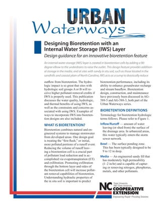
- 1. Designing Bioretention with an Internal Water Storage (IWS) Layer Design guidance for an innovative bioretention feature An internal water storage (IWS) layer is created in bioretention cells by adding a 90- degree elbow to the underdrains to raise the outlet. This design feature provides addition- al storage in the media, and at sites with sandy in situ soil, such as those located in the sandhills and coastal plain of North Carolina, IWS acts as a sump to drastically reduce - - - BIORETENTION DEFINITIONS - WHAT IS BIORETENTION? Inflow/Runoff - Bowl - - Media - -
- 2. Figure 1. Schematic of a bioretention cell with an internal water storage layer. In situ soil Underdrain Mulch Layer Gravel Layer Drainage Overflow Outflow Exfiltration/ Infiltration - IWS (Internal Water Storage) layer - Evaporation/ Evapotranspiration - - - 2
- 3. PARAMETERS AND PROCESSES OF BIORETENTION HYDRAULIC DESIGN Delivery rate of water to the cell (runoff rate) Bowl volume CREATING AN INTERNAL WATER STORAGE (IWS) LAYER CONSTRAINTS AND CONCERNS WITH INTERNAL WATER STORAGE WHAT FACTORS DO YOU CONSIDER? Underlying Soils. - Surrounding Land Use. - - - Available Storage/Effective Porosity. - 3
- 4. Seasonally High Water Table. - - - WHAT ARE THE BENEFITS OF USING INTERNAL WATER - STORAGE? - New credit for bioretention with IWS. - Table 1. Storage volume available for varying internal water storage layer depths. Design - assumptions: (1) the side walls are vertical, (2) the media is present under the entire bowl, (3) the IWS has no slope, and (4) drainage area is 100 percent impervious (CN = 98). 36 in media depth (30% effective porosity) and 8 in gravel layer (25% effective porosity) IWS Depth in Gravel Storage Volume Depth in Typical Storm Size Captured and Media (in) Gravel and Media (in) (average ponding depth = 9 in) (8 + 12) = 20 5.6 0.62-inch event (8 + 18) = 26 7.4 0.82-inch event (8 + 24) = 32 9.2 1.02-inch event - - 4
- 5. Figure 2. Design recommendations for bioretention with IWS to receive updated removal credits. Table 2. Old and revised pollutant removal credits for bioretention with IWS. Nitrogen Remov- Phosphorus Total Suspended Solids Region al Credit Removal Credit Removal Credit Old NCDENR Credit 35% 45% 85% (Statewide) Revised NCDENR Credit1 (Sandhills and Coastal Plain) 60% 60% 85% Revised NCDENR Credit1 (Piedmont and Mountains) 40% 45% 85% *Hydrologic Soil Group A or B 1 Must incorporate IWS to receive revised credit. Figure 3. Area impacted by increased pollutant removal credit for bioretention with IWS. Image modified with permission from N.C. DWQ, 2007b. 5
- 6. REMOVAL CREDITS — WHAT ARE THEY? NCDENR assigns pollutant removal credits (or per- centages) to a suite of BMPs, including bioretention. As pollutant loads enter a given BMP, some frac- - tion or percentage of them is retained or removed by the BMP. The higher the fraction of pollutant removal, the better the BMP works. Under the new NCDENR guidelines, if 10 pounds of nitrogen annu- ally enter a coastal plain bioretention cell with an Hydrologic benefit. - IWS, it is assumed that only four pounds of nitrogen would leave the bioretention cell. - Nitrate removal. - - - - - - - - - - Figure 4. Ouflow volume versus runoff volume for the grassed cell with a 2-ft IWS zone in Rocky Mount, NC. Drain- age and overflow volumes are presented, as well as a 1:1 line. 6
- 7. Table 3. Performance of bioretention with IWS in the piedmont versus upper coastal plain. Location/ Media IWS Layer # of Events # of Events Site Underlying Soil Depth (ft) Thickness (ft) Monitored with Drainage Piedmont Greensboro-1 (G-1) 4 2 63 18 (clay loam) Piedmont Greensboro-2 (G-2) 4 No IWS 63 40 (clay loam) Rocky Mount Upper Coastal 3 2 78 5 (Grassed) Plain (sand) Rocky Mount Upper Coastal 3 2 78 4 (Mulch/Shrub) Plain (sand) Piedmont 2 40 22 Graham South 3 (sandy loam) Piedmont Graham North 2 1 40 34 (loamy clay) - - Thermal benefit. - - - - - - 7
- 8. TYING-IN OUTLET — INCORPORATING IWS INTO BIORETENTION DESIGN - - WHAT WILL INSTALLING INTERNAL WATER STORAGE COST? - - Figure 5. Upturned elbow installed in storm sewer drop inlet Figure 6. Upturned elbow installed in storm structure in Rocky Mount. sewer drop inlet structure in Greensboro. - - - 8
- 9. Figure 7. Example showing how IWS can make retrofits for bioretention possible. Figure 9. Cross sections of Graham bioretention cells (all units in feet). Figure 8. Example where an upturned elbow was installed outside of a storm sewer drop inlet box because the underd- rains were below invert elevation of the existing storm sewer. DESIGN CONCERNS Diminished performance in subsequent storms. - Figure 10. Graham bioretention outlets highlighted in yellow circles (elevation = 91.75 ft) and brick storm sewer structure in white rectangle (elevation = 91 ft). 9
- 10. Figure 12. Geologic map of central NC highlighting Triassic soil groups (white outline). Image modified with permission from N.C. GS, 2009. Figure 11. Levels of flow at the outlet for the two cells in Greensboro with vary- ing antecedent dry periods (June, shorter – left & July, longer – right). Zero represents the surface of the outlet. Doesn’t perform as well hydrologically with clay in - situ soils in the piedmont. - - Table 4. Relating drawdown time (emptying the excess water content) to exfiltration rate for biore- tention with IWS.1 Soil Type Exfiltration Drawdown Rate (in/hr) Time (days) - Loamy Sand 2.5 0.53 Sandy Loam 1.0 1.3 Loam 0.5 2.7 Clay 0.2 6.7 - - Compacted Clay 0.05 26.7 1 3 ft media, 8 in gravel, and 2 ft IWS. 10
- 11. Don’t set the top of the IWS layer too close to the soil What impact does compaction have on IWS perfor- surface. mance? - - - FLOWCHART FOR IWS DESIGN A) Can an Internal Water Storage drainage configuration be used in bioretention design? 1) Is the site new, or does a bioretention cell already exist? New Existing 2) How far is the water table below the Address #3, then assess if an upturned elbow proposed bottom of the bioretention can be added to the existing under-drain out- cell (below underdrain layer)? let. This is most easily done if the underdrain outlets into a stormwater drop inlet structure (See Figures 5 & 6). > 2 ft < 2 ft 3) What is the Hydrologic Soil Bioretention cannot be used Group of the in situ soil? A or B C D Use IWS. No recommendation Use conventional drain- given at this time. age, never use IWS. 4) How will the underdrain be tied into the outlet? Outlet structure Trenched and daylighted 5) Is the outlet structure/de- IWS recommended to save on vice at or below the eleva- trenching and pipe cost. tion of the underdrains? Yes No Conventional can be used, Use IWS, incorporate upturned but IWS is recommended elbow before entering struc- (elbow inside structure). ture (See Figure 8). 11
- 12. FLOWCHART FOR IWS DESIGN B) What removal credit will be granted for these bioretention cells if IWS is properly used? 1) What is the pre-construction underlying soil infiltration rate? > 1 in/hr < 1 in/hr 2) What region of NC is the bioretention TN: 35% site in? TP: 45%. Piedmont or Coastal Plain Mountains or Sandhills 3) Other regulations to meet to be awarded increased removal credit. TN: 40% TN: 60% TP: 45%. TP: 60%. surface of media (1 to 1.5 ft below the surface of the media would ideally be used for maximum hydrologic benefit). C) Steps to size the IWS layer to capture the bowl volume? 1) What is the bowl volume? Bioretention surface area × average ponding depth. 2) What is the storage volume Surface area of gravel layer × depth of gravel × 0.25. in the gravel layer? area if media was not placed below side slopes in bowl or if the pit was not dug with vertical walls. 3) What does the depth in the (Bowl volume − volume stored in gravel) ÷ (surface IWS layer need to be to store area of media layer × 0.30). the entire bowl volume? 0.30 = effective porosity estimate for sandy media area if media was not placed below side slopes in bowl or if the pit was not dug with vertical walls. 4) Can this depth be achieved Is (Media depth − media depth from #3) > 1 ft? without exceeding the maximum allowable IWS Yes No layer depth? Proceed with Set IWS outlet 1 ft from suggested depth. the surface of the media. 12
- 13. SAMPLE CALCULATIONS A few sample calculations illustrating IWS layer design features are provided. Tying underdrains into outlets/water courses (Figure 13) Given: Surrounding landscape description: land slope = 20:1 (5 percent) Problem: If underdrain has a 1 percent slope, Figure 13. Description of site for Example #1 in “Sample Calculations.” (A) Conventional: Underdrain outlet depth = 1 ft + 3 ft + 1 ft = 5 ft (assuming minimum elevation change) On a 20:1 slope, to get 5 ft elevation change, length = 5 ft × 20 = 100 ft Length = 100 ft + 1 × 20 = 120 ft Approximate length = 120 ft. (b) IWS: Underdrain outlet depth = 1 ft + 1 ft = 2 ft (minimum elevation change) On a 20:1 slope, to get 2 ft elevation change, length = 2 ft × 20 = 40 ft Length = 40 ft + 0.4 × 20 = 48 ft; Approximate length = 48 ft. With conventional drainage, the length to outlet the underdrain is 2.5 times longer than the length of pipe needed to outlet the IWS bioretention cell (120 ft versus 48 ft). By using IWS in relatively flat landscapes in eastern North Carolina, the length of the ditch is reduced, as is the depth of the ditch. This can mean a substantial savings in construction cost. 13
- 14. SAMPLE CALCULATIONS Storage depth for bioretention with IWS (Figure 14) The depth of water storage in the IWS layer can be estimated with Figure 14 for various depths of the IWS layer. In Figure 14, the first 8 inches assume an effective porosity of 25 percent for 6 in of #57 gravel and 2 in of choking stone. The rest of the IWS thickness assumes a 30 percent effective porosity for the 4 in layer of washed sand and sandy bioretention fill media. The water storage depth calculation assumes that the IWS was completely drained before an event occurs. IWS should never be closer to the surface than 12 in, so trapped pollutants in the media surface do not become soluble and exit with the effluent. Figure 14. Calculation of water stored in IWS layer based on depth of IWS layer (depth includes an 8-inch gravel layer). (Note: maintain 12-inches of separation between sur- face of media and top of IWS layer) For example, a 36-in media depth bioretention cell has 6 in of #57 gravel, 2 in of choking stone, and 4 in of washed the water storage depth, the top of the IWS layer will be 12 in below the surface of the media, so 24 in of media will be included in the IWS layer. Average depth/thickness of IWS layer = 6 in + 2 in + 4 in + 24 in = 36 in Using Figure 14, this equates to 10.4 in of water storage. Internal water storage depth = (depth of gravel × 0.25) + [(depth of sand + depth of media in IWS) × 0.30] (Note: IWS storage depth will correspond to average ponding depth in bowl only if media is placed below side slopes of bioretention cell and if the pit is excavated with vertical sidewalls) Water storage depth = [(6 in + 2 in) × 0.25] + [(4 in + 24 in) × 0.30] = 2 in + 8.4 in = 10.4 in Summary of complementary IWS Calculation Spreadsheet On the NC State University Stormwater Team Web site is a link for downloads (http://www.bae.ncsu.edu/stormwater/ downloads.htm). The model and a document containing an example and model explanations are available on this characteristics of the IWS layer, antecedent moisture conditions, surface infiltration rate, and surrounding soil exfiltra- tion rate. Finally, the user can manually enter hourly rainfall data or enter a depth and use one of the SCS-Type II or Type III storms to predict the percentage of runoff that results in overflow, drainage, and exfiltration (no flow). 14
- 15. REFERENCES - - - - - - - - - - - - 15
- 16. NC STATE UNIVERSITY RESOURCES RELATED WEB SITES - - - - - - - Prepared by Robert A. Brown, E.I William F. Hunt, P.E., Ph.D. Shawn G. Kennedy Department of Biological and Agricultural Engineering Published by NORTH CAROLINA COOPERATIVE EXTENSION Distributed in furtherance of the acts of Congress of May 8 and June 30, 1914. North Carolina State University and North Carolina A&T State University commit themselves to positive action to orientation. North Carolina State University, North Carolina A&T State University, U.S. Department of Agriculture, and local governments cooperating. E10 51868 AG-588-19W 11/09—VB/KEL