40. Press Release October 8, 2008 Contact: Kerjon Lee Office: (626) 458-4348 Mobile: (626) 476-0533 [email_address] New County Building Standards Bring LID Practices to LA County Communities LOS ANGELES—The County of Los Angeles Board of Supervisors approved a precedent setting suite of green building ordinances today, introducing new building standards that support water and energy conservation, diversion of waste from landfills and a healthier environment. The new County ordinances will apply to industrial, residential and commercial developments within County unincorporated areas and go into effect on January 1, 2009.
60. Sign in Restaurant: “ Open 7 days a week and weekends.” Source: University of Texas Department of Advertising
61. Classified Ad: “ Dog for sale. Eats anything and is fond of children.” Source: University of Texas Department of Advertising
62. Sign in Dance Hall: “ Good clean dancing every night but Sunday.” Source: University of Texas Department of Advertising
63. Used Car Dealer Ad: “ Why go elsewhere and be cheated when you can come here?” Source: University of Texas Department of Advertising
64. Auto Repair Service Ad: “ Try us once, you’ll never go anywhere again.” Source: University of Texas Department of Advertising
65. We Create what we Plan to Create ...when you plan for people and places, you get people and places. When your plans cities for cars and traffic, you get cars and traffic... Source: Project for Public Spaces/Soren Simonsen
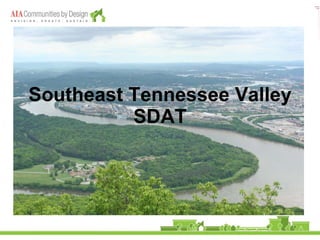
IN 2005 the Center delivered 6 SDATs in communities located across the country. Cache Valley, UT Forest City, NC Pittsfield, MA Oklahoma City, OK Northampton, MA Alexandria Twp., NJ IN 2006 the Center continued to encourage this regional diversification, delivering an additional 8 SDATs for a total of 14 in just 18 months (between May 2005 and November 2006) Longview, WA; Guemes Island, WA; Northern Nevada; Lawrence, KS; Northeast Michigan; Syracuse, NY; New Orleans, LA; Hagerstown, MD
Multidisciplinary expertise – While architecture is obviously an important component of each SDAT, team members represent a broad spectrum of expertise and disciplines. LA, ecologists, air quality experts, historic preservationists, economic development experts, and a number of other fields have been represented. To date, over 20 disciplines have participated in SDATs, a number that will surely continue to grow. Objectivity – Team members come from outside the community in question, usually outside the region and the state of the community. By pulling people in from all over the country, we ensure that the team approaches the community with a clear and objective vision, without a predetermined bias or emotional attachment. Community participation – The team’s recommendations are developed using the information given to them by the community. The SDAT is for the community; by encouraging as much community and public participation as possible
Ratio of annual runoff in the Los Angeles River at Firestone Blvd. to annual ppt at the Los Angeles Civic Center. As urbanization as proceeded in Los Angeles, so has runoff relative to rainfall increased, from a low of 5% in the 20’s to at least 50%.
Home > About Us > Overview > History of CBP History of the Bay Program The Chesapeake Bay was the nation's first estuary targeted by Congress for restoration and protection. Since the formation of the Chesapeake Bay Program in the 1980s, Bay Program partners have signed several agreements to reduce pollutants into the Bay and restore its living resources. In addition to these agreements, each year the Chesapeake Executive Council meets to reaffirm its commitment to Bay restoration. New policy documents are signed annually to address emerging issues or new opportunities. Early History and Formation of CBP In the late 1970s, U.S. Senator Charles “Mac” Mathias (R-Md.) sponsored a congressionally funded $27 million, five-year study to analyze the rapid loss of living resources that was devastating the Bay. The study identified an oversupply of nutrients as the main source of the Bay's degradation. The publication of these initial research findings in the early 1980s led to the creation of the Chesapeake Bay Program as the means to restore this exceptionally valuable resource. The Chesapeake Bay Agreement of 1983 The original Chesapeake Bay Agreement , a simple, one-page pledge by the partners to work together to restore the Bay, was signed in 1983 by the group that later became known as the Chesapeake Executive Council. The members of the Executive Council are: The governors of Maryland , Virginia and Pennsylvania . The mayor of the District of Columbia . The administrator of the U.S. Environmental Protection Agency . The chairman of the Chesapeake Bay Commission , a tri-state legislative body.
While many people know that “sprawl is bad,” what are the core issues that make sprawl so undesirable? Consumptive of Land: Sprawl continues to spread across formerly rural areas, converting open space and sensitive lands into new housing and shopping centers. Blandness: the high development and infrastructure costs involved in building on the fringe results in low quality construction, and the “cookie cutter” homes that no one seems to care for. These subdivisions lack the basic elements that a neighborhood need in order to develop into a true community with a distinct character. Inherently inefficient: Disconnected roads create interior roads that are largely unused, while funneling all traffic onto a few arterials that become overloaded, congested, and require expensive maintenance. Suburban roads are designed to be confusing, making wayfinding in sprawl development patterns difficult. Mandatory car use for every trip adds further cost to both the private and public sectors, even for the shortest of trips. Fiscally unsustainable: The largest costs to municipalities for new developments is extension of utility lines and streets. Further maintenance of these facilities are becoming less and less feasible for city budgets. Levels of service for other needs, such as police, fire, and schools are reduced for everyone when sprawl continues. Cost per unit to the city increases substantially in sprawl developments compared to connected communities. Socially and economically segregating: Separates citizens into distinct socioeconomic groups. Suburbs are designed primarily for motorists, marginalizing those who are too young to drive, too old to drive, or unable to drive for other reasons (nearly 1/3 of the population). Safety: Wide residential streets in sprawl developments have higher fatality rates than narrower, traditional streets, due to higher design speeds. Emergency response times are much slower in cul-de-sac type development. Single use developments used for only part of the day (housing subdivisions, office parks, malls) are less safe during off hours with no “eyes on the street.” Unhealthy: Numerous studies have looked at the link between obesity and sprawl style development. Suburbs discourage walking, often making walking unsafe, uncomfortable, or impossible. With mandatory car use, air quality is also negatively affected by sprawl.
Traditional Development is the way that towns and cities have developed for centuries. Suburban style of development with separated uses has only been happening for the last 50 years. There is now a growing consensus that traditional development patterns are functionally better than more auto-centric development. These time-tested principles are simple and easily applied to any scale of development. Traditional development is based on just a few concepts that plan for a diversity of uses, users, connections, and choices. Sprawl style development does the opposite: reduces the number of choices, reduces the number of connections, and creates large pods of one kind of use and user.
The Center: Each neighborhood has a clear center, focused on the common activities of commerce, culture, and governance. With a defined center, you have a community “heart” around which people gather both psychologically and physically. With many suburban cities that have developed over the last 50 years, all these uses have been scattered “no place in particular” and are now trying to create centers where the community heart can be. What is a Village Square? A place to locate community services Church School Neighborhood services Parks and plazas A community gathering place From the beginning of the Plat of Zion plan Joseph Smith planned three sections of land to be used for public buildings, and more specifically, temples for a “center of worship.” (Richard Bushman 2005) Support at the center served the well-being of the people through providing a physical, psychological, and sociological framework on the very basic levels of attachment and connection. The concept of three squares in the center, the placement of public buildings on those squares – providing for goods and services – and, the inclusion of temples (the symbol of the faith that would require the sacrifice of all things and in some cases their lives) that would create attachment for the people, all surrounded by homes with a random distribution between the wealthy and the poor (and only seven blocks by seven blocks before the pattern was to repeat again) was brilliant and inspired. Smith’s plan was not only “mixed use,” it was “mixed socio-economic status” and consequently had enormous potential to accommodate and encourage diversity.
2. The Five Minute Walk: Most people are willing to walk ¼ mile or less to reach a school/church/commercial area. “Walkable” areas are defined as those areas that provide a wide number of options within ¼ mile. With the original 1833 Plat of Zion plan, nearly 75% of the town was within a short, 5-minute walk of the center blocks. Planning the city around these village centers will serve to concentrate needed services in defined areas, creating distinct districts with differing character.
Developing more, smaller parks is a bit harder for cities in the short term. Developing one large, easily maintained park is much cheaper to maintain for a city than for many smaller parks; however, fewer people will use a park if they have to get in a car to drive to it. We are much more likely to use our neighborhood park, small though it may be, than to travel to a larger, more desirable park. A small neighborhood park, within walking distance of many people, will be used at different times of the day and week. A park that is used is a self-sustaining amenity. If most people are walking to a park, the city doesn’t have to invest as much in parking facilities, and more land and money can be spent in providing quality park space, rather than another parking lot. Also, a park that is regularly used drives out undesirable elements that have come to be synonymous with many large, infrequently used parks in cities across the country.
Creating a refined network of roads is vital to a functional city. Predictability and legible pathways are important elements of way finding. Pathways create ease of flow and are simple to extend.
VW not a
Bring training to where the people are Regional effort with local programs. Identifying neighborhoods where they are needed. Multiple delivery methods Flexible and accessibility Range of skills, and industries – not just VW jobs and related.
not enough on its own. Engaging residents as a means for education
Way of
environmental education as a formal part of the curriculum state level requirements
Without community involvement in planning decisions

![[object Object],Center for Communities by Design](data:image/gif;base64,R0lGODlhAQABAIAAAAAAAP///yH5BAEAAAAALAAAAAABAAEAAAIBRAA7)