

Recomendados
Mais conteúdo relacionado
Semelhante a Eops 2012 02_27
Semelhante a Eops 2012 02_27 (20)
Mais de Christopher Krembs
Mais de Christopher Krembs (20)
Último
Último (20)
Eops 2012 02_27
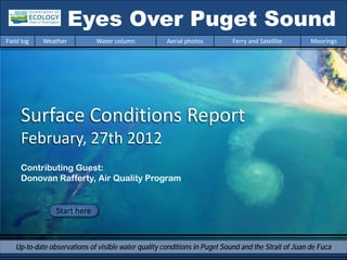
- 1. Eyes Over Puget Sound Field log Weather Water column Aerial photos Ferry and Satellite Moorings Surface Conditions Report February, 27th 2012 Contributing Guest: Donovan Rafferty, Air Quality Program Start here Up-to-date observations of visible water quality conditions in Puget Sound and the Strait of Juan de Fuca
- 2. Marine Conditions from Feb. 27, 2012 at a Glance Field log Weather Water column Aerial photos Ferry and Satellite Moorings Personal flight impression p. 3-4 LONG-TERM MARINE MONITORING UNIT We got a sunny day and are testing Mya Keyzers an ozone sampler. Laura Friedenberg Weather conditions p. 7 Little sunshine, cold air temperatures, and higher river flows in the second part of Skip Albertson February. Aerial photography p. 8-27 Dr. Christopher Freshwater plumes extend far into the Krembs waterways. First blooms begin in South Sound. Ferry and satellite p. 28-29 Dr. Brandon Chilly surface temperatures and pulses of high Sackmann CDOM waters in Central Sound. In-situ mooring data p. 30 David Mora A thinner freshwater layer at Mukilteo reflects a low discharge of the Snohomish river. Previous Eyes Over Puget Sound reports: www.ecy.wa.gov/programs/eap/mar_wat/eops/
- 3. Personal flight impression 2-27-2012 Field log Weather Water column Aerial photos Ferry and Satellite Moorings Marine Flight 4 (South Sound) The weather this month made getting our last flight out very unpredictable. Luckily, there was a break in the weather on Monday and we were able to get it done. It turned out to be a stellar day for sampling! It was clear with some sun but cold with wind 10kts or below. Everything was working great (including field crew) and we successfully worked our way through all 10 stations. The Olympics looked particularly gorgeous with a Mya and Laura ready to go! dusting of snow in the foothills. We started a new collaboration this month with Donovan Rafferty from Ecology’s Air Quality Program. We will be taking his ozone analyzer along on flights to sample the air we pass through looking for ozone plumes. Ozone in the lower atmosphere is a pollutant and also acts as a greenhouse gas. It can cause eye and respiratory tract irritation, as well as damage to plants by inhibiting photosynthesis and growth. Monitoring for ozone can help us understand where it comes from and in what concentrations. Donovan has rigged up a special box to hold the ozone sensor, a fan, a battery pack and a GPS unit. A GPS receiver is strung through to the Olympic Mountains near Lilliwap front window of the plane and tubing which connects to the analyzer is threaded out of the cabin vent to “sniff” and gather data. We are in the testing phase right now. We want to be ready to collect quality data this summer when ozone plumes can be found in our more urban areas. Collaborations like this provide more data for the public and managers without additional costs. It also makes our time in the plane even more valuable and expands the contextual envelope for our own data. A sharp clam shell gave us yet another flat tire!
- 4. Personal flight impression 2-27-2012 Field log Weather Water column Aerial photos Ferry and Satellite Moorings Donovan (Air Quality Program, Ecology) and Joe (pilot, Kenmore Air) getting the ozone analyzer set up Algal mats in Nisqually Instruments and intake tubing Intake tubing for analyzer GPS receiver
- 5. Donovan Rafferty, Air Quality Program Field log Weather Water column Aerial photos Ferry and Satellite Moorings A C Guest: Donovan Rafferty Seasonally, elevated ozone concentrations occur in the Puget Sound Basin. At the ground they can affect public and environmental health. B •Air quality models forecast high concentrations near the San Juan Islands. •Placing a portable ozone analyzer on marine flights can test and verify ozone model predictions. Donovan assembles the portable ozone analyzer (A) and installs GPS (B) and tubes for the air intake (C) •We are currently testing the ozone monitoring on board the float plane. package on marine flights to prepare for summer measurements over the Central Salish Sea. The instrument is turned on and continuously records ozone concentrations, position, and altitude Many thanks to the Marine Monitoring Unit and during the routine marine flight. This saves resources Kenmore Air pilot Joe. and time.
- 6. New Flight and Stations for the year 2012 Field log Weather Water column Aerial photos Ferry and Satellite Moorings Flight and Station Maps 2012 New sites for 2012 Port Gamble (PGA001) - This site was last visited in 2001. It was considered impaired for DO and bacteria in previous water quality assessments and has undergone sediment remediation activities. Port Madison (PMA001) - Sampled most recently in 1995, this location has had several improvements & shellfish harvest has recently been restored in this bay. Eagle Harbor (EAG001) - A super-fund site, this location has been part of clean-up efforts conducted by EPA and WSDOT at a ferry maintenance site.
- 7. Weather of the last two weeks of Feb., 2012 Field log Weather Water column Aerial photos Ferry and Satellite Moorings Meteorological conditions typically explain up to half of the variance in observed marine variables (Moore et al. 2008), particularly in shallower waters like those of South Puget Sound. I summarized the specific conditions prevalent during the past two weeks, from north to south. Source: http://www-k12.atmos.washington.edu/k12/grayskies/nw_weather.html Summary: Air temperatures during the past few days have been increasingly colder than expected. This follows a weak warm spell a week ago. Sunshine has been very low except on the day of the marine flight. Rivers have been running above normal for the past week. Winds have been predominantly from the SE in the north, to the SW in the south. Moore et al. 2008. Local and large-scale climate forcing of Puget Sound oceanographic properties on seasonal to interdecadal timescales. Limnol. Oceanogr., 53(5), 1746–1758
- 8. Summary: Aerial Photography 2-27-2012 Field log Weather Water column Aerial photos Ferry and Satellite Moorings River plumes extend largely into Central Basin. Some jellyfish aggregations persist in Budd Inlet. South Sound has first signs of algae blooms. Start here Eddy north of McNeil Island 4:20 PM Mixing and Fronts: 2 5 8 9 10 11 12 Front Commencement Bay, Blake Island, Central Basin Dana Passage 14 15 Plume Suspended sediment: 1 2 6 9 10 11 Extensive in Central Basin and Commencement Bay and near major river estuaries. 12 14 Collaborating with Air Quality, (Ecology) Bloom Visible blooms: 6 7 South Budd Inlet and Henderson Inlet Debris 1 2 3 4 7 8 11 Debris South Sound: West of Harstine Island, Dana Passage Central Basin: Off Shilshole Bay
- 9. Field log Weather Water column Aerial photos Ferry and Satellite Moorings Aerial photography image guide 15 1 14 Flight Information: 13 2 10 Morning flight: Freezing temperature 3 9 High visibility but de-icing 4 12 Left residue on window 11 8 5 Evening flight: High visibility, altitude 2500ft 7 Observational maps (AM) 6 Observational maps (PM)
- 10. 1 Aerial photography Navigate Field log Weather Water column Aerial photos Ferry and Satellite Moorings Plume along shore. Location: Bremerton, Sinclair Inlet, 8:28 AM
- 11. 2 Aerial photography Navigate Field log Weather Water column Aerial photos Ferry and Satellite Moorings Plume Front, debris line and plume. Location: Harstine Island, Case Inlet 8:31 AM
- 12. 3 Aerial photography Navigate Field log Weather Water column Aerial photos Ferry and Satellite Moorings Debris Debris near Harstine Island Bridge. Location: West of Harstine Island (South Sound) 8:40 AM
- 13. 4 Aerial photography Navigate Field log Weather Water column Aerial photos Ferry and Satellite Moorings Debris Debris line. Location: West of Squaxin Island (South Sound) 8:41 AM
- 14. 5 Aerial photography Navigate Field log Weather Water column Aerial photos Ferry and Satellite Moorings Debris line. Location: Dana Passage (South Sound), 8:44 AM
- 15. 6 Aerial photography Navigate Field log Weather Water column Aerial photos Ferry and Satellite Moorings Plume Bloom Beginning bloom. Location: Near Swantown Marina, Budd Inlet (South Sound), 8:46 AM
- 16. 7 Aerial photography Navigate Field log Weather Water column Aerial photos Ferry and Satellite Moorings Bloom First signs of an algal bloom. Location: Henderson Inlet (South Sound), 4:10 PM
- 17. 8 Aerial photography Navigate Field log Weather Water column Aerial photos Ferry and Satellite Moorings Front Bloom Algal bloom and weak front. Location: Henderson Inlet (South Sound), 4:15 PM
- 18. 9 Aerial photography Navigate Field log Weather Water column Aerial photos Ferry and Satellite Moorings Eddy Eddy with suspended sediment. Location: McNeil Island (South Sound), 4:20 PM
- 19. 10 Aerial photography Navigate Field log Weather Water column Aerial photos Ferry and Satellite Moorings Front Front north of Tacoma Narrows. Location: Gig Harbor (Central Sound), 4:21 PM
- 20. 11 Aerial photography Navigate Field log Weather Water column Aerial photos Ferry and Satellite Moorings Plume Plume River plume west of Tacoma. Location: Vashon Island (Central Sound), 4:22 PM
- 21. 12 Aerial photography Navigate Field log Weather Water column Aerial photos Ferry and Satellite Moorings Front Plume Plume Front and river plume. Location: Entrance to Quartermaster Harbor, Vashon Island (Central Sound), 4:23 PM
- 22. 13 Aerial photography Navigate Field log Weather Water column Aerial photos Ferry and Satellite Moorings Bloom Beginning algal bloom. Location: Quartermaster Harbor 4:28 PM
- 23. 14 Aerial photography Navigate Field log Weather Water column Aerial photos Ferry and Satellite Moorings mixing Front . Location: Near Blake Island (Central Sound), 4:36 PM
- 24. 15 Aerial photography Navigate Field log Weather Water column Aerial photos Ferry and Satellite Moorings Front stretching in direction of Edmonds. Location: Off Carkeek Park (Seattle), 4:39 PM
- 25. Field log Weather Water column Aerial photos Ferry and Satellite Moorings Aerial photography observations in Central Sound Navigate Date: 2-27-2012 Morning Evening 15 1 14 13 10 11 12 Numbers on map refer to picture numbers for spatial reference
- 26. Field log Weather Water column Aerial photos Ferry and Satellite Moorings Navigate 3 Morning 4 2 Aerial 5 photography 6 Observations in South Sound: 2-27-2012 9 Evening 8 7 Numbers on map refer to picture numbers for spatial reference
- 27. Field log Weather Water column Aerial photos Ferry and Satellite Moorings Legend to map annotations Navigate Comments: Maps are produced by observers during and after flights. They are intended to give an approximate reconstruction of the surface conditions on scales that connect to and overlap with satellite images in the section that follows.
- 28. Daily ferry and satellite observations in Central Sound, 2-27-2012 Field log Weather Water column Aerial photos Ferry and Satellite Moorings Contact: brandon.sackmann@ecy.wa.gov 26 Feb 26 Feb Current Conditions: Localized areas of high colored dissolved organic material (associated with higher river flows); surface temperatures are 7-8 °C throughout Central Sound and the Strait of Juan de Fuca. --- Daily ‘Quick-Look’ Products Available --- MERIS True Color image used for spatial context (19 February (http://www.ecy.wa.gov/programs/eap/mar_wat/eops/clipper.ht 2011). Image is not coincident with ferry data shown on right ml)
- 29. Field log Weather Water column Aerial photos Ferry and Satellite Moorings CDOM fluorescence as an indicator of freshwater influence in Central Sound A primary source of Colored Dissolved Organic Matter (CDOM) to Puget Sound is from rivers. Pulses of colored water have been seen making their way from Whidbey Basin into Central Puget Sound, associated with recent rainfall and high river flows.
- 30. Mooring observation and trends Field log Weather Water column Aerial photos Ferry and Satellite Moorings Go to our mooring site at: http://www.ecy.wa.gov/programs/eap/mar_wat/moorings.html Summary: On February 19 the freshwater layer thickness was low reflecting the Snohomish discharge minimum (see previous page). The mooring report is currently limited to describing the thickness of the freshwater layer between Whidbey Basin and Central Basin. Daily average depth of the 28.55 isohaline at Mukilteo We track the depth of the isohaline 28.55 (±0.05) and measure the thickness of the freshwater layer at our Mukilteo station. The sensor experiences tidal pressure variations of 11.8 to 15.6 dbar. Real-time data online (click)
- 31. Field log Weather Water column Aerial photos Ferry and Satellite Moorings Get your data from Ecology’s Environmental Assessment Program Long – Term Real – Time Monitoring Network Sensor Network Ecology’s long-term marine monitoring stations Aerial survey: Ferry and satellite : ftp://www.ecy.wa.gov/eap brandon.sackmann@ecy.w /Flight_Blog/ a.gov Ferry track Morning flight Evening flight Access core Access mooring monitoring data: Freshwater Report: ftp://ecy.wa.gov/eap/Freshwater data: http://www.ecy.wa.gov/a http://www.ecy.wa.gov/pr Report/Ambient_Monitoring- pps/eap/marinewq/mwda ograms/eap/mar_wat/mo Monthly_Summary.html taset.asp orings.html
- 32. Field log Weather Water column Aerial photos Ferry and Satellite Moorings You may subscribe or unsubscribe to the Eyes Over Puget Sound email listserv by going to: http://listserv.wa.gov/cgi-bin/wa?A0=ECOLOGY-EYES-OVER-PUGET-SOUND We are looking for feedback to improve our products. Dr. Christopher Krembs ckre461@ecy.wa.gov Marine Monitoring Unit Environmental Assessment Program WA Department of Ecology Many thanks to our business partners: Clipper Navigation, Swantown Marina and Kenmore Air.