

Recomendados
Recomendados
Mais conteúdo relacionado
Mais procurados
Mais procurados (20)
Destaque
Semelhante a Typhoon pablo bopha activation
Semelhante a Typhoon pablo bopha activation (20)
Mais de Catherine Graham
Mais de Catherine Graham (9)
Último
Último (20)
Typhoon pablo bopha activation
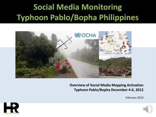
- 1. Social Media Monitoring Typhoon Pablo/Bopha Philippines Overview of Social Media Mapping Activation Typhoon Pablo/Bopha December 4-6, 2012 February 2013
- 2. Pacific Endeavor Knowledge Management August 15, 2012 Presented by Cat Graham In 2011 volunteers contributed over 17,000 hours of service. In 2012 they monitored over 300 events in 56 countries participated in, helped develop or execute over a dozen exercises or experiments that included social media and online crisis mapping. “The volunteers of Humanity Road are doing a superb job of providing useful and actionable advice to disaster affected communities, both before and after disasters strike."– Gisli Olafsson, ICE-SAR Team Leader (NetHope) Global 501c3 NGO public charity Digital Disaster Response About Humanity Road A few folks we have worked with and supported Humanity Road in the News
- 3. On Wednesday, December 5th Humanity Road received a request to activate on behalf of UNOCHA via the Digital Humanitarian Network (DHN). Since our volunteer network had been monitoring social media prior to activation, we had already collected information in advance of activation. The DHN joint solution determined to activate both Humanity Road and the Standby Taskforce. The focus for Humanity Road volunteers was the collection and input of reports that were generated prior to December 5th. In order to provide a joint response that is seamless, volunteers submitted reports into a crisis map provided by Standby Volunteer Taskforce volunteers. This streamlined workflow, the team further separated focus of resources on particular dates for data mining to improve efficiency of joint resource. The solution team was given 12 hours to produce a data set for UN OCHA Coordinated Assessment Support Section (CASS) in Geneva. The resulting output assisted UN OCHA CASS in creating a situational report and the dataset was utilized by the Google Crisis team as an overlay into their Crisis Map. The following outlines the timeline and outputs for this groundbreaking activation. Typhoon Pablo/Bopha – Overview
- 4. About The Digital Humanitarian Network “The purpose of the Digital Humanitarian Network (DHNetwork) is to leverage digital networks in support of 21st century humanitarian response. More specifically, the aim of this network-of-networks is to form a consortium of Volunteer & Technical Communities (V&TCs) and to provide an interface between formal, professional humanitarian organizations and informal yet skilled-and-agile volunteer & technical networks. http://digitalhumanitarians.com/ “ HR SBTF GW OB HOT SWB GISC Corp Map A TWB DK ESRI UNV
- 5. Typhoon Pablo/Bopha - Activations Wed Dec 3 - 4 Humanity Road monitoring event Situation Report Humanity Road Volunteers mobilized early on December 3, 2012 monitoring the Typhoon for emerging impacts. Volunteers from Urgent Needs and Animals in Disaster team deployed online to monitor and collect emerging impacts and support urgent needs. The team was geospatially distributed from Vienna, Germany, USA, and New Zealand. Our situation report was released early on December 4 and another one posted on December 5 summarizing the destruction in Cateel. Wed Dec 3 - 4 Hashtags identified included #bopha, #pablo, #typhoon, #pa bloPH, #bophaPH, #Philippines , #Mindanao, #Visayas, #Hinatu an, #CDO (Cagayan de Oro), #walangpasok (school cancellations), #reliefPH, rescu ePH, #pablosafetytips
- 6. Typhoon Pablo/Bopha DHN Activation Report Map Thu Dec 6 Wed Dec 5 Wed Dec 4 Humanity Road is monitoring event UN OCHA activates DH Network, DHN deploys Humanity Road and Standby Task Force Content was collected into Ushahidi platform which was pulled into several output formats & Delivered Thursday morning The United Nations Office for the Coordination of Humanitarian Affairs (OCHA) activated the Digital Humanitarian Network (DHN) on December 5th at 3pm Geneva time (9am New York). The deployment team was given 12 hours to complete the project
- 7. Social Media Message Volunteer Crisis Team Requesting Official Dateline Philippines Cateel & Boston hardest Hit areas Social Media Crisis Map Brought to you by Typhoon Pablo/Bopha – Collection The activation requested to collect all relevant tweets about Typhoon Pablo posted on December 4th and 5th; identifying pictures and videos of damage/flooding shared in those tweets; geo-locate, time-stamp and categorize this content. Volunteer network coordinated by DHN was supported by Humanity Road and Stand-by Volunteer Task Force (SVTF). The team then provided the database at 5am Geneva time the following day. Information was categorised in sixteen categories. Over 20,000 feeds were scanned filtering 122 unique data items. Wed Dec 5
- 8. Typhoon Pablo/Bopha- Outputs The DHN Team provided the database at 5am Geneva time the following day on Dec 6. The UN OCHA Coordinated Assessment Support Section in Geneva compiled Social Media Map and Report using the data. Subsequently the data was imported into Google Crisis Response Map as a data layer and NetHope utilized the situation report as well in their report issued December 6 Wed Dec 6
- 9. Typhoon Pablo/Bopha - NetHope Reports NetHope utilized the information, Pulling from the initial HR Situation report For their NetHope Situation report #1 Issued Dec 6
- 10. Typhoon Pablo/Bopha- Google Crisis Map Reports The Google Crisis Organization exported the data from the crisismap as a layer. The crisis map, available in Filipino, shows the typhoon track, landslide- and flood-prone areas, areas under public storm warning signals, and other important information about the disaster. (Source)
- 11. Typhoon Pablo/Bopha- UN OCHA Report Page 1 UN OCHA Coordinated Assessment Support Section in Geneva compiled Social Media Report using the database provided to them. Reports
- 12. Typhoon Pablo/Bopha- UN OCHA Report Page 2 Reports
- 13. Typhoon Pablo/Bopha- UN OCHA Report Page 3 Reports
- 14. Typhoon Pablo/Bopha- UN OCHA Report Page 4 Reports
- 15. “… assessment results after a disaster determine the future and scope of the relief efforts and directly impact the affected population. The results of this exercise will also contribute to on-going work …. in the Philippines with regards to Communication with Disaster Affected Communities (CDAC). This allows humanitarian actors to establish two way communication with affected communities, increasing affected communities involvement in decision making process” On behalf of United Nations Office for the Coordination of Humanitarian Affairs, I would like to take a moment to thank Humanity Road, Stand-by Volunteer Task Force (SVTF), DHNetwork and ….UN OCHA ISS for job well done” December 9, 2012 From a letter of thanks addressed to the Digital Humanitarian Network, and deployed team Humanity Road, Standby Volunteer Task Force
- 16. Brought to you by www.humanityroad.org Driven by Need, Led by Experience, Powered by Volunteers.