
Recomendados
Recomendados
Mais conteúdo relacionado
Mais procurados
Mais procurados (9)
Semelhante a Ecohydrodynamics of cold-water coral reefs
Semelhante a Ecohydrodynamics of cold-water coral reefs (20)
Mais de Heriot-Watt University
Mais de Heriot-Watt University (17)
Último
Último (20)
Ecohydrodynamics of cold-water coral reefs
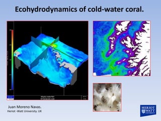
- 1. Ecohydrodynamics of cold-water coral. Juan Moreno Navas. Heriot -Watt University. UK
- 2. Ecohydrodynamics The determination of the hydrodynamic constraints on ecosystems with different time and length scale has been coined by the term Ecohydrodynamics. This concept also encompasses the physical, chemical and biological characteristics of the water bodies surrounding marine ecosystems.
- 3. Ecohydrodynamics of cold-water coral. • The Ecohydrodynamic conditions around the coral reefs determine the supply of food particles and larvae. • The interactions between currents, internal waves, upwellings/donwelllings and the topography creates suitable conditions for the development of suspension-feeding cold water corals. • The lateral and vertical advection of particles may therefore play an important role in the functioning of coral ecosystem. • The suspension-feeding cold-water coral communities rely on the delivery of phytoplankton, zooplankton and organic matter derived from near- surface primary productivity.
- 4. Located to the east of the island of Mingulay in the Sea of Hebrides, UK. Each reef is formed by seabed mounds up to five metres high that likely have been growing since the early Holocene (Roberts et al. 2005). High dynamic area Barra Sea of the Hebrides Mingulay Reef mounds
- 5. Ecohydrodynamics. Sea of the Hebrides (a) (b) (c) Analysis of colour fronts using 23-30 Apr. 2011 MERIS FR composites: (a) Chl-a; (b) enhanced colour; (c) simplified Chl-a front map.
- 6. Ecohydrodynamics. Sea of the Hebrides % Mean all-seasons : (a) thermal fronts; (b) 300m Chl-a fronts; (c) 1km Chl-a fronts
- 7. Ecohydrodynamics of Mingulay Reef complex • Previous studies revealed two dominant food supply mechanisms to the reefs, a regular rapid downwelling of surface water delivering pulses of warm water and periodic advection of high turbidity bottom waters(Davies et al. 2009). • A 3D ocean model has been applied to provide an adequate assessment of the water circulation, water exchange and renewal in the Mingulay Reef complex.
- 8. Mathematical model The Mass and Momentum equations solutions. Momentum equation - x u1 u j u1 1 pa f u2 g dz t x x x1 x Tim e derivative j coriolis z 1 1 barotropic atmospheric advective baroclinic pressure u1 1 S11 z 1 S12 z Kj xj xj x1 x2 turbulent diffusion radiation stresses (waves) Mass equation – 3D Mass equation – 2D U1 U2 D u1 u2 u3 0 0 t x1 x2 t x1 x2 x3
- 9. Initial condition. Vertical & horizontal discretization. Physical parameter Numerical value Time step: 2s Grid mesh: 300, 100m 3D Sigma coordinate with Horizontal cells (x,y): 193, 244 4 layers Vertical coordinate: Sigma Vertical Vertical layers: 8 Horizontal Eddy Viscosity: 4.3810 Vertical Eddy viscosity: 0.001 Drag coefficient: 0.0025 River discharge: No Salinity: 35 psu Temperature: 11c Forced: Tide from FES2004 Horizontal
- 10. Ecohydrodynamics of Mingulay Reef complex 3D ocean model : two different grid resolution. Mingulay 1 A 300 m A B Mingulay 5 100 m animation slices
- 11. 3D ocean model results. Currents are tidally driven Time scale: tidal cycle Lenght scale: 20x20 Km
- 12. 3D ocean model results. High turbulence in the Reefs area. High turbidity bottom waters(Davies et al. 2009). Mingulay 1 Mingulay 5
- 13. 3D ocean model results. Mingulay 1 Mingulay 5
- 14. 3D ocean model results. Mingulay 1
- 15. Downwelling of surface water delivering pulses of warm water. Scanfish data Dmitry Aleynik & Mark Inall (SAMS) Murray Roberts (Heriot-Watt
- 16. 3D ocean model results. Downwelling of surface water delivering pulses of warm water (Davies et al. 2009) and high particle delivery to the bottom every 6 hours.
- 17. 3D ocean model and GIS. This modelled information has been integrated into a 3D GIS Mingulay 1 Mingulay 1 Mingulay 5
- 18. 3D ocean model and GIS. Colour-coded habitat classification map (Roberts et al. 2005) The significant decline in richness with easting (Henry et al 2010)
- 19. Conclusions The model and remote sensing techniques provide the spatial and temporal aspect of water circulation in the reef complex (turbulence, Downwelling). The model will provide better understanding of food supply, larvae transport, community composition and sediment dynamics. This modelled information has been integrated into a 3D GIS, thus providing a user interface for visualization interrogation of results and as an input into other spatial and ecological modeling projects.