SlideShare uma empresa Scribd logo
1 de 9
Ascension Descente Distance Points GPS 
1616 m 1591 m 27 km 2373 
Postes de contrôle : 
TECHNIKA 1 à 8 
Equipe médicale dans les ravitaillements 
secteur 1 : 4 pers. 
Approche pour une ambulance 
secteur 1 : 8 places 
Chemins pédestres = 23 km 
Chemins carrossables = 2 km 
Routes goudronnées = 2 km 
Chemin T3 
Chemin T3 
Chef du secteur 1 : Grégoire Tanniger 
Départ 21h00 
Etivaz 
TRACE GARMIN 
OREGON 600 
Secteur Etivaz/Diablerets 
Ravitaillement 1 
Les Diablerets 
Secteur 1 
Poste de contrôle 
Point d’eau (facultatif) 
Ravitaillement officiel 
Point possible pour extraction en ambulance 
Chemin T3 = chemin de montagne abrupte 
Barrière horaire limite! 
Col du Pillon 3h00 
Ravitaillement des Diablerets 4h30 
Traversée de 
route Cantonale 
Col du Pillon 
Col du Pillon
1250 
1200 
1150 
1100 Départ à 21h00 de 
Ascension Descente Distance Points GPS 
1616 m 1591 m 27 km 2373 
Chef du secteur 1 : Grégoire Tanniger 
1 2 3 4 5 6 7 8 9 10 11 12 13 14 15 16 17 18 19 20 21 22 23 24 25 26 27 
1950 
1900 
1850 
1800 
1750 
1700 
1650 
1600 
1550 
1500 
1450 
1400 
1350 
1300 
1050 
L’ Etivaz 1’100m 
Diablerets ravitaillement 1: 1’150m 
Fenêtre d’Arnon 1’885 m 
Col du Voré 1’912 m 
Col du Pillon 1’550 m 
Postes de contrôle : Chemin T3 = chemin de montagne abrupte 
TECHNIKA 1 à 8 
Chemins pédestres = 23 km 
Chemins carrossables = 2 km 
Routes goudronnées = 2 km 
TRACE GARMIN 
OREGON 600 
Secteur Etivaz/Diablerets 
Secteur 1 
Poste de contrôle 
Point d’eau (facultatif) 
Ravitaillement officiel 
Point possible pour extraction en ambulance 
Equipe médicale dans les ravitaillements 
secteur 1 : 4 pers. 
Approche pour une ambulance 
secteur 1 : 8 places 
Croisement de route principale: 1 
Barrière horaire limite! 
Col du Pillon 3h00 
Ravitaillement des Diablerets 4h30 
Traversée de 
route Cantonale 
Chemin T3 
Chemin T3 
Traversée de 
route Cantonale 
Col du Pillon 
La Cierne Chaubert 1’360 m 
Lac d’ Arnon 1’540 m 
Près Jordan 1’730 m 
Pont d’ Aigue Noire 1’200m
Ascension Descente Distance Points GPS 
1770 m 1155 m 19,5 km 1720 
Chef du secteur 1 : Grégoire Tanniger 
Chef du secteur 2 : Georges Sanga 
Chemins pédestres = 17,5 km 
Chemins carrossables = 1 km 
Routes goudronnées = 1 km 
TRACE GARMIN 
OREGON 600 
Secteur Diablerets/ la Pare & Marnèche 
Ravitaillement 1 
Les Diablerets 
Ravitaillement 2 
La Marnèche 
Chef du secteur 1 : Grégoire Tanniger 
Chef du secteur 2 : Georges Sanga 
Secteur 2 
Postes de contrôle : 
TECHNIKA 8 à 11 
Equipe médicale dans les Ravitaillements 
secteur 1 & 2 : 4 pers. 
Approche pour une ambulance 
secteur 1 & 2 : 4 places 
Chemin T3 
Chemin T3 
Barrière horaire limite! 
Sommet de la Pare 9h00 
Ravitaillement de la Marnèche 10h30 
Poste de contrôle 
Point d’eau (facultatif) 
Ravitaillement officiel 
Point possible pour extraction en ambulance 
Traversée de la RC 
Pont Bourquin 
Secteur 1
Secteur Diablerets/ la Pare & Marnèche 
2600 
2500 
2400 
2300 
2200 
2100 
2000 
1900 
1800 
1700 
1600 
1500 
1400 
1300 
1200 
1100 
1000 
La Pare 2’540 m 
La Palette 2’170 m 
Ascension Descente Distance Points GPS 
1770 m 1155 m 19,5 km 1720 
Col Des Andérets 2’030m 
Col de Seron 2’153m 
TRACE GARMIN 
OREGON 600 
Secteur 1 Secteur 2 
Chef du secteur 1 : Grégoire Tanniger 
Chef du secteur 2 : Georges Sanga 
Barrière horaire limite! 
Sommet de la Pare 9h00 
Ravitaillement de la Marnèche 10h30 
Ravitaillement des Diablerets 1’150m Ravitaillement de la Marnèche 1’800 m 
1 2 3 4 5 6 7 8 9 10 11 12 13 14 15 16 17 18 19 19,5 
Chemins pédestres = 17,5 km 
Chemins carrossables = 1 km 
Routes goudronnées = 1 km 
Poste de contrôle 
Point d’eau (facultatif) 
Ravitaillement officiel 
Point possible pour extraction en ambulance 
Postes de contrôle : 
TECHNIKA 8 à 11 
Equipe médicale dans les ravitaillements 
secteur 1 & 2: 4 pers. 
Approche pour une ambulance 
secteur 1 & 2: 4 places 
Croisement de route principale: 1 
Chemin T3 = chemin de montagne abrupte 
Traversée de la RC 
Pont Bourquin 
Traversée de la RC 
Pont Bourquin 
Chemin T3 
Chemin T3
Ascension Descente Distance Points GPS 
828 m 1191 m 14,5 km 2373 
Chemins pédestres = 14km 
Chemins carrossables = 0 km 
Routes goudronnées = 0,5 km 
Ravitaillement 2 
La Marnèche 
Ravitaillement 3 
Col des Mosses 
Chemin T3 
TRACE GARMIN 
OREGON 600 
Secteur Marnèche /Mosses 
Secteur 2 
Secteur 3 
Chef du secteur : 2 Georges Sanga 
Chef du secteur : 3 Fabrice Mermoud 
Postes de contrôle : 
TECHNIKA 11 à 16 
Equipe médicale dans les ravitaillements 
secteur 1 & 2: 5 pers. 
Approche pour une ambulance 
secteur 2 & 3 : 3 places 
Poste de contrôle 
Point d’eau (facultatif) 
Ravitaillement officiel 
Point possible pour extraction en ambulance 
Barrière horaire limite! 
Sommet du Pic Chaussy 12h00 
Chemin T3 = chemin de montagne abrupte
2350 
2300 
2250 
2200 
2150 
2100 
2050 
2000 
1950 
1900 
1850 
1800 
1750 
1700 
1650 
1600 
1550 
1500 
1450 
1400 
1350 
Pic Chaussy 2’330 m 
TRACE GARMIN 
OREGON 600 
Secteur Marnèche/Mosses 
Ascension Descente Distance Points GPS 
828 m 1191 m 14,5 km 2373 
Lac Lioson 1’900 m 
Ravitaillement de la Marnèche 1’800 m 
Ravitaillement Les Mosses : 1’450 m 
Secteur 2 Secteur 3 
Chef du secteur : 2 Georges Sanga 
Chef du secteur : 3 Fabrice Mermoud 
Barrière horaire limite! 
Sommet du Pic Chaussy 12h00 
1 2 3 4 5 6 7 8 9 10 11 12 13 14 14,5 
Chemins pédestres = 14km Poste de contrôle 
Chemins carrossables = 0 km 
Point d’eau (facultatif) 
Ravitaillement officiel 
Point possible pour extraction en ambulance 
Routes goudronnées = 0,5 km 
Postes de contrôle : 
TECHNIKA 11 à 16 
Equipe médicale dans les Ravitaillements 
secteur 1 & 2: 5 pers. 
Approche pour une ambulance 
secteur 2 & 3 : 3 places 
Chemin T3 = chemin de montagne abrupte 
Chemin T3 
Les Semeleys 1’820 m 
Vers les petits lacs 1’970 m
Chemins pédestres = 16 km 
Chemins carrossables = 7 km 
Routes goudronnées = 3 km 
Postes de contrôle : 
TECHNIKA 16 à 26 
Equipe médicale dans les ravitaillements 
secteur 3 : 7 pers. 
Approche pour une ambulance 
secteur 3 : 7 places 
Poste de contrôle 
Point d’eau (facultatif) 
Ravitaillement officiel 
Point possible pour une ambulance 
Bord de la RC 
Contour de la Borne 
Traversée RC 
Caserne Lécherette 
TRACE GARMIN 
OREGON 600 
Secteur Mosses/Etivaz 
Ravitaillement 4 
La Rechargère 
Ravitaillement 3 
Col des Mosses 
ARRIVEE / ETIVAZ 
Barrière horaire limite! 
T 18 En Cuixon : T 18 13h45 !!! 
Chef du secteur : Fabrice Mermoud 
Barrière horaire limite! 
Les Ecrouvignes 17h00 
Ravitaillement de la Rechargère 18h00 
Contour de la Borne 18h30 
ARRIVEE 20h00 
Ascension Descente Distance Points GPS 
1’270 m 1’550 m 26 km 1’451
Chef du secteur : Fabrice Mermoud 
Départ Les Mosses : 1’450 m Arrivée L’Etivaz : 1’140 m 
26.0 4 
Petit Praz Cornet : 1’668 m 
Les Ecrouvignes : 1,660 m 
Ravitaillement de la Rechargère : 1,225m 
0 1 2 3 4 5 6 7 8 9 10 11 12 13 14 15 16 17 18 19 20 21 22 23 24 25 
Chemins pédestres = 16 km 
Chemins carrossables = 7 km 
Routes goudronnées = 3 km 
Bord de la RC 
Contour de la Borne 
TRACE GARMIN 
OREGON 600 
Secteur Mosses/Etivaz 
Postes de contrôle : 
TECHNIKA 16 à 26 
Equipe médicale dans les ravitaillements 
secteur 3 : 7 pers. 
Approche pour une ambulance 
secteur 3 : 7 places 
Croisement de route principale: 2 
Poste de contrôle 
Point d’eau (facultatif) 
Ravitaillement officiel 
Point possible pour extraction en ambulance 
Barrière horaire limite! 
Les Ecrouvignes 17h00 
Ravitaillement de la Rechargère 18h00 
Contour de la Borne 18h30 
ARRIVEE 20h00 
Secteur 3 
Traversée RC 
Caserne Lécherette 
Traversée de 
route Cantonale 
Barrière horaire limite! 
En Cuixon : T 18 13h45 !!! 
T 18 
Ascension Descente Distance Points GPS 
1’270 m 1’550 m 26 km 1’451 
Col de Sonlomont 1’505 m 
La Cierne 1’200 m 
Les Chargiaux 1’110 m 
Commun de l’Hongrin 1’470 mm

Mais conteúdo relacionado

Destaque

2024 State of Marketing Report – by Hubspot
2024 State of Marketing Report – by Hubspot2024 State of Marketing Report – by Hubspot
2024 State of Marketing Report – by HubspotMarius Sescu
 
Everything You Need To Know About ChatGPT
Everything You Need To Know About ChatGPTEverything You Need To Know About ChatGPT
Everything You Need To Know About ChatGPTExpeed Software
 
Product Design Trends in 2024 | Teenage Engineerings
Product Design Trends in 2024 | Teenage EngineeringsProduct Design Trends in 2024 | Teenage Engineerings
Product Design Trends in 2024 | Teenage EngineeringsPixeldarts
 
How Race, Age and Gender Shape Attitudes Towards Mental Health
How Race, Age and Gender Shape Attitudes Towards Mental HealthHow Race, Age and Gender Shape Attitudes Towards Mental Health
How Race, Age and Gender Shape Attitudes Towards Mental HealthThinkNow
 
AI Trends in Creative Operations 2024 by Artwork Flow.pdf
AI Trends in Creative Operations 2024 by Artwork Flow.pdfAI Trends in Creative Operations 2024 by Artwork Flow.pdf
AI Trends in Creative Operations 2024 by Artwork Flow.pdfmarketingartwork
 
PEPSICO Presentation to CAGNY Conference Feb 2024
PEPSICO Presentation to CAGNY Conference Feb 2024PEPSICO Presentation to CAGNY Conference Feb 2024
PEPSICO Presentation to CAGNY Conference Feb 2024Neil Kimberley
 
Content Methodology: A Best Practices Report (Webinar)
Content Methodology: A Best Practices Report (Webinar)Content Methodology: A Best Practices Report (Webinar)
Content Methodology: A Best Practices Report (Webinar)contently
 
How to Prepare For a Successful Job Search for 2024
How to Prepare For a Successful Job Search for 2024How to Prepare For a Successful Job Search for 2024
How to Prepare For a Successful Job Search for 2024Albert Qian
 
Social Media Marketing Trends 2024 // The Global Indie Insights
Social Media Marketing Trends 2024 // The Global Indie InsightsSocial Media Marketing Trends 2024 // The Global Indie Insights
Social Media Marketing Trends 2024 // The Global Indie InsightsKurio // The Social Media Age(ncy)
 
Trends In Paid Search: Navigating The Digital Landscape In 2024
Trends In Paid Search: Navigating The Digital Landscape In 2024Trends In Paid Search: Navigating The Digital Landscape In 2024
Trends In Paid Search: Navigating The Digital Landscape In 2024Search Engine Journal
 
5 Public speaking tips from TED - Visualized summary
5 Public speaking tips from TED - Visualized summary5 Public speaking tips from TED - Visualized summary
5 Public speaking tips from TED - Visualized summarySpeakerHub
 
ChatGPT and the Future of Work - Clark Boyd
ChatGPT and the Future of Work - Clark Boyd ChatGPT and the Future of Work - Clark Boyd
ChatGPT and the Future of Work - Clark Boyd Clark Boyd
 
Getting into the tech field. what next
Getting into the tech field. what next Getting into the tech field. what next
Getting into the tech field. what next Tessa Mero
 
Google's Just Not That Into You: Understanding Core Updates & Search Intent
Google's Just Not That Into You: Understanding Core Updates & Search IntentGoogle's Just Not That Into You: Understanding Core Updates & Search Intent
Google's Just Not That Into You: Understanding Core Updates & Search IntentLily Ray
 
Time Management & Productivity - Best Practices
Time Management & Productivity -  Best PracticesTime Management & Productivity -  Best Practices
Time Management & Productivity - Best PracticesVit Horky
 
The six step guide to practical project management
The six step guide to practical project managementThe six step guide to practical project management
The six step guide to practical project managementMindGenius
 
Beginners Guide to TikTok for Search - Rachel Pearson - We are Tilt __ Bright...
Beginners Guide to TikTok for Search - Rachel Pearson - We are Tilt __ Bright...Beginners Guide to TikTok for Search - Rachel Pearson - We are Tilt __ Bright...
Beginners Guide to TikTok for Search - Rachel Pearson - We are Tilt __ Bright...RachelPearson36
 

Destaque (20)

2024 State of Marketing Report – by Hubspot
2024 State of Marketing Report – by Hubspot2024 State of Marketing Report – by Hubspot
2024 State of Marketing Report – by Hubspot
 
Everything You Need To Know About ChatGPT
Everything You Need To Know About ChatGPTEverything You Need To Know About ChatGPT
Everything You Need To Know About ChatGPT
 
Product Design Trends in 2024 | Teenage Engineerings
Product Design Trends in 2024 | Teenage EngineeringsProduct Design Trends in 2024 | Teenage Engineerings
Product Design Trends in 2024 | Teenage Engineerings
 
How Race, Age and Gender Shape Attitudes Towards Mental Health
How Race, Age and Gender Shape Attitudes Towards Mental HealthHow Race, Age and Gender Shape Attitudes Towards Mental Health
How Race, Age and Gender Shape Attitudes Towards Mental Health
 
AI Trends in Creative Operations 2024 by Artwork Flow.pdf
AI Trends in Creative Operations 2024 by Artwork Flow.pdfAI Trends in Creative Operations 2024 by Artwork Flow.pdf
AI Trends in Creative Operations 2024 by Artwork Flow.pdf
 
Skeleton Culture Code
Skeleton Culture CodeSkeleton Culture Code
Skeleton Culture Code
 
PEPSICO Presentation to CAGNY Conference Feb 2024
PEPSICO Presentation to CAGNY Conference Feb 2024PEPSICO Presentation to CAGNY Conference Feb 2024
PEPSICO Presentation to CAGNY Conference Feb 2024
 
Content Methodology: A Best Practices Report (Webinar)
Content Methodology: A Best Practices Report (Webinar)Content Methodology: A Best Practices Report (Webinar)
Content Methodology: A Best Practices Report (Webinar)
 
How to Prepare For a Successful Job Search for 2024
How to Prepare For a Successful Job Search for 2024How to Prepare For a Successful Job Search for 2024
How to Prepare For a Successful Job Search for 2024
 
Social Media Marketing Trends 2024 // The Global Indie Insights
Social Media Marketing Trends 2024 // The Global Indie InsightsSocial Media Marketing Trends 2024 // The Global Indie Insights
Social Media Marketing Trends 2024 // The Global Indie Insights
 
Trends In Paid Search: Navigating The Digital Landscape In 2024
Trends In Paid Search: Navigating The Digital Landscape In 2024Trends In Paid Search: Navigating The Digital Landscape In 2024
Trends In Paid Search: Navigating The Digital Landscape In 2024
 
5 Public speaking tips from TED - Visualized summary
5 Public speaking tips from TED - Visualized summary5 Public speaking tips from TED - Visualized summary
5 Public speaking tips from TED - Visualized summary
 
ChatGPT and the Future of Work - Clark Boyd
ChatGPT and the Future of Work - Clark Boyd ChatGPT and the Future of Work - Clark Boyd
ChatGPT and the Future of Work - Clark Boyd
 
Getting into the tech field. what next
Getting into the tech field. what next Getting into the tech field. what next
Getting into the tech field. what next
 
Google's Just Not That Into You: Understanding Core Updates & Search Intent
Google's Just Not That Into You: Understanding Core Updates & Search IntentGoogle's Just Not That Into You: Understanding Core Updates & Search Intent
Google's Just Not That Into You: Understanding Core Updates & Search Intent
 
How to have difficult conversations
How to have difficult conversations How to have difficult conversations
How to have difficult conversations
 
Introduction to Data Science
Introduction to Data ScienceIntroduction to Data Science
Introduction to Data Science
 
Time Management & Productivity - Best Practices
Time Management & Productivity -  Best PracticesTime Management & Productivity -  Best Practices
Time Management & Productivity - Best Practices
 
The six step guide to practical project management
The six step guide to practical project managementThe six step guide to practical project management
The six step guide to practical project management
 
Beginners Guide to TikTok for Search - Rachel Pearson - We are Tilt __ Bright...
Beginners Guide to TikTok for Search - Rachel Pearson - We are Tilt __ Bright...Beginners Guide to TikTok for Search - Rachel Pearson - We are Tilt __ Bright...
Beginners Guide to TikTok for Search - Rachel Pearson - We are Tilt __ Bright...
 

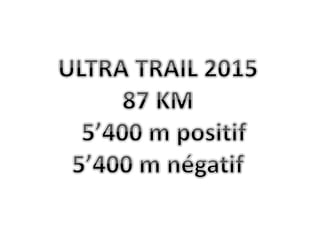
Ultra Trail du Barlatay

  • 1.
  • 2. Ascension Descente Distance Points GPS 1616 m 1591 m 27 km 2373 Postes de contrôle : TECHNIKA 1 à 8 Equipe médicale dans les ravitaillements secteur 1 : 4 pers. Approche pour une ambulance secteur 1 : 8 places Chemins pédestres = 23 km Chemins carrossables = 2 km Routes goudronnées = 2 km Chemin T3 Chemin T3 Chef du secteur 1 : Grégoire Tanniger Départ 21h00 Etivaz TRACE GARMIN OREGON 600 Secteur Etivaz/Diablerets Ravitaillement 1 Les Diablerets Secteur 1 Poste de contrôle Point d’eau (facultatif) Ravitaillement officiel Point possible pour extraction en ambulance Chemin T3 = chemin de montagne abrupte Barrière horaire limite! Col du Pillon 3h00 Ravitaillement des Diablerets 4h30 Traversée de route Cantonale Col du Pillon Col du Pillon
  • 3. 1250 1200 1150 1100 Départ à 21h00 de Ascension Descente Distance Points GPS 1616 m 1591 m 27 km 2373 Chef du secteur 1 : Grégoire Tanniger 1 2 3 4 5 6 7 8 9 10 11 12 13 14 15 16 17 18 19 20 21 22 23 24 25 26 27 1950 1900 1850 1800 1750 1700 1650 1600 1550 1500 1450 1400 1350 1300 1050 L’ Etivaz 1’100m Diablerets ravitaillement 1: 1’150m Fenêtre d’Arnon 1’885 m Col du Voré 1’912 m Col du Pillon 1’550 m Postes de contrôle : Chemin T3 = chemin de montagne abrupte TECHNIKA 1 à 8 Chemins pédestres = 23 km Chemins carrossables = 2 km Routes goudronnées = 2 km TRACE GARMIN OREGON 600 Secteur Etivaz/Diablerets Secteur 1 Poste de contrôle Point d’eau (facultatif) Ravitaillement officiel Point possible pour extraction en ambulance Equipe médicale dans les ravitaillements secteur 1 : 4 pers. Approche pour une ambulance secteur 1 : 8 places Croisement de route principale: 1 Barrière horaire limite! Col du Pillon 3h00 Ravitaillement des Diablerets 4h30 Traversée de route Cantonale Chemin T3 Chemin T3 Traversée de route Cantonale Col du Pillon La Cierne Chaubert 1’360 m Lac d’ Arnon 1’540 m Près Jordan 1’730 m Pont d’ Aigue Noire 1’200m
  • 4. Ascension Descente Distance Points GPS 1770 m 1155 m 19,5 km 1720 Chef du secteur 1 : Grégoire Tanniger Chef du secteur 2 : Georges Sanga Chemins pédestres = 17,5 km Chemins carrossables = 1 km Routes goudronnées = 1 km TRACE GARMIN OREGON 600 Secteur Diablerets/ la Pare & Marnèche Ravitaillement 1 Les Diablerets Ravitaillement 2 La Marnèche Chef du secteur 1 : Grégoire Tanniger Chef du secteur 2 : Georges Sanga Secteur 2 Postes de contrôle : TECHNIKA 8 à 11 Equipe médicale dans les Ravitaillements secteur 1 & 2 : 4 pers. Approche pour une ambulance secteur 1 & 2 : 4 places Chemin T3 Chemin T3 Barrière horaire limite! Sommet de la Pare 9h00 Ravitaillement de la Marnèche 10h30 Poste de contrôle Point d’eau (facultatif) Ravitaillement officiel Point possible pour extraction en ambulance Traversée de la RC Pont Bourquin Secteur 1
  • 5. Secteur Diablerets/ la Pare & Marnèche 2600 2500 2400 2300 2200 2100 2000 1900 1800 1700 1600 1500 1400 1300 1200 1100 1000 La Pare 2’540 m La Palette 2’170 m Ascension Descente Distance Points GPS 1770 m 1155 m 19,5 km 1720 Col Des Andérets 2’030m Col de Seron 2’153m TRACE GARMIN OREGON 600 Secteur 1 Secteur 2 Chef du secteur 1 : Grégoire Tanniger Chef du secteur 2 : Georges Sanga Barrière horaire limite! Sommet de la Pare 9h00 Ravitaillement de la Marnèche 10h30 Ravitaillement des Diablerets 1’150m Ravitaillement de la Marnèche 1’800 m 1 2 3 4 5 6 7 8 9 10 11 12 13 14 15 16 17 18 19 19,5 Chemins pédestres = 17,5 km Chemins carrossables = 1 km Routes goudronnées = 1 km Poste de contrôle Point d’eau (facultatif) Ravitaillement officiel Point possible pour extraction en ambulance Postes de contrôle : TECHNIKA 8 à 11 Equipe médicale dans les ravitaillements secteur 1 & 2: 4 pers. Approche pour une ambulance secteur 1 & 2: 4 places Croisement de route principale: 1 Chemin T3 = chemin de montagne abrupte Traversée de la RC Pont Bourquin Traversée de la RC Pont Bourquin Chemin T3 Chemin T3
  • 6. Ascension Descente Distance Points GPS 828 m 1191 m 14,5 km 2373 Chemins pédestres = 14km Chemins carrossables = 0 km Routes goudronnées = 0,5 km Ravitaillement 2 La Marnèche Ravitaillement 3 Col des Mosses Chemin T3 TRACE GARMIN OREGON 600 Secteur Marnèche /Mosses Secteur 2 Secteur 3 Chef du secteur : 2 Georges Sanga Chef du secteur : 3 Fabrice Mermoud Postes de contrôle : TECHNIKA 11 à 16 Equipe médicale dans les ravitaillements secteur 1 & 2: 5 pers. Approche pour une ambulance secteur 2 & 3 : 3 places Poste de contrôle Point d’eau (facultatif) Ravitaillement officiel Point possible pour extraction en ambulance Barrière horaire limite! Sommet du Pic Chaussy 12h00 Chemin T3 = chemin de montagne abrupte
  • 7. 2350 2300 2250 2200 2150 2100 2050 2000 1950 1900 1850 1800 1750 1700 1650 1600 1550 1500 1450 1400 1350 Pic Chaussy 2’330 m TRACE GARMIN OREGON 600 Secteur Marnèche/Mosses Ascension Descente Distance Points GPS 828 m 1191 m 14,5 km 2373 Lac Lioson 1’900 m Ravitaillement de la Marnèche 1’800 m Ravitaillement Les Mosses : 1’450 m Secteur 2 Secteur 3 Chef du secteur : 2 Georges Sanga Chef du secteur : 3 Fabrice Mermoud Barrière horaire limite! Sommet du Pic Chaussy 12h00 1 2 3 4 5 6 7 8 9 10 11 12 13 14 14,5 Chemins pédestres = 14km Poste de contrôle Chemins carrossables = 0 km Point d’eau (facultatif) Ravitaillement officiel Point possible pour extraction en ambulance Routes goudronnées = 0,5 km Postes de contrôle : TECHNIKA 11 à 16 Equipe médicale dans les Ravitaillements secteur 1 & 2: 5 pers. Approche pour une ambulance secteur 2 & 3 : 3 places Chemin T3 = chemin de montagne abrupte Chemin T3 Les Semeleys 1’820 m Vers les petits lacs 1’970 m
  • 8. Chemins pédestres = 16 km Chemins carrossables = 7 km Routes goudronnées = 3 km Postes de contrôle : TECHNIKA 16 à 26 Equipe médicale dans les ravitaillements secteur 3 : 7 pers. Approche pour une ambulance secteur 3 : 7 places Poste de contrôle Point d’eau (facultatif) Ravitaillement officiel Point possible pour une ambulance Bord de la RC Contour de la Borne Traversée RC Caserne Lécherette TRACE GARMIN OREGON 600 Secteur Mosses/Etivaz Ravitaillement 4 La Rechargère Ravitaillement 3 Col des Mosses ARRIVEE / ETIVAZ Barrière horaire limite! T 18 En Cuixon : T 18 13h45 !!! Chef du secteur : Fabrice Mermoud Barrière horaire limite! Les Ecrouvignes 17h00 Ravitaillement de la Rechargère 18h00 Contour de la Borne 18h30 ARRIVEE 20h00 Ascension Descente Distance Points GPS 1’270 m 1’550 m 26 km 1’451
  • 9. Chef du secteur : Fabrice Mermoud Départ Les Mosses : 1’450 m Arrivée L’Etivaz : 1’140 m 26.0 4 Petit Praz Cornet : 1’668 m Les Ecrouvignes : 1,660 m Ravitaillement de la Rechargère : 1,225m 0 1 2 3 4 5 6 7 8 9 10 11 12 13 14 15 16 17 18 19 20 21 22 23 24 25 Chemins pédestres = 16 km Chemins carrossables = 7 km Routes goudronnées = 3 km Bord de la RC Contour de la Borne TRACE GARMIN OREGON 600 Secteur Mosses/Etivaz Postes de contrôle : TECHNIKA 16 à 26 Equipe médicale dans les ravitaillements secteur 3 : 7 pers. Approche pour une ambulance secteur 3 : 7 places Croisement de route principale: 2 Poste de contrôle Point d’eau (facultatif) Ravitaillement officiel Point possible pour extraction en ambulance Barrière horaire limite! Les Ecrouvignes 17h00 Ravitaillement de la Rechargère 18h00 Contour de la Borne 18h30 ARRIVEE 20h00 Secteur 3 Traversée RC Caserne Lécherette Traversée de route Cantonale Barrière horaire limite! En Cuixon : T 18 13h45 !!! T 18 Ascension Descente Distance Points GPS 1’270 m 1’550 m 26 km 1’451 Col de Sonlomont 1’505 m La Cierne 1’200 m Les Chargiaux 1’110 m Commun de l’Hongrin 1’470 mm